|
|
THE MEXICAN CENSUS |
The Indigenous Languages of Mexico: A Present-Day Overview
Mexico's 1921 Census: A Unique Perspective
Indigenous Mexico Statistics: The 2005 Conteo
Extranjeros in Mexico (1895-2000)
Mexico
and Its
Religions
The
Indigenous Languages of
By
John P. Schmal
The
most recent census count in Mexico
reveals that a multitude of languages are used by Mexican nationals throughout
the country. It is true that the percentage of Mexicans who are speaking
indigenous languages is steadily declining, but a great many people have held
on to their mother tongue, sometimes taking it with them to other parts of
1. Nahuatl. 1,376,026 Mexicans
speak twenty-eight Nahuatl languages and live in every state of
2. Maya. The Maya language is the
second most commonly spoken language in
3. Mixteco. In 2005, it was
believed that 423,216 Mexicans spoke one of the 57 Mixtec languages,
representing 7.04% of all indigenous speakers. Mixtecs are unique in that they
have migrated in large numbers to every corner of the
4. Zapoteco. It was estimated that
410,901 persons spoke one of the 64 Zapotec languages of
Many people wonder how so many Zapotec and Mixtec languages evolved from the
same origin. But, if one understands the topography of
5. Tzeltal. In 2005, 371,730
persons spoke the Tzeltal language, representing 6.18% of all indigenous
speakers in
6. Tzotzil. The Tzotzil are close
cousins of the Tzeltal who also inhabitants of
7. Otomi. In 2005, 239,850 persons
in
8. Totonaca. The Totonaca language
was spoken by 230,930 persons in 2005, representing 3.84% of the indigenous
speakers in
9. Mazateco. The Mazateco language
was spoken by 206,559 individuals in 2005, accounting for 3.44% of the
indigenous speakers. Mazateco is spoken in several states, but is most
predominanet in
10. Chol. A total of 185,299
persons in
11. Huasteco. In 2005, 149,532
persons in
12. Chinanteca. In 2005, 125,706
person in
13. Mixe. The Mixe language is an
isolated language that is primarily spoken in
14. Mazahua. The Mazahua tongue is
a northern extension of Otomanguean language, which was spoken by
approximately 111,840 Mexicans in 2005, representing 1.86% of all indigenous
speakers. The Mazahua language is most commonly spoken in the State of
15. Purepecha. The Purepecha
people - sometimes referred to as the Tarascans - are a unique people and the
only indigenous group that consistently defeated the Aztecs in battle. Their
language is a language isolate which seems to have no known affiliation with
any other Mexican languages. Some researchers have suggested a South American
origin. At any rate, 105,556 Mexicans spoke Purepecha in 2005, representing
1.76% of all indigenous speakers. Purepechas have migrated all over
16. Tlapaneco. The Tlapanecos in
Guerrero are very similar to the Purepecha of Michoacan. They too speak a
language isolate, with no close affiliation with neighboring languages. The
Tlapanecos also held out against the Aztecs and lived in a small enclave that
resisted Aztec intrusions for more than a century. Their original homeland was
a small area that lies completely within the present-day boundaries of
Guerrero. As a result, 93.5% of all Tlapanecos lived in Guerrero in 2005.
17. Tarahumara. The Tarahumara of
Chihuahua are famous and well-known to many Americans who have journeyed south
of the border to visit these intriguing people. In 2005, 75,371 persons spoke
Tarahumara, representing 1.25% of all indigenous speakers. Although 96.1% of
these people lived in
18. Zoque. The Zoque are one of
the few non-Maya groups living in
19. Amuzgo. The Amuzgos are
another Otomanguean language group. In 2005, 43,761 Mexicans spoke one of
their three languages, representing 0.73% of
20. Tojolabal. In 2005, 43,169
persons spoke the Tojolabal language, representing 0.72% of all indigenous
speakers. This language is a Mayan language which its origins clearly tied to
the State of
There are almost 300 Mexican languages, and roughly 70 of them were tallied in
the 2000 census and 2005 census count. Several more deserve honorable mention.
Huichol: In twenty-fourth place,
the Huichol language survived and prospered even as most of its neighbors in
Nayarit and Jalisco died out from the onslaught of war, disease, assimilation
and mestizaje. In 2005, 35,724 persons spoke the Huichol language in
Mayo. In twenty-fifth place, the
Mayo are one of three surviving Cahita languages. The Cahita people originally
spoke 18 languages, but were largely decimated during the 1500s and 1600s. The
Mayos, and their Yaqui cousins, continued to endure and, at time resist,
against both the Spanish Government and, later, the Mexican Government. In
2005, 32,702 Mexicans spoke the Mayo language, representing 0.54% of all
indigenous speakers. They were primarily distributed across their two homeland
states:
Cora. In twenty-eighth place, the
Cora language was spoken by 17,086 persons in 2005, representing 0.28% of the
indigenous speakers. The Coras primary homeland has always been Nayarit, where
97.0% of their speakers resided in 2005.
Yaqui. In thirty-first place, the
famous Yaqui Indians of Sonora are famous for their resistance against the
Mexican Government. During the early 1900s, many Yaquis had to flee to
INDIGENOUS MEXICO STATISTICS: THE 2010 CENSUS
By John P. Schmal
The
2010 Census
The results of the 2010 Mexican
Census have been published and a comparison with the 2000 Censo and 2005
Conteo (Count) reveals a significant increase in the number of Mexicans 5
years of age and older who speak indigenous languages. But while the overall
numbers rose in many states, the percentage of indigenous speakers in
individual states actually dropped in many parts of
The overall number of
indigenous speakers dropped from 6,044,547 to 6,011,202 between 2000 and 2005,
but increased to 6,695,228 in 2010. At
the same time, the percentage of indigenous speakers dropped from 7.2% to 6.7%
between 2000 and 2005 and remained at 6.7% in 2010.
It is important to point out
that the criteria in this tally represents people who speak
indigenous languages and that the number of Mexicans who consider
themselves to be indigenous – through culture, tradition, spirit, genetics
and other factors –was measured in a separate census question to be
discussed below.
Most
Spoken Languages
Náhuatl remains the most
widely spoken language in
More than 50% of the people who
speak indigenous languages in
The following table illustrates the number of speakers
for the primary indigenous languages of
|
Mexico’s
Indigenous Languages (1970 to 2010) |
|||||
|
Indigenous
Language |
1970
Census |
1990
Census |
2000
Census |
2010
Census |
2010
Census (%) |
|
Náhuatl |
799,394 |
1,197,328 |
1,448,936 |
1,544,968 |
23.08% |
|
Maya |
454,675 |
713,520 |
800,291 |
786,113 |
11.74% |
|
Mixtec Languages |
233,235 |
386,874 |
446,236 |
476,472 |
7.12% |
|
Tzeltal |
99,412 |
261,084 |
284,826 |
445,856 |
6.66% |
|
Zapotec Languages |
283,345 |
403,457 |
452,887 |
450,419 |
6.73% |
|
Tzotzil |
95,383 |
229,203 |
297,561 |
404,704 |
6.04% |
|
Otomí |
221,062 |
280,238 |
291,722 |
284,992 |
4.26% |
|
Totonaca |
124,840 |
207,876 |
240,034 |
244,033 |
3.64% |
|
Mazateco |
101,541 |
168,374 |
214,477 |
223,073 |
3.33% |
|
Chol |
73,253 |
128,240 |
161,766 |
212,117 |
3.17% |
|
Huasteco |
66,091 |
120,739 |
150,257 |
161,120 |
2.41% |
|
Mazahua |
104,729 |
127,826 |
133,430 |
135,897 |
2.03% |
|
Chinantec Languages |
54,145 |
109,100 |
133,374 |
133,438 |
1.99% |
|
Mixe |
54,403 |
95,264 |
118,924 |
132,759 |
1.98% |
|
Purépecha |
60,411 |
94,835 |
121,409 |
124,494 |
1.86% |
|
Tlapaneco |
30,804 |
68,483 |
99,389 |
120,072 |
1.79% |
|
Tarahumara |
25,479 |
54,431 |
75,545 |
85,018 |
1.27% |
|
Zoque |
27,140 |
43,160 |
51,464 |
63,022 |
0.94% |
|
Tojolabal |
13,303 |
36,011 |
37,986 |
51,733 |
0.77% |
|
13,883 |
28,228 |
41,455 |
50,635 |
0.76% |
|
|
Chatino |
11,773 |
29,006 |
40,722 |
45,019 |
0.67% |
|
Huichol |
6,874 |
19,363 |
30,686 |
44,788 |
0.67% |
|
36,267 |
38,561 |
42,306 |
0.63% |
||
|
27,818 |
31,254 |
38,477 |
41,091 |
0.61% |
|
|
Mayo |
27,848 |
37,410 |
31,513 |
39,616 |
0.59% |
|
5,617 |
18,469 |
25,544 |
35,873 |
0.54% |
|
|
Cora |
6,242 |
11,923 |
16,410 |
20,078 |
0.30% |
|
Huave |
7,442 |
11,955 |
14,224 |
17,554 |
0.26% |
|
Yaqui |
7,084 |
10,984 |
13,317 |
17,116 |
0.26% |
|
Cuicateco |
10,192 |
12,677 |
13,425 |
12,785 |
0.19% |
|
Other Languages |
63,997 |
308,768 |
179,699 |
248,067 |
3.71% |
|
Mexican |
3,111,415 |
5,282,347 |
6,044,547 |
6,695,228 |
100.00% |
By percentage, the nine states within indigenous speaking
populations of more than 10% are:
Another factor in the decline
is that many indigenous migrants who move from Oaxaca, Puebla, Guerrero, or
Campeche to large urban areas in Mexico City or the North may have children
who, in the absence of a nurturing mother culture, may tend to assimilate and
perhaps stop speaking their mother tongue as they socialize and work with
their non-indigenous friends, associates, and neighbors.
The number and percentage of indigenous speakers in each
of the Mexican states is illustrated in the table below, along with
information on the two most commonly spoken languages of each state. The table
is sorted by percent (the third column):
|
State |
Number
of Persons Who Speak an Indigenous Languages* |
% |
Most
Commonly Spoken Language |
% |
Second
Most Commonly Spoken Language |
|
Oaxaca |
1,165,186 |
34.2% |
Zapotec |
31.1% |
Mixteco |
|
Yucatán |
537,516 |
30.3% |
Maya |
98.7% |
Chol |
|
|
1,141,499 |
27.2% |
Tzeltal |
37.9% |
Tzotzil |
|
Quintana Roo |
196,060 |
16.7% |
Maya |
89.6% |
Tzotzil |
|
Guerrero |
456,774 |
15.1% |
Náhuatl |
27.5% |
Mixteco |
|
|
359,972 |
15.1% |
Náhuatl |
65.8% |
Otomi |
|
|
91,094 |
12.3% |
Maya |
78.2% |
Chol |
|
|
601,680 |
11.7% |
Náhuatl |
72.6% |
Totonaco |
|
|
248,196 |
10.7% |
Náhuatl |
55.5% |
Huasteco |
|
Veracruz de Ignacio de la Llave |
644,559 |
9.4% |
Náhuatl |
53.6% |
Totonaca |
|
Nayarit |
49,963 |
5.1% |
Huichol |
47.7% |
Cora |
|
|
104,014 |
3.5% |
Tarahumara |
77.8% |
Tepehuanes |
|
Michoacán de Ocampo |
136,608 |
3.5% |
Purépecha |
83.1% |
Náhuatl |
|
|
60,526 |
3.0% |
Chontal de Tabaco |
60.8% |
Chol |
|
Estado de México |
376,830 |
2.8% |
Mazahua |
30.7% |
Otomí |
|
Tlaxcala |
27,653 |
2.6% |
Náhuatl |
83.7% |
Totonaca |
|
|
60,310 |
2.5% |
Mayo |
46.4% |
Yaqui |
|
|
30,894 |
2.1% |
Tepehuanes |
80.0% |
Huichol |
|
Morelos |
31,388 |
2.0% |
Náhuatl |
61.4% |
Mixteco |
|
|
10,661 |
1.9% |
Náhuatl |
27.9% |
Mixteco |
|
Querétaro |
29,585 |
1.8% |
Otomí |
80.8% |
Náhuatl |
|
|
41,005 |
1.5% |
Mixteco |
37.2% |
Zapoteco |
|
Distrito Federal |
122,411 |
1.5% |
Náhuatl |
27.5% |
Mixteco |
|
Nuevo León |
40,137 |
1.0% |
Náhuatl |
53.9% |
Huasteco |
|
Sinaloa |
23,426 |
0.9% |
Mayo |
47.2% |
Náhuatl |
|
Jalisco |
51,702 |
0.8% |
Huichol |
33.1% |
Náhuatl |
|
Tamaulipas |
23,296 |
0.8% |
Náhuatl |
42.9% |
Huasteco |
|
Colima |
3,983 |
0.7% |
Náhuatl |
35.5% |
Mixteco |
|
Zacatecas |
4,924 |
0.4% |
Huichol |
19.1% |
Náhuatl |
|
Guanajuato |
14,835 |
0.3% |
Otomi |
21.6% |
Chichimeca Jonaz |
|
|
2,436 |
0.2% |
Náhuatl |
16.0% |
Mazahua |
|
Coahuila de Zaragoza |
6,105 |
0.2% |
Náhuatl |
15.2% |
Kikapú |
|
|
6,695,228 |
6.7% |
Náhuatl |
23.1% |
Maya |
|
* These statistics refer to persons who are five years of age and older. |
|||||
In previous censuses, information on the indigenous speaking population five years of age and older was obtained from the Mexican people. However, in the 2010 census, this approach was changed and the Government also began to collect data on people 3 years and older because from the age of 3, children are able to communicate verbally. With this new approach, it was determined that there were 6,913,362 people 3 years of age or more who spoke an indigenous language (218,000 children 3 and 4 four years of age fell into this category). The population of children aged 0 to 2 years in homes where the head of household or a spouse spoke an indigenous language was 678 954.
The states with the highest percentages of population
aged 3 and over speaking an indigenous language were:
However, in nine states, this percentage was lower than a
percent (Jalisco, Sinaloa,
Mexicans
Considered Indigenous
The 2010 census also included a question that asked
people if they considered themselves indigenous, whether or not an indigenous
language was spoken. The results of this question indicated that 15.7 million persons 3 years of age and older identified themselves as
“indigenous.” By
comparison, 6.9 million people in the
same age bracket were tallied as indigenous speakers, meaning that
approximately 8.8 million Mexicans aged 3 and older did not speak an
indigenous language but considered themselves to be of indigenous origin.
The states with the greatest percentage of persons who
considered themselves indigenous were
|
State |
Percentage
of Persons 3 years of age and older who speak an indigenous language |
Percentage
of Persons 3 years of age and older who are considered indigenous |
|
Yucatán |
29.6% |
62.7% |
|
|
33.8% |
58.0% |
|
Quintana Roo |
16.2% |
33.8% |
|
|
27.3% |
32.7% |
|
|
12.0% |
32.0% |
|
|
14.8% |
30.1% |
|
|
11.5% |
25.2% |
|
Guerrero |
15.2% |
22.6% |
|
Veracruz de Ignacio de la Lave |
9.3% |
19.9% |
|
|
10.6% |
19.2% |
|
Tlaxcala |
2.6% |
17.1% |
|
Morelos |
1.9% |
15.5% |
|
Querétaro |
1.8% |
15.1% |
|
Michoacán de Ocampo |
3.5% |
14.6% |
|
Colima |
0.7% |
13.3% |
|
|
2.5% |
11.9% |
|
Estado de México |
2.7% |
11.3% |
|
|
2.9% |
10.7% |
|
Nayarit |
5.2% |
10.1% |
|
|
3.5% |
8.4% |
|
|
1.8% |
7.1% |
|
|
1.4% |
5.7% |
|
Distrito Federal |
1.5% |
5.2% |
|
Jalisco |
0.8% |
4.8% |
|
Sinaloa |
0.9% |
4.6% |
|
Guanajuato |
0.3% |
4.3% |
|
|
0.2% |
4.2% |
|
Tamaulipas |
0.8% |
3.9% |
|
|
2.2% |
3.8% |
|
Zacatecas |
0.4% |
2.9% |
|
Nuevo León |
0.9% |
1.9% |
|
Coahuila de Zaragoza |
0.2% |
1.9% |
|
|
6.6% |
14.9% |
Tasa de Monolingüismo
(Rate of Monolingualism)
Between the 2000 and 2010 censuses, the number of Mexicans who spoke indigenous languages but did not speak Spanish dropped from 16.9% of the population to 15.2%. In the 2010 census, the rate of monolingualism among indigenous speakers showed marked differences according to age. Of all children aged 5 to 9 years, 36.9% were monolingual. Among adults 65 years and older, the rate was 23%.
Among youths aged 15 to 29 years and people aged 30 to 64 years, the percentage of monolingual indigenous speakers was 6.8% and 12.5%, respectively. The following table reveals the rate of monolingualism in both the 2000 and 2010 census for the most commonly spoken Mexican languages:
|
Principle
Languages |
2000
Census – Rate of Monolingualism (Percent) |
2010
Census – Rate of Monolingualism (Percent) |
|
Amuzgo |
46.1 |
41.4 |
|
Tzeltal |
41.4 |
36.9 |
|
Tzotzil |
40.6 |
36.7 |
|
Tlapaneco |
32 |
28.5 |
|
Cora |
31.5 |
27.8 |
|
Chatino |
30.3 |
27 |
|
Chol |
29.8 |
22.4 |
|
Mixtec Languages |
23 |
21.3 |
|
Tojolabal |
30.2 |
20.4 |
|
Mixe |
25 |
19.6 |
|
Mazateco |
25.5 |
19.5 |
|
Huave |
16.3 |
17.2 |
|
Total |
16.9 |
15.2 |
|
Tepehuano |
19.9 |
14.9 |
|
Huichol |
15.5 |
14 |
|
Totonaca |
16.4 |
12.9 |
|
Tarahumara |
18 |
12.5 |
|
Chinantec Languages |
13.4 |
11.6 |
|
Náhuatl |
13.8 |
10.5 |
|
Zapotec Languages |
11 |
9 |
|
Purépecha |
12.9 |
7.8 |
|
Huasteco |
10 |
7.4 |
|
Maya |
8.2 |
6.6 |
|
Zoque |
9.4 |
6.5 |
|
Yaqui |
6 |
5.1 |
|
Otomí |
5.9 |
4.4 |
|
Cuicateco |
7.7 |
4.1 |
|
Mazahua |
1.9 |
1.1 |
|
Mayo |
0.7 |
0.3 |
|
Mexican Republic |
16.9 |
15.2 |
|
Source: INEGI, Tasa de monolingüismo de la población hablante de lengua indígena de 5 y más años por principales lenguas según sexo, 2000 y 2010 |
||
Highest Rates of
Monolingualism
The Mexican indigenous language with the highest rate of monoligualism is the Amuzgo tongue. Amuzgo is an Oto-Manguean language spoken in certain sections of both Guerrero and Oaxaca by a little more than 50,000 people. It is only the twentieth most spoken language group in the Mexican Republic. But the rate of monolingualism for this language dropped from 46.1% in 2000 to 41.4% in 2010.
The second and third Mexican languages with the highest rate of monolingualism are sister-languages, Tzeltal (36.9%) and Tzotzil (36.7%) – both are Mayan tongues spoken in the State of Chiapas. Both languages saw significant increases in their overall populations between the 2000 and 2010 census, but declines in the rate of monolingualism.
The fourth language with the highest rate of monolingualism is Tlapaneco (28.5%), which is spoken by over 120,000 individuals and is the sixteenth most commonly spoken language group in Mexico. Tlapaneco is spoken in Guererro. Remarkably, the Tlapaneco were one of the few indigenous groups in Southern Mexico that were not conquered by the Aztecs and they have managed to retain many elements of their original culture.
The language with the fifth highest rate of monolingualism is the Cora language (27.8%), which is spoken primarily in Nayarit, as well as in some parts of Jalisco.
The Future
The future of Mexico’s indigenous languages is not certain, but there does appear to be some effort to carry on some of the nation’s ancient languages. The movement of indigenous peoples from their places of origin to other parts of Mexico will play some role in the continued decline of some languages. On the other hand, the sense of pride and cultural identity among some indigenous groups will ensure the survival of many of the languages well into the future.
Sources:
Instituto Nacional de Estadística Geografía e Informática
(INEGI). Conteos de Población y
Vivienda, 2005.
INEGI. Censos de
Población y Vivienda, 2000 y 2010.
INEGI, Censo de Población y Vivienda (2010): Panorama sociodemográfico de México (March 2011).
INEGI, Principales
resultados del Censo de Población y Vivienda 2010.
Copyright © 2011,
by John P. Schmal.
RACIAL
AND CULTURAL IDENTITY IN MEXICO: 2015
By
John P. Schmal
Mexico’s
2015 Intercensal Survey
In
2016, the Mexican government agency, Instituto
Nacional de Estadística Geografía e Informática (INEGI), published the 2015
Intercensal Survey, which upgraded Mexico’s socio-demographic information
to the midpoint between the 2010 census and the census to be carried out in
2020. With a sample size of over 6 million homes, this survey provides
information on the national, state and municipio level, as of March 15th, 2015.
Considered
Indigenous Classification
One
of the 2015 survey questions asked, “De
acuerdo, con su cultura, se considera
indígena?” Essentially, Mexican residents were being asked if they
considered themselves indigenous through their culture. Survey respondents had
four possible responses:
Based
on the responses to this question, eight
Mexican states in 2015 had populations that considered one-third or more of
their people to be of indigenous descent, as noted below:
|
Rank |
State |
Percent |
Rank |
State |
Percent |
|
1 |
Oaxaca |
65.7% |
5 |
Hidalgo |
36.2% |
|
2 |
Yucatán |
65.4% |
6 |
Chiapas |
36.1% |
|
3 |
Campeche |
44.5% |
7 |
Puebla |
35.3% |
|
4 |
Quintana
Roo |
44.4% |
8 |
Guerrero |
33.9% |
Nearly
two-thirds of the populations of both Oaxaca and Yucatán considered themselves
to be indigenous. In all, 16 states had an indigenous population of over 20%. On
the other hand, the state with the lowest percentage of persons considered
indigenous was Tamaulipas (6.3%), followed by two other northern Mexican states:
Nuevo León (6.9%) and Coahuila (6.9%).
Across
all states, the survey reported that 21.5%
of all Mexicans considered themselves to be of indigenous descent, which
means that more than one-fifth of the entire population of the nation recognized
its indigenous origins. A table at the end of this article illustrates the
survey results for all the Mexican states and the Distrito Federal (DF).
The
Indigenous-Speaking Population
The
2015 census count told a different story with regards to the population of
persons 3 years of age and older who spoke Indigenous languages. While 21.5
percent of Mexican residents recognize that their culture and physical
appearance has been inherited from indigenous ancestors, a much smaller percent
of people actually speak an indigenous language: 6.5%.
Another
question in the 2015 survey asked each participant if they spoke an indigenous
dialect or language. Only persons 3 years of age and older were considered for
this category.
Not
a single state had a population of indigenous speakers that exceeded one-third
of its total population. Only Oaxaca — with 32.2% of its people speaking
indigenous languages — approached the one-third mark.
As a matter of fact, only eight states actually had populations of 10% or
more who spoke indigenous languages, as noted below:
|
Rank |
State |
Percent |
Rank |
State |
Percent |
|
1 |
Oaxaca |
32.2% |
5 |
Hidalgo |
14.2% |
|
2 |
Yucatán |
28.9% |
6 |
Campeche |
11.5% |
|
3 |
Chiapas |
27.9% |
7 |
Puebla |
11.3% |
|
4 |
Quintana
Roo |
16.6% |
8 |
San
Luis Potosí |
10.0% |
|
5 |
Guerrero |
15.3% |
|
|
|
A
table at the end of this article illustrates the survey results for all the
Mexican states and the Distrito Federal (DF).
Afromexican
Population
Still
another 2015 survey question asked “De
acuerdo con su cultura, historia y tradiciones, se considera negra(o), es decir,
afromexicana(o) o afrodescendiente?” Essentially, each Mexican resident
was asked if, according to their culture, history and traditions, they
considered themselves to be black (i.e., an Afromexican or Afro-descendant).
Once again, each respondent had four possible answers.
The
survey revealed that only nine states had Afromexican populations that exceeded
0.5%, as illustrated in the following table:
|
Rank |
State |
Percent |
Rank |
State |
Percent |
|
1 |
Guerrero |
6.5% |
6 |
Baja
California Sur |
1.5% |
|
2 |
Oaxaca |
4.9% |
7 |
Nuevo
León |
1.5% |
|
3 |
Veracruz |
3.3% |
8 |
Jalisco |
0.8% |
|
4 |
Estado
de México |
1.9% |
9 |
Quintana
Roo |
0.6% |
|
5 |
Distrito
Federal |
1.8% |
|
|
|
While
census data from the sixteenth and seventeenth centuries indicate that many
African slaves labored throughout Mexico in the colonial period, assimilation
with Spaniards, mestizos and Indians over time had reduced their cultural
influence on present-day populations in Mexico.
Principal
Indigenous Languages
The
principal languages spoken in Mexico in 2015 are shown in the following table,
which shows the states of origin for each language:
|
Language |
Primary State /States of Origin |
Percent of the Population 3 Years and Older Who Speak Indigenous
Languages |
|
Náhuatl |
Multiple
– Central Mexico |
23.4% |
|
Maya |
Multiple
– Yucatán Peninsula |
11.6% |
|
Tzeltal |
Chiapas |
7.5% |
|
Mixteco |
Oaxaca
& Guerrero |
7.0% |
|
Tzotzil |
Chiapas |
6.6% |
|
Zapoteco |
Oaxaca |
6.5% |
|
Otomí |
Multiple
- Central Mexico |
4.2% |
|
Totonaco |
Puebla
& Veracruz |
3.6% |
|
Ch’ol |
Chiapas |
3.4% |
|
Mazateco |
Oaxaca,
Veracruz & Puebla |
3.2% |
|
Other Languages |
Various |
22.9% |
As in past censuses, Náhuatl, the language of the Aztecs,
continued to be the language of almost one-quarter of all indigenous speakers in
Mexico. Thanks to the widespread migration of laborers from one part of Mexico
to another, many of these “Top
Ten” languages are spoken in a wide range of states, some of which are
far the original homeland of the language.
Mexican
Migration from Place of Origin
According
to the 2015 Intercensal Survey, with the information on the place of birth of
each survey respondent, INEGI reported that 17.4% of Mexican residents
throughout the country were either born in an entity other than the entity in
which they resided, or were born abroad (i.e., U.S., Guatemala, etc.).
According
to the 2015 Survey, the following states have the largest percentage of their
populations born in another entity (Mexican state or the Distrito Federal) or
another country:
Ø
Quintana
Roo (54.1%)
Ø
Baja
California (44.1%)
Ø
Baja
California Sur (39.6%)
Ø
Estado
de México (33.7%)
Ø
Colima
(28.7%)
Ø
Morelos
(27.3%)
Ø
Querétaro
(25.4%)
Ø
Campeche
(24.0%)
Ø
Tamaulipas
(23.1%)
Ø
Nuevo
León (21.2%)
The
states with the least percent of people born in another country or state were
Chiapas (3.4%), Guerrero (4.9%) and Oaxaca (6.2%).
Migration
and Indigenous Languages
If
the high level of migration continues in many parts of Mexico, Indigenous
languages will continue to be spread across the entire Mexican Republic.
However, with new generations of children and grandchildren adapting to new
cultural environments, it is also possible that some of the descendants of these
migrants will no longer speak their mother tongue and will become more
comfortable with the Spanish language.
Linguistic
and Ethnic Identity in Mexico
The
following table contains 2015 Intercensal Survey data relating to populations
that speak indigenous languages or identity themselves to be of Indigenous or
Afromexican descent. The table has been sorted by indigenous identity (the first
row):
Linguistic and Ethnic Identity in Mexico (2015)
|
|||
|
State |
Percentage of the Total Population That Consider
Themselves to be Indigenous |
Percentage of Persons 3 Years of Age and Older Who Speak an
Indigenous Language |
Percentage of the Total Population That Consider Themselves to be
Afrodescendants |
|
Oaxaca |
65.7% |
32.2% |
4.9% |
|
Yucatán |
65.4% |
28.9% |
0.3% |
|
Campeche |
44.5% |
11.5% |
0.4% |
|
Quintana Roo |
44.4% |
16.6% |
0.6% |
|
Hidalgo |
36.2% |
14.2% |
0.1% |
|
Chiapas |
36.1% |
27.9% |
0.1% |
|
Puebla |
35.3% |
11.3% |
0.1% |
|
Guerrero |
33.9% |
15.3% |
6.5% |
|
Veracruz |
29.3% |
9.2% |
3.3% |
|
Morelos |
28.1% |
2.0% |
0.4% |
|
Michoacán |
27.7% |
3.6% |
0.1% |
|
Tabasco |
25.8% |
2.7% |
0.1% |
|
Tlaxcala |
25.2% |
2.7% |
0.1% |
|
San Luis Potosí |
23.2% |
10.0% |
0.0% |
|
Nayarit |
22.2% |
5.4% |
0.1% |
|
Estados
Unidos Mexicanos |
21.5% |
6.5% |
1.2% |
|
Colima |
20.4% |
0.6% |
0.1% |
|
Querétaro |
19.2% |
1.7% |
0.1% |
|
Sonora |
17.8% |
2.4% |
0.1% |
|
Estado de México |
17.0% |
2.7% |
1.9% |
|
Baja California Sur |
14.5% |
1.5% |
1.5% |
|
Sinaloa |
12.8% |
1.4% |
0.0% |
|
Aguascalientes |
11.7% |
0.3% |
0.0% |
|
Chihuahua |
11.3% |
2.7% |
0.1% |
|
Jalisco |
11.1% |
0.8% |
0.8% |
|
Guanajuato |
9.1% |
0.2% |
0.0% |
|
Distrito Federal |
8.8% |
1.5% |
1.8% |
|
Baja California |
8.5% |
1.5% |
0.2% |
|
Durango |
7.9% |
2.4% |
0.0% |
|
Zacatecas |
7.6% |
0.3% |
0.0% |
|
Coahuila de Zaragoza |
6.9% |
0.2% |
0.1% |
|
Nuevo León |
6.9% |
1.2% |
1.5% |
|
Tamaulipas |
6.3% |
0.7% |
0.3% |
Sources:
INEGI, “Principales
resultados de la Encuesta Intercensal 2015. Estado Unidos Mexicanos.”
Online:
INEGI, “Principales
resultados de la Encuesta Intercensal 2015. Estado Unidos Mexicanos:
III: Etnicidad.” Online:
http://www.senado.gob.mx/comisiones/asuntos_indigenas/eventos/docs/etnicidad_240216.pdf
INEGI, “Encuesta
Intercensal 2015: Cuestionario para viviendas particulares habitadas y población.”
Online: http://www.beta.inegi.org.mx/contenidos/proyectos/enchogares/especiales/intercensal/2015/doc/eic2015_cuestionario.pdf
MEXICO’S 1921 CENSUS: A UNIQUE PERSPECTIVE
By John P. Schmal (© 2007)
In the aftermath of the Mexican revolution, Mexico’s Departamento de la
Estadística Nacional administered a census that would be unique among
Mexico’s census counts administered between 1895 and 2005. In this new census,
the Mexican Government decided to ask Mexicans about their perception of their
own racial heritage. In the 1921 census, residents of the Mexican Republic were
asked if they fell into one of the following categories:
1. "Indígena pura" (of pure indigenous heritage).
2. "Indígena mezclada con blanca" (of mixed indigenous and white
heritage).
3. "Blanca" (of White or Spanish heritage).
4. "Extranjeros sin distinción de razas" (Foreigners without racial
distinction).
5. "Cualquiera otra o que se ignora la raza" (Either other or chose to
ignore the race)
States With the Largest "Indígena Pura" Population
The results were a remarkable reflection of México’s own perception of its indigenous and mestizo identities. Although only three states had more than 50% pure indigenous populations (Oaxaca, Puebla and Tlaxcala), a total of eight states had more than 40% of the same classification (Oaxaca, Puebla, Tlaxcala, Chiapas, Guerrero, Campeche, Yucatán, and México).
The five states with the largest populations of "indígena pura" were:
The Most Indigenous State: Oaxaca
The most indigenous state, in terms of absolute numbers and percentage was Oaxaca, in which
675,119 persons out of 976,005 inhabitants were classified as indígena. In effect, this meant that 69.17% of Oaxaca’s population had a pure indigenous identity.
Not all of "pure indigenous" population of Oaxaca, however, spoke indigenous languages. Only 482,478 individuals five years of age or more spoke thirty indigenous languages. This represented 49.43% of the population five years of age and older and 57.18% of the entire state population. [Children up to the age of four in indigenous households were not included in the tally of languages.]
Another 274,752 residents of Oaxaca described themselves as "mezclada," representing an additional 28.1% of the population. The combination of the indigenous and mezclada categories represented 949,871 individuals who had possessed some element of indigenous descent and represented 97.32% of the entire state population.
As a matter of contrast, only 13,910 persons were categorized as "blanca," while another 11,124 did not claim a designation and 1,100 were "extranjeros" (foreigners).
The Second Most Indigenous State: Puebla
The State of Puebla had the second largest "pure indigenous" population, with 560.971 (who represented 54.73% of the entire state population). In addition, 403,221 residents of Puebla were classified as mezclada, representing another 39.34% of the population. Puebla had the sixth largest number of mezclada inhabitants. Combining the pure indigenous with the mezclada element, we can estimate that 964,192 persons were of some indigenous origin, representing 94.07% of the total state population of 1,024,955.
As with Oaxaca, however, a smaller element of the population spoke native tongues. In all, 247,392 individuals five years of age and older spoke a wide range of indigenous languages, representing only 24.14% of the entire state population.
Puebla had a much higher number of blanca residents: a total of 58,032 inhabitants, who made up 5.66% of the state population.
The Third Most Indigenous State: Veracruz
Veracruz has the third largest "indígena pura" population with 406,638, representing 35.06% of the state population. Veracruz also had the fourth-highest number of mezclada residents: 556,472 (or 47.97%). Combining the two indigenous classifications, we observed that 963,110 persons out of a total population of 1,110,971 claimed some indigenous descent and that this group represented 86.69% of the state population.
In striking contrast, however, only 120,746 residents of Veracruz spoke indigenous languages, representing 10.87% of the state population and 12.62% of residents five years of age or more.
The Fourth Most Indigenous State: México
The State of México had the fourth largest indígena pura population, 372,703, equal to 42.13% of the state population. Together with the mestizo/mezclada population, which numbered 422,001 (47.70% of the state population), the total population with an indigenous heritage was 794,704, or 89.84% of the population.
In stark contrast, only 172,863 residents of the State of México spoke indigenous languages, representing only 19.54% of the total state population.
Other states with significant numbers of indígena pura population are as follows:
5. Guerrero - 248,526 persons (43.84%)
6. Hidalgo – 245,704 persons (39.49%)
7. Chiapas – 200.927 persons (47.64%)
8. Jalisco – 199,728 persons (16.76%)
9. Michoacán – 196,726 persons (20.93%)
10. Distrito Federal– 169,820 (18.75%)
11. Yucatán – 155,155 persons (43.31%)
12. San Luis Potosí – 136,365 persons (30.60%)
13. Tlaxcala – 97,670 persons (54.70%)
Because the populations of the various states vary widely, the percentage of pure indigenous persons in a given state provide us with a different set of results. The contrast between absolute numbers and percentages of the pure indigenous population was largely contingent on the population of each state. For example, Tlaxcala actually had the third largest percentage of indígena pura inhabitants but, because of its small population, was in thirteenth place in terms of percentage.
And Jalisco’s largely pure indigenous population of 199,728 represented only 16.76% of its total population of 1,191,957. Jalisco, as a matter of fact, had the largest population of any state in México, followed closely by Veracruz (1,159,935), Puebla (1,024,955) and the Distrito Federal (906,063).
States With the Largest "Indígena Mezclada Con Blanca" Population
In the 1921 census, the status "Indígena Mezclada con Blanca"
implied that a person was of mestizo origin. Persons classified by this identity
probably did not speak Indian languages, but still felt an attachment to their
indigenous roots and probably had indigenous facial features.. The eight Mexican
states with the largest populations of "Indígena Mezclada con Blanca"
were:
1. Jalisco - 903,830 (75.83%)
2. Guanajuato - 828,724 (96.33%)
3. Michoacán - 663,391 (70.59%)
4. Veracruz - 556,472 (47.97%)
5. Distrito Federal - 496,359 (54.78%)
6. México – 422,001 (47.71%)
7. Puebla – 403,221 (39.34%)
8. Sinaloa – 335,474 (98.30%)
9. Zacatecas – 326,615 (86.10%)
10. Hidalgo – 320,250 (51.47%)
In terms of percentages, the states with the largest mezclada population were Sinaloa (98.30%), Guanajuato (96.32%), Durango (89.10%), Zacatecas (86.10%), and Querétaro (80.15%).
The State With the Largest Mezclada Population: Jalisco
As with the other classifications, the percentage of "indígena mezclada con blanca" in each state varied widely because of the level of assimilation and the states’ overall population. For Jalisco, the large number of mestizos in the state was a reflection of Jalisco’s mestizaje over the centuries. The combination of Jalisco’s mezclada and indígena pura populations (903,830 and 199,728) indicated that 92.58% of Jalisco’s total population (1,103,558 out of 1,191,957 people) had an indigenous background. In addition, 87,103 residents of Jalisco claimed to be White (7.31%).
Although the inhabitants of Jalisco had a strong link to their indigenous origins, only 195 persons in the entire state spoke indigenous languages. Two languages dominated within this small group of indigenous speakers (99 Huichol speakers and 81 Náhuatl speakers).
Guanajuato: The Second Largest Mezclada Population
Guanajuato was settled early in the colonial period and underwent mestizaje at an early date. 828,724 of Guanajuato’s population of 860,364 classified themselves as indígena mezclada con blanca, representing 96.33% of the state population. Only 25,458 persons claimed pure indigenous background (representing 2.96%) of the population and another 4,687 classified themselves as blanca. In contrast, only 220 inhabitants of Guanajuato spoke indigenous languages. [All but one of these indigenous speakers spoke the Otomí tongue.]
Sinaloa: The State with the Largest Percentage of Mezclada
In the 1921 Mexican census, 335,474 persons were classified as mezclada, representing an extraordinary 98.30% of the state population. Incredibly, a mere 3,163 people (or 0.93% of the state population) identified themselves as pura indígena. The number of person classified as white was smaller yet: only 644 people out of a total state population of 341,265.
Zacatecas: A State Without Indigenous Speakers
Zacatecas posed one of the most interesting cases in this analysis. With 8.54% of its inhabitants identified as "pura indígena" and another 86.1% classified as mestizo, 94.64% of Zacatecas’ inhabitants identified with their indigenous origins. At the same time, not a single inhabitant of the state claimed to speak an indigenous language. This would lead one to speculate that in some parts of México, persons who spoke Indian languages may, in fact, have denied this fact.
States With the Largest Blanca Population
The states with the largest populations of "Blanca" or White
persons were:
1. Distrito Federal - 206,514
2. Chihuahua - 145,926
3. Sonora - 115,151
4. Veracruz - 114,150
5. México - 88,660
In terms of percentage, the "blanca" classification was most prominent
in these states:
1. Sonora - 41.85%
2. Chihuahua - 36.33%
3. Baja California Sur - 33.40%
4. Tabasco - 27.56%
5. District Federal - 22.79%
One of the most interesting aspects of the 1921 census is that several Mexican states contained very small numbers of Indigenous speakers but had significant populations of people who were identified as "pura indígena." Some examples of these states are:
Coahuila
The State of Coahuila had 44,779 individuals who were identified as "indígena pura," representing 11.38% of the state population. If you combined the pure indigenous and mestizo populations, you would recognize that 89.26% of Coahuila’s population had some kind of indigenous heritage. However, in the entire state of 393,480 inhabitants, only 293 persons spoke an indigenous language. [All of these indigenous speakers spoke the Kikapóo language.]
Tamaulipas
Tamaulipas presented a similar issue. In 1921, 39,606 inhabitants of the state were recognized as of pure indigenous background, representing 13.80% of the population. The combined "indígena pura" and mestizo population was calculated at 83.16%. However, in the entire state only 237 persons spoke more than 15 indigenous languages, of which only one (Huasteca) was actually native to the State.
San Luis Potosí
San Luis Potosí, with large indigenous areas in its eastern regions, boasted a total "indígena pura" population of 136,365, which represented 30.6% of the state population. With a mestizo population tallied at 61.88%, the combined percentage of persons with some indigenous origins was 92.48%. However, only 1,738 inhabitants of the state claimed to speak one of the state’s six indigenous languages (Huasteco, Mayo, Mazateco, Náhuatl, Otomí and Totonaco).
The Overview
The table below outlines the racial classifications of the 1921 census by percentage:
|
Racial Makeup of the Mexican Republic (1921 Census) © Copyright 2007, John P. Schmal |
||||
|
State |
Indígena Pura (% of Total State Population) |
Indígena Mezclada con Blanca (% of State Population) |
Blanca (% of State Population) |
Extranjeros sin distinción de razas (% of State Population) |
|
Aguascalientes |
16.70% |
66.12% |
16.77% |
0.41% |
|
Baja California |
7.72% |
72.50% |
0.35% |
19.33% |
|
Baja California Sur |
6.06% |
59.61% |
33.40% |
0.93% |
|
Campeche |
43.41% |
41.45% |
14.17% |
0.60% |
|
Coahuila |
11.38% |
77.88% |
10.13% |
0.61% |
|
Colima |
26.00% |
68.54% |
4.50% |
0.12% |
|
Chiapas |
47.64% |
36.27% |
11.82% |
4.27% |
|
Chihuahua |
12.76% |
50.09% |
36.33% |
0.82% |
|
District Federal |
18.75% |
54.78% |
22.79% |
3.26% |
|
Durango |
9.90% |
89.10% |
0.01% |
0.15% |
|
Guanajuato |
2.96% |
96.33% |
0.54% |
0.15% |
|
Guerrero |
43.84% |
54.05% |
2.07% |
0.04% |
|
Hidalgo |
39.49% |
51.47% |
8.83% |
0.21% |
|
Jalisco |
16.76% |
75.83% |
7.31% |
0.10% |
|
México |
42.13% |
47.71% |
10.02% |
0.14% |
|
Michoacán |
20.93% |
70.59% |
6.90% |
0.08% |
|
Morelos |
34.93% |
61.24% |
3.59% |
0.22% |
|
Nayarit |
18.32% |
66.04% |
5.24% |
0.24% |
|
Nuevo León |
5.14% |
75.47% |
19.23% |
0.08% |
|
Oaxaca |
69.17% |
28.15% |
1.43% |
0.11% |
|
Puebla |
54.73% |
39.34% |
5.66% |
0.22% |
|
Querétaro |
19.40% |
80.15% |
0.30% |
0.11% |
|
Quintana Roo |
13.08% |
26.90% |
9.63% |
13.64% |
|
San Luis Potosí |
30.60% |
61.88% |
5.41% |
0.24% |
|
Sinaloa |
0.93% |
98.30% |
0.19% |
0.58% |
|
Sonora |
13.78% |
40.38% |
41.85% |
2.05% |
|
Tabasco |
18.50% |
53.67% |
27.56% |
0.27% |
|
Tamaulipas |
13.80% |
69.36% |
13.54% |
2.69% |
|
Tlaxcala |
54.70% |
42.44% |
2.53% |
0.08% |
|
Veracruz |
35.06% |
47.97% |
9.84% |
0.82% |
|
Yucatán |
43.31% |
33.83% |
21.85% |
0.91% |
|
Zacatecas |
8.54% |
86.10% |
5.26% |
0.10% |
|
The Mexican Republic*** |
29.16% |
59.33% |
9.80% |
0.71% |
|
Classifications: Indígena Pura (Pure Indigenous Origins) Indígena Mezclada con Blanca (Indigenous Mixed with White) Blanca (White) Extranjeros sin distinction de razas (Foreigners without racial distinction) One percent of the population of the Republic of Mexico chose a fifth option: "Cualquiera otra o que se ignora la raza" (persons who chose to ignore the question or "other." Source: Departamento de la Estadística Nacional, "Annuario de 1930" (Tacubaya, Distrito Federal, 1932). |
||||
© 2008, John P. Schmal. All rights reserved.
Sources:
Departamento de la Estadística Nacional, "Annuario de 1930" (Tacubaya,
D.F., Mexico, 1932), pp. 40, 48.
The 1921 census figures for each state were published in individual volumes by
state. Each volume was published by the Departamento de la Estadística Nacional
between 1927 and 1929 under the titles of "Resumen del Censo General de
Habitantes de 30 de Noviembre de 1921."
About the Author
John Schmal is the coauthor of "The Indigenous Roots of a Mexican-American Family" (available as item M2469 through Heritage Books at http://heritagebooks.com). Recently, he also published "The Journey to Latino Political Representation" (available as item S4114).
INDIGENOUS MEXICO STATISTICS: THE 2005 CONTEO
By John P. Schmal
The results of the 2005 Mexican Conteo (Count) have been published and a comparison with the 2000 Mexican Censo (Censo) indicates a decline in the overall number of Mexican citizens who speak indigenous languages. The overall number of indigenous speakers has dropped from 6,044,547 to 6,011,202 persons five years of age and older. This represented a drop in the national percentage of indigenous speakers from 7.2% to 6.7%.
It is important to point out that the criteria in this count represents people who speak indigenous languages and that the number of Mexicans who consider themselves to be indigenous – through culture, tradition, spirit, genetics and other factors – is probably much greater in some parts of the country. Additionally, any children up to the age of four living in indigenous households are not tallied as being indigenous speakers.
Náhuatl remains the most widely spoken language in Mexico with 1,376,026 persons five years of age and older using that tongue. Náhuatl speakers, in fact, represented 22.89% of the indigenous speakers in the entire Republic in the 20005 Conteo. Some of the other prominent languages are:
2. Maya (759,000 speakers – 12.63% of all indigenous speakers)
3. Mixtec Languages (423,216 – 7.04%)
4. Zapotec Languages (410,901 – 6.84%)
5. Tzeltal (371,730 – 6.18%)
6. Tzotzil (329,937 – 5.49%)
7. Otomí (239,850 – 3.99%)
The Náhuatl, Maya, Mixtec and Zapotec languages are found in considerable numbers in many states far from their traditional homelands, in large part because of migration to the north and urban areas.
The states with the largest number of indigenous speakers are, in terms of absolute numbers and percentages, are:
1. Oaxaca (1,091,502 indigenous speakers – 35.3% of the state population)
2. Yucatán (538,355 speakers – 33.5% of the state population)
3. Chiapas (957,255 speakers – 26.1% of the state population)
4. Quintana Roo (170,982 speakers – 19.3% of the state population)
5. Hidalgo (320,029 – 15.5% of the state population)
6. Guerrero (383,427 – 14.2% of the state population)
7. Campeche (89,084 – 13.3% of the state population)
8. Puebla (548,723 – 11.7% of the state population)
9. San Luis Potosí (234,815 – 11.1% of the state population)
10. Veracruz (605,135 – 9.5% of the state population).
With the exception of the Chiapas dialects, many of the most populous indigenous languages have declined in absolute numbers, possibly due to immigration to the United States and other countries. It is also possible that many indigenous migrants who move from Oaxaca, Puebla, Guerrero, or Campeche to large urban areas in Mexico City or the North may have children who, in the absence of a nurturing mother culture, may tend to assimilate and perhaps stop speaking their mother tongue as they socialize and work with their non-indigenous friends, associates, and neighbors.
We continue to see large numbers of Zapotec and Mixtec speakers dominating the indigenous landscape in many western and northern states, in large part because of decades of migration from Oaxaca to other parts of the country. A long distance from their traditional lands, the Mixtecs represent significant percentages of the indigenous-speaking people in several states, including Baja California (38.2% of indigenous speakers), Baja California Sur (21.5%), Distrito Federal (10.4%), Sinaloa (10.2%) and Estado de México (6.8%).
Similarly, the Zapotecs make up significant portions of the indigenous-speaking populations of several states, including Baja California (9.6%), Baja California Sur (8.7%), Distrito Federal (8.4%), Colima (6.5%) and Sinaloa (5.6%). Nevertheless, both the Zapotec and Mixtec languages saw significant overall population drops between 2000 and 2005 and large-scale immigration to the United States is certainly a compelling factor in that trend.
In the states of the Yucatán Peninsula, the Yucatec Maya dialect continues to dominate. For example, in the State of Yucatán, there are 527,107 Maya speakers, who represent 97.9% of the total indigenous-speaking population of the state.
While many languages have declined in absolute numbers, several of the most important Mayan tongues in Chiapas actually increased between the 2000 Censo and the 2005 Conteo. The five most widely spoken languages of Chiapas have all increased in absolute numbers:
1. Tzeltal (362,658 indigenous speakers – 37.9% of the state’s indigenous population)
2. Tzotzil (320,921 indigenous speakers – 33.5%)
3. Chol (161,794 speakers – 16.9%)
4. Zoque (43,936 speakers – 4.6%)
5. Tojolabal (42,798 – 4.5%)
This increase may be related to the high visibility and sense of pride that many Chiapas Indians have begun to feel towards their indigenous heritage, and, in fact, people who did not previously speak Tzotzil or Tzeltal fluently, may be learning the language to take part in the Cultural Renaissance now occurring.
The Náhuatl language continues to dominate many of the Mexican states. In Veracruz, for example, the 318,626 Náhuatl speakers make up 52.7% of the State’s indigenous speakers. The other widely spoken languages in Veracruz are the Totonac (19.2%), Huasteco (8.4%), Popoluca (5.3%), and Otomí (2.8%).
The Tarahumara Indians, one of the few surviving remnants of Chihuahua’s indigenous heritage, continue to represent 77.3% of Chihuahua’s people who speak Indian languages. But indigenous speakers only represent 3.4% of the total state population five years of age and older.
In Sonora, the two surviving traditional languages still dominate the indigenous-speaking population: the Mayo number 24,470 people (47.3%) and the Yaqui number 13,552 people (14.7%). But, here again, the indigenous speakers represent only 2.5% of Sonora’s entire population five years of age and older.
Mexico’s total population increased from 97,483,412 in the 2000 Censo to 103,263,388 in the 2005 Conteo. Interestingly, women outnumber men by 51.34% by 48.66%, a telling reminder that many breadwinners may have left the country to find gainful employment elsewhere.
Below is a graphic interpretation, illustrating the contrast in the indigenous speaking populations of Mexico’s states between the 2000 Censo and the 2005 Conteo:
|
A COMPARISON OF MEXICO’S INDIGENOUS-SPEAKING POPULATIONS BETWEEN THE 2000 CENSO AND THE 2005 CONTEO (BY STATE) - Copyright © 2006, by John P. Schmal. |
||||
|
State |
2000 Censo – Population of Persons Five Years of Age and More Who Speak an Indigenous Language |
2000 Census – Percentage |
2005 Conteo – Population of Persons Five Years of Age and More Who Speak an Indigenous Language |
2005 Conteo – Percentage |
|
Aguascalientes |
1,244 |
0.2 |
2,713 |
0.3 |
|
Baja California |
37,685 |
1.9 |
33,604 |
1.4 |
|
Baja California,Sur |
5,353 |
1.4 |
7,095 |
1.6 |
|
Campeche |
93,765 |
15.5 |
89,084 |
13.3 |
|
Coahuila de Zaragoza |
3,032 |
0.2 |
5,842 |
0.3 |
|
Colima |
2,932 |
0.6 |
2,889 |
0.6 |
|
Chiapas |
809,592 |
24.7 |
957,255 |
26.1 |
|
Chihuahua |
84,086 |
3.2 |
93,709 |
3.4 |
|
Distrito Federal |
141,710 |
1.8 |
118,424 |
1.5 |
|
Durango |
24,934 |
2.0 |
27,792 |
2.1 |
|
Guanajuato |
10,689 |
0.3 |
10,347 |
0.2 |
|
Guerrero |
367,110 |
13.9 |
383,427 |
14.2 |
|
Hidalgo |
339,866 |
17.3 |
320,029 |
15.5 |
|
Jalisco |
39,259 |
0.7 |
42,372 |
0.7 |
|
México |
361,972 |
3.3 |
312,319 |
2.6 |
|
Michoacán de Ocampo |
121,849 |
3.5 |
113,166 |
3.3 |
|
Morelos |
30,896 |
2.3 |
24,757 |
1.8 |
|
Nayarit |
37,206 |
4.6 |
41,689 |
5.0 |
|
Nuevo León |
15,446 |
0.5 |
29,538 |
0.8 |
|
Oaxaca |
1,120,312 |
37.2 |
1,091,502 |
35.3 |
|
Puebla |
565,509 |
13.1 |
548,723 |
11.7 |
|
Querétaro Arteaga |
25,269 |
2.1 |
23,363 |
1.7 |
|
Quintana Roo |
173,592 |
23.1 |
170,982 |
19.3 |
|
San Luis Potosí |
235,253 |
11.7 |
234,815 |
11.1 |
|
Sinaloa |
49,744 |
2.2 |
30,459 |
1.3 |
|
Sonora |
55,694 |
2.9 |
51,701 |
2.5 |
|
Tabasco |
62,027 |
3.7 |
52,139 |
3.0 |
|
Tamaulipas |
17,118 |
0.7 |
20,221 |
0.8 |
|
Tlaxcala |
26,662 |
3.2 |
23,807 |
2.5 |
|
Veracruz de Ignacio de la Llave |
633,372 |
10.4 |
605,135 |
9.5 |
|
Yucatán |
549,532 |
37.4 |
538,355 |
33.5 |
|
Zacatecas |
1,837 |
0.2 |
3,949 |
0.3 |
|
Mexican Republic |
6,044,547 |
7.2 |
6,011,202 |
6.7 |
Below is a second illustration indicating the evolution of Mexico’s indigenous languages in terms of their total numbers within the Mexican Republic.
|
THE EVOLUTION OF MEXICO’S INDIGENOUS LANGUAGES FROM 1970 TO 2005 -- Copyright © 2006, by John P. Schmal. |
|||||
|
Primary Languages |
1970 |
1990 |
2000 |
2005 |
2005 - % of all Indigenous Languages Spoken |
|
Náhuatl |
799,394 |
1,197,328 |
1,448,936 |
1,376,026 |
22.89% |
|
Maya |
454,675 |
713,520 |
800,291 |
759,000 |
12.63% |
|
Mixtec Languages |
233,235 |
386,874 |
446,236 |
423,216 |
7.04% |
|
Zapoteco Languages |
283,345 |
403,457 |
452,887 |
410,901 |
6.84% |
|
Tzeltal |
99,412 |
261,084 |
284,826 |
371,730 |
6.18% |
|
Tzotzil |
95,383 |
229,203 |
297,561 |
329,937 |
5.49% |
|
Otomí |
221,062 |
280,238 |
291,722 |
239,850 |
3.99% |
|
Totonaca |
124,840 |
207,876 |
240,034 |
230,930 |
3.84% |
|
Mazateco |
101,541 |
168,374 |
214,477 |
206,559 |
3.44% |
|
Chol |
73,253 |
128,240 |
161,766 |
185,299 |
3.08% |
|
Huasteco |
66,091 |
120,739 |
150,257 |
149,532 |
2.49% |
|
Chinanteca Languages |
54,145 |
109,100 |
133,374 |
125,706 |
2.09% |
|
Mixe |
54,403 |
95,264 |
118,924 |
115,824 |
1.93% |
|
Mazahua |
104,729 |
127,826 |
133,430 |
111,840 |
1.86% |
|
Purépecha |
60,411 |
94,835 |
121,409 |
105,556 |
1.76% |
|
Tlapaneco |
30,804 |
68,483 |
99,389 |
98,573 |
1.64% |
|
Tarahumara |
25,479 |
54,431 |
75,545 |
75,371 |
1.25% |
|
Zoque |
27,140 |
43,160 |
51,464 |
54,004 |
0.90% |
|
Amuzgo |
13,883 |
28,228 |
41,455 |
43,761 |
0.73% |
|
Tojolabal |
13,303 |
36,011 |
37,986 |
43,169 |
0.72% |
|
Chatino |
11,773 |
29,006 |
40,722 |
42,791 |
0.71% |
|
Chontal |
36,267 |
38,561 |
36,578 |
0.61% |
|
|
Popoluca |
27,818 |
31,254 |
38,477 |
36,406 |
0.61% |
|
Huichol |
6,874 |
19,363 |
30,686 |
35,724 |
0.59% |
|
Mayo |
27,848 |
37,410 |
31,513 |
32,702 |
0.54% |
|
Tepehuano |
5,617 |
18,469 |
25,544 |
31,681 |
0.53% |
|
Cora |
6,242 |
11,923 |
16,410 |
17,086 |
0.28% |
|
Huave |
7,442 |
11,955 |
14,224 |
15,993 |
0.27% |
|
Yaqui |
7,084 |
10,984 |
13,317 |
14,162 |
0.24% |
|
Cuicateco |
10,192 |
12,677 |
13,425 |
12,610 |
0.21% |
|
Other Languages |
63,997 |
308,768 |
179,699 |
278,685 |
4.64% |
|
Total Indigenous Speakers in Mexico |
3,111,415 |
5,282,347 |
6,044,547 |
6,011,202 |
100% |
Source: Instituto Nacional de Estadística Geografía e Informática (INEGI). Conteos de Población y Vivienda, 2005.
Copyright © 2008, by John P. Schmal.
EXTRANJEROS IN MEXICO (1895-2000)
By John P. Schmal (© 2007)
Immigration to Mexico
From the early Sixteenth Century to the end of the Nineteenth Century, Mexico saw a continuous surge of immigrants from Spain. But several other countries – most notably Portugal, Italy, Germany, France, the Philippines and China – also contributed a steady stream of immigrants to various parts of Mexico through the centuries. Immigration from North America and other parts of Latin America and the Caribbean has also been healthy over the long haul.
Extranjeros in Mexico’s 1895 Census
According to the 1895 Mexican census, the countries with the largest number of natives living in Mexico were:
The total number of extranjeros living in Mexico numbered 56,355 in 1895. In contrast, the number of people five years of age and older who spoke foreign languages amounted to only 23,916 persons. Of course, those individuals who were born in Spain and Guatemala and spoke Spanish did not speak a foreign language. Therefore the five most widely spoken foreign languages were:
During the reign of Porfirio Díaz (1876-1910), foreigners were invited to Mexico to serve as skilled professionals in a number of industries, including the railroad and mining industries. This policy guaranteed a steady stream of immigrant who entered Mexico, some of whom stayed and raised families.
Extranjeros in 1900
The total number of extranjeros living in Mexico increased from 56,355 in 1895 to 67,674 in 1900. Although Spain remained the largest contributor of natives to Mexico, United States moved into second place as the country of birth for Mexican residents. The most represented countries were:
2 United States (15,242)
3 Guatemala (5,820)
4. France (3,970)
Extranjeros in 1910
In 1910, the total number of extranjeros living in Mexico almost doubled to 117,108 persons. Although the largest number of natives continued to be from the Spain, Guatemala and the United States, natives of China increased almost fourfold from 2,660 in 1900 to 13,203 in 1910. The countries most represented by extranjeros in Mexico’s 1910 census were:
In the 1910 census, 56,491 persons five years of age and older spoke some foreign language. The most widely spoken foreign language was English (with 24,480 English speakers), followed by Chinese (12,972 speakers), French (4,729), German (4,132) and Arabic (3,545).
Extranjeros in 1921
Mexico experienced a violent revolution that caused widespread death, destruction and migration from 1910 to 1920. By the time the next census was taken in 1921, more than a million Mexicans had been killed and internal migration had displaced millions more. In 1921, the number of extranjeros dropped from 117,108 in 1910 to 101,312. The countries with the largest representation were:
As a general rule, many of the foreign populations decreased during the revolution as many people fled the country to escape the turmoil. The number of persons speaking foreign languages also dropped from 56,4391 in 1910 to 47,989 in 1921. The six most widely spoken foreign languages were:
Extranjeros in 1930
The number of extranjeros in Mexico increased from 101,312 in 1921 to 159,844 in 1930. The most represented countries were:
Arabic countries saw significant increases with several native populations well represented in the Mexican census: Saudi Arabia (4,435 natives), Lebanon (3,963) and Syria (5,159). However, speakers of foreign languages declined significantly from 47,989 to 8,223. The three most widely spoken languages were: English (5,134 speakers), Chinese (1,008) and German (503). The decline in foreign languages may have been due to a reluctance of individuals to admit that they spoke foreign languages, as well as assimilation of second-generation of Mexicans.
Extranjeros in 1940
The total number of extranjeros in Mexico dropped dramatically from 159,844 in 1930 to 67,548 in 1940. As the older generation of immigrants died out, the Mexican-born children of the foreign-born individuals took their place as natives of Mexico, not a foreign country. The five countries with the largest representation in Mexico during this census year were:
Natives of Arab countries continued to make up a significant portion of the foreign natives: Lebanon (2,454 natives), Saudi Arabia (1,070) and Syria (1,041). Significant numbers of natives from the United Kingdom, Germany, Japan and the Soviet Union were also represented among the extranjeros.
During this census, the number of people who spoke foreign languages also dropped from 8,223 in 1930 to 6,465 in 1940. German was the most widely spoken foreign language (with 5,111 speakers), followed by English (1,159 speakers). It is likely that many people tallied in the census simply did not admit that they spoke foreign languages. It is also possible that many of the 14,923 natives from Canada and the U.S. may actually have been the children of Mexican immigrants who returned to Mexico with their children during the repatriation of the 1930’s and in the aftermath of a devastating world-wide economic depression.
Extranjeros in 1950
Between 1940 and 1950, the number of foreign-born residents in Mexico increased significantly from 67,548 to 106,015. The largest number of immigrants that had entered Mexico during the last decade came from the United States and Spain. For the first time, United States had the largest representation. The most widely represented countries were:
Other countries represented in significant numbers were France, Germany, Italy, Cuba, Japan, Lebanon and Poland. Speakers of foreign languages also increased dramatically from 6,465 in 1940 to 100,830 in 1950. The five most widely spoken languages correlated to some extent with the influx of natives:
Although the influx of English speakers correlated with the increase of immigrants from Canada, the United Kingdom and the U.S., the number of German speakers (9,383) did not seem to match the number of German-born Mexicans (1,811), indicating possibly that second-generation German-Mexicans may have retained their German language skills. There seemed to be a similar phenomenon with French (5,975 French speakers compared to 1,088 French natives in Mexico). Chinese, on the other hand, seemed to correlate well between the two classifications.
Extranjeros in 1960
Between 1950 and 1960, the number of foreign-born in Mexico more than doubled from 106,015 to 223,468. The United States had the largest number of natives, followed at a great distance by Spain, Guatemala and Germany, as indicated below:
Between 1950 and 1960, the number of persons speaking foreign languages also increased from 100,830 to 147,827. English speakers were the largest group (103,154), followed by French, German, Arabic, Japanese and Polish. Spanish-speakers from Spain, Guatemala and other Latin American countries, of course, would not be included as speakers of foreign languages and, as such, did not figure in the calculations for speakers of foreign languages.
Between 1960 and 1970, the number of foreign-born in Mexico dropped for the first time from 223,468 to 192,208. The number of U.S.-born natives barely decreased from 97,902 to 97,248 while the number of Spanish immigrants dropped significantly from 49,637 to 31,038. Below is a tally of the extranjeros in Mexico at the time of the 1970 census:
One of the most notable increases took place among natives from a variety of Latin American countries. Immigration from 13 Latin American countries accounted for 24,561 foreign-born individuals in the 1970 census. Although a variety of reasons for this immigration may have instigated this enhanced movement, the flight of refuges from Castro’s Cuba probably played a role in placing Cuban-born nationals in fifth place.
Extranjeros in 1980
Between 1970 and 1980, the number of foreign-born persons in Mexico increased from 192,208 to 268,900. Once again, natives from the United States made up the largest segment with 157,080 persons, followed by Spain (32,240). However, natives from 13 Latin American countries totaled 33,981 and made up 12.6% of all the foreign-born residents. The countries most represented by the extranjeros in the 1980 census were:
Extranjeros in 2000
At the time of the 2000 census, 492,617 extranjeros lived in Mexico. A total of 343,591 extranjeros were born in the United States, representing 69.75% of the entire immigrant population. The countries most represented by the extranjeros in the 2000 census were:
1. United States (343,591 natives)
2. Guatemala (23,957)
3. Spain (21,024)
4. Cuba (6,647)
5. Argentina (6,465)
6. Colombia (6,215)
Immigrants from both the United States and the rest of the Americas constituted 87.5% of all extranjeros living in Mexico in 2000. However, Canada, France and Germany also continued to contribute several thousand of their natives to Mexico’s resident population.
If current trends continue in the Twenty-First Century, it is likely that immigration from both the United States and Latin America will continue to constitute the largest number of extranjeros residing in Mexico.
© 2008, John P. Schmal. All rights reserved.
Sources:
Departamento de la Estadística Nacional, "Annuario de 1930" (Tacubaya, D.F., Mexico, 1932),
Secretaria de la Economia Nacional, Direccion General de Estadistica, "Annuario Estadistico de los Estados Unidos Mexicano" (1938-1972)
Instituto Nacional de Estadística Geografía e Informática (INEGI), Censo de Poblacion y Vivienda de los Estados Unidos Mexicanos" (1980-2000).
First published at: http://www.somosprimos.com/sp2007/spdec07/spdec07.htm
Mexico
and Its Religions
By
John P. Schmal
From
the earliest of times, religion has been an important element in the life of
the Mexican people. The pre-Hispanic indigenous inhabitants of
Many
of the Mexican Indians adapted rather quickly to Catholicism but their
conversion was made easier as they were able to incorporate elements of their
old cultures and superstitions. This fusion of Catholicism with some elements
of the original traditions lead to what some persons call Folk
Catholicism, which provided many indigenous people with a smoother
transition to Christianity. This “Folk Catholicism” is practiced in some
parts of
As
the Nineteenth Century progressed,
Starting
in the 1830s, the Conservative Party, advocating the status quo, came into
direct conflict with the Liberal Party, which essentially sought to reduce the
power of the established order – the large landowners and Catholic Church.
Eventually, the Liberals gained control of the Federal Government and enacted
the Constitution of 1857, effectively abolishing many of the Church’s
special privileges. In 1878, schools were secularized and during the next
decade, religious institutions were stripped of their legal status. Finally,
in 1898,
In
spite of these seemingly anti-Catholic government measures enacted over a
period of several decades, the vast majority of the Mexican people remained
staunchly Roman Catholic. By the time of the 1895 census, at least 9,580
Catholic churches or temples existed throughout the land, in contrast to only
189 Protestant churches. The states containing the most Catholic Churches
were:
The
1900 Census
Catholicism
in
In
the 1900 census, twenty-three Mexican states boasted populations of 99% or
more Catholics. In fact, three states spread across different parts of
It
is believed that as many as one in eight Mexicans – almost two million
people – perished in the Mexican Revolution (1910-1920). The 1921 census
count reflects this decrease, as the population of
The
Mexican Revolution represented a crisis of major proportions for all elements
of Mexican society, including the Catholic Church. One of the major
consequences of the Mexican Revolution was the Constitution of 1917. The
articles of this constitution deprived the Catholic Church of its traditional
privileged position in Mexican society by secularizing all primary education
and requiring the registration of all clergymen with the government (to
regulate their “professional conduct”).
Article 24, which forbade public worship outside the confines of the church,
had antagonized many Mexican citizens. In 1926, President Plutarco Elias
Calles, in implementing the articles of the Constitution, signed the so-called
Intolerable
Acts. The implementation of these strongly anti-clerical laws
antagonized many Catholics and laid the foundation of the so-called Cristero
Religious War.
During
the period from 1926 to 1932, the government of Jalisco changed hands ten
times. At one point, some 25,000 rebels had been mobilized to resist the
articles of the Constitution. The bloody conflict was formally ended in June
1929. However, outbreaks of violence continued into the 1930s. Over time, the
uneasy relationship between the Church and state relaxed considerably and,
while the oppressive laws originally signed into law by Calles remained on the
books, little effort was made to enforce them.
The
1930 Census
By
the time of the 1930 census, the Cristero Rebellion had ended and Mexican
Catholicism -while greatly reduced in economic power and influence - was still
the religious creed of 16,179,667 individuals, who made up 97.7% of the
Mexican population. The population of the Protestants, by now, had increased
significantly, amounting to 130,322 individuals, equivalent to about 0.7% of
the Mexican population. The number of Buddhists had increased to 6,743, and
the number of Jewish believers reached 9,072 persons.
In
the 1930 census, Querétaro had the largest percentage of Catholics (99.54%),
followed by Guanajuato (99.25%) and
The
1950 Census
The 1950 Mexican census counted 25,791,071 persons in all, of which 25,329,498 were Catholics, representing 98.21% of the total population. In the same census, the Protestant population had climbed to 330,111, now making up 1.28% of the population. The Jewish population also reached 17,574 persons.
In
1950, the Catholic states with the largest percentage of Catholics were: Querétaro
(99.77%), Baja California Sur (99.69%), Guanajuato (99.67%), and Colima
(99.53%). The
The
2000 Census
In
the 2000 census, the
It
is noteworthy that significant numbers of people in the southern states had
become Protestant in recent decades. The states with the largest percentages
of Protestants were:
The Government of Mexico has kept statistics on religion in every census since
1895. All such statistics - including those cited in this work - are available
in various publications of INEGI (Instituto Nacional de Estadística
Geografía e Informática) from the last century.
Sources:
Departamento de la Estadística Nacional, Annuario de 1930 (Tacubaya,
D.F., México, 1932).
Secretaría de Economia, Estadísticas Sociales del Porfiriato, 1877-1910
(México, 1956).
INEGI, Estados Unidos Mexicanos, XII Censo General de Población y Vivienda,
2000. Tabulados Básicos y por Entidad Federativa. Bases de Datos y Tabulados
de la Muestra Censal.
Carlos Garma, “Religious Affiliation in Indian
INDIGENOUS
ROOTS IN MEXICO
Tracing Your Indigenous Roots in México
By John P. Schmal
Because I volunteer as a Mexican genealogical consultant at the Los Angeles Family History Center a few days out of each month, many people have asked me for assistance in tracing their indigenous roots in México. For three hundred years, México was blessed with an exceptional record-keeping system. For the most part, Spanish padres in the small Mexican parishes were very diligent in recording the lives of their parishioners. In many parts of México, expedientes de bautismos, matrimonios y defunciones provide family history researchers with interesting details about the lives and origins of their ancestors that cannot be found in most other countries.
It is possible for people to trace their indigenous roots in México, but it may involve a little bit of work and creative thinking. Depending upon which state your family came from, you may have great success or you may have very limited success. Your success depends upon several inter-related factors.
Racial classifications
Up until 1821, most Spanish priests recorded the racial classifications of the persons they baptized and married. The Spanish racial order included a large variety of categories that included español (White), mestiso, mulato, indio, coyote and lobo. Although this method of categorization was, in our present-day eyes, a very racist and degrading system, it does offer the researcher and family historian some insight into their own ethnic makeup. After 1821, the racial classifications were made illegal.
Assimilation and Mestizaje
If a person is trying to determine the name of the Indian tribe from which they descend, they may be disappointed. The assimilation and mestizaje of the Mexican people started early in the Sixteenth Century and continued at various levels for the next three hundred years of colonial México. In many parts of México, Indians lost their tribal identity early on. And intermarriage among various indigenous groups was common, thus obscuring one’s descent from a particular ethnic group.
When the Spaniards arrived in some areas, a social transformation took place. The Spaniards, with their superior military tactics, easily overwhelmed the tribes that resisted them. The loss of life from disease or war caused a social chaos among some indigenous groups. But in some areas, the indigenous peoples accepted the suzerainty of the Spaniards and a peaceful process of assimilation resulted.
The processes that took place differed from one region to another, but the effect was the same for the majority of México’s native peoples. The existing social structures disintegrated and blended into more dominant Indian groups or assimilated into the central Hispanic culture. The pre-Hispanic cultural link that had been handed down from parents to their children was severed. A new religion, Christianity, replaced the old religions. And two languages - Spanish and Náhuatl - became the primary languages of the subdued tribes, who essentially evolved into what we now know as the Mexican people.
Because converted Indians were now God-fearing Christians, they no longer felt pride in or reverence for their old cultures. So, after being Christianized and Hispanicized, many indigenous people assumed Christian given names and Spanish surnames.
To help with the social and religious transformation, the Spanish authorities brought peaceful sedentary Christianized Indians from other parts of México into the region. These so-called "civilized" Indians were given the task of helping their Indian brethren to adapt to the new Christian way of life under Spanish tutelage. These Indian groups - the Tlaxcalans, the Mexica, Otomí, and the Purépecha, among others - had all undergone the same experience several decades earlier.
The result of this social and cultural transformation is that many people probably are descended from many kinds of Indian tribal groups. A person from Sain Alto in Zacatecas, for example, may be descended from the Zacatecos Indians who were indigenous to the area, but may also be descended from Otomí, Tlaxcalan and Mexica Indians who settled in the area during the Sixteenth and Seventeenth Centuries.
The Generic Classification "Indio / India"
Because of the "lost identity" of so many indigenous people, most parish priests employed the generic terms "indio" or "india" to describe the persons being baptized or getting married in their parish books. The following excerpt from a 1773 document in Lagos de Moreno, Jalisco – translated into English – describes the marriage of two Indians:
"In the Parish of Lagos on the 10th of July 1773, having read the marriage banns in solemn Mass on three holy days, on the 13th, 20th, and 24th of June, as required by the Holy Council of Trent, I, Father Miguel Días asked for the consent of JOSE DIONICIO DELGADO, Indian, originally from and a resident of this parish in the post of Quarenta, legitimate son of Leon Delgado and Josefa Ramires, and RITA QUITERIA DE LARA, Indian, originally from and a resident of this parish in Sabinda, legitimate daughter of Carlos Antonio de Lara, and of Maria Valades, and having expressed mutual consent, I married them..."
Note that the José Dionicio Delgado and his bride Rita Quiteria de Lara are both called Indians, without reference to a specific tribe. This was a widespread practice through many parts of México, where the Indians simply assumed or were given surnames. It is worth noting that surnames such as de la Cruz and de los Reyes were frequently given to Indian peasants by their parish priests.
There is no better example of the generic use of "indio" than the baptism of the famous son of Oaxaca: Benito Juárez:
"In the Parish Church of Santo Tomas Ixtlan, on the 22nd of March of the year of 1806, I, Father Mariano Cortabarria, assisted by Vicar Antonio Puche, baptized solemnly BENITO PABLO, son of Marcelino Juárez and Brigida Garcia, Indians of the village of San Pablo Guelatao, belonging to this main district; his paternal grandparents are Pedro Juárez and Justa Lopez; the maternal grandparents: Pablo Garcia and Maria Garcia; the godmother was Apolonia Garcia, an Indian and the wife of Francisco Garcia, and whom I advised of her obligation and spiritual parentage, and in witness thereof we signed the present act." [Source: Pere Foix, Juárez (México, D.F.: Editorial Trillas, 1949), p. 23.]
We know that Benito Juárez was a Zapotec Indian, but because he was born into a Christian Mexican family, his parents were simply given the generic classification of "indios" in the church recording of his baptism.
Ethnic Classifications
In some states, such as Sonora, Chihuahua, or Coahuila, church records occasionally reference a specific kind of Indian tribe. In Ciudad de Chihuahua, marriages between "indios de Tarahumara" and "indios de Yaqui" are commonly found in Eighteenth Century records. Such marriages took place because Yaqui laborers from Sonora and Tarahumaras from southern Chihuahua came in significant numbers to the ciudad looking for employment. As an example, the following marriage took place in 1751:
"On the 12st of May of 1751, Father José Ruis de Mexa, having resided over everything that is right, and finding no impediments to marriage resulting, married in the face of the church, BALTHASAR, a Yaqui Indian from the Pueblo of Saguaripa, with MARIA ROSALIA of the Pueblo of Torimp…"
As you can see by this document, the two people being married do not have surnames. Eventually, all Mexicans would adopt surnames, but in the 1600s and 1700s, some native inhabitants lacked surnames. This poses a major stumbling block to researching indigenous roots.
Useful Tools
However, some tools are available to assist researchers in analyzing ancestral records. The International Genealogical Index (IGI) for México contains almost 30 million extracts for México. The IGI and other associate databases can be accessed at the following website:
http://www.familysearch.org/Eng/Search/frameset_search.asp
Indigenous Identity
Regardless of the amount of mestizaje and cultural assimilation that may have taken place since the Sixteenth Century, the indigenous identity of the Mexican people was preserved well into the Twentieth Century. In the 1921 census, 4,179,449 persons claimed to be "indígena pura." These pure indigenous individuals represented 29.16% of the Mexican Republic’s total population. Even more people, however, recognized the duality of their ethnic identity. In the same census, 8,504,561 Mexican citizens classified themselves as "indígena mezclada con blanca," representing 59.33% of the nation’s population. The population who acknowledged that they were "blanca," amounted to only 9.8% of the population.
Expectations in Research
Tracing indigenous roots in México can be a rewarding and exciting experience, but the most important factor in tracing your family tree is to accept whatever results you find. When a person has fixed expectations, they are likely to be disappointed. In my own research over the last 16 years, I have found that every Mexican family has a blend of both Spanish and Indian roots.
Copyright
© 2008 by John P. Schmal. All rights under applicable law are hereby reserved.Primary Sources: John P. Schmal and Donna S. Morales, "Mexican-American Genealogical Research: Following the Paper Trail to Mexico" (Heritage Books: 2003).
Various films of the Family History Library. Catalog Website:
http://www.familysearch.org/Eng/Library/FHLC/frameset_fhlc.asp
TRACING YOUR INDIGENOUS ROOTS IN SONORA: A CHALLENGE AND AN ADVENTURE
By John P. Schmal
In recent years, many Americans have taken an interest in their indigenous roots from northern Mexico. From the Late Eighteenth Century to the present, significant numbers of people from the State of Sonora migrated to Los Angeles and other areas of California. From the 1880s to the 1920s, Los Angeles Times newspapers were filled with stories about the battles fought between the Yaquis and the Mexican Government forces. Many Yaquis and other indigenous peoples in the State fled north to escape persecution from government forces. Some people simply needed to get away from the constant turmoil to find stable employment in California or Arizona. And today, many Californians claim descent from these refugees.
Located in northwestern Mexico, Sonora occupies 180,833 square kilometers, which amounts to 9.2% of the national territory of Mexico. Sonora shares 588 kilometers of borders with the United States, specifically with the States of Arizona and New Mexico. This state also shares a common border with the Mexican states of Chihuahua (on the east), Sinaloa (on the southeast), and Baja California (northwest). Sonora also has a long shoreline along the Gulf of California.
In 2000, Sonora had a total population of 2,183,108, making up 2.2% of the national population of the Mexican Republic. Sonora, with Hermosillo with its capital, is a mostly mountainous state, with vast desert stretches located along its western coastal region. Politically, Sonora is divided into seventy-two municipios.
The Ethnic Makeup of Sonora
Many people identify Sonora with the Yaqui, Pima and Pápago Indians. However, Sonora actually has a very diverse mix of origins. Among the many Spaniards who came to the area were significant numbers of Basques from northern Spain. Equally important to Sonora’s economy was the large number of African slaves who were brought into the region to work for the mining industry. A 1783 census indicated that there were 13 gold mines and 100 silver mines in twenty mining districts throughout Sonora (from Pfefferkorn, "Description of Sonora," published in 1989 by the University of Arizona Press in Tucson).
The ethnic diversity of Sonora was illustrated by the 1921 Mexican census, which asked the residents to classify themselves in several categories, including "indígena pura" (pure indigenous), "indígena mezclada con blanca" (indigenous mixed with white) and "blanca" (white). Out of a total state population of 275,127 residents, 37,914 persons (or 13.8%) claimed to be of pure indigenous background. A much larger number - 111,089, or 40.4% - classified themselves as being mixed, while a slightly larger number – 115,151 (41.9%) – claimed to be white.
Although 37,914 persons were classified as being of pure indigenous background, only 6,765 residents of the State in 1921 actually admitted to speaking an indigenous language. The most commonly spoken indigenous language was the Mayo language, which 5,941 individuals used. The Yaqui language was spoken by only 562 persons. This meager showing may have been the result of the deportations taking place in the previous three decades, but may also indicate that many Yaqui speakers were fearful of admitting their linguistic and cultural identity, for fear of government reprisal.
Tracing Your Indigenous Roots in Sonora
Many people have expressed an interest in finding a connection to their Yaqui ancestors. Others indicate some indigenous background, but are not clear if it is Pima, Mayo, Opata or Yaqui. In recent years, I have worked with several individuals in tracing their lineages, utilizing the resources of the Family History Library (FHL) in Salt Lake City. Through this library and its associated Family History Centers scattered around the United States, you can access many church and civil records for most of the cities and towns of Sonora. Anyone can access this online catalog to see the availability of records for his or her specific region:
http://www.familysearch.org/Eng/Library/FHLC/frameset_fhlc.asp
Once you have determined what records you need, you can order each roll of microfilm for $6.05. Once this arrives, you will have one month to utilize it at your local Family History Center. If you see long-term value in the film, you can renew it permanently and the library will make it part of its permanent collection.
The Problems
There are a number of issues that can complicate researching indigenous roots in Sonora. These problems are discussed below:
Racial Classifications
Up until 1822, most Sonoran priests recorded the racial classifications of the persons they baptized and married. The Spanish racial order included a large variety of categories that included español (White), mestiso, mulato, indio, coyote and lobo, which covered the spectrum of skin color. Although this method of categorization was, in our present-day eyes, a very racist and degrading system, it does offer the researcher and family historian some insight into their own ethnic makeup.
After 1822, the racial classifications were made illegal in Mexico, although some parishes in Sonora continued to designate people as Yaqui, Opata, Pima, Pápago and Seri. Other Parishes –like Hermosillo and Guaymas – almost completely abandoned the labeling. By the 1850s, most of these tribal designations disappear from the church registers and you can usually not tell what kind of an Indian your ancestor was. At best, they occasionally referred to an indigenous person as "indígena."
The Generic Classification "Indio / India"
Because of the "lost identity" of so many indigenous people who had become assimilated into Mexico’s colonial life, parish priests employed the generic terms "indio" or "india" to describe many of the persons being baptized or getting married in their parish books. Once the ancestors of these people had been baptized as Christians, they had become subjects of the Spanish empire and, in essence, the children of the local mission or parish. Their tribal identity had become unimportant because they were living, working and worshipping in the Spanish-speaking Christian community.
More than most Mexican states, however, Sonoran priests did frequently describe their parishioners as Pima, Yaqui and Pápago. But in a large parish like Alamos in the south, researchers are more likely to see lobo, coyote, mestizo and indio applied to their ancestors during the colonial period.
Jurisdictional Issues and Missing Church Records
Another problem with parish records in Sonora is the placement of church records. Sometimes several towns or cities may be attached to one parish. For example, in the Family History Library Catalog, you will notice that there are no church records available for Pitiquito or Caborca. However, both towns are close to Altar, where the parish records date back to 1771.
The Presidio de Santa Gertrudis de Altar was established in the 1775 within the territory of the Pimas. However, the nearby town of Caborca was established earlier (in 1688) by the Jesuit missionary, Eusebio Francisco Kino. Originally called "Caborca Viejo," the modern mission was established in 1790. The Altar jurisdiction was very large and for a long time was the central administrative point for the present-day municipios of Caborca, Oquitoa, Tubutama, Saric, Pitiquito, Puerto Penasco and San Luis Rio Colorado.
Because of these jurisdictional issues, many baptisms and marriages of people from Pitiquito and Caborca can be seen in the Altar records. For example, the following 1806 marriage of two Yaqui Indians from the "Mision de Caborca" can be seen in the Altar records:
En el año del Señor de mil ochocientos y seis, dia veinte, y ocho de Julio, haviendo precedido las tres amonestaciones, que dispose el Santo Concilio Tridenino, y no resultando impedimento alguno, Yo, Fr. Santiago Visategui, Pon. App. y Ministro de esta Mision de Caborca, pregunte a DOMINGO YGNACIO BUITEMEA, soltero, hijo de PEDRO DOMINGO BUITEMEA, y de JUANA MARIA BAISEA, difuntos, y a JUANA MARIA CECILIA, doncella, hija de FRANCISCO BUITEMEA, y de MARIA DOMINGA LILIJAN tambien difuntos, todos Yndios Yaquis de los Pueblos de Vica y Buimiris, y haviendo dado su mutual consentimiento por palabras de presente, que hacen verdadero matrimonios…
During the Eighteenth and Nineteenth Centuries, many Indians in Sonora frequently moved from their traditional areas to towns and missions in the territories of other tribes. Although Pimas inhabited the area around Altar and Caborca, researchers will frequently find baptisms of Opatas, Seris, Yaquis, Pápagos and Yumas, all of whom came to or were brought to the presidio and the mission. I have transcribed the following baptism of a Pima Indian child from Caborca’s Mission records in 1799:
En el año del Señor a mil setecientos noventa y nueve dia dos de Diciembre, Yo Fr. Ramon Lopez, Misionero Ap. De esta mission de Caborca, bautice solemnemente a un parbulo, que nacio el dia veinte y nueve del mes proximo pasado de Noviembre, hijo de MANUEL GALINDO, y de CALENDARIA SERRANO, conyuges, Yndios de esta mision. Se le puso por nombre JUAN MARIA CALIPTO….
The family history researcher exploring Sonora roots should be prepared to see Spanish words and names spelled differently from the way they are spelled today. Except for the Yaquis, most indigenous people will also carry Spanish surnames.
Although Altar’s records go back to 1771, the marriage records are largely incomplete and mixed with the baptisms. Altar’s records are contained on 49 rolls of film. It is most unfortunate that there appear to be no baptism or marriages available for Altar from 1836 to 1850. For anyone whose ancestors came from Altar, this is a potential stumbling block, although it can be worked out.
Another problem with searching for your indigenous roots in Sonora is that the parents of newly converted Indians may not be recognized in the church records. Essentially, if the baptized person was now a Christian his non-Christian parents were not considered important to the church record. As an example, I have transcribed the baptism of a Yuma Indian girl in Altar’s church in November 1853:
En la Parroquia de Guadalupe de Altar en trienta dias del mes de Noviembre de mil ochocientos cincuenta y tres, bautisé solmnemete á una niña de edad siete años á quien pusé por nombre MARIA SELAYA, hija de PADRES NO CONOCIDOS, Indígena Yuma. Fueron Padrinos: CLAUDIO SELAYA y JOSEFA SELAYA, á quienes adverti el parentesco y de mas obligaciones de que doy fé.
With this baptism, a young indigenous girl without parents was given the Spanish surname of her godparents.
Rayon and San Miguel de Horcasitas
In both Altar and in Rayón, near the center of Sonora, I have found various baptisms and marriages of some Yaquis and Pimas as late as the 1830s. Like Altar, Rayón was a center of attraction in terms of employment, and I have seen Pimas, Pápagos and Yaquis equally represented in the City during certain periods.
The parish registers of Nuestra Señora del Rosario in Rayón commence in 1813 and the registers for nearby San Miguel Arcángel in San Miguel de Horcasitas begin in 1750.
Magdalena
Although Santa María Magdalena Church in Magdalena has some records as far back as 1698, its marriage records only reach back to 1850. In genealogical research, working with both marriage and baptism records from one location is important and when one or the other is missing it can make an already difficult search more complicated.
Some of the earlier records of Magdalena include baptisms of both Pima and Pápago Indians. (In the United States, the Pápagos are known as Tohono O'odham). Below, I have transcribed the 1771 baptism of a Pápago Indian child from Magdalena’s parish records:
En quarto de Julio de mil setecientos setenta y uno, Yo el infra escrito Ministro por su Magestad de esta Mission de Santa María Magdalena bautice solemnemente d un parvulo, que nacio el dia dos por la mañana, hijo de JOACHIM ARELLANO, Pápago, y de su legitima mugger, MAGDALENA PARMA, Pápago, hijos de dicha Mission alque puse por nombre, FELIS MARIA. Fueron Padrinos FELIPSE GONZALEZ, Pima Govez., y su muger MARIA SUSANA, Pápago, hijos de la Mission….
Even in Magdalena, in the northern border area far from Yaqui territory, researchers can find some Yaqui records. As an example, I have transcribed this March 1841 baptism of a Yaqui child, whose parents have Yaqui surnames:
En dicha Yglesia e el mismo dia mes y año, yo el Br. Trinidad Garcia Rojas, cura encargado del Rio de San Ygnacio y puntos de la linea, bautizé y escrcizé y puso el Santo oleo y sagrado crisma an niño de seis meces de nacido aquien puse por nombre JOSE LUIS DE LA CONCEPCION (de la nacion Yaqui), hijo legitimo de JUAN AGUSTIN AGUIBUAMEA and JUANA MARIA GUAISATA. Fueron sus padrinos: JOSE LUIS HUYUAMEA y MARIA REFUGIA CONSEPCION….
Huatabampo
The Mayo Indians inhabit southern Sonora and northern Sinaloa. In 1614, a Jesuit mission, Santa Cruz de Mayo, was established in what is now the municipio of Huatabampo to assist the Mayo Indians with their spiritual lives. However, the actual town of Huatabampo was not founded until 1898 and parish records of the town only begin in 1906.
Nearby Navojoa, also in the territory of the Mayo Indians, has parish records that only go back to 1891. Navojoa, Cohuirimpo, Masiaca, Navojoa and Tesi were, until 1917, part of the large Alamos district, and it is there that the researcher can hope to find records for their ancestors.
Quiriego and Sahuaripa
Quiriego, which lies on the border between the traditional Yaqui and Mayo homelands, was, for some time, attached to the Parish of Sahuaripa, for which church records are available. Sahuaripa, located in southeast Sonora, was originally a town of Opatas. A mission was founded there in 1641 and we currently have access to Sahuaripa’s baptisms as far back as 1781. However, marriage records only start around 1810 and are not complete until 1854. The registers include events from several parishes, including: Arivechi, Bacanora, Bacum, Carrizal, Cócorit, La Dura, Movas, Onavas, Nuri, Quiriego, Rebeico, Rio Chico, Rosario, San Antonio de la Huerta, San Nicolás, Santa Rosa, Santo Tomás, Soyopa, Tacupeto, Tepachi, Tepoca, Tezopan, Trinidad and Yécora.
The Parish of Alamos
Alamos is a colonial Mexican town established in the late Seventeenth Century in the territory of the Mayo Indians. The parish itself was founded in 1685 and the records we have access to begin in 1696. However, there are gaps of several years in both baptisms and marriages during the next hundred years, complicating intensive research. For example, the baptisms from late 1699 to early 1751 are missing, as are the marriages from between 1699 to 1758.
As an important part of the silver mining industry, Alamos attracted many kinds of people: Spaniards, African slaves, free mulatos, Indians from other parts of Mexico and Mayo and Yaqui Indians from the surrounding regions. And this diversity is represented in the colonial Alamos records. However, the generic term "indio" is applied more frequently than the Yaqui and Mayo classifications, and coyotes, lobos, mulatos and mestizos are fairly abundant in the Alamos colonial registers.
Hermosillo
Hermosillo, the capital of Sonora is located in the west central portion of the State. The city was originally founded in an area that contained Seri, Tepoca and Pima Bajo Indians.
In 1741, the town was given the name Pitic. Much later in 1828, it was renamed Hermosillo in honor of the revolutionary general, José María González de Hermosillo, but it did not become the capital of Sonora until 1879.
Hermosillo’s Church, La Asunción, was not established until the 1780s and the parish registers – contained on 194 rolls of film by the Family History Library – begin in 1783. The early records of Hermosillo contain a fair amount of indigenous peoples and an equally large amount of Spaniards. Many of the early indigenous parishioners had not yet adopted the Spanish apellidos, which is illustrated by this 1783 baptism in Hermosillo:
En Veintiguatro de Septiembre de 1783 baptizé solemnemente aun parvulo Pima, que nacio el 22 del mismo mes, y se le puso por nombre FRANCISCO XAVIER, hijo de JUAN BAPTISTA, y de su muger TOMASA, Indios Pimas de esta Villa y Mission del Pitic: Padrinos: Francisco Duarte, Pima de Cumuripa, y Rosa Seamo, india del Pueblo de Santa del Mayo, aguienes adverti el parentesco spiritual the y para que conste lo firmé en dicho dia mes, y año ut supra
Although Hermosillo was not in the territory of the Yaquis, a fair amount of Yaquis moved to this population center to work and raise their families. With time, many of the Yaquis started to use surnames. One example of this is in the baptism record of a person whose parents had Yaqui surnames in 1784:
En seis de Junio del 1784, Yo el infrascrito --- asistemente de Santa Villa de San Pedro de la Conguista baptize solemnemnte el parvulo, el primero que nacio el 30 del mes anterior, y se le puse el nombre, FRANCISCO, hijo de MANUEL BUSAAEL y de MARIA CHANAYEI, conjuges Hiaguis de Huirivis, sirvientes de Duarzo…
In the colonial records, the Mexican priests had many different spellings for Yaqui. The above-reference record used the spelling, Hiaguis, but there were other kinds as well.
I am happy to report that the records for Hermosillo, for a period of many years before and after the end of the revolution (1823) are quite good and fairly easy to understand. However, designations of "Indio" and "Yaqui" become very scarce after 1810. It is quite likely that many Yaquis baptized or married in the church may not have been categorized as such. For the most part, the marriage records at Hermosillo began in 1814 and are quite detailed for most of the Nineteenth Century.
Guaymas
Guaymas is located along the Sea of Cortez, approximately 120 kilometers south of Hermosillo. This town was near the northern edge of the Yaqui territory. When the San José de Guaymas Mission was established by the Jesuits in 1701, the territory was within the domain of the Seri Indians. Guaymas was not promoted to the status of a town until 1859.
The parish registers of the San Fernando Church are contained on 63 rolls of
film and begin in 1783. However, with the exception of several years in the
1780s, the marriage records for Guaymas do not start until 1846. Although large
numbers of Yaquis moved to this town for employment, the Guaymas records, like
the Hermosillo records, are not filled with many indigenous classifications
after 1820. If you are looking for your Yaqui ancestors in Guaymas, you may find
them, but they will probably not be called Yaquis.
For a few short years in the 1780s, Guaymas contains a large amount of marriages of Yaquis who have Spanish given names and Yaqui surnames. Some of the individuals married during this period included: DOLORES ABASHESEALAE, JUAN MATHEO ACHEMEA, PABLO AGUAETEMEA, LORENZO AMIMOLLESPO, LUIZ AREMIPAI, GERONIMO BACOMEAME, LUIZ BASORITEMEA, MAURICIO BUITEMEA, MARIA LORETO CALASAYTE, MICHAELA CAULIQUI, LUIZ COCHOTAGUE, JUAN ANDREZ GAIGUOTEMEA, JUAN FRANCO GUAPOPIJUAME, THOMS. HAMACAMEAME, XAVIER JAIGUOTEMEA,
MATHEO MACHIGUIQUITI, NICOLASSA SEALLOQUESIA, MELCHOR TANGINSICOMEA and AUGUSTIN TETUJEBITMEA.
The Mission 2000 Database
Mission 2000 is a database of Spanish mission records of southern Arizona and northern Sonora containing baptisms, marriages, and burials from Seventeenth Century to the mid-Nineteenth Century. Some of the mission records extracted for this database include Arizpe, Caborca, Magdalena, San Ignacio and Horcasitas. The ethnicity of the names in this database include Apache, Seri, Opata, Yuma, Yaqui, Spanish and Mexican. You can access this database at:
http://home.nps.gov/applications/tuma/search.cfm
A Challenge
Tracing your indigenous roots in Sonora can be very challenging. The movement of people – both Spanish and indigenous – from one city to another can complicate your research. However, the International Genealogical Index and the FHL’s Pilot Database can be valuable tools in helping your research and help you detect the movements that may have taken place from generation to generation. These tools are available at:
http://pilot.familysearch.org/recordsearch/start.html#p=0
http://www.familysearch.org/eng/search/frameset_search.asp?PAGE=igi/search_IGI.asp&clear_form=true
For those who have an interest in understanding Sonora’s indigenous research, please read the following story written by this author:
http://houstonculture.org/mexico/sonora.html
Dedication:
I have traced indigenous roots in Sonora with several friends and acquaintances, but I dedicate this article to my friend, Teddy Whitefeather, a true daughter of Sonora.
Copyright © 2009 by John P. Schmal. All rights under applicable law are hereby reserved.
Primary Sources:
John P. Schmal and Donna S. Morales, "Mexican-American Genealogical Research: Following the Paper Trail to Mexico" (Heritage Books: 2003).
Various films of the Family History Library. Catalog Website:
http://www.familysearch.org/Eng/Library/FHLC/frameset_fhlc.asp
Indigenous Coahuila
de Zaragoza
By John P. Schmal
|
The state of
Coahuila is located in the northern reaches of the Mexican Republic. Bordered by
the United States (Texas) on its northern border, Coahuila also touches the
state of Chihuahua on its west, Durango on the southwest, Zacatecas and San Luis
Potosí on the south, and Nuevo León on the east. As the third largest Mexican
state, Coahuila is made up of 151,595 square kilometers, which is equal to 7.7%
of the national territory. Politically, the
State of Coahuila – with its capital in Saltillo -- is divided into
thirty-eight municipios. With a
population of 2,748,391 people in 2010, Coahuila has the 17th largest population
in the Mexican Republic, which is roughly 2.4% of the Mexican population. The distribution
of Coahuila’s population is roughly 90% urban and 10% rural, compared to a 78%
urban and 22% rural distribution, nationally. Its
largest cities are:
The state was
named Coahuila de Zaragoza: after the ethnic tribal group Coahuiltec and General
Ignacio Zaragoza (1829-1862), who was known for his defeat of the French
invasion force at Battle of Puebla on May 5, 1862. Political
Chronology From 1575, the
present-day area of Coahuila was part of Spain’s Nueva Vizcaya province. On
January 23, 1691, Coahuila became a part of the Province of Coahuila and Texas, and later became part of Nueva
Vizcaya (until 1787). After that, Coahuila had become a separate province as
part of the “Provincias Internas,” a colonial,
administrative district of the northern Spanish Empire. In 1822, Mexico became an independent republic. The
Constitution of 1824 created Nuevo León, Coahuila and Texas as a single state.
Nuevo León was detached on May 7, 1824, after Coahuila and Texas had
adopted a new constitution on March 11, 1827.
Later, on November 14, 1835, Coahuila was separated from Texas and given
statehood on its own. Coahuila was
occupied by U.S. forces in 1847 and 1848, but stayed a part of Mexico after the
Treaty of Guadalupe Hidalgo (1848) detached a significant part of Northern
Mexico and annexed it to the United States. However, from 1856 to 1868, Coahuila
and Nuevo León were granted joint statehood. Finally, in 1868, Coahuila earned
separate status as the sovereign state of Coahuila de Zaragoza. First
Contacts with Spaniards After the
Spaniards had conquered Tenochtitlán (Mexico City), they began to gradually
expand to the north in search of new territories. The silver rush emerging in
Zacatecas (commencing in 1546) inspired an increasing number of Spanish
entrepreneurs to move further north. The first Spanish explorers probably
wandered into Coahuila sometime after 1535.
Initially, the arid conditions and fierce resistance of the indigenous
groups in the region made it difficult for the Spaniards and their Indian allies
to establish a permanent settlement. The
Spaniards’ initial interest in Coahuila was focused on the region’s mineral
wealth. Various entrepreneurs and explorers entered the area in the hopes of
beginning new settlements, where silver or gold could be mined.
Nearly all of
the indigenous people encountered by the Spanish explorers and settlers spoke
dialects of Cotoname, a Coahuiltecan
language in the Hokan group. But some of the people living in the sparsely
inhabited area west of the Sierra were called Tobosos, who probably spoke an
Uto-Aztecan language. In the South, the newcomers confronted Coahuiltecan-speaking
Cabezas. Alberto del
Canto, later the magistrate of Saltillo, is believed to have discovered silver
at the future site of Monclova in 1577, but his settlement – Minas de la
Trinidad – was subsequently abandoned because of Indian hostility. Irritilas
and Laguneros According to
Peter Gerhard, “The North Frontier of New Spain” (1982), a missionary who
knew the Parras region in 1595 wrote that the “original” inhabitants of the
area were Yritilas (Irritilas) and Mayranos. Both groups are identified with the
people who were later called Laguneros or Salineros, who extended westward to
the vicinity of Cerro Gordo. Inhabiting the
Laguna de Parras (San Pedro), the Laguneros – also known as the Irritilas –
were described by the Spaniards as “Lake People,” because they occupied the
lakes of the tablelands of Mapimí. They were believed to have been an
Aztecoidan branch of the Uto-Aztecan stock, but this is not certain. The Indians
lived primarily from fishing, hunting, and gathering, but they probably also
sowed maize around the lakeshores as floodwaters receded. They are now extinct. Tobosos The linguist
John Reed Swanton regarded the Toboso Indians as a “predatory tribe living in
the Seventeenth Century in the Bolsón de Mapimí and extending northward at
least to the Río Grande.” From their positions in both Coahuila and
Chihuahua, the Tobosos frequently raided Spanish settlements to the east in
Coahuila and Nuevo León. Some evidence originally linked the Tobosos with the
Athapaskans (Apaches), but more recent research has produced enough evidence to
indicate that the Toboso language was probably Uto-Aztecan. Guachichiles The
Guachichiles, of all the Chichimeca Indians, occupied the most extensive
territory, extending some 100,000 square kilometers from Lake Chapala (Jalisco)
in the south to Saltillo (Coahuila) in the north.
Considered both warlike and brave, the Guachichiles roamed through a
large section of the present-day state of Zacatecas. The Aztecs used the term
“Guachichile” as a reference to “heads painted of red,” a reference to
the red dye that they used to paint their bodies, faces and hair. The Guachichil
group of tribes is regarded as connected with the present-day Huichol language
group (of Jalisco and Nayarit) and has been classified as part of the Aztecoidan
division of the Uto-Aztecan linguistic family.
The
Guachichiles and their “Chichimeca” cousins, the Zacatecos, waged the
40-year war (1550-1590) known as the “Chichimeca War” against Spanish
forces, primarily in the vast region south of Coahuila (Zacatecas, Northern
Jalisco, Aguascalientes, Western San Luis Potosí and Guanajuato).
They were never decisively defeated in battle, but were pacified through
gifts that included many of the materials used by Spaniards and “civilized”
Indians to live and thrive in their Spanish settlements. A detailed discussion
of the Chichimeca War is discussed in the article below: http://www.houstonculture.org/mexico/zacatecas_indig.html Zacatecos The Zacatecos
were an indigenous tribe related to the Cazcan of the Aztecoidan family and
Uto-Aztecan stock, occupying a large part of the State of Zacatecas and smaller
portions of eastern Durango and southern Coahuila.
They were bordered by the Irritilas and Laguneros on the north, the
Tepehuán on the west, and the Guachichile on the east. On the south, they were
bordered by the Cora and Cazcan. According to David Frye, “Northeastern
Mexico,” by 1620, some elements of the Zacatecos had moved farther north to
live among indigenous groups in the mission town of Parras in the aftermath of
the Chichimeca War. Conchos
(Northwest Coahuila) The Conchos have
been described in great detail by several researchers.
They were named for the Spanish word for “shells,” a likely reference
to the many shellfish found in the Conchos River.
The Concho Indians lived near the junction of the Rio Concho River and
Rio Grande Rivers in northern Chihuahua. However,
the Conchos are also believed to have extended their reach into the modern-day
state of Coahuila. The Conchos were
placed by Mason and Johnson in the Taracahitian division of the Uto-Aztecan
linguistic stock, with two major subdivisions: the Chinarra around the salt
lakes and sand dunes of northern Chihuahua, and the Chizo, an eastern
subdivision that inhabits the area east of the Concho and near the big bend of
the Río Grande. In 1934,
Kroeber placed the Concho in the Cahita-Opata-Tarahumara group, most closely
related to Opata and less so with the Tarahumara. The
Apaches In the north the
Spanish frontier met the Apache southward expansion. In the first half of the
seventeenth century, Apaches acquired horses from Spanish colonists of New
Mexico and achieved dominance of the Southern Plains. The Apache expansion was
intensified by the Pueblo Indian Revolt of 1680, when the Apaches lost their
prime source of horses and shifted south to prey on Spanish settlements in
Coahuila. Juan Domínguez de Mendoza recorded the names of numerous Indian
groups east of the lower Pecos River that were displaced by Apaches. In 1780,
the Comanches from the north began to harass the Apaches with raids that reached
as far south as Monclova. As a result, the Apaches moved toward the coastal
plain of Texas and became known as the Lipan Apaches. The Lipans in turn
displaced the last Indian groups native to southern Texas, most of whom went to
the Spanish missions in the San Antonio area. By 1790 the Spaniards had turned
their attention from the aboriginal groups and focused on containing the Apache
invaders in Coahuila, Chihuahua and Texas. The
Coahuiltecan Tribes The Coahuiltecan
tribes were made up of hundreds of bands of hunter-gatherers who ranged over the
eastern part of Coahuila, northern Tamaulipas, Nuevo León and southern Texas
south and west of San Antonio River and Cibolo Creek. It is believed that the
Coahuiltecans reached all the way to the Gulf coast at the mouth of the Nueces.
Northeast of that point they were succeeded by Karankawan tribes. Toward the
north, the Coahuiltecans were displaced by the Apache and Comanche. However,
some tribes along the lower Rio Grande may have belonged to a distinct family, Tamaulipecan
(described in 1864 by Orozco y Berra). The
Coahuiltecans were tattooed and wore a breechcloth or hide skirt, fiber sandals,
and, in bad weather, they covered themselves with animal hides. Animal teeth,
bones, feathers, stones, and seeds were worn as jewelry and sometimes woven into
their intricately braided hair. Shelter consisted of small temporary huts of
brush or grass, sensible structures given their way of life and the climate of
the area over which they ranged. It was the practice of the Coahuiltecans (or
Coahuiltecos) to move from one traditional campsite to another, following the
seasons and herds of migrating animals. During the Spanish colonial period a
majority of the Coahuilatecan natives were displaced from their traditional
territories by Spaniards advancing from the south and Apaches advancing from the
north. A large number of the small tribal groups or bands belonging to the
Coahuiltecan stock remain unknown to this day and even their locations – in
some cases – are not clear. Early
Settlements On July 25,
1577, the Portuguese explorer Captain Alberto del Canto founded San Estevan
(later known as La Villa de Santiago del
Saltillo) near a mission that had been established four years earlier.
Saltillo became the oldest post-conquest settlement in Northern Mexico.
However, in 1581, the Saltillo inhabitants were forced to retreat to
Durango and Mazapil by sustained Indian attacks. But after 14 years, the
Spaniards were able to return and establish San Esteban de Tlaxcala in 1591. In 1578,
Francisco de Urdinola established the town of Parras, which was actually abandoned for a few years, but settlers
returned there in 1598. Between 1583 and 1585, an expedition led by Luis
Carvajal y de la Cueva resulted in the foundation of Nuevo Almadén. Other settlements followed in the Seventeenth
Century, but unfortunately, no major concentrations of gold or silver veins were
found. Coahuila's earth's richness
is in metalloids such as iron, carbon, fluorite, and others, which would be
discovered much later. Tlaxcaltecan
Settlements In 1590, Viceroy Luis de Velasco II commanded that 400 families of
loyal, converted Tlaxcaltecans Indians (from Tlaxcala in the south) be settled
alongside the Chichimec and other nomadic tribes of the northern frontier area.
In June 1591, a caravan of 100 wagons and 932 colonists began their journey.
These 932 colonists consisted of 690 married individuals, 187 children and 55
single or widowed individuals. On August 5, 1591 the caravan arrived at Cuicillo,
where the caravan split up for different destinations. One of the four groups -- 245
Tlaxcaltecans led by Capitan Buenaventura Paz -- was sent from San Juan del Rio
to parts of Nuevo León, Durango and Coahuila. The purpose of
the Tlaxcaltecan caravan was to offer the Tlaxcalans an opportunity to serve as
examples of “civilized Indians” for the native Indians.
They would play a role in the Christianizing of the nomadic desert
tribes. The town of San Estebán de la
Nueva Tlaxcala in Coahuila was among the settlements founded for this
purpose. In 1674, Fray Juan de Larios conquered a great deal of the territory of
Coahuila and established the village of Guadalupe, another Tlaxcalan settlement. Nearby, the city
of Monclova was also established in 1674 and soon after it was declared the
capital of the area. Missions as a Place of Refuge In northeastern
Coahuila and adjacent Texas, the displacement of Coahuiltecans and other nomadic
groups by the Spaniards and Apaches created an unusual ethnic mix. Inevitably,
the numerous Spanish missions in the region would provide a refuge for the
displaced and declining Indian populations. In the mission system, local Indians
mixed with displaced groups from Coahuila, Chihuahua and Texas. The number
of Indian groups at the missions varied from fewer than twenty groups to as many
as 100. Missions in existence the longest usually had more groups, particularly
in the north. Mission Indian villages usually consisted of about 100 Indians of
mixed groups who generally came from a wide area surrounding a mission. Although
survivors of a group often entered a single mission, individuals and families of
one ethnic group might scatter to five or six missions. Some Indians never
entered a mission. The former
hunter-gatherers were willing to become part of the mission system for a number
of reasons. The irrigation system promised a more stable supply of food than
they normally enjoyed. Diseases brought by Europeans had depleted their numbers,
making the Coahuiltecans even more vulnerable to their now-mobile enemies. The
presidio – frequently located close to a mission -- offered much greater
protection from the Apaches. The
missionaries, along with lay helpers and usually no more than two soldiers and
their families, instructed the natives in the Catholic faith and in the elements
of Spanish peasant society. The Indians learned various trades, including
carpentry, masonry, blacksmithing, and weaving; they also did a great deal of
agricultural work. Because the
missions had an agricultural base, they declined when the Indian labor force
dwindled. Missions were distributed unevenly. Some were in remote areas, while
others were clustered, often two to five in number, in small areas. A large
number of displaced Indians collected in the clustered missions, which generally
had a military garrison (presidio) for protection. Eventually, all the Spanish
missions were abandoned or transferred to diocesan jurisdictions. Classification of the Coahuiltecans Initially,
the Spaniards had little interest in describing the natives or classifying them
into ethnic units. There was no obvious basis for classification, and major
cultural contrasts and tribal organizations went unnoticed, as did similarities
and differences in the native languages and dialects. The Spanish padres
referred to each Indian group as a nación,
and described them according to their association with major terrain features or
with Spanish jurisdictional units. Only in Nuevo León did observers link Indian
populations by cultural peculiarities, such as hairstyle and body decoration.
Thus, modern scholars have found it difficult to identify these hunting and
gathering groups by language and culture. The first
attempt at classification of the Coahuila Indians was based on language, but
came after most of the Indian groups had become extinct. Over time, Indians from
other linguistic groups entered the Texas, Tamaulipas and Coahuila missions.
Eventually, many of the ethnohistorians and anthropologists came to
believe that the entire region was occupied by numerous small Indian groups who
spoke related languages and shared the same basic culture, the Coahuiltecan
culture. By the mid-nineteenth century, Mexican linguists had constructed what
is now known as "Coahuiltecan culture" by assembling bits of specific and
generalized information recorded by Spaniards for widely scattered and limited
parts of the region. A majority of
the Coahuiltecan Indians lost their identity during the seventeenth and
eighteenth centuries. Their names disappeared from the written record as
epidemics, warfare, migration, dispersion by Spaniards to work at distant
plantations and mines, high infant mortality, and general demoralization took
their toll. Small remnants of tribes merged with larger remnants of other
groups. By 1800 the names of few ethnic units appear in documents, and by 1900
the names of groups native to the region had disappeared. Loss of Ethnic Identity A majority
of the Coahuiltecan Indians lost their identity during the seventeenth and
eighteenth centuries. Their names disappeared from the written record as
epidemics, warfare, migration, dispersion by Spaniards to work at distant
plantations and mines, high infant mortality, and general demoralization took
their toll. Small remnants merged with larger remnants. By 1800 the names of few
ethnic units appear in documents, and by 1900 the names of groups native to the
region had disappeared. Missions and refugee communities near Spanish or Mexican
towns were the last bastions of ethnic identity. The Indians caused little
trouble and provided unskilled labor. Ethnic names vanished with intermarriages.
By the end of the eighteenth century, missions closed and Indian families were
given small parcels of mission land. Eventually, the survivors passed into the
lower economic levels of Mexican society. Population Figures According
to the “Handbook of Texas Online,” estimates of the total Coahuiltecan
population in 1690 vary widely. One scholar estimates the total nonagricultural
Indian population of northeastern Mexico, which included desert lands west to
the Río Conchos in Chihuahua, at 100,000; another scholar (Ruecking, 1953)
compiled a list of 614 group names (Coahuiltecan) for northeastern Mexico and
southern Texas and estimated the average population per group as 140 and
therefore reckoned the total population at 86,000. Kikapú Kikapú is the
only current indigenous language that might be considered indigenous to Coahuila.
The Kikapú of Coahuila are part of an Algonquin speaking tribe of northern
origin that also lives in Oklahoma, Kansas, and Texas. The Mexican Kikapú live
primarily around the town of El Nacimiento de los Kikapúes, located in the
municipio of Melchor Múzquiz, Coahuila. According to the INI (2003) and the
National Council on Population (Consejo Nacional de Población CONAPO), there
were 339 Kikapú speakers in 1995 and only 138 in 2000, but it is likely that
many tribal members do not speak the language (but may be considered part of the
Kikapú ethnic group).
The
Background of the “Kickapoo Indians” Before contact
with Europeans, the Kickapoo lived in northwest Ohio and southern Michigan in
the area between Lake Erie and Lake Michigan. Beginning in the 1640s, the
Algonquin tribes in this region came under attack from the east, first by the
Ottawa and Iroquian-speaking Neutrals, and then the Iroquois. By 1658 the
Kickapoo had been forced west into southwest Wisconsin. About 1700 they
began to move south into northern Illinois and by 1770 had established
themselves in central Illinois (near Peoria) extending southeast into the Wabash
Valley on the western border of Indiana. After wars with the Americans and
settlement of the Ohio Valley, they signed treaties during 1819 ceding their
remaining land east of the Mississippi River and relocated to southern Missouri
(1819-24). Initially, most moved to the lands assigned them, but many remained
in central Illinois and refused to leave until they were forcibly removed by the
military in 1834. Several bands of
Kickapoo did not want to stay in Missouri and began wandering south and west,
spreading across Oklahoma and Texas all the way to the Mexican border (and
beyond). In 1832 the Missouri Kickapoo exchanged their reserve for lands in
northeast Kansas. After the move, factions developed, and in 1852, a large group
left and moved to Chihuahua in northern Mexico, where some of the Kickapoo had
already made their home. The Mexican Kickapoo (known as Kikapú in Mexico) were
joined by other tribal members between 1857 and 1863, but
between 1873 and 1878, approximately half of the Mexican Kickapoo
returned to Oklahoma in the United States. In 2000, the
largest concentration of the Kikapú were found in the Coahuila’s north
central municipio of Múzquiz, where 106 of the 125 Kikapú speakers lived at
the time of the 2000 census. Indigenous
Coahuila in the Twentieth Century By the late
Nineteenth Century, nearly all the indigenous groups of Coahuila had
disappeared. The 1895 census
recorded only 19 indigenous speakers in the entire state.
This number increased slightly to 55 in 1900 and to 263 in 1910.
In 1910, Coahuila had 262 Kikapú speakers, which means that only one
indigenous person in the state spoke a language other than Kikapú. In the unique
1921 Mexican census, residents of each state were asked to classify themselves
in several categories, including “indígena pura” (pure indigenous), “indígena
mezclada con blanca” (indigenous mixed with white) and “blanca” (white).
Out of a total state population of 393,480,
The
2010 Census According to the
2010 Mexican census, only 6,105 persons five years of age or more in the State
of Coahuila actually spoke an indigenous language. The most represented
languages in the State were:
With the
exception of the Kikapú speakers, the majority of these indigenous speakers
were either migrants from other parts of Mexico or the children of migrants who
arrived in the State at a later date. In 2010, only 39 residents of Coahuila
were monolingual speakers of their indigenous language. In the final analysis,
Coahuila ranked at the bottom of all the Mexican states for the number of its
indigenous speakers. Mexicans
Considered Indigenous The 2010 census included a
question that asked people if they considered themselves indigenous, whether or
not an indigenous language was spoken. The results of this question indicated
that 15.7 million persons in Mexico 3 years of age and older identified
themselves as “indigenous.” By
comparison, 6.9 million people in the same age bracket were tallied as
indigenous speakers, meaning that approximately 8.8 million Mexicans aged 3 and
older did not speak an indigenous language but considered themselves to be of
indigenous origin. In all, only 14,638
residents of Coahuila in 2010 were classified as indigenous, about 0.5% of the
state’s population and more than double the number of indigenous speakers
(6,105). The two municipios with the largest number of “indigenous” persons
were Saltillo (3,992) and Torreón (3,219), but Múzquiz with 760 indigenous
persons had one of the highest percentages of all Coahuila municipios. The
Future Most of Coahuila’s
indigenous population disappeared, dispersed or assimilated in the Eighteenth
Century. While the Kikapú speakers hang on in northern Coahuila, the only other
source of indigenous speakers in the State will come from the migrant workers
who travel from Oaxaca, Guerrero and other southern states. Coahuila is Mexico’s top
mining state in large part because of its large coal reserves. Thanks to
Coahuila’s coal industry, its export-oriented manufacturing industry (the
maquiladora) and Saltillo’s prosperous automobile industry, it is likely that
migrants will continue to enter Coahuila’s border, thus bringing an influx of
new indigenous speakers from other states. Copyright
© 2014, by John P. Schmal. Sources:
Alessio
Robles, Vito’ “Coahuila y Texas en la Epoca Colonial” (Mexico City:
Editorial Cultura, 1938; 2d ed., Mexico City: Editorial Porrúa, 1978). Bolton, Herbert
Eugene (ed.). “Spanish Exploration in the Southwest, 1542-1706” (New York:
Scribner, 1908; rpt., New York: Barnes and Noble, 1959) Campbell, Thomas
N. “Coahuiltecans and Their Neighbors,” in “Handbook of North American
Indians,” Vol. 10 (Washington: Smithsonian Institution, 1983). Campbell, Thomas
N. “The Indians of Southern Texas and Northeastern Mexico: Selected Writings
of Thomas Nolan Campbell.” (Austin: Texas Archeological Research Laboratory,
1988). Campillo Cuautli,
Hector. “Diccionario Ilustrado y Enciclopedia Regional del Estado de Coahuila”
(Mexico, D.F.: Fernández Editories, 1987). Departamento
de la Estadística Nacional, “Annuario de 1930” (Tacubaya, D.F., Mexico,
1932). Departamento de
la Estadistica Nacional, Estados Unidos Mexicanos, “Censos General de
Habitantes: 30 de Noviembre de 1921, Estado de Jalisco,” (Mexico, Distrito
Federal: Talleres Graficos de la Nación, 1926) Forbes,
Jack D. “Unknown Athapaskans: The Identification of the Jano, Jocome, Jumano,
Manso, Suma, and Other Indian Tribes of the Southwest,” Ethnohistory 6
(Spring 1959). Frye,
David. “The Native Peoples of Northeastern Mexico” in “The Cambridge
History of the Native Peoples of the Americas: Volume II: Mesoamerica: Part 2”
(edited by Richard E.W. Adams and Murdo J. MacLeod (Cambridge University Press,
2000)). Gerhard, Peter.
“The North Frontier of New Spain” (Princeton, New Jersey: Princeton
University Press, 1982). Gibson, Arrell Morgan, “The Kickapoos; Lords of the Middle Border” (Norman, Oklahoma: University of Oklahoma Press, 1963). Griffen,
William B. “Culture Change and
Shifting Populations in Central Northern Mexico” (Tucson: University of
Arizona Press, 1969). Hackett, Charles
W. (ed.) “Historical Documents Relating to New Mexico, Nueva Vizcaya, and
Approaches Thereto, to 1773” (Washington: Carnegie Institution, 1923-37). INEGI, “Censo de Población y Vivienda (2010): Panorama Sociodemográfico de México”
(March 2011). Nielsen, George R, “The Kickapoo People” (Phoenix Indian Tribal Series,
1975). Powell, Philip
Wayne. “Soldiers Indians and Silver: North America's First Frontier War.”
(Tempe, Arizona: Center for Latin American Studies, Arizona State University,
1975). Ruecking,
Freidrich H., “The Economic Systems of the Coahuiltecan Indians of Southern
Texas and Northeastern Mexico (1953). Sauer, Carl.
“The Distribution of Aboriginal Tribes and Languages in Northwestern Mexico”
(Berkeley: University of California Press, 1934). Swanton, J.R.
“Linguistic Material from the Tribes of Southern Texas and Northeastern
Mexico” (Washington: Smithsonian Institution, 1940).
|
ZACATECAS HISTORY AND RESEARCH
Mexican Americans Finding Their Roots: Utilizing Local Resources
The
History of Zacatecas
The Indigenous People of Zacatecas
The Mexicanization of the Zacatecas Indians
Genealogical Research in Zacatecas
Indigenous Roots: Zacatecas, Guanajuato and Jalisco (the Chichimeca
Story)
Mexican
Americans Finding Their Roots: Utilizing
Local Resources
by John P. Schmal
|
Several million Americans have ancestors from the states of Jalisco, Zacatecas and Aguascalientes. This is not surprising when we consider that large numbers of Mexican immigrants from these states were moving to the United States during the first three decades of the Twentieth Century. Oral interviews and statistical data had indicated that these three states were among the five central Mexican states that fed large numbers of railroad workers to help build, maintain and expand the railroad industry in the United States. And, more often than not, the railroad workers would bring their families to join them after spending some time in the U.S. Immigrants arriving in the U.S. during the 1950s and 1960s also came from Zacatecas and Jalisco. And, in recent decades, immigrants from these states continued to arrive in the U.S. For many sons of Zacatecas, Jalisco and Aguascalientes, there is a sense of pride in having ancestors from these lands. Jalisco, in particular, has been an important cultural center for several centuries and is easily one of the most famous Mexican states. But Jalisco, Aguascalientes and Zacatecas are a good distance from most parts of the United States. The City of Zacatecas is about 1,229 miles (1,978 kilometers) southeast of Los Angeles, California, and the cities of Aguascalientes and Guadalajara are even farther away. As a result, anyone who would like to research their family history might expect to spend many weeks and dollars in the pursuit of his or her roots, traveling to various towns to visit local churches or municipios. A Local Resource What many people do not know is that there is a local resource that is available to Americans in any part of the country. The Family History Library (FHL) in Salt Lake City Utah) holds copies of many of the church and civil records for all three states. And, in addition to holding these records, the Library has developed important databases that assist genealogists in tracing their Mexican roots. Many years ago, Mormon missionaries visited many of the churches and municipio registries and asked for permission to make copies of their records. The churches and municipios allowed their records to be copied and made available to a wide audience through the library. And these records are available to people of any religion at any Family History Center in the country (or the world) Family History Centers Family History Centers (FHCs) are branches of the Family History Library. There are over 4,500 centers in 88 countries and approximately 1,800 in the United States. Each FHC is a free resource available to any patron who has an interest in pursuing his or her roots. From these centers, patrons can order a roll of microfilm for $6.05. This roll of film will arrive at the library and be available for analysis and copying for one month. A patron also has the option of requesting the film to be made part of the center’s permanent collection for an additional fee. Zacatecas The FHC owns 4,149 rolls of microfilm for the State of Zacatecas. Zacatecas is the eighth largest state of Mexico and is divided into 57 municipios. The Library actually has the civil registration for nearly all of Zacatecas’ municipios. Furthermore, the FHL has parish registries for 84 of Zacatecas’ parishes. In all, eleven towns in the State of Zacatecas have church records going back to the 1600s, while another sixteen churches have records reaching back into the 1700s. For the most part, the baptism and marriage records of the Zacatecas churches in the Eighteenth and Nineteenth Century are remarkably detailed. With some exceptions, starting around 1800, the baptism records listed the child’s parents, as well as their abuelos paternos and abuelos maternos. Civil registration officially began in 1859, and beginning around 1885, most Zacatecas municipio records are very detailed. Aguascalientes I have been researching the records of Aguascalientes for almost two decades. I have found that the records of La Ciudad, as well as those of outlying areas like Calvillo, can be filled with an extraordinary amount of detail. The church records in La Ciudad de Aguascalientes begin in 1616 and continue up to the present. In all, the Library owns 631 rolls of microfilm for the two Catholic churches in the capital city. In addition, the Library also owns another 460 rolls for the civil records spanning from 1859 to 1961. The one major drawback to research in La Ciudad is that it has been a large population center since the 1700s. As a result, there are a lot of baptisms and marriages to look at. The good news, however, is that many records from Aguascalientes are contained in the Library’s online databases which serve as excellent aides in genealogical research (the International Genealogical Index). In all, the FHL owns 2,219 rolls of microfilm for Aguascalientes. Jalisco Jalisco is slightly larger than Zacatecas but, through time, has been inhabited by many more people (because of a more favorable climate). For the state of Jalisco alone, the Family History Library owns 19,597 rolls of microfilm, covering roughly 200 cities, municipios and villas. The Family History Library has the civil registration for most of the 124 municipios in Jalisco. The Library also owns copies of the parish records for 180 parishes located in every part of the State. Of the Jalisco churches, 46 have registers going back to the 1600s and another 37 have records stretching back to the 1700s. Like Zacatecas, Jalisco’s church records become very detailed around 1800. And, some parishes started using indexes around 1850, a practice that enhances the researcher’s abilities. Guadalajara, the second largest city in Mexico and – some say – the cultural center of Mexico, was originally founded in 1542 and became a point of attraction for migrants in the early 1600s as the city became the economic powerhouse of colonial Mexico. Although some records for Guadalajara are available from the earliest days of its founding, the first church records commence in 1599. Today, the FHL owns an impressive 3,400 rolls of microfilm from 14 Guadalajara churches and the municipio’s registry archives. The Family History Library Catalog Anyone who is interested in checking for the availability of records from any given location in Jalisco, Zacatecas and Aguascalientes can begin their search from this website: http://www.familysearch.org/Eng/Library/FHLC/frameset_fhlc.asp As an example, to search for the records available for Nochistlan, Zacatecas, one would enter "Nochistlan" in the "place" field and "Zacatecas" in the "part of" field. You will then receive two options: México, Zacatecas, Nochistlán México, Zacatecas, Nochistlán de Mejia Sometimes the name of the municipio and the city will be different. Once you have resolved those issues, you can complete your search, looking for church, civil or census records. To see what years the individual microfilms contain, you will need to press "View Film Notes." The International Genealogical Index Some of the records contained on the FHL’s microfilms have been summarized in short extracts that are contained in several databases. You can enter your own searches at this link: http://www.familysearch.org/eng/search/frameset_search.asp For Jalisco researchers, the best bet many be to go to the "International Genealogical Index" link (the fourth option), where you can search on individual states. It takes time to become skilled in the use of this database, but over time, it can be a valuable resource for any researcher.
|
|
The state of Zacatecas, located in the north-central portion of the Mexican Republic, is a land rich in cultural, religious, and historical significance. With a total of 75,040 square kilometers, Zacatecas is Mexico's eighth largest state and occupies 3.383% of the total surface of the country. Politically, the state is divided into fifty-six municipios and has a total of 5,064 localities, 86% of which correspond to the old haciendas. With a population of 1,441,734 inhabitants, Zacatecas depends upon
cattle-raising, agriculture, mining, communications, food processing, tourism,
and transportation for its livelihood. Although much of Zacatecas is desert, the
primary economic driver of the state is agriculture. Zacatecas is Mexico's
foremost producer of beans, chili peppers and cactus leaves, and holds second
place in guava production, third in grapes, and fifth in peaches. Sources: Katz, Friedrich, The Life and Times of Pancho Villa (Stanford, California: Stanford University Press, 1998). Olague, Jesus et al., Breve Historia de Zacatecas (Mexico City, 1996). Powell, Philip Wayne. Soldiers, Indians and Silver: North America's First Frontier War (Tempe, Arizona: Center for Latin American Studies, Arizona State University, 1973). Wasserman, Mark. Everyday Life and Politics in Nineteenth Century Mexico: Men, Women, and War (Albuquerque: The University of New Mexico Press, 2000).
|
|
INDIGENOUS ZACATECAS: FROM
CONTACT TO THE PRESENT DAY By John P. Schmal In 2010, Zacatecas had a
population of 1,579,209 people, ranking it No. 25 among the Mexican
states in terms of population. The
capital of the State is Zacatecas, which had a population of 129,011 in
2010, representing 8.2% of the state’s total population. Guadalupe is
the second largest city in terms of population, followed by Fresnillo
and Jerez de García-Salinas. The
Zacatecas Economy The Zacatecas economy
primarily depends upon cattle-raising, agriculture, mining,
communications, food processing, tourism, and transportation. From 1546
to the present day, Zacatecas has depended upon silver mining for its
livelihood. Today, the more than 15 mining districts in Zacatecas yield
silver, lead, zinc, gold, phosphorite, wollastonite, fluorite and
barium. In fact, thanks of
Zacatecas, Mexico is the largest
producer of silver in the world today, contributing 17 percent of
the world’s total output. In fact, Fresnillo Plc. (Public limited
company), which owns silver mines throughout Mexico, is the largest
producer of silver in the world and its Saucito mine, located 8 km
southwest of its Fresnillo mine, is the largest silver producing mine in
the world. The Fresnillo mine is number six in world production. As of 2016, mining
contributes 29.8% to the gross domestic product (GDP) of Zacatecas. But
of Zacatecas’ 628,000 workers, more than one-quarter (173,368 – or
25.3%) are employed by the agriculture, forestry, fishing and hunting
industries. Although much of Zacatecas is desert, the primary economic
driver of the state is agriculture. Zacatecas farmers are Mexico’s
foremost producers of beans, chili peppers and cactus leaves and also
grow significant guava, grape and peach crops. Pre-Columbian
Zacatecas First occupied between
about 200 and 300 A.D., La Quemada's population probably peaked after
500 A.D., and was abandoned completely by 900 A.D. Some historians
believe that La Quemada may have been the legendary Chicomostoc,
the place where the Aztecs stayed nine years during their extended
journey from Aztlán to Tenochtitlán
(the site of present day Mexico City). The massive ruins at this
fortified ceremonial site consist of extensive terraces and broad stone
causeways, as well as gigantic pillars, 18 feet in height and 17 feet in
circumference. Located in
the municipio of Villanueva, La Quemada’s massive ruins remain one of
Zacatecas’ most important archeological sites and is located about 56
km south of the City of Zacatecas on Federal Highway 54 Zacatecas–Guadalajara,
in Mexico. The archaeological site
of Alta Vista, at
Chalchihuites, is located 137 miles to the northwest of the City of
Zacatecas and 102 miles southeast of the City of Durango. Located to the
west of Sombrerete in the northwestern corner of the state, it is
believed that the site was a cultural oasis that was occupied more or
less continuously from 100 A.D. to 1400 A.D. The archaeologist Manuel
Gamio referred to Chalchihuites as a “culture of transition” between
the Mesoamerican civilizations and the so-called Chichimeca
hunters/gatherers who lived in the arid plateau of central Mexico when
the Spaniards arrived. Although both Chalchihuites and Le Quemada
represented outposts of Mesoamerican settlement, climatic changes
eventually led to their abandonment. Early
Spanish Exploration After the conquest of
southern Mexico in 1521, Hernán Cortés sent several expeditions north
to explore La
Gran Chichimeca. Juan Alvarez Chico and Alonso de Avalos each
led expeditions northward into the land we now call Zacatecas. By this
time, the Aztec and Tlaxcalan nations had aligned themselves with the
Spaniards and most explorations were undertaken jointly with Spanish
soldiers and Indian warriors. These expeditions went north in the hopes
of developing trade relations with the northern tribes and finding
mineral wealth. Each expedition was accompanied by missionaries who did
their part to Christianize the native peoples. Nuño
de Guzmán In December 1529, Nuño
de Guzmán, left Mexico City at the head of a force of five hundred
Spaniards and 10,000 Indian soldiers. According to J. Lloyd Mecham, the
author of Francisco
de Ibarra and Nueva Vizcaya, “Guzmán was an able and even
brilliant lawyer, a man of great energy and firmness, but insatiably
ambitious, aggressive, wily, and cruel.” In
a rapid and brutal campaign lasting from February to June, 1530, Guzmán
traveled through Michoacán, Jalisco, and southern Zacatecas. The
historian Peter Gerhard writes that “Guzmán's strategy throughout was
to terrorize the natives with often unprovoked killing, torture, and
enslavement. The army left a path of corpses and destroyed houses and
crops, impressing surviving males into service and leaving women and
children to starve.” Taking formal possession
of the conquered areas, Guzmán named his conquered territory “Greater Spain.”
However, twelve years later, the Spaniard administration renamed
the region as Nueva
Galicia (New Galicia). This
new territory initially took in most of the present-day states of
Zacatecas, Durango, Coahuila, Aguascalientes, San Luis Potosi, and
Nayarit. Reports of Guzmán's
brutal treatment of the indigenous people got the attention of the
authorities in Mexico City. In 1536, he was arrested, imprisoned and put
on trial. Two years later, his trial was removed to Spain, where he
would die in poverty and disgrace. But the actions of this man would
stir up hatred and resentment that would haunt the Spaniards for the
rest of the Sixteenth Century. The
First Guadalajara One of the earliest
encounters that the Zacatecas Indians had with the Europeans took place
in 1530 when Juan de Oñate, a lieutenant of the conquistador Nuño de
Guzmán, began construction of a small town near the site of present-day
Nochistlán in southern Zacatecas. Oñate called this small village La
Villa de Espíritu Santo de Guadalajara in honor of the Spanish
city where Guzmán had been born. However, from the
beginning, the small settlement had come under Indian attack and in
1531, the Indians of nearby Teul massacred the local Spanish garrison as
well as the reinforcements dispatched to subdue them. Recognizing that
the neighborhood was not very receptive to its Spanish neighbors, Guzmán,
in 1533, decided to move Guadalajara to another site, closer to the
center of the province. The City of Guadalajara - today the second
largest urban center of Mexico - would be founded at its present
location farther south in 1542. La
Gran Chichimeca When the Spaniards
started exploring Zacatecas in the 1520s and 1530s, they encountered
several nomadic tribes occupying the area which they referred to as La Gran Chichimeca. The
Aztecs had collectively referred to these Indians with the
all-encompassing term, Chichimecas.
The primary Chichimeca groups that occupied the present-day area of
Zacatecas were the Zacatecos, Cazcanes, Tepehuanes and Guachichiles, and
they had never been conquered by the Aztecs. According to Eugene B.
Sego’s Ph.D. dissertation, the Gran Chichimeca could be “roughly
perceived by visualizing an imaginary line running west from the
present-day site of Querétaro through Lake Chapala and Guadalajara,
thence north to Durango, northeast to Saltillo, and then south along the
Sierra Madre Oriental mountain range, to the point of beginning.”
Its southern boundary lay only seventy miles north of Mexico
City. All
of the Chichimeca Indians shared a primitive hunting-collecting culture,
based on the gathering of mesquite and tunas (the fruit of the nopal).
However, many of them also lived off of acorns, roots and seeds.
Many Chichimec tribes utilized the juice of the agave as a substitute
for water when the latter was in short supply. The Chichimecas also
hunted a large number of small animals, including frogs, lizards, snakes
and worms. The historian Philip
Wayne Powell has written several books that dealt with the Chichimeca
Indians and the Spanish encounter with these Indians. In his publication
Soldiers Indians and Silver: North
America's First Frontier War, Mr. Powell noted that “Hernán
Cortés, the Conqueror, defeated the Aztecs in a two-year campaign”
but that his “stunning success created
an illusion of European superiority over the Indian as a warrior.”
Continuing with this line of thought, Mr. Powell observed that “this
lightning-quick subjugation of such massive and complex peoples as the
Tlaxcalan, Aztec, and Tarascan, proved to be but prelude to a far longer
military struggle against the peculiar and terrifying prowess of Indian
America's more primitive warriors.” Mixtón
Rebellion (1540-1541) In the spring of 1540,
the Indian population of western Mexico began a fierce rebellion against
the Spanish rule. The indigenous tribes living along today's
Three-Finger border region between Jalisco and Zacatecas led the way in
fomenting the insurrection. In the hills near Teul and Nochistlán, the
Indians attacked Spanish settlers and soldiers and destroyed churches. By April of 1541, the
Cazcanes of southern Zacatecas and northern Jalisco were waging a
full-scale revolt against all symbols of Spanish rule. Pedro de
Alvarado, the conqueror of Guatemala, hastened to Guadalajara in June
1541 with a force of 400 men. Refusing to await reinforcements, Alvarado
led a direct attack against the Juchipila Indians near Nochistlán. On
June 24, several thousand Indians attacked the Spaniards with such
ferocity that they were forced to retreat with heavy losses. In this
retreat, Alvarado was crushed when he fell under a horse. He died in
Guadalajara from his injuries on July 4, 1541. It took the better part
of two years to contain the Mixtón Rebellion. Antonio de Mendoza, who
had become the first Viceroy of Nueva España in 1535, quickly assembled
a force of 450 Spaniards and 30,000 Aztec and Tlaxcalan warriors. In a
series of short sieges and assaults, Mendoza captured the native
fortresses one by one. By December, 1541, the native resistance had been
completely crushed. The Mixtón Rebellion had a profound effect upon the
Spanish expansion into central and northern Mexico. The historian J.
Lloyd Mecham wrote that “the uprising in Nueva Galicia not only
checked advance in that direction, but even caused a temporary
contraction of the frontiers.” The
Discovery of Silver (1546) In 1546, an event of
great magnitude that would change the dynamics of the Zacatecas frontier
took place. On September 8, a Basque nobleman, Juan
de Tolosa, meeting with a small group of Indians near the site of
the present-day city of Zacatecas, was taken to some nearby mineral
outcroppings. Once it was determined that the mineral samples from this
site were silver ore, a small mining settlement was very quickly
established at Zacatecas, 8,148 feet above sea level. Suddenly, the dream of
quick wealth brought a multitude of prospectors, entrepreneurs, and
laborers streaming into Zacatecas. Indians from southern Mexico, eager
to earn the higher wages offered by miners, flooded into the region. In
the next two decades, rich mineral-bearing deposits would also be
discovered farther north in San Martín (1556), Chalchihuites (1556),
Avino (1558), Sombrerete (1558), Fresnillo (1566), Mazapil (1568), and
Nieves (1574). However, “the rather sudden intrusion of the
Spaniards,” writes Allen R. Franz, the author of Huichol
Ethnohistory: The View from Zacatecas, soon precipitated a
reaction from these “hostile and intractable natives determined to
keep the strangers out.” Native
Tribes of Zacatecas The various Chichimeca
Indians living in the region of present-day Zacatecas are described in
the following paragraphs. Zacatecos.
The Zacatecos Indians occupied much of what is now northern Zacatecas
and northeastern Durango. Their lands bordered with those of the
Tepehuanes on the west and the Guachichiles on the east. Mr. Powell
writes that the Zacatecos were “brave and bellicose warriors and
excellent marksmen.” They were greatly feared by the neighboring
tribes, in particular the Cazcanes, whom they attacked constantly. Although many of the
Chichimeca Indians were nomadic, some of the Zacatecos Indians had
dwellings of a more permanent character, inhabiting areas near the
wooded sierras. The Zacatecos Indians grew roots, herbs, maize, beans,
and some wild fruits. They hunted rabbits, deer, birds, frogs, snakes,
worms, and rats. Eventually, the Zacatecos would develop a fondness for
the meat of the larger animals brought in to their territory by the
Spaniards. During their raids on Spanish settlements, they frequently
stole mules, horses, cattle, and other livestock, all of which became a
part of their diet. Peter Masten Dunne, the
author of Pioneer
Jesuits in Northern Mexico, writes that the Zacatecos were “a
tall, well-proportioned, muscular people.” They had oval faces with
“long black eyes wide apart, large mouth, thick lips and small flat
noses.” The Zacatecos married young, with most girls being married by
the age of fifteen. Monogamy was their general practice. Most of the
Zacatecas Indians smeared their bodies with black clay. This paint
helped shield them from the sun's rays but also kept vermin off their
skin. In contrast, their fellow tribal group, the Guachichiles painted
themselves with red clays. Guachichiles.
Of all the Chichimec tribes, the Guachichile Indians occupied the
largest territory, – an estimated 100,000 square kilometers – from
Saltillo, Coahuila in the north to Lake Chapala in eastern Jalisco on
the southern end. Their territory extended through parts of eastern
Zacatecas, western San Luis Potosí, parts of eastern Jalisco,
Aguascalientes and western Guanajuato. Their territory extended westward
close to the city of Zacatecas and eastward into sections of San Luis
Potosí. The name Guachichil ‒ given
to them by the Aztecs ‒ meant “head colored red.” They had
been given this label, writes Mr. Dunne, because “they were
distinguished by red feather headdresses, by painting themselves red
(especially the hair), or by wearing head coverings (bonetillas) made of
hides and painted red.” The archaeologist Paul Kirchhoff wrote that
the following traits characterized the Guachichile Indians: “painting
of the body; coloration of the hair; head gear; matrilocal residence;
freedom of the married woman; special forms of cruelty to enemies.” In the development of
tribal alliances, the Guachichiles were considered the most advanced of
the Chichimec tribes. They were a major catalyst in provoking the other
tribes to resist the Spanish settlement and exploitation of Indian
lands. “Their strategic position in relation to Spanish mines and
highways,” wrote Mr. Powell, “made them especially effective in
raiding and in escape from Spanish reprisal.” The Spanish frontiersmen
and contemporary writers referred to the Guachichiles “as being the
most ferocious, the most valiant, and the most elusive” of all their
indigenous adversaries. In addition, the Christian missionaries found
their language difficult to learn because of its “many sharply variant
dialects.” As a result, the conversion of these natives to
Christianity did not come easy. Cazcanes.
The Cazcanes Indians occupied southern Zacatecas and northern Jalisco.
Occupying territory to the west of the Guamares and Tecuexes and south
of the Zacatecos Indians, they were a partly nomadic people whose
principal religious and population centers were in Teul, Tlaltenango,
Juchipila, and Teocaltiche. After their defeat in the Mixtón Rebellion,
the Cazcanes began serving as auxiliaries to the northward Spanish
advance. For this reason, they would occasionally come under attack by
the Zacatecos Indians. Tepehuánes.
The Tepehuán Indians occupied the southwestern part of Zacatecas.
According to Buelna (1891), they received their name from the Náhuatl
term tepetl, "mountain," and huan, "at the junction
of.” The Tepehuanes were
located mainly in Durango, on the eastern slope of the Sierra Madre
Occidental, but extended into the reaches of what is now western
Zacatecas. Unlike the Zacatecas and Guachichiles, the Tepehuanes did not
become involved in operations against the Spaniards in the Chichimec
War. The historian Charlotte
M. Gradie has discussed in great deal the Tepehuanes and their famous
revolt that began in 1616 and ravaged much of Durango for three years.
The Chichimeca War
(1550-1590) Mr. Powell writes that
rush to establish new settlements and pave new roads through Zacatecas,
“left in its wake a long
stretch of unsettled and unexplored territory...” As these
settlements and the mineral output of the mines grew in numbers, “the
needs to transport to and from it became a vital concern of miners,
merchants, and government.” To function properly, the Zacatecas silver
mines “required well-defined and easily traveled routes.” These
routes brought in badly-needed supplies and equipment from distant towns
and also delivered the silver to smelters and royal counting houses in
the south. Mr. Powell wrote that
these highways “became the tangible, most frequently visible evidence
of the white man's permanent intrusion” into their land. As the
natives learned about the usefulness of the goods being transported
(silver, food, and clothing), “they quickly appreciated the
vulnerability of this highway movement to any attack they might
launch.” In time, the Zacatecos
and Guachichile Indians, in whose territory most of the silver mines
could be found, started to resist the intrusion by assaulting the
travelers and merchants using the roads. And thus began La Guerra de los Chichimecas
(The War of the Chichimecas), which eventually became the longest
and most expensive conflict between Spaniards and the indigenous peoples
of New Spain in the history of the colony. The attacks against the
silver caravans usually took place in a narrow pass, in rocky terrain,
at the mouth of a ravine, or in a place with sufficient forestation to
conceal their approach. They usually ambushed their victims at dawn or
dusk and struck with great speed. Mr. Powell wrote that “surprise,
nudity, body paint, shouting, and rapid shooting were all aimed at
terrifying the intended victims and their animals. There is ample
evidence that they usually succeeded in this.” The Spaniards'
superiority in arms was not effective when they were taken by surprise. In hand-to-hand combat,
the Chichimeca warriors gained a reputation for courage and ferocity.
Even when the Chichimeca warrior was attacked in his hideout or
stronghold, Mr. Powell writes, “He usually put up vigorous resistance,
especially if unable to escape the onslaught. In such cases, he fought -
with arrows, clubs, or even rocks! Even the women might take up the
fight, using the weapons of fallen braves. The warriors did not readily
surrender and were known to fight on with great strength even after
receiving mortal wounds.” The intensity of the
attacks increased with each year. Then, in 1554, the worst disaster of
all occurred when a train of sixty wagons with an armed escort was
attacked by the Chichimecas in the Ojuelos Pass. In addition to
inflicting great loss of life, the Chichimecas carried off more than
30,000 pesos worth of clothing, silver, and other valuables. By the late
1580s, thousands had died and a general depopulation of the Zacatecas
mining camps became a matter of concern for the Spanish authorities. The
Turning of the Tide (1585) If there was any single
date that represented a turning of the tide in the Chichimec War, it
would be October 18, 1585. On this day, Alonso Manrique de Zuñiga, the
Marqués de Villamanrique, became the seventh viceroy of Mexico. Mr.
Powell writes that “to this great viceroy must go the major share of
credit for planning and largely effecting the end” of the war and
“the development of basic policies to guarantee a sound pacification
of the northern frontier.” Villamanrique evaluated the deteriorating
situation, consulted expert advice, and reversed the practices of the
past. The Viceroy learned that
many Spanish soldiers had begun raiding peaceful Indians for the purpose
of enslavement. Infuriated by this practice, the Marqués prohibited
further enslavement of all captured Indians and freed or placed under
religious care those who had already been captured. He also appointed
Don Antonio de Monroy to conduct investigations into this conduct and
punish the Spaniards involved in the slave trade. Villamanrique also
launched a full-scale peace offensive. He opened negotiations with the
principal Chichimeca leaders, and, according to Mr. Powell, made to them
promises of food, clothing, lands, religious administration, and
agricultural implements to attract them to peaceful settlement. As it
turns out, the olive branch proved to be more persuasive than the sword,
and on November 25, 1589, the Viceroy was able to report to the King
that the state of war had ended. Peace
by Persuasion The policy of peace by
persuasion was continued under the next Viceroy, Luis de Velasco. He
sent Franciscan and Jesuit missionaries into the former war zone and
spent more money on food and agricultural tools for the Chichimecas. He
also recruited some 400 families of Tlaxcalans from the south and
settled them in eight towns of the war zone. Velasco's successor, the
Conde de Monterrey, completed Velasco's work by establishing a language
school at Zacatecas to teach missionaries the various Chichimeca
dialects. Through this effort, the conversion of the Chichimeca Indians
to Christianity would be streamlined. Peace
by Purchase The most important
component of the “peace by purchase” policy involved the
shipment and distribution of food, clothing, and agricultural implements
to strategically located depots. The clothing shipped, according to
Mr. Powell, included coarse woolen cloth, coarse blankets, woven
petticoats, shirts, hats and capes. The agricultural implements included
plows, hoes, axes, hatchets, leather saddles, and slaughtering knives.
“However,” writes Mr. Powell, “the most fundamental contribution
to the pacification process at century's end was the vast quantity of
food, mostly maize and beef.” Another important element of the
pacification was the maintenance of freedom. Many of the Indians had
been granted exemption from forced service and tribute and had thus
retained their independence of action. Assimilation
and Mestizaje As the Chichimeca War
ended and the Zacatecos and Guachichile Indians settled down to work for
their former enemies, the nomadic tribes of Zacatecas disappeared. In
the meantime, Catholic missionaries had begun a vigorous campaign to win
the hearts and souls of the native people of Zacatecas. By 1596,
fourteen monasteries dotted the present-day area of Zacatecas. The peace
offensive and missionary efforts were so successful that within a few
years, the Zacatecos and Guachichile Indians had settled down to
peaceful living within the small settlements that now dotted the
Zacatecas landscape. Working in the fields and mines alongside the
Aztec, Tlaxcalan, Otomí and Tarascan Indians who had also settled in
Zacatecas, the Chichimeca Indians were very rapidly assimilated into the
more dominant cultures. Absorbed into the Spanish and Indian groups that
had invaded their lands half-a-century earlier, the Guachichiles
and Zacatecas Indians disappeared as distinguishable cultural entities.
And thus, Mr. Powell concludes, “the
sixteenth-century land of war thus became fully Mexican in its
mixture.” The
1921 Census According to the 1921
Mexican census, the state of Zacatecas contained 379,329 persons in a
republic that boasted a total population of 14,334,780.
In all, 32,422 Zacatecas residents (or 8.55%) claimed to be of
pure indigenous background, while another 326,615 claimed to be of mixed
indigenous and Caucasian background. The 1921 Zacatecas census
classifications are summarized in the following table:
The Huicholes and
Tepehuanes who have traditionally occupied portions of far western
Zacatecas have survived to this day, but most of them now live in the
neighboring states of Durango, Chihuahua, Nayarit and Jalisco. In the
1930 census, only 27 persons in Zacatecas were tallied as persons over
the age of five who spoke an indigenous language. This number increased
to 284 in 1950 and to 1,000 in the 1970 census. With the exception of
the Huichol and Tepehuanes speakers, all indigenous languages spoken in
Zacatecas during the twentieth centuries were transplanted languages
from states south of Zacatecas (i.e., Oaxaca, Chiapas and Michoacán). Indigenous
Languages Spoken in Zacatecas (2000) In the 2000 census, a
mere 1,837 persons in Zacatecas spoke indigenous languages, with the
main languages spoken being the Tepehuán (358 persons), Huichol (330
persons), Náhuatl (330), Otomí (119), Mazahua (101), and Purépecha
(80). The majority of these speakers of Indian languages were
transplants from other states. Most of the original
indigenous peoples of Zacatecas do not exist as individual cultural
entities anymore, but genetically their blood has been passed forward to
present generations of Zacatecanos and Mexican Americans. The fifty-year
struggle of the Zacatecas Indians is a tribute to their resolve and
independence, and the fact that they could not be defeated through war
alone, but had to be bribed into peace, is a testimony to their tenacity
and strength. Indigenous Languages Spoken in Zacatecas
(2010) In
the 2010 census, 5,157 indigenous speakers 3 years and older resided in
Zacatecas, but almost one-third of these indigenous speakers did not
specify which language they spoke, as noted in the following table:
The Huichol and Tepehuano
languages are spoken by persons who mostly live in Durango and Nayarit,
but many of these groups have moved to the larger urban areas of
Zacatecas and Jalisco to obtain gainful employment. Copyright © 2017 by John
P. Schmal. All Rights Reserved. Sources: Bakewell, P.J. Silver
Mining and Society in Colonial Mexico: Zacatecas, 1546-1700.
Cambridge: Cambridge University Press, 1971. Departamento de la Estadística
Nacional. Annuario de 1930. (Tacubaya, Distrito Federal, 1932). Dunne, Peter Masten. Pioneer
Jesuits in Northern Mexico. Berkeley: University of California
Press, 1944. Franz, Allen R.
“Huichol Introduction: The View from Zacatecas,” in Stacy B.
Schaefer and Peter T. Furst (eds.), People of the Peyote: Huichol Indian History, Religion, and Survival.
Albuquerque: University of New Mexico Press, 1996. Hedrick, Basil C. et al. The
North Mexican Frontier: Readings in Archaeology, Ethnohistory, and
Ethnography. Carbondale: Southern Illinois University Press,
1971. Instituto Nacional de
Estadística y Geografía (INEGI). Superficie
de la República Mexicana por Estados. 2015. INEGI. Población
de las Entidades de México según los Conteos Censos Oficiales y
Proyecciones de Población del INEGI (2010). Kirchoff, Paul. “The
Hunter-Gathering People of North Mexico,” in the North Mexican Frontier: Readings
in Archaeology, Ethnohistory, and Ethnography. Carbondale:
Southern Illinois University Press, 1971. Olague, Jesus et al. Breve
Historia de Zacatecas. Mexico City, 1996. Powell, Philip Wayne. Soldiers,
Indians and Silver: North America's First Frontier War. Tempe,
Arizona: Center for Latin American Studies, Arizona State University,
1973. Secretaríat de Economía,
ProMéxico Trade and Investment: Zacatecas. Online: http://mim.promexico.gob.mx/work/models/mim/Documentos/PDF/mim/FE_ZACATECAS_vfi.pdf Sego, Eugene B. Six
Tlaxcalan Colonies on New Spain’s Northern Frontier: A Comparison of
Success and Failure. Ann Arbor, Michigan: UMI Dissertation
Services, Indiana University, Ph.D. Thesis: 1990, p. 4. The Silver Institute,
“Silver Production.” Online: http://www.silverinstitute.org/site/supply-demand/silver-production/
|
||||||||||||||||||||||||||||||||||||||||||||||||||||||||||||||||||
THE INDIGENOUS PEOPLE OF
ZACATECAS
By John P. Schmal
Millions of Americans today look to the Mexican state of Zacatecas as their
ancestral homeland. But it is very difficult to locate historical information on
Zacatecas in the English language media. As a result, many Zacatecanos
know little or nothing about the region in which their ancestors lived for
thousands of years.
If you look at a present-day linguistic map of Mexico, you will find that no
indigenous languages are spoken in the state today. But, all obvious evidence to
the contrary, Zacatecas was indeed occupied by several Indian groups over the
last two millennia. And these indigenous natives, when confronted by the
Europeans and their Indian allies from southern Mexico did not go quietly into
the night. Instead, for the better part of the Sixteenth Century they waged a
fierce guerrilla war against the intruders who had ventured onto their native
lands.
One of the earliest encounters that the Zacatecas Indians had with the Europeans
took place in 1530 when Juan de Oñate, a lieutenant of the conquistador Nuño
de Guzmán, began construction of a small town near the site of present-day
Nochistlán in southern Zacatecas. Oñate called this small village La Villa
de Espíritu Santo de Guadalajara in honor of the Spanish city where Guzmán
had been born.
However, from the beginning, the small settlement had come under Indian attack
and in 1531, the Indians of nearby Teul massacred the local Spanish garrison as
well as the reinforcements dispatched to subdue them. Recognizing that the
neighborhood was not very receptive to its Spanish neighbors, Guzmán, in 1533,
decided to move Guadalajara to another site, closer to the center of the
province. The City of Guadalajara - today the second largest urban center of
Mexico - would be founded at its present location farther south in 1542.
But the indigenous history of Zacatecas stretches so far into the past that we
are unable to say exactly when people settled the area. Even today, in many
parts of Zacatecas, a hundred or more ancient ruins in the state give testimony
to an ancient civilization that flourished in western Zacatecas along the
eastern slopes of the Sierra Madre Occidental between about 200 and 1250 A.D.
The largest pre-Columbian settlement in Zacatecas can be found in southwestern
Zacatecas. In 1535, when the Spaniards discovered La Quemada, they
commented on its wide streets and "imposing appearance." The massive
ruins at this fortified ceremonial site consist of extensive terraces and broad
stone causeways, as well as gigantic pillars, 18 feet in height and 17 feet in
circumference. First occupied between about 200 and 300 A.D., La Quemada's
population probably peaked after 500 A.D.
Eighteenth Century historians conjectured that this might have been the
legendary Chicomostoc, the place where the Aztecs stayed nine years during their
extended journey from Aztlán to Tenochtitlán (the site of present day Mexico
City). Other interpretations of La Quemada have speculated that it may have been
an enclave of Teotihuacan culture, a Toltec market site, or a Tarascan fort.
Between 500 and 700 A.D., it is believed that La Quemada was a trade center for
the collection and redistribution of raw materials (such as salt, minerals and
shells). After 850 A.D., however, La Quemada went into decline, and by 900, the
site was abandoned completely.
The archaeological site of Alta Vista, at Chalchihuites, is located 137 miles to
the northwest of the City of Zacatecas and 102 miles southeast of the City of
Durango. Located to the west of Sombrerete in the northwestern corner of the
state, it is believed that the site was a cultural oasis that was occupied more
or less continuously from 100 A.D. to 1400 A.D.
The archaeologist Manuel Gamio referred to Chalchihuites as a "culture of
transition" between the Mesoamerican civilizations and the so-called
Chichimeca hunters/gatherers who lived in the arid plateau of central Mexico.
Chalchihuites and Le Quemada were both outposts of Mesoamerican settlement in an
ecological and cultural frontier area. However, in this transition zone,
climatic changes caused continual shifts in the available resource base,
discouraging most attempts at creating permanent settlements.
When the Spaniards started exploring north central Mexico in the 1520s, they
encountered several nomadic tribes occupying the area we now call Zacatecas. The
Aztecs had collectively referred to these Indians with the all-encompassing
term, Chichimecas. The primary Chichimeca groups that occupied the present-day
area of Zacatecas were the Zacatecos, Cazcanes, and Guachichiles.
Although the Aztecs employed the term Chichimeca frequently, they acknowledged
that they themselves were the descendants of Chichimeca Indians. Mr. Alfredo
Moreno González, in his book Santa Maria de Los Lagos, explains that the word
Chichimeca has been subject to various interpretations over the years. Some of
these suggestions included "linaje de perros" (of dog lineage), "perros
altaneros" (arrogant dogs), or "chupadores de sangre"
(blood-suckers). With time, however, the Aztecs and other Indians came to fear
and respect the Chichimeca Indians as brave and courageous defenders of their
ancestral homelands.
In December 1529, Nuño de Guzmán, left Mexico City at the head of a force of
five hundred Spaniards and 10,000 Indian soldiers. According to J. Lloyd Mecham,
the author of Francisco de Ibarra and Nueva Vizcaya, "Guzmán was an
able and even brilliant lawyer, a man of great energy and firmness, but
insatiably ambitious, aggressive, wily, and cruel." In a rapid and brutal
campaign lasting from February to June, 1530, Guzmán traveled through
Michoacán, Jalisco, and southern Zacatecas. The historian Peter Gerhard writes
that "Guzmán's strategy throughout was to terrorize the natives with often
unprovoked killing, torture, and enslavement. The army left a path of corpses
and destroyed houses and crops, impressing surviving males into service and
leaving women and children to starve."
Reports of Guzmán's brutal treatment of the indigenous people got the attention
of the authorities in Mexico City. In 1536, he was arrested, imprisoned and put
on trial. Two years later, his trial was removed to Spain, where he would die in
poverty and disgrace. But the actions of this man would stir up hatred and
resentment that would haunt the Spaniards for the rest of the Sixteenth Century.
In the meantime, the present-day areas of Zacatecas, Jalisco, and Aguascalientes
were all lumped together as part of the Spanish administrative province, Nueva
Galicia.
The historian Philip Wayne Powell has written several books that dealt with the
Chichimeca Indians and the Spanish encounter with these Indians. In his
publication Soldiers Indians and Silver: North America's First Frontier War,
Mr. Powell noted that "Hernán Cortés, the Conqueror, defeated the Aztecs
in a two-year campaign" but that his "stunning success created an
illusion of European superiority over the Indian as a warrior." Continuing
with this line of thought, Mr. Powell observed that "this lightning-quick
subjugation of such massive and complex peoples as the Tlaxcalan, Aztec, and
Tarascan, proved to be but prelude to a far longer military struggle against the
peculiar and terrifying prowess of Indian America's more primitive
warriors."
In the Spring of 1540, the Indian population of western Mexico began a fierce
rebellion against the Spanish rule. The indigenous tribes living along today's
Three-Fingers border region between Jalisco and Zacatecas led the way in
fomenting the insurrection. In the hills near Teul and Nochistlán, the Indians
attacked Spanish settlers and soldiers and destroyed churches.
By April of 1541, the Cazcanes of southern Zacatecas and northern Jalisco were
waging a full-scale revolt against all symbols of Spanish rule. Pedro de
Alvarado, the conqueror of Guatemala, hastened to Guadalajara in June 1541 with
a force of 400 men. Refusing to await reinforcements, Alvarado lead a direct
attack against the Juchipila Indians near Nochistlán. On June 24, several
thousand Indians attacked the Spaniards with such ferocity that they were forced
to retreat with heavy losses. In this retreat, Alvarado was crushed when he fell
under a horse. He died in Guadalajara from his injuries on July 4, 1541.
It took the better part of two years to contain the Mixtón Rebellion. Antonio
de Mendoza, who had become the first Viceroy of Nueva España in 1535, quickly
assembled a force of 450 Spaniards and 30,000 Aztec and Tlaxcalan warriors. In a
series of short sieges and assaults, Mendoza captured the native fortresses one
by one. By December, 1541, the native resistance had been completely crushed.
The Mixtón Rebellion had a profound effect upon the Spanish expansion into
central and northern Mexico. The historian J. Lloyd Mecham wrote that "the
uprising in Nueva Galicia not only checked advance in that direction, but even
caused a temporary contraction of the frontiers."
However, in 1546, an event of great magnitude that would change the dynamics of
the Zacatecas frontier took place. On September 8, a Basque nobleman, Juan de
Tolosa, meeting with a small group of Indians near the site of the present-day
city of Zacatecas, was taken to some nearby mineral outcroppings. Once it was
determined that the mineral samples from this site were silver ore, a small
mining settlement was very quickly established at Zacatecas.
Suddenly, the dream of quick wealth brought a multitude of prospectors,
entrepreneurs, and laborers streaming into Zacatecas. Indians from southern
Mexico, eager to earn the higher wages offered by miners, flooded into the
region. In the next two decades, rich mineral-bearing deposits would also be
discovered farther north in San Martín (1556), Chalchihuites (1556), Avino
(1558), Sombrerete (1558), Fresnillo (1566), Mazapil (1568), and Nieves (1574).
However, "the rather sudden intrusion of the Spaniards," writes Allen
R. Franz, the author of Huichol Ethnohistory: The View From Zacatecas,
soon precipitated a reaction from these "hostile and intractable natives
determined to keep the strangers out."
Most of the semi-nomadic Indians of Zacatecas shared a primitive
hunting-collecting culture, based on the gathering of mesquite and tunas (the
fruit of the nopal). Some of them also lived off of acorns, roots and seeds. In
some areas, they even cultivated maize and calabashes. From the mesquite they
made white bread and wine. Many Chichimeca tribes utilized the juice of the
agave as a substitute for water when the latter was in short supply. Several of
the Chichimeca Indians are described in the following paragraphs:
Zacatecos. The Zacatecos Indians occupied much of what is now
northern Zacatecas and northeastern Durango. Their lands bordered with those of
the Tepehuanes on the west and the Guachichiles on the east. Mr. Powell writes
that the Zacatecos were "brave and bellicose warriors and excellent
marksmen." They were greatly feared by the neighboring tribes, in
particular the Cazcanes, whom they attacked constantly.
Although many of the Chichimeca Indians were nomadic, some of the Zacatecos
Indians had dwellings of a more permanent character, inhabiting areas near the
wooded sierras. They inhabited homes constructed of adobe or sun-dried bricks
and stones. They slept on the floor of their one-room homes. A fireplace in the
middle of the floor, surrounded by rocks, was used for cooking food. The
Zacatecos Indians grew roots, herbs, maize, beans, and some wild fruits. They
hunted rabbits, deer, birds, frogs, snakes, worms, and rats. Eventually, the
Zacatecos would develop a fondness for the meat of the larger animals brought in
to their territory by the Spaniards. During their raids on Spanish settlements,
they frequently stole mules, horses, cattle, and other livestock, all of which
became a part of their diet.
Peter Masten Dunne, the author of Pioneer Jesuits in Northern Mexico, writes
that the Zacatecos were "a tall, well-proportioned, muscular people."
They had oval faces with "long black eyes wide apart, large mouth, thick
lips and small flat noses." The men wore breechcloth, while the women wore
short petticoats of skins or woven maguey. Both sexes wore their hair long,
usually to the waist. The Zacatecos married young, with most girls being married
by the age of fifteen. Monogamy was their general practice. The Indians smeared
their bodies with clay of various colors and painted them with the forms of
reptiles. This paint helped shield them from the sun's rays but also kept vermin
off their skin.
Guachichiles. Of all the Chichimec tribes, the Guachichile Indians
occupied the largest territory, from Saltillo in the north to some parts of Los
Altos (Jalisco) and western Guanajuato in the south. Their territory extended
westward close to the city of Zacatecas. The name Guachichil - given to them by
the Aztecs - meant "head colored red." They had been given this label,
writes Mr. Dunne, because "they were distinguished by red feather
headdresses, by painting themselves red (especially the hair), or by wearing
head coverings (bonetillas) made of hides and painted red." The
archaeologist Paul Kirchhoff wrote that the following traits characterized the
Guachichile Indians: "painting of the body; coloration of the hair; head
gear; matrilocal residence; freedom of the married woman; special forms of
cruelty to enemies."
In the development of tribal alliances, the Guachichiles were considered the
most advanced of the Chichimec tribes. They were a major catalyst in provoking
the other tribes to resist the Spanish settlement and exploitation of Indian
lands. "Their strategic position in relation to Spanish mines and
highways," wrote Mr. Powell, "made them especially effective in
raiding and in escape from Spanish reprisal." The Spanish frontiersmen and
contemporary writers referred to the Guachichiles "as being the most
ferocious, the most valiant, and the most elusive" of all their indigenous
adversaries. In addition, the Christian missionaries found their language
difficult to learn because of its "many sharply variant dialects." As
a result, the conversion of these natives to Christianity did not come easy.
Cazcanes. The Cazcanes Indians occupied southern Zacatecas and
northern Jalisco. Occupying territory to the west of the Guamares and Tecuexes
and south of the Zacatecos Indians, they were a partly nomadic people whose
principal religious and population centers were in Teul, Tlaltenango, Juchipila,
and Teocaltiche. After their defeat in the Mixtón Rebellion, the Cazcanes began
serving as auxiliaries to the northward Spanish advance. For this reason, they
would occasionally come under attack by the Zacatecos Indians.
The Chichimeca War (1550-1590). Mr. Powell writes that rush to
establish new settlements and pave new roads through Zacatecas, "left in
its wake a long stretch of unsettled and unexplored territory..." As these
settlements and the mineral output of the mines grew in numbers, "the needs
to transport to and from it became a vital concern of miners, merchants, and
government." To function properly, the Zacatecas silver mines
"required well-defined and easily traveled routes." These routes
brought in badly-needed supplies and equipment from distant towns and also
delivered the silver to smelters and royal counting houses in the south.
Mr. Powell wrote that these highways "became the tangible, most frequently
visible evidence of the white man's permanent intrusion" into their land.
As the natives learned about the usefulness of the goods being transported
(silver, food, and clothing), "they quickly appreciated the vulnerability
of this highway movement to any attack they might launch."
In time, the Zacatecos and Guachachile Indians, in whose territory most of the
silver mines could be found, started to resist the intrusion by assaulting the
travelers and merchants using the roads. And thus began La Guerra de los
Chichimecas (The War of the Chichimecas), which eventually became the
longest and most expensive conflict between Spaniards and the indigenous peoples
of New Spain in the history of the colony."
The attacks against the silver caravans usually took place in a narrow pass, in
rocky terrain, at the mouth of a ravine, or in a place with sufficient
forestation to conceal their approach. They usually ambushed their victims at
dawn or dusk and struck with great speed. Mr. Powell wrote that "surprise,
nudity, body paint, shouting, and rapid shooting were all aimed at terrifying
the intended victims and their animals. There is ample evidence that they
usually succeeded in this." The Spaniards' superiority in arms was not
effective when they were taken by surprise.
In hand-to-hand combat, the Chichimeca warriors gained a reputation for courage
and ferocity. Even when the Chichimeca was attacked in his hideout or
stronghold, Mr. Powell writes, "he usually put up vigorous resistance,
especially if unable to escape the onslaught. In such cases, he fought - with
arrows, clubs, or even rocks! Even the women might take up the fight, using the
weapons of fallen braves. The warriors did not readily surrender and were known
to fight on with great strength even after receiving mortal wounds."
The intensity of the attacks increased with each year. Then, in 1554, the worst
disaster of all occurred when a train of sixty wagons with an armed escort was
attacked by the Chichimecas in the Ojuelos Pass. In addition to inflicting great
loss of life, the Chichimecas carried off more than 30,000 pesos worth of
clothing, silver, and other valuables. By the late 1580s, thousands had died and
a general depopulation of the Zacatecas mining camps became a matter of concern
for the Spanish authorities.
If there was any single date that represented a turning of the tide in the
Chichimec War, it would be October 18, 1585. On this day, Alonso Manrique de
Zuñiga, the Marqués de Villamanrique, became the seventh viceroy of Mexico.
Mr. Powell writes that "to this great viceroy must go the major share of
credit for planning and largely effecting the end" of the war and "the
development of basic policies to guarantee a sound pacification of the northern
frontier." Villamanrique evaluated the deteriorating situation, consulted
expert advice, and reversed the practices of the past.
The Viceroy learned that many Spanish soldiers had begun raiding peaceful
Indians for the purpose of enslavement. Infuriated by this practice, the
Marqués prohibited further enslavement of all captured Indians and freed or
placed under religious care those who had already been captured. He also
appointed Don Antonio de Monroy to conduct investigations into this conduct and
punish the Spaniards involved in the slave trade.
Villamanrique also launched a full-scale peace offensive. He opened negotiations
with the principal Chichimeca leaders, and, according to Mr. Powell, made to
them promises of food, clothing, lands, religious administration, and
agricultural implements to attract them to peaceful settlement." As it
turns out, the olive branch proved to be more persuasive than the sword, and on
November 25, 1589, the Viceroy was able to report to the King that the state of
war had ended.
The policy of peace by persuasion was continued under the next Viceroy, Luis de
Velasco. He sent Franciscan and Jesuit missionaries into the former war zone and
spent more money on food and agricultural tools for the Chichimecas. He also
recruited some 400 families of Tlaxcalans from the south and settled them in
eight towns of the war zone. Velasco's successor, the Conde de Monterrey,
completed Velasco's work by establishing a language school at Zacatecas to teach
missionaries the various Chichimeca dialects. Through this effort, the
conversion of the Chichimeca Indians to Christianity would be streamlined.
The most important component of the "peace by purchase" policy
involved the shipment and distribution of food, clothing, and agricultural
implements to strategically located depots. The clothing shipped, according to
Mr. Powell, included coarse woolen cloth, coarse blankets, woven petticoats,
shirts, hats and capes. The agricultural implements included plows, hoes, axes,
hatchets, leather saddles, and slaughtering knives. "However," writes
Mr. Powell, "the most fundamental contribution to the pacification process
at century's end was the vast quantity of food, mostly maize and beef."
Another important element of the pacification was the maintenance of freedom.
Many of the Indians had been granted exemption from forced service and tribute
and had thus retained their independence of action.
Peter Gerhard, the author of The North Frontier of New Spain, has
explored various jurisdictions of Zacatecas, and it is through this work that we
have some insight into the tribal groups that occupied certain parts of
Zacatecas:
Sombrerete (Northwestern Zacatecas). At contact, the indigenous
people living in this area were Zacatecos Indians. Spanish explorers passed
through the area in 1552 and miners settled at San Martín (northwest of
present-day Sombrerete) around 1555.
Jerez (southwestern Zacatecas). According to Peter Gerhard, a
small band of Spaniards settled at the site of present-day Jerez in 1569 and ,
at that time, were surrounded by Chichimecas, "probably Zacateco speakers,
although there may have been Guachichiles in the vicinity." Mr. Gerhard
also comments that western part of this region may have been occupied at contact
by Tepecano farmers. The hostility of the Indians in this area did not taper off
until the 1590s.
Fresnillo (Central Zacatecas). At contact, this area was occupied
by Zacateco-speaking racherías of hunter-gatherers. To the east of Fresnillo
were Guachichile Indians. On the western fringe of this district, there may have
been some Tepecano and Huichol villages. Up until 1590, the hostility of the
local Indians continued to be a problem to Spanish miners and farmers. Mr.
Gerhard writes that in the 1590s, as the Chichimec War ended, Tlaxcalans moved
into the Valparaíso and Trujillo valleys to work on farms and cattle haciendas.
The Zacatecos Indians in the area either gradually retired to the north or were
assimilated.
Sierra de Pinos (Southeastern Zacatecas). At contact, this area
was sparsely population by Guachichile-speaking hunters and gatherers.
Mazapil (Northeast Zacatecas). This area was ruled over by a
powerful Guachichile leader at contact. Silver was not discovered in this area
until 1568 and the Guachichiles in the area were not pacified until after 1590.
Nieves (Northwest Zacatecas). At contact, most of this
jurisdiction was occupied by rancherías of Zacateco-speaking Chichimecs.
Zacatecas (South central Zacatecas). At contact, this area, which
had extensive forests (that were destroyed in the Sixteenth Century), was
inhabited by Zacatecos Indians. After the establishment of the mining
settlement, some of the first mine-workers, according to Mr. Gerhard, were the
Zacatecos Indians. However, the Spanish authorities also brought African slaves,
Náhuatl-speaking Mexicans and Tlaxcalans, and Tarascans. Cazcanes, who had been
enslaved after the Mixtón War, also came to work in the area.
In 1562, an attack by the Zacatecos and Guachichile Indians caused great damage
to the city and the mines. But, by 1588, Zacatecas earned the title of city.
Viceroy Mendoza's use of Indian auxiliaries to put down the Mixtón rebellion
had brought many Indian allies from central Mexico into the Gran Chichimeca.
Some of the early Indian mine laborers at Zacatecas after 1546 were some of the
remnants of Mendoza's forces from the Mixtón Rebellion.
Near the city of Zacatecas, Mr. Gerhard writes, each Indian group "lived in
its own barrio," and these became pueblos segregated by nationality and
language. Eventually there were barrios for the Aztecs (Mexicalpa), the
Tlaxcalans (Tlacuitlapan), Tarascans (Tonaláa), and Texcocans (El Niño).
As the Chichimeca War ended and the Zacatecos and Guachichile Indians settled
down to work for their former enemies, the nomadic tribes of Zacatecas
disappeared. Absorbed into the Spanish and Indian groups that had invaded their
lands half-a-century earlier, the Guachichiles and Zacatecas Indians disappeared
as distinguishable cultural entities. And thus, Mr. Powell concludes, "the
sixteenth-century land of war thus became fully Mexican in its mixture."
Although most Zacatecanos and Mexican Americans can look to the indigenous
peoples of Zacatecas as their ancestors, there is virtually nothing left of the
old cultures. The languages they spoke, the religions they adhered to, the
cultures they practiced are today unknown. Professor Julian Nava, in this
videotape production about Zacatecas, explains that there are many architectural
monuments left by ancient inhabitants of the area, and few have been studied so
far.
The Huicholes and Tepehuanes who occupied portions of far western Zacatecas have
survived to this day, but most of them live in the neighboring states of
Durango, Chihuahua, Nayarit and Jalisco. In the 1930 census, only 27 persons
were tallied as persons over the age of five who spoke an indigenous language.
This number increased to 284 in 1950 and to 1,000 in the 1970 census.
In the 2000 census, a mere 1,837 persons speak indigenous languages, with the
main languages spoken by Tepehuán (358 persons), Huichol (330 persons),
Náhuatl (330), Otomí (119), Mazahua (101), and Purépecha (80). The majority
of these speakers of Indian languages are transplants from other states.
The Indigenous peoples of Zacatecas do not exist as individual cultural entities
anymore, but genetically their blood has been passed forward to present
generations of Zacatecanos and Mexican Americans. The fifty-year struggle of the
Zacatecas Indians is a tribute to their resolve and independence, and the fact
that they could not be defeated through war along, but had to be bribed into
peace, is a testimony to their tenacity and strength.
Copyright © 2008 by John P. Schmal. All Rights Reserved.
Sources:
P.J. Bakewell, Silver Mining and Society in Colonial Mexico: Zacatecas,
1546-1700. Cambridge: Cambridge University Press, 1971.
Alfredo Moreno González, Santa Maria de Los Lagos. Lagos de Moreno:
D.R.H. Ayuntamiento de Los Lagos de Moreno, 1999.
Donna S. Morales and John P. Schmal, My Family Through Time: The Story of a
Mexican-American Family. Los Angeles, California, 2000.
Philip Wayne Powell, Soldiers Indians and Silver: North America's First
Frontier War. Tempe, Arizona: Center for Latin American Studies, Arizona
State University, 1975.
Peter Masten Dunne, Pioneer Jesuits in Northern Mexico. Berkeley:
University of California Press, 1944.
Allen R. Franz, "Huichol Introduction: The View From Zacatecas," in
Stacy B. Schaefer and Peter T. Furst (eds.), People of the Peyote: Huichol
Indian History, Religion, and Survival. Albuquerque: University of New
Mexico Press, 1996.
Basil C. Hedrick et al., The North Mexican Frontier: Readings in Archaeology,
Ethnohistory, and Ethnography. Carbondale: Southern Illinois University
Press, 1971.
Paul Kirkchhoff, "The Hunter-Gathering People of North Mexico," in the
North Mexican Frontier: Readings in Archaeology, Ethnohistory, and
Ethnography. Carbondale: Southern Illinois University Press, 1971.
About the Author:
John Schmal was born and raised in Inglewood, California. He attended Loyola-Marymount University in Los Angeles and St. Cloud State University in Minnesota, where he studied Geography, History and Earth Sciences and received two BA degrees.
Mr. Schmal specializes in Mexican, German, California, Texas and U.S. Census genealogical research. With regards to Mexican research, John Schmal has spent nearly two decades studying and extracting records from the states of Zacatecas, Jalisco, Chihuahua, Sonora, Guanajuato and Michoacán.
John also provides lectures on Indigenous Mexico to libraries and classes. He is the coauthor of Mexican-American Genealogical Research: Following the Paper Trail to Mexico (Heritage Books, 2002). He has also coauthored six other books on Mexican-American themes, all of them published by Heritage Books in Maryland. He is an Associate Editor of www.somosprimos.com and a board member of the Society of Hispanic Historical and Ancestral Research (SHHAR).
Recently, John Schmal published The Journey to Latino Political Representation, about the struggle for Hispanic representation in California, Texas and the U.S. Congress. The preface to this book was written by his friend, Edward Telles, a professor at UCLA and the author of an award-winning book about race in Brazil.
THE MEXICANIZATION OF THE ZACATECAS INDIANS
by
John P. Schmal
Across the 756,066 square miles that comprise Mexico you can find a great
variety of landscapes and climates. While mountains and plateaus cover more than
two-thirds of her land mass, the rest of Mexico’s environment is made up of
deserts, tropical forests, and fertile valleys. Mexico’s many mountain ranges
tend to split the country into countless smaller valleys, each forming a world
of its own.
Mexico’s "fragmentation into countless mountain valleys, each with its
own mini-ecology," according to the historian Nigel Davies, led the Indians
within each geographical unit to develop their own language and culture. This
cultural development is a key to understanding Mexican history. Mexico’s
remarkable cultural and linguistic diversity, in large part, led to her conquest
by the Spaniards. Speaking more than 180 mutually alien languages, the original
Mexican Indians viewed each other with great suspicion from the earliest times.
When Hernán Cortés (1485-1547) came to Mexico in 1519, he found a large but
fragmented collection of tribes. It was this lack of unity that he exploited to
his advantage. Even today, almost five centuries after The Conquest, sixty-two
ethnic indigenous groups speak ninety-one languages and make up almost ten
percent of Mexico’s population.
The Chichimeca Indians
The Indians of Jalisco, Zacatecas, Aguascalientes and Guanajuato were
collectively called the Chichimecas, a derogatory epithet given to them by the
Aztec Indians, who were themselves of Chichimec descent. The definitive source
for information relating to the Chichimeca Indians is Philip Wayne Powell’s Soldiers,
Indians, and Silver: North America’s First Frontier War.
The Chichimeca Indians and their fifty-year resistance to Spanish rule
(1550-1600) is significant because the aftermath of that conflict (known as La
Guerra de los Chichimecas – The War of the Chichimecas)
is archetypal of what was repeated many times in other parts of Mexico. The
Chichimeca conflict and other wars of resistance forced the Spaniards to rely
heavily upon their Indian allies. The result of this dependence upon indigenous
allies as soldados (soldiers) and pobladores (settlers) led to enormous and
wide-ranging migration and resettlement patterns that would transform the
geographic nature of the indigenous peoples of Mexico. In describing this
phenomenon, Mr. Powell noted that the "Indians formed the bulk of the
fighting forces against the Chichimeca warriors." Continuing with this
reflection, Mr. Powell wrote:
"As fighters, as burden bearers, as interpreters, as scouts, as emissaries,
the pacified natives of New Spain played significant and often indispensable
roles in subjugating and civilizing the Chichimeca country. Occasionally armies
composed exclusively of these native warriors (particularly the Otomíes) roamed
the tierra de guerra to seek out, defeat, and help Christianize the hostile
nomad of the north. On some parts of the frontier defense against Chichimeca
attacks was at times exclusively in the hands of the native population... "
"Spanish authority and personnel were in most cases supervising agents for
manpower supplied by Indian allies. The white men were the organizers of the
effort; native allies did much of the hard work and often bore the brunt of the
fighting. In the early years of the war the Spaniards placed heavy reliance upon
those natives who had been wholly or partly subdued by the Cortesian conquest
– Mexicans, Tarascans, Otomíes, among others."
"This use of native allies... led eventually to a virtual disappearance of
the nomadic tribes as they were absorbed into the northward-moving Tarascans,
Aztecs, Cholultecans, Otomíes, Tlaxcalans, Cazcanes, and others... within a few
decades of the general pacification at the end of the century the Guachichiles,
Zacatecos, Guamares, and other tribes or nations were disappearing as
distinguishable entities in the Gran Chichimeca."
By the second decade of the Seventeenth Century, Mr. Powell concludes, "the
Sixteenth-Century land of war thus became fully Mexican in its mixture."
Sources:
Nigel Davies, The Ancient Kingdoms of Mexico (London: Penguin Books, 1990), p. 15.
J. Alden Mason, "The Native Languages of Middle America" in The
Maya and Their Neighbors (New York: Appleton-Century Company, 1940), p. 58.
James F. Smith, "Mexico’s Forgotten Find Cause for New Hope," Los
Angeles Times, February 23, 2001, pp. A1, A12.
Philip Wayne Powell, Soldiers, Indians and Silver: North America’s First
Frontier War (Tempe, Arizona: Center for Latin American Studies, Arizona
State University, 1975).
Copyright © 2008, by John P. Schmal. This article has been derived in part from
Donna S. Morales and John P. Schmal, Mexican-American Genealogical Research:
Following the Paper Trail to America. All rights under applicable law are
hereby reserved. Reproduction of this article in whole or in part without the
express permission of John P. Schmal is strictly prohibited.
GENEALOGICAL RESEARCH IN ZACATECAS
by John P. Schmal
The Mexican state of Zacatecas, located in the north-central portion of the Republic, is a land rich in cultural, religious, and historical significance. Surrounded by Coahuila on the north, San Luis Potosi on the east, Aguascalientes and Jalisco on the south, and Durango on the east, Zacatecas is the eighth largest state in Mexico. The name Zacatecas is derived from the fusion of two Náhuatl words, Zacatl (grass, hay) and co (located). Thus, the literal translation of the state name in English would be "the place where a lot of hay is found."
By virtue of its large size (75,040 square kilometers), Zacatecas has contributed its fair share of immigrants to the United States during the last century. In the days preceding and during the Mexican Revolution (1910-1920), many inhabitants fled Zacatecas for the American states of Texas and California. During the height of the Revolution, the capital city of Zacatecas became the focus of national attention when it was seized by the forces of Pancho Villa in the famous battle known as La Toma de Zacatecas (The Taking of Zacatecas) on June 23, 1914.
In pre-Columbian times, Zacatecas was home to many indigenous tribes. By the time the Spaniards first arrived in the region (1531), the Zacatecos, Caxcanes, Irritilas, Guachichiles, Tecuexes, and Tepehuanes were still making their homes in the area. Most of these Indians put up a fierce resistance to the Spanish encroachment upon their territory. However, in 1546, silver was discovered in Zacatecas. With this discovery, the Spanish incursion into Zacatecas became ever more determined and, in time, the Spanish forces – superior in weaponry and tactics – subdued all the native tribes. Today, Zacatecas has more than fifteen mining districts which yield silver, lead, zinc, gold, phosphorite, wollastonite, fluorite, and barium.
The richest resource available to Americans who are trying to find their roots in Zacatecas can be found in the Family History Library (FHL), whose catalog can be accessed at its website,
http://www.familysearch.org/Eng/Library/FHLC/frameset_fhlc.asp
When you go to this website, you can utilize the place search by simply entering the name of your ancestral town. The FHL owns church, civil or census records for at least ninety-four separate localities in Zacatecas, and you can view these microfilmed records at your nearest Family History Center.
The Family History Library owns the Catholic church records for at least eighty-six distinct locations in Zacatecas, the earliest of which (the city of Zacatecas) goes back to 1605. All told, eleven towns in Zacatecas have church records going back to the 1600s, while another sixteen localities have records reaching back into the 1700s. For the most part, the baptism and marriage records of the Zacatecas churches are remarkably detailed. With few exceptions, starting around 1800, the baptism records listed the abuelos paternos and abuelos maternos. In addition, marriage records will not only give the age, birthplace, residency, and occupation of the newlyweds, but the same information for their parents and witnesses.
Mexico enacted civil registration in 1859. Within the next decade, nearly all of the fifty-six municipios of Zacatecas started to collect birth, marriage, and death records. The Family History Library has compiled the municipio civil records for forty-nine of these municipios. Most of their records begin between 1861 and 1867. As an added bonus, the FHL also has the 1930 census records for at least forty-two municipios on microfilm.
There are three preliminary steps to take in a successful search for your Zacatecas ancestors: First, you should locate your ancestral town on a map. Secondly, you need to find out the name of the municipio in which the town was located since civil records were only recorded in the capital city of each municipio. Thirdly, it is important to be aware of the names of adjacent villages where your ancestors may have attended church or baptized their children.
For the first step, it is important to realize that maps of Zacatecas in atlases and tourist brochures only show the largest and most historically significant cities. For this reason, I strongly advise that you visit a college or university map library to locate a large scale map (preferably 1:250,000). If you have an ancestral community which you have not been able to locate on a conventional map or in the FHL catalog, you will understand the reason for this course of action.
A few years ago, I was trying to locate the church and civil records for a family that had lived in the small Hacienda de Santa Monica, Zacatecas, during the Nineteenth Century and the first decade of the 1900s. However, I was unable to find the hacienda on any conventional maps of Zacatecas. My next step was to pay a visit to the UCLA Map Library where I located a gazetteer of Zacatecas. Having pinpointed the geographic coordinates of Santa Monica in the gazetteer, I subsequently consulted a large-scale present-day map of Zacatecas, which showed Santa Monica as a small town. I made note of the fact that Santa Monica belonged to the municipio of Sain Alto and was a short distance from the small town of Rio de Medina.
Once I had become familiar with the terrain surrounding Santa Monica, Zacatecas, I was able to check the FHL catalog. I found that the Catholic Church records for Rio de Medina went back to 1899. I also checked the FHL inventory for Sain Alto and found that Sain Alto’s civil records went back to 1862, while some of their church records went back to 1792. I was able to locate the family in question in the records of both towns.
The point of this example is to state that a successful search for your Zacatecas ancestors may be contingent on some extracurricular research. If you are able to do the essential footwork and locate your ancestors, you may be able to trace your ancestors clear back to the Seventeenth Century.
ZACATECAS, GUANAJUATO, AND JALISCO
by John P. Schmal
If your ancestors are from Zacatecas, Guanajuato, Aguascalientes or Jalisco,
it is likely that you may be descended from the indigenous peoples who inherited
these areas before the Spaniards arrived from the south. The historian Eric Van
Young of the University of California at San Diego has called this area, the
"the Center-West Region" of Mexico. This cultural region, according to
Dr. Van Young, includes all of the modern states of Jalisco, Michoacán, Colima,
Nayarit, and Aguascalientes, as well as parts of Zacatecas and Guanajuato,
amounting to about one-tenth of Mexico's national territory.
The states of Jalisco, Zacatecas and Aguascalientes did not exist in the
Sixteenth Century, but substantial parts of these states belonged to the Spanish
province of Nueva Galicia, which embraced some 180,000 kilometers ranging from
the Pacific Ocean to the foothills of the Sierra Madre Occidental.
Across this broad range of territory, a wide array of indigenous groups lived before 1522 (the year of contact with Spanish explorers). Domingo Lázaro de Arregui, in his Descripción de la Nueva Galicia – published in 1621 – wrote that 72 languages were spoken in the Spanish colonial province of Nueva Galicia. But, unfortunately, some of the Amerindians who lived in this area have not been studied extensively. Dr. Van Young - in analyzing this - has explained that "the extensive and deep-running mestizaje of the area has meant that at any time much beyond the close of the colonial period the history of the native peoples has been progressively interwoven with (or submerged in) that of non-native groups."
Unfortunately, our image of pre-Hispanic Jalisco is obscured by the cultural
shock, the devastation, and widespread displacement that was inflicted upon the
indigenous peoples of western Mexico during the Sixteenth Century. Four primary
factors influenced the post-contact indigenous distribution of Jalisco as it
evolved into a Spanish colony. These factors are presented below in
chronological order:
A. The occupation and conquest of Nuño de Guzmán (1529-1536).
B. The influence of epidemics in reducing the indigenous population.
C. The Mixtón Rebellion (1540-1541).
D. The Chichimeca War (1550-1590)
The Chichimeca Indians
In 1522, shortly after the fall of Tenochtitlán (Mexico City), Hernán Cortés
commissioned Cristóbal de Olid to journey into the area now known as Jalisco.
In these early days, the Spaniards found it necessary to utilize the services of
their new allies, the Christianized sedentary Indians from the south.
These indigenous auxiliaries - serving as scouts and soldiers - were usually Mexica (from Tenochtitlán), Tarascan (from Michoacán), Otomí Indians (from Querétaro), Cholulans, or Tlaxcalans. Unlike other Indians, they were permitted to ride horses and to carry side arms as soldiers in the service of Spain.
As the Spaniards and their Amerindian allies from the south made their way north into present-day Jalisco, Guanajuato and Zacatecas, they started to encounter large numbers of nomadic Chichimeca Indians. Philip Wayne Powell - whose Soldiers, Indians, and Silver: North America's First Frontier War is the definitive source of information relating to the Chichimeca Indians - referred to Chichimeca as "an all-inclusive epithet" that had "a spiteful connotation."
Utilizing the Náhuatl terms for dog (chichi) and rope (mecatl), the Mexica had referred to the Chichimecas literally as "of dog lineage." But some historians have explained that the word Chichimeca has been subject to various interpretations over the years, including "perros altaneros" (arrogant dogs) and "chupadores de sangre" (blood-suckers). The Spaniards borrowed this designation from their Mexica allies and started to refer to the large stretch Chichimeca territory as La Gran Chichimeca (the Great Chichimeca).
Although Chichimeca was used as an umbrella term for all of the nomadic hunters and gatherers inhabiting this part of Mexico, these indigenous peoples were actually divided into several distinct cultures. However, because most of the Chichimeca Indians were rapidly assimilated into the Hispanic culture of Seventeenth Century Mexico, there have been very few historical investigations into their now extinct cultures and languages. Ironically, these indigenous peoples are - in large part - the genetic ancestors of the present-day inhabitants of Guanajuato, Jalisco, Zacatecas, and Aguascalientes. And, as a result, they are thus the ancestors of many Mexican Americans.
The historian Paul Kirchhoff, in his work "The Hunting-Gathering People
of North Mexico," has provided us with the best description of the
Chichimeca Indian groups. Most of the Chichimeca Indians shared a primitive
hunting-collecting culture, based on the gathering of mesquite, agave, and tunas
(the fruit of the nopal). However, many of them also lived off of acorns, roots
and seeds. In some areas, the Chichimecas even cultivated maize and some
calabashes. From the mesquite they made white bread and wine. Many Chichimec
tribes utilized the juice of the agave as a substitute for water when the latter
was in short supply.
The Zacatecos Indians
The Zacatecos Indians, occupying 60,000 square kilometers in the present-day
states of Zacatecas, eastern Durango, and Aguascalientes, may have received
their name from the Mexica word zacate (grass). But some contemporary sources
have said that the name was actually taken from the Zacatecos language and that
it meant cabeza negra ("black head"). This would be a reference to the
Chichimeca's penchant for painting their bodies and faces with various pigments
(in this case, black pigment).
The Zacatecos Indians lived closest to the silver mines that the Spaniards would discover in 1546. The Zacatecos Indians inhabited large portions of northwest and southwest Zacatecas. Their lands bordered with those of the Tepehuanes on the west and the Guachichiles on the east. They roamed as far north as Parras, where they came into contact with the Irritilas of Coahuila.
The Zacatecos Indians belonged to the Aztecoidan Language Family and were thus of Uto-Aztecan stock. It was believed that the Zacatecos were closely related to the Caxcanes Indians of northern Jalisco and southern Zacatecas. The Zacatecos were "a tall, well-proportioned, muscular people, their strength being evidenced by the great burdens they carried for the Spaniards." They had oval faces with "long black eyes wide apart, large mouth, thick lips and small flat noses." The men wore breechcloth, while the women wore short petticoats of skins or woven maguey. Both sexes wore their hair long, usually to the waist.
The Zacatecos Indians married young, with most girls being married by the age of fifteen. Monogamy was their general practice. The Indians smeared their bodies with clay of various colors and painted them with the forms of reptiles. This paint helped shield them from the sun's rays but also kept vermin off their skin.
Some Zacatecos Indians grew roots, herbs, maize, beans, and some wild fruits. Most of them hunted rabbits, deer, birds, frogs, snakes, worms, moles, rats, and reptiles. Eventually, the Zacatecos and some of the other Chichimecas would develop a fondness for the meat of the larger animals brought in by the Spaniards. During their raids on Spanish settlements, they frequently stole mules, horses, cattle, and other livestock, all of which became a part of their diet.
Although most of the Chichimeca Indians were nomadic, some of the Zacatecos Indians had dwellings of a more permanent character, inhabiting areas near the wooded sierras. They inhabited homes constructed of adobe or sun-dried bricks and stones. They slept on the floors of their one-room homes and a fireplace in the middle of the floor, surrounded by rocks, was used for cooking food.
Mr. Powell writes that the Zacatecos were "brave and bellicose warriors and excellent marksmen." They were greatly feared by the neighboring tribes, in particular the Caxcanes, whom they attacked in later years after they began cooperating with the Spaniards.
The Guachichiles
The Guachichile Indians were the most populous Chichimeca nation, occupying
perhaps 100,000 square kilometers, from Lake Chapala in Jalisco to modern
Saltillo in Coahuila. The Guachichiles inhabited all of eastern Zacatecas and
some parts of western San Luis Potosí, northeastern Jalisco and western
Guanajuato.
The Guachichile Indians were classified with the Aztecoidan division of the Uto-Aztecan linguistic family. It was believed that they were closely related to the Huichol Indians, who continue to live in Nayarit and the western fringes of Zacatecas in the present day era.
The name "Guachichil" was given to them by the Mexica, and meant head colored red. They had been given this label because "they were distinguished by red feather headdresses, by painting themselves red (especially the hair), or by wearing head coverings (bonetillas) made of hides and painted red."
The archaeologist Paul Kirchhoff wrote that the following traits characterized the Guachichile Indians: "painting of the body; coloration of the hair; head gear; matrilocal residence; freedom of the married woman; special forms of cruelty to enemies." In the development of tribal alliances, the Guachichiles were considered the most advanced of the Chichimec tribes. They were a major catalyst in provoking the other tribes to resist the Spanish settlement and exploitation of Indian lands. "Their strategic position in relation to Spanish mines and highways," wrote Mr. Powell, "made them especially effective in raiding and in escape from Spanish reprisal."
The Spanish frontiersmen and contemporary writers referred to the Guachichiles "as being the most ferocious, the most valiant, and the most elusive" of all their indigenous adversaries. In addition, the Christian missionaries found their language difficult to learn because of its "many sharply variant dialects." As a result, the conversion of these natives to Christianity did not come easy.
In the development of tribal alliances, the Guachichiles were considered the
most advanced of the Chichimec tribes. They were a major catalyst in provoking
the other tribes to resist the Spanish settlement and exploitation of Indian
lands. "Their strategic position in relation to Spanish mines and
highways," wrote Mr. Powell, "made them especially effective in
raiding and in escape from Spanish reprisal."
The Guamares
The nation of the Guamares, located in the Guanajuato Sierras, was centered
around Pénjamo and San Miguel. They extended as far north as San Felipe, and
almost to Querétaro in the east. They also extended as far west as
Aguascalientes and Lagos de Moreno.
The author, Gonzalo de las Casas, called the Guamares "the bravest, most
warlike, treacherous, and destructive of all the Chichimecas, and the most
astute (dispuesta)." One Guamar group called the "Chichimecas Blancos"
lived in the region between Jalostotitlán and Aguascalientes. This branch of
the Guamares painted their heads white. However, much like the Guachichiles,
many of the Guamares colored their long hair red and painted the body with
various colors (in particular red).
The Caxcanes
If your ancestors are from northern Jalisco – both the Three-Fingers Border
region (with Zacatecas) or Los Altos – it is likely that you have many
ancestors who were among the Caxcanes Indians. The Caxcanes Indians were a tribe
of the Nahuatlan (Aztecoidan) division of the Uto-Aztecan linguistic stock.
Caxcanes Indians occupied portions of present day Aguascalientes, southern
Zacatecas and northern Jalisco. Their range - at certain times - extended south
toward Lake Chapala and beyond the Río Grande de Santiago.
Dr. Phil C. Weigand of the Departmento de Antropología of the Colegio de Michoacán in Mexico has theorized that the Caxcan Indians probably originated in the Chalchihuites area of northwestern Zacatecas. After the collapse of the Chalchihuites culture around 900 to 1000 A.D., Dr. Weigand believes that "the Caxcanes began a prolonged period of southern expansion" into parts of Jalisco.
Dr. Weigand has further noted that - at the time of the Spanish contact - the Cazcan "were probably organized into small conquest states." He also states that the "overriding theme of their history seems to have been a steady expansion carried by warfare, to the south."
Dr. Weigand also observed that the Caxcanes "appear to have been organized into highly competitive, expansion states. These states possessed well-developed social hierarchies, monumental architecture, and military brotherhoods." The Caxcanes are believed to have built their primary peñoles (fortifications) and religious centers at Juchípila, Teúl, Teocaltiche, Tlatenango, Nochistlán, Jalpa and El Chique.
The Caxcanes played a major role in both the Mixton Rebellion (1540-41) and the Chichimeca War (1550-1590), first as the adversaries of the Spaniards and later as their allies against the Zacatecos and Guachichiles. The cocolistle epidemic of 1584 greatly reduced the number of Caxcanes. In the decades to follow, the surviving Caxcanes assimilated into the more dominant cultures that had settled in their territory. Today, Dr. Weigand writes, "the Caxcanes no longer exist as an ethnic group" and that "their last survivors" were noted in the late 1890s.
All of these Indian groups were involved in the Mixtón Rebellion (1540-1541) and the Chichimeca War (1550-1590). Mr. Powell's book Solders, Indians and Silver is a very detailed description of this war, which stands as the longest lasting war between the Spaniards and an Amerindian tribe. Although the Apache and Yaqui Indians offered serious resistance to the Spaniards over a period of time, these campaigns were not continuous as the forty-year struggle against the Chichimecas were.
In the end, the Chichimecas acquiesced to Spanish rule. Most of the Chichimeca tribes were not militarily defeated, but were bribed and persuaded into settling down by the Spanish administrators. Within decades they were assimilated into the evolving mestizaje culture of Mexico. Today, the languages, the spiritual beliefs and the cultural practices of most of the Chichimeca Indians are lost to us. Their customs have disappeared into extinction. However, the blood of the Guachichiles, Zacatecos, Caxcanes and Guamares still flows through the heart of anyone whose ancestors came from Guanajuato, Zacatecas, Jalisco and Aguascalientes. Their cultural extinction was not followed by genetic extinction.
Copyright © 2008, by John Schmal. All Rights Reserved.
Sources:
Peter Masten Dunne, Pioneer Jesuits in Northern Mexico (Berkeley:
University of California Press, 1944).
J. Lloyd Mecham, Francisco de Ibarra and Nueva Vizcaya (Durham, North
Carolina: Duke University Press, 1927).
Paul Kirchhoff, "The Hunting-Gathering People of North Mexico," in
Basil C. Hedrick et al. (ed.), The North Mexican Frontier: Readings in
Archaeology, Ethnohistory, and Ethnography (Carbondale, Illinois: Southern
Illinois University Press, 1971), pp. 200-209
Donna S. Morales and John P. Schmal, Mexican-American Genealogical Research:
Following the Paper Trail to Mexico (Bowie, Maryland: Heritage Books, 2002).
Philip Wayne Powell, Soldiers, Indians and Silver; North America's First
Frontier War (Tempe, Arizona: Center for Latin American Studies, Arizona
State University, 1975).
John R. Swanton, The Indian Tribes of North America, Smithsonian
Institution Bureau of American Ethnology Bulletin 145 (Washington, D.C.:
Smithsonian Institution Press, 1952).
Eric Van Young, "The Indigenous Peoples of Western Mexico from the Spanish
Invasion to the Present," in Richard E.W. Adams and Murdo J. MacLeod (ed.),
The Cambridge History of the Native Peoples of the Americas, Volume II:
Mesoamerica, Part 2 (Cambridge, U.K.: Cambridge University Press, 2000), pp.
136-186.
About the Author:
John Schmal was born and raised in Inglewood, California. He attended Loyola-Marymount University in Los Angeles and St. Cloud State University in Minnesota, where he studied Geography, History and Earth Sciences and received two BA degrees.
Mr. Schmal specializes in Mexican, German, California, Texas and U.S. Census genealogical research. With regards to Mexican research, John Schmal has spent nearly two decades studying and extracting records from the states of Zacatecas, Jalisco, Chihuahua, Sonora, Guanajuato and Michoacán.
John also provides lectures on Indigenous Mexico to libraries and classes. He is the coauthor of Mexican-American Genealogical Research: Following the Paper Trail to Mexico (Heritage Books, 2002). He has also coauthored six other books on Mexican-American themes, all of them published by Heritage Books in Maryland. He is an Associate Editor of www.somosprimos.com and a board member of the Society of Hispanic Historical and Ancestral Research (SHHAR).
Recently, John Schmal published The Journey to Latino Political
Representation, about the struggle for Hispanic representation in
California, Texas and the U.S. Congress. The preface to this book was written by
his friend, Edward Telles, a professor at UCLA and the author of an
award-winning book about race in Brazil.
The Caxcanes of Nochistlán: Defenders of Their Homeland
By John P. Schmal
Throughout human history, many groups of people have witnessed the arrival of aliens from far away countries in their traditional homeland territories. Responses to such intrusions have varied from century to century, continent to continent and from one people to another. In most cases, the invader intruded upon the economy, the resources and the political administration of the indigenous peoples. And all too often, the invader dominates and enslaves the people. Other occupations are less dramatic.
Although this is an event that has taken place time and again to many peoples, I find the story of the Caxcanes in the Juchipila and Nochistlán areas of southern Zacatecas to be particularly interesting. Although the Caxcanes have disappeared as a cultural and linguistic entity, millions of people whose origins are in southern Zacatecas and northern Jalisco carry on the genetic legacy of the Caxcanes.
The Caxcanes living in the vicinity of present-day Juchipila and Nochistlan in April of 1530 were visited by an army of intruders, led by Nuño Beltran de Guzmán. Guzmán, commanding an army of 300 Spaniards and 6,000 indigenous soldiers, had left Mexico City four months earlier to escape a political war with the great Conquistador, Hernán Cortés. When Guzmán’s forces entered the area, most of the Caxcanes faded into the surrounding hills of the Sierra de Nochistlán. The Caxcanes, themselves, had been newcomers to the area three centuries earlier. In the Twelfth Century, the Caxcanes had driven out another indigenous group, the Tecuexes, using armed force.
On December 3, 1531, Guzmán, a native of Guadalajara in Espana, had tasked his chief lieutenant, Captain Juan de Oñate, with creating a settlement at the place the native peoples called Nochistlán. Guadalajara, named in honor of Guzmán to honor his birthplace, was officially founded on January 5, 1532. The building of the city progressed but faced a major obstacle in that the local Indians refused to provide manual labor for the town’s construction. Lacking basic resources and located far from other Spanish settlements, the young city of Guadalajara struggled.
When Guzman visited the town in May 1533, the inhabitants of the town told Guzman that they lacked sufficient resources of water. In addition, they were very concerned about Indian attacks. The Spanish inhabitants seemed perplexed that they could not get the Caxcanes to labor for them but it’s possible that the Caxcanes had already heard about the abuses of the notorious encomendero system and did not want to subject themselves to a system that was so degrading. While the encomienda system was meant to establish a beneficial relationship between the Spanish encomendero and the community he was responsible for. However, in some areas, the system quickly degenerated into an abusive system rife with taxes and closely resembling slavery.
So the Caxcanes resisted and did not cooperate. And, in July 1533, Guzman ordered that Guadalajara be moved south. The historian Peter Gerhard has indicated that as many as 50,000 Indians lived in the area at the time of contact, including approximately 6,000 families in Nochistlan. Eventually, the conquest of the area proceeded as it did in other adjacent areas of what we now call Zacatecas and Jalisco.
Mixtón Rebellion
Eventually the abuse of the encomienda system led to a violent uprising of
the Caxcanes and Tecuexes and other Indians throughout the region. Tenamaxtle,
originally from Nochistlan, was one of the leaders of this rebellion which
quickly spread south. With the help of his second-in-command, Caitlacotl,
Tenamaxtle led a coalition of 60,000 indigenous soldiers southward to threaten
Guadalajara.
The revolt gained the attention of the Viceroy Antonio Mendoza who called for
aid. Pedro de Alvarado had recently arrived in the coastal area to take part in
the search for gold in the northern regions, but decided to assist the Viceroy.
To Alvarado, the Great Conquistador, the Conqueror of Guatemala and the
Architect of La Noche Triste, this change of plans was a minor convenience. As
he had done so many times in the past, he expected to put the indigenous rebels
in their place.
Against the advice of Mendoza, Pedro de Alvarado made a reckless attack against Nochistlan on June 245h. The resistance of the Caxcanes surprised Alvarado and his men who were forced to retreat. In the chaos of the retreat, Alvarado was crushed under a horse. In great pain, he died of his injuries in Guadalajara on July 4, 1541.
Later, in the year, Viceroy Mendoza had put together enough forces to force the Caxcanes and Tecueces of Nochistlan and surrounding areas into submission. The reconquest was tragic. Many of the surviving Caxcanes around Apozol and Juchipila were enslaved and sent to Guadalajara. In addition to the hard labor imposed upon them, many of these Indians died in the epidemic of 1546-1548. However, some of those who survived returned to their homes after a decade.
On December 12, 1550 Bishop Maraver sent a letter to King of Spain requesting that the Crown permit the conversion of the Caxcanes. In an effort to carry out this effort, the Bishop indicated that the entry of Spanish soldiers in the area should be prohibited for at least 15 years so that the clergy could concentrate their efforts on the people of the region, without distraction by possible negative elements. This request was granted.
In the following decades, many indigenous groups in the area of Nochistlan and Juchipila remained hostile towards Spanish intruders and their indigenous allies from the south. Gradually, however, the area was settled by outsiders who made Nochistlan and Juchipila their homes.
The resistance of the Caxcanes and the Tecuexes in southern Zacatecas and northern Jalisco has been forgotten by some, but not by all. Some people from this area feel a sense of pride in the fact that the famous Guadalajara had to removed 150 kilometers to the south because of the resistance of their ancestors.
The Caxcanes no longer exist as a cultural entity. According to the Czech anthropologist, Ales Hrdlicka, the last speakers of their language died in the late 1890s. However, anyone whose ancestors from the border regions of southern Zacatecas and northern Jalisco is most likely descended from the Caxcanes.
The people of Nochistlán also speak with pride of their resistance to the French. More than three centuries later, during the French occupation, Colonel J. Jesús Mejía led an attack on French forces on May 13, 1864. During this period, the people of Nochistlan still talk about the French general who was shot in the head.
Dedication
I dedicate this story to my two friends, Sonia and Cristina Perez. Together, the three of us spent a year tracing their Moyahua, Juchipila and Nochistlan roots back over 300 years. We estimate that about two-thirds of their ancestors are descended from the Caxcanes Indians. This research project was a rewarding experience for the three of us.
Sources:
Carvajal de Barragán, Paulina, "Costumbres y Tradiciones en Guadalajara," in Manuel Caldera Robles, ed., "Capítulos de Historia de la Ciudad de Guadalajara, Tomo II". (Guadalajara: Ayuntamiento de Guadalajara, 1989-1992).
Gerhard, Peter, "The North Frontier of New Spain" (Princeton, NJ: Princeton University Press).
Torres, Francisco Mariano de, "Crónica de la Sancta Provincia de Xalisco" (Mexico, 1960).
JALISCO HISTORY AND RESEARCH
Mexico: The Best Records in the World
By John P. Schmal
Many people look to Mexico as a nation rich in mineral resources, cultural antiquities and historical significance. Indeed, it is this... and much more. But many people, aware of Mexico's tumultuous past, a history full of political strife and turmoil, don't realize that - inspite of its difficult periods - Mexico has an extraordinary record of keeping diligent and detailed records of its people and their significant life events.
My ancestors lived in Illinois, Minnesota and New York in the 1850s and 1860s and getting information on my ancestors from those areas for those two decades is exceedingly difficult. However, I have traced the Mexican lineages of my relatives and my friends in Zacatecas, Jalisco, Guanajuato, Aguascalientes and Chihuahua during the same two decades with extraordinary success. Many Mexican Catholic church records from the 1800s, from the 1700s and even from the 1600s are very rich in details that you would never see in most American records. (There are exceptions, of course.)
It is worth noting that most American counties did not begin keeping birth and death records until the 1900s, and the recording to marriage records was only slightly better. However, Mexico started civil registration in 1859 and this practice was in widespread practice by the 1880s, and these records, for the most part, are very detailed.
To the family history researcher, Mexico is a land whose vital records are rich in both detail and availability. Mexico's Registros Parroquiales (Parish Registers) - in particular - have provided many Mexican Americans with a fabulous window into their past. From one end of Mexico to another, countless church books and civil registries have chronicled the life events of ordinary laborers and slaves, alongside those of wealthy landowners. Millions of baptisms, marriages and confirmations were performed and it appears that a great number of these church records have survived to the present day. Mexico's civil registration, enacted in 1859, provides the researcher with a secondary source that is sometimes even more detailed than the church records.
To help you better appreciate this valuable resource, I would like to present a translated record of the 1903 marriage record of Olayo Morales and Juana Luevano. This marriage record was performed by the Judge of the Civil Court in the small town of Cieneguilla in the state of Aguascalientes in central Mexico. The civil registry of birth, marriage and death records from Cieneguilla have been microfilmed by Genealogical Society of Utah and are now present on seventeen rolls of film
The civil marriage record of Olayo Morales and Juana Luevano, as translated to English, tells us:
In Cieneguilla on January 18, 1903 at nine in the morning in this office and before the recording judge, appeared the citizens OLAYO MORALES and JUANA LUEVANO, who stated that they desired to be married (in a civil ceremony) in conformity with the applicable laws for which they will make their best efforts. The first party (Olayo) is single, 22 years of age, originally from Santa Maria and a resident of this place, a laborer, and the legitimate son of Eustacio Morales and Juana Salas, who are living. The second party (Juana) is 16 years old, the legitimate daughter of Tiburcio Luevano and Manuela Martinez, who are also alive. At once, and at the end of the demonstration of their legal capacity to marry, introduced as witnesses were the citizens Crispin Santana (50 years of age) and Zacarias Salinas (60 years of age), both married and adults of age, laborers and residents of this hacienda, witnesses for the first party. The second party presented as witnesses the citizens Juan Perez and Eligio Chavez, both married, adults of age, laborers, and residents of this property, who under the protest of their truthfulness, declared that they are not aware of any impediments to marriage, prior to the consent of the parents, I, the Judge, made the presentation and I decided that it will be published for the period required by law. According to the content that was read to the people present in front of me, I, the Judge, signed it. The people present did not sign it because they do not know how to write.
Signed, Pablo Valdivia
This rich detail can also be found in the following 1788 marriage in the Catholic Church of Aguascalientes which I have also translated to English:
In the Village of Aguas Calientes on the 23rd day of April, 1788, having presided over the usual preparatory steps and having read the arranged marriage banns as required by the Holy Council of Trent in the parish church on three holy days in solemn Mass on the 6th, 13th, and 20th days of the current month, and no impediment to marriage having resulted, I, Father Sir Thomas Serrano, with permission from Father Andres Martinez, the senior interim parish priest, assisted in the marriage in my presence and by these words celebrated in Holy Mass - JOSE CIPRIANO GOMES, of Spanish origin (White), originally from and a resident of this jurisdiction in Juiquinaqui, legitimate son of Antonio Gomes and Rita Quitaria de Robalcava - and MANUELA MASIAS, Spanish, originally from this jurisdiction in the Canutillo and resident of the above-mentioned Juiquinaqui, natural daughter of Ines Masias (deceased) - (joined) in Blessed Nuptials. The padrinos (sponsors)were Antonio Flores and Dolores Garcia and the witnesses, Matias Hernandez and Juan Valades - In witness thereof we signed it.
Even the marriages of slaves and Indians were recorded in detail by the parish priests, as is evident in this partial translation of a 1774 marriage record from Charcas, San Luis Potosí, which indicates the marriage between one Jacinto Ramon Rodriguez Flores, a mulato esclavo (slave mulato), and Maria Manuela Sauzeda (a mestiza from El Rancho del Sitio). The translation of this 233-year-old marriage document reads in part:
In this Parish Church of Our Lady of Charcas on the 16th of August in 1774, having presided over the usual preparatory steps as required by the Holy Council of Trent and the synod of this town,... I married JACINTO RAMON RODRIGUEZ FLORES, a mulato, originally of Aalosto, servant in this place, widower of Rita Quiteria Felicia, who was buried in the Parish a year and three months ago, legitimate son of Francisco Rodriguez and Maria Magdalena Perez, deceased mulata slave,
And MARIA MANUELA SAUZEDA, a mestiza of the Post of Animas in this jurisdiction and resident of Ranch of San Jose de Sitio, legitimate daughter of Francisco Xavier Zauzeda and Martina Xaviera Perez, and not having found any impediments, I proclaimed the banns of marriage...
Mixed marriages of couples who had various combinations of Spanish, African, and Indian blood were common throughout Mexico in the colonial period and many of those records can be viewed today, by either visiting the ancestral parish or accessing the film through the Family History Library's microfilmed resources.
Stepping back into an earlier century, I now present another translated marriage record from the parish archives in Lagos de Moreno, Jalisco from 1673:
On the 6th day of the month of July of the year 1673, I married and veiled within the church FRANCISCO DE CARDONA, a native of Saint Barholome de la Agua, a dependent of the Bishopric of Guadalajara, legitimate son of Francisco de Cardona and Magdalena de Carbajal, with LUISA DE ROBALCABA, native of this village, legitimate daughter of Jose Gonsalez de Robalcaba and Ana Gonsalez Florida (already deceased), resident of this village, having presided over the conciliar measures as required by the Holy Council of Trent, and having published the marriage banns in Holy Mass on three holy days, on Sunday the 9th of July, Sunday the 16th of July and Saturday the 22nd of July. I continued (with the marriage), no impediments to marriage that I know of having resulted...
The evidence is clear that Mexico has another rich resource that many people, in fact, were not aware of.
Los Tapatiós de California: Returning to Their Jalisco Roots
The History of Jalisco
By John P. Schmal
The Mexican state of Jalisco seems to inspire a sense of cultural identity
and pride that is not nearly as evident with other Mexican states. Even among
some second- and third-generation Americans, loyalty to and interest in Jalisco
is commonplace among Mexican Americans. To many people, Jalisco represents the
essence of Mexican culture, tradition and music. The Tapatiós are well-known
for their energetic and colorful dances, which are usually accompanied by the
mariachi music that made Guadalajara famous. The state itself has been
contributing large numbers of immigrants to the U.S. since the early Twentieth
Century and continues to send many Jaliscans to California, Texas, Illinois and
other American states.
One of the founding fathers of Los Angeles, Luis Quintero, was born in
Guadalajara and his descendants, numbering in the thousands, live throughout Los
Angeles and neighboring counties. In my own personal and professional dealings,
I have known at least a couple hundred people who either came from Jalisco or
whose ancestors came from the place. In fact, my nieces and nephews have
ancestors from Tequila and Hostotipaquillo in the valleys of northern Jalisco,
not far from the Nayarit border.
Thousands of Jaliscans have been arriving in Los Angeles and throughout
California each year for the last half-century, and, today, the sons and
daughters of Jalisco work in California's banks, health care companies,
publishing companies, schools, libraries and factories. Many of them attend
elementary school or are making their way through college, while others stand on
street corners, looking for day laboring opportunities. Today, without a doubt,
the lifeblood of Jalisco flows through the heart of California.
I spend a few hours of each month as a volunteer Family History Consultant for
people who are seeking to find their roots in Mexico and have met with many
individuals who were interested in exploring their Jalisco roots. Many of them
also have ancestors from Michoacán, Zacatecas, and Guanajuato, but for some
reason, they have a compelling urge to explore their Jalisco origins first and
foremost. (Michoacán runs a close second, in large part because some people
have a sense of pride for their Purépecha/Tarascan roots in Jalisco’s
neighbor to the south).
Some of the most successful, rewarding and enjoyable research that I’ve done
is Jalisco research. Jalisco’s parish priests and the civil registrars
followed a rigorous system of record-keeping that was not nearly as meticulous
in some of the other Mexican states. As an added benefit, a significant number
of Jalisco's parish records after 1850 are indexed, offering great opportunities
for the family history researcher.
The most endearing characteristic of Jalisco records after 1800 is what I call The
Abuelos Factor. Unlike some Mexican states and most countries of the
world, a baptism record in the Jalisco parish books gives the family historian
six new names to research: the padres (parents), abuelos paternos (paternal
grandparents), and abuelos maternos (maternal grandparents) of the person being
baptized.
As an example, the following baptism – translated into English from Spanish
– was recorded on September 29, 1885 for Juana Luevano in the northern Jalisco
town of Villa Hidalgo (a hop, skip and jump from the border with Aguascalientes):
In the Parish of Paso de Sotos on the 29th of September of 1885, I, Father
Estevan Agredano... baptized solemnly and poured Holy Oil and Sacred Chrism on Juana,
who was born on the 27th day at seven in the morning in this place, legitimate
daughter of Tiburcio Luevano and Manuela Martinez.
Paternal grandparents: Pablo Luevano and Manuela Serna. Maternal
grandparents: Timoteo Martinez and Fermina Rubalcaba. Godparents: Paulin
Diaz and Epifania Aguallo, whom I advised of their spiritual and parental
obligation. In witness thereof, I signed it.
For the most part, people researching in Michoacán, Guanajuato and several
other Mexican states do not usually have the benefit of the Abuelos Factor. But
many post-1800 records in Zacatecas, Aguascalientes and Chihuahua are influenced
by the Abuelos Factor which makes jumping from one generation to another an
easier process.
The most important repository of Jalisco records for most Americans to research
are available through the Family History Library in Salt Lake city. This
library probably has the largest genealogical resources for the state of Jalisco
in the world and its catalog can be accessed at the following link:
http://www.familysearch.org/Eng/Library/FHLC/frameset_fhlc.asp
For the state of Jalisco alone, the Family History Library owns at least 20,000
rolls of microfilm, covering roughly 200 cities, municipios, and villas. Of the
165 towns and villages whose Catholic churches are represented in this
collection, 46 have registers going back to the 1600s while another 37 have
records stretching back to the 1700s. Each roll of microfilm in the FHL
collection can be ordered from any local Family History Center for $6.05. That
roll of film will stay "in-house" for one month and can be renewed at
the end of that period.
Most of Jalisco's 124 municipios are also represented in the FHL catalog.
Although Mexico enacted civil registration in 1859, most of the municipios of
Jalisco did not start keeping birth, marriage, and death records until 1867 or
later. This collection is constantly being updated for some cities. In addition,
the 1930 Mexican census is available for almost one hundred of the municipios.
Another invaluable resource for the Hispanic researcher is the International
Genealogical Index (IGI). In this database, many of the church records held by
the FHL have been indexed. Of Mexico's 30 million baptism and marriage entries
in the IGI, Jalisco accounts for about 3.5 million. In my own research, I have
found this powerful and dynamic database to be of enormous value for pre-1880
baptisms and marriages.
Guadalajara, the second largest city in Mexico, is the capital of Jalisco.
Founded in 1542, Guadalajara became the administrative capital of the province
of Nueva Galicia. As the second largest tourist destination in Mexico, the
Guadalajara Metropolitan Area enjoys the highest quality of life in Mexico. With
a present-day population of around 4 million people, it is not surprising that
many Mexican Americans search for their roots in the parish registers of
Guadalajara and its immediate vicinity.
The FHL owns an impressive 3,400 rolls of microfilm dealing with Guadalajara.
Fifteen Catholic churches, some with baptism and marriage registers stretching
back as far as 1635, are represented on 1,500 rolls of film. Padrones (local
census lists) from 1639 to 1875 comprise 48 rolls of film and can be a very
useful resource. Property and water rights records can be found on 269 rolls of
microfilm and date back to 1584. Notarial and probate records, dating back to at
least 1583, make up almost 1,300 rolls.
It is interesting to note that, as one goes back in time, the records of some
cities actually become more detailed. For example, a researcher exploring the
marriage records in Lagos de Moreno between 1650 and 1670 will find that they
are amazingly detailed, even for Indian couples who have no surnames.
In pre-Columbian times, many indigenous groups inhabited Jalisco, and, in fact,
the present-day territory of Jalisco was crisscrossed by a large number of small
autonomous states speaking a multitude of languages, some of which are long
forgotten. The area around Guadalajara was inhabited by Cocas and Tecuexes,
while the northern Altos region was dominated by the Caxcanes and Guachichiles.
The Otomies lived around Zapotitlán, Juchitlán, Autlán in the south, but it
is possible that they were transplanted Indians who came to fill a demographic
void left by the original inhabitants after epidemics had reduced their numbers.
The Purépecha Indians (Tarascans), identified with the State of Michoacán, inhabited some of the southern border regions. The Tepehuán Indians, presently inhabiting Chihuahua, Durango and Nayarit, once lived in some of the northern mountains of Jalisco’s Three-Fingers Border Region with Zacatecas. The Huicholes, who now live in Nayarit, also inhabited some regions of northern Jalisco until shortly after the Spanish contact.
An integral part of genealogical research is historical perspective and understanding Jalisco’s indigenous past is a step towards understanding your own family history. Only three authors have dealt with the topic of Jalisco’s indigenous people at great length. The following two books may be of assistance to the determined researcher:
Peter Gerhard, The North Frontier of New Spain. Princeton, New Jersey: Princeton University Press, 1982.
Eric Van Young, "The Indigenous Peoples of Western Mexico from the Spanish Invasion to the Present: The Center-West as Cultural Region and Natural Environment," in Richard E. W. Adams and Murdo J. MacLeod, The Cambridge History of the Native Peoples of the Americas, Volume II: Mesoamerica, Part 2. Cambridge, U.K.: Cambridge University Press, 2000, pp. 136-186.
In addition, Dr. Phil Weigand of the Centro de Estudios Arqueologicos, El Colegio de Michoacan, in Zamora, Michoacán, has spent years studying the archaeology and history of the indigenous peoples of Jalisco and Zacatecas. Dr. Weigand has written many books and articles on the topic of indigenous Jalisco, both pre-Hispanic and later, and most of these works can be found in the California University library system. Although most of his works are in Spanish, a few are in English.
Many people have come to me talking about the etymology of their surname and how it came from a certain place in Spain at a certain time. Sometimes they give very intricate details about a surname’s history, without really knowing exactly how they connect to the surname, and sometimes their sources of this information are just quotes off the Internet, not from published academic sources.
This is all good information to know and may turn out to be useful (and hopefully accurate), but it is important for people to realize that there is only one way to actual trace your own family tree and that is to look for your ancestors one generation at a time, baptism by baptism, marriage by marriage, going back gradually through time. Like any genealogical research project, tracing your roots in Jalisco demands a certain amount of patience, perseverance, and determination, as well as an open mind. Once you get the hang of it, it is really quite simple and the rewards can be spectacular.
Jalisco is still a vibrant and proud state. People who come from there have difficulty shedding their cultural ties to their tapatió heritage and generally maintain a sense of identity about their Jaliscan origins. The State of Jalisco, with its rich cultural inheritance, has become, in many ways, part of California society as well. But no matter how American you are, it doesn’t hurt to know about your ancestors from Jalisco and the evolution that transformed them from Indian warriors and Spanish settlers into American citizens.
Copyright © 2008 by John P. Schmal. All Rights Reserved.
Source: John P. Schmal and Donna S. Morales, Mexican-American Genealogical Research: Following the Paper Trail to Mexico (Heritage Books, 2002).
THE HISTORY OF JALISCO
By John P. Schmal
For more than a century, Mexican nationals have been crossing the southern border to begin new lives in the United States. A large percentage of those immigrants have come from the state of Jalisco. Jalisco, located in the west central part of the Mexican Republic, is the sixth largest of Mexico's thirty-one states. Within its 124 municipios, the state boasts a population that is approaching seven million.
Bordered by the Pacific Ocean on its west, the 31,210 square miles of Jalisco
make up 4.1% of the total area of Mexico and touches seven other Mexican states.
While Colima and Michoacán lay to her south and east, Zacatecas, Aguascalientes
and Nayarit lay to the north. In addition, Jalisco has a common border with
Guanajuato and a small sliver of San Luis Potosí on her northeastern frontier.
Today, Jalisco is a land of peace. But from the early Sixteenth Century until
the Cristero Rebellion of the 1920s, Jalisco's beautiful landscape was ravaged
by warfare time and again. Over a period of four centuries, many battles were
fought on the soil of Jalisco. When one learns of the trials and tribulations
endured by the people of Jalisco, he or she can begin to appreciate and
understand the pride that Jaliscans feel for their native soil.
The name "Jalisco" is believed to be derived from the Nahuatl words xalli
(sand, gravel) and ixtli, which means "face," or by
extension, plane. Thus, the word Jalisco would literally mean "sandy
place." The first inhabitants of Jalisco were nomadic tribes traveling
through the area en route to the south. At one point, the Toltecs ruled over the
Kingdom of Xalisco. But, in 1112, the Indian subjects of this kingdom rose in
rebellion, leading to the disintegration of Xalisco. Among the indigenous tribes
inhabiting Jalisco at the time of the Spanish encounter were the Cazcanes (who
inhabited the northern regions near Teocaltiche and Lagos de Moreno) and the
Huicholes (who also inhabited the northwestern region near present-day Huejúcar
and Colotlán).
The Guachichile Indians, who inhabited a large part of Zacatecas, also had some
representation in the Los Altos area near Tepatitlán and Arandas. The Cuyuteco
Indians, who spoke the Nahua language of the Aztecs, lived in the western sector
near the present-day towns of Cuyutlán and Mixtlán. Living close to what is
now Guadalajara were the Tecuexes and Cocas. However, the Tecuexes also extended
to the northeast through Los Altos all the way to Lagos de Moreno. The Guamares
lived in the far east, along what is now the border of Jalisco and Guanajuato.
The Otomíes, who inhabited the southern area near Zapotitlán and border area
with Colima, were transplanted Christian Indians brought to the region as allies
of the Spaniards.
In 1522, shortly after the fall of Tenochtitlán (Mexico City), Hernán Cortés
commissioned Cristóbal de Olid to journey into the unexplored territories of
the northwest to explore that area we now call Jalisco. Then, in December 1529,
the President of the First Audiencia in Nueva España (Mexico), Nuño
Beltrán de Guzmán, left Mexico City with a force of 300 Spaniards and
6,000 Indian allies. Guzmán, a lawyer by profession, had already gained a
reputation as a ruthless and cruel administrator when he served as Governor of
Panuco on the Gulf Coast. With little regard for Spanish laws forbidding the
enslavement of Indians, Guzmán had enslaved and shipped tens of thousands of
Indians off to the Caribbean Islands to live out their lives as slaves.
Traveling through Michoacán, Guanajuato, Jalisco, and Sinaloa, Guzmán left a
trail of devastation and terror wherever he went. In 1531, Guzmán ordered his
chief lieutenant, Juan de Oñate, to found La Villa de Guadalajara
- named after the city of his birth in Spain - on the plateau near Nochistlán
in the present-day state of Zacatecas. The construction of Guadalajara began on
January 5, 1532. However, the small settlement came under repeated attacks
almost immediately from the local Cazcanes Indians and, on August 5, 1533, had
to be abandoned. The town of Guadalajara would be moved four times before
finding its final home on February 14, 1542 at its present site.
While Guzmán ravaged through the western and central parts of Mexico, reports
of his brutal treatment of the Indians reached the authorities in Mexico City.
One man who took special notice of Guzmán's genocidal transgressions was
Antonio de Mendoza, who in 1535 was appointed as the first of sixty-one viceroys
who would rule Nueva España. Egged on by both Bishop Bartolome de las Casas and
Archbishop Juan de Zumarraga, strong advocates for the Indians, Mendoza arrested
Guzmán in 1536 and imprisoned him. He was returned to Spain where he died in
obscurity and disgrace.
The long-range implications of Guzmán's reign of terror were realized in 1541
when the Mixtón Rebellion pitted the indigenous people of Jalisco against
Spanish rule. Under the leadership of Tenamaxtli, the Indians fortified their
positions near Mixtón, Nochistlán, and other towns, while laying siege to
Guadalajara. Unable to cope with the intensity of this uprising, Cristóbal de
Oñate, the Acting Governor of the region, pleaded for aid from Viceroy Mendoza.
The famous conquistador, Pedro de Alvarado, coming to the aid of Oñate, led an
attack on Nochistlán. However, the indigenous defenders counterattacked with
such ferocity that Alvarado's forces were routed. In this hasty retreat, a horse
fell upon Pedro de Alvarado. Mortally wounded by the crushing weight of the
horse, Alvarado, the conqueror of Guatemala, died in Guadalajara a week later on
June 24, 1541.
However, eventually Viceroy Mendoza, with a force of 300 horsemen, 300 infantry,
eight pieces of artillery and 20,000 Tlaxcalan and Aztec Indian allies,
succeeded in recapturing one town after another, against great resistance. By
December 8, 1541, most of the indigenous resistance had been ended. In 1548,
King Carlos V of Spain decreed the creation of the Audiencia of Nueva Galicia,
which included all of present-day Jalisco, Zacatecas, and Aguascalientes.
In 1550, the Chichimeca War started. The definitive source of information
relating to the Chichimeca Indians and the Chichimeca War is Philip Wayne
Powell's Soldiers, Indians, and Silver: North America's First Frontier War.
Although Zacatecas, Aguascalientes, and Guanajuato were the primary
battlegrounds in this fierce frontier war, some parts of Jalisco also came under
attack. In 1554, the worst disaster of all took place when Chichimeca Indians
attacked a Spanish caravan of sixty wagons with an armed escort in the Ojuelos
Pass. In addition to inflicting great loss of life, the Chichimecas carried off
more than 30,000 pesos worth of clothing, silver, and other valuables.
By the last decade of the century, the efforts of Viceroy Alonso Manrique de
Zuñiga to make peace with the Chichimecas met with success. Mr. Powell has
described in detail the efforts of Viceroy Mendoza to achieve peace. The end of
hostilities brought a period of extended prosperity for the economy of Jalisco.
During the Sixteenth and Seventeenth Century, the commercial importance of
Jalisco became a crucial ingredient to the success of Spain's prized colony.
Guadalajara, because of its strategic location within the Spanish colony, became
prosperous as it funneled imported goods - both legal and illegal - to other
parts of the colony. This period was also a period of consolidation in which
certain Indian groups were formally brought under Spanish control. In 1721, the
leader of the Coras, an indigenous group living in present-day Nayarit and
western Jalisco, negotiated a peace with the Spanish authorities.
On September 16, 1810, Father Miguel Hidalgo set into motion the Mexican
struggle for independence when he issued El Grito de Dolores (The
Cry of Dolores) from his parish in Guanajuato. What started as a small rebellion
quickly snowballed into a full-scale revolution. Moving from one town to
another, Hidalgo's insurgents were able to take control of some cities without
firing a shot.
On November 4, 1810, the rebel forces defeated a Creole militia at Zacoalca,
killing over 250 Loyalists. This victory left the city of Guadalajara vulnerable
to rebel attack. On November 26, 1810, the forces of Hidalgo entered
Guadalajara. Once in the city, the rebels arrested many Spaniards and announced
the abolition of slavery. In the meantime, the recruitment efforts of Hidalgo
brought the rebel strength up to about 80,000 in January. However, on January
13, 1811, Hidalgo learned that the Royalist forces of General Félix María
Calleja del Rey were approaching Guadalajara. Upon receiving this news, Hidalgo
assembled his forces and led them to the outskirts of the city. Here the rebel
forces took up positions on several hills and awaited the arrival of the enemy.
On January 17, 1811, at Calderón Bridge on the Lerma River east of Guadalajara,
Hidalgo's forces joined battle with the Royalist forces of Gen. Calleja del Rey.
Hidalgo's men were on the verge of victory when - suddenly - Royalist artillery
fire struck one of the insurgents' ammunition wagons. A stupendous explosion
resulted, igniting the grass of the plains and panicking Hidalgo's men. Within
minutes, Hidalgo's forces were in a massive retreat. It was this battle that
broke the back of Hidalgo's revolt. Eventually, Hidalgo was captured and
executed (July, 1811).
As the revolution continued, Jalisco remained the site of confrontations between
royalist forces and insurgents. In 1812, insurgent activity became particularly
strong in the vicinity of Lake Chapala. However, after the capture and execution
of key leaders, the rebel movement lost momentum and some insurgent leaders
accepted amnesty in 1816. The uncertainty of the rebellion against Spain was
further magnified on the morning of May 31, 1817 when a massive earthquake
caused great damage to Guadalajara and the surrounding areas. Jalisco remained,
for the duration of the war, a stronghold of periodic insurgent activity.
Finally, in 1822, the Spanish authorities relinquished their claim on Mexico,
and Royalist forces embarked for Spain, leaving behind an independent Mexican
Republic.
On June 2, 1823, the Free State of Jalisco was established in confederation with
the other Mexican states. But independence did not bring stability to Jalisco.
The historian Dawn Fogle Deaton writes that in the sixty-year period from 1825
to 1885, Jalisco witnessed twenty-seven peasant (primarily indigenous)
rebellions. Seventeen of these uprisings occurred within one decade, 1855-64,
and the year 1857 witnessed ten separate revolts.
According to Ms. Deaton, the cause of these "waves of unrest, popular
protest, and open rebellion" arose "out of the political and social
struggles among classes and between classes." She further explained that
the "commercialization of the economy," especially in agriculture, had
led to fundamental changes in the lifestyles of the peasants and thus brought
about "the seeds of discontent."
The peasant rebellions were accompanied by revolts on the state level against
the federal government. On April 12, 1834, the Jalisco Legislature invited the
states of Querétaro, Guanajuato, San Luis Potosí, Michoacán, Nuevo León,
Tamaulipas, Tampico and Durango to form a coalition to defend themselves against
the Federal rule of General Antonio López de Santa Anna. During that summer, a
mob of about sixty to eighty men, through intimidation and threats, persuaded
the leaders of Guadalajara to resign. Through such manipulation, the Federal
Government kept Jalisco under heel.
During the 1850s, the ongoing and passionate battle between the Liberals and
Conservatives spilled into Jalisco. From 1855 to 1864, Ms. Deaton writes,
Jalisco's government witnessed eighteen transfers of power. One of the key
issues was the role of the Catholic Church and the separation of church and
state. The Liberals viewed the Church as their staunch opponent and as the
conservatives' political and economic supporter. In effect, Liberal advocates
sought to reduce influence of the Church.
Then, with the adoption of a Liberal-based constitution in January 1857, the
Conservative/Liberal conflict evolved into a full-scale civil war, referred to
as the War of the Reform. With the resignation of President Comonfort, Liberal
leader Benito Juárez had become Acting President of the Mexican Republic.
However, Conservative forces moved quickly to attack Juárez in Mexico City. As
a result, Juárez was forced to flee to Guadalajara.
Then, on March 20, 1858, faced with the imminent arrival of Conservative forces,
Benito Juárez and his Liberal forces were forced to flee Guadalajara. Soon he
would arrive in Veracruz, where he set up his government. Reaching its peak in
June and July of 1859, the War of the Reform paralyzed the economy of Jalisco. A
large segment of southern Jalisco, including Guadalajara, were devastated,
leading to a mass migration of middle class persons. Of the thirty most
important battles of the War of the Reform, twelve took place on Jalisco's
territory.
With the end of the War of the Reform and the return of Juárez to Mexico City
in 1861, Mexico faced a French invasion. The French, invited to Mexico by the
Conservatives, moved - against great resistance - to occupy most of the country.
During the French occupation, multiple confrontations between French and
Republican troops took place within the territory of Jalisco. On December 18,
1866, Mexican forces under General Eulogio Parra won a decisive battle against
the French forces near Acatlán. Within months, the French would completely
evacuate their forces from Mexico.
A state of Jalisco's prominence was unable to avoid becoming a battleground
during the Mexican Revolution (1910-1920). In Manuel M. Diéguez, an ally of
President Venustiano Carranza and the Governor of Jalisco, enacted a reign of
terror. During his occupation of Guadalajara, Diéguez's forces persecuted the
clergy, confiscated holdings of the rich, and imprisoned or executed followers
of Victoriano Huerta. As the rebel forces of Pancho Villa approached
Guadalajara, many people from the Jalisco countryside joined forces with the
Villistas. Finally, on December 17, 1914, Villa entered Guadalajara, forcing
Diéguez to flee. Soon after, Villa called together the richest men of both
Jalisco and Guadalajara and announced a forced loan of one million pesos.
Passing out money to the poor, Villa became enormously popular, but his victory
was short-lived and soon he had to leave the city. By April, the
Constitutionalist forces of Diéguez once again controlled Guadalajara.
One of the major consequences of the Mexican Revolution was the Constitution of
1917. The articles of this constitution deprived the Catholic Church of its
traditional privileged position in Mexican society by secularizing all primary
education and requiring the registration of all clergymen with the government
(to regulate their "professional conduct"). Article 24, which forbade
public worship outside the confines of the church, had antagonized many Mexican
citizens.
In 1926, President Plutarco Elías Calles, in implementing the articles of the
Constitution, signed the so-called Intolerable Acts. The
implementation of these strongly anti-clerical laws antagonized many Catholics
and laid the foundation of the so-called "Cristero Religious War." Los
Altos and the "Three-Fingers" border region of northern Jalisco, long
regarded as a vanguard of Catholicism in Mexico, would become battlefields in
this next war, which started in 1926.
During the period from 1926 to 1932, the government of Jalisco changed hands ten
times. At one point, some 25,000 rebels had been mobilized to resist the
articles of the Constitution. The bloody conflict was formally ended in June
1929. However, outbreaks of violence continued into the 1930s. Over time, the
uneasy relationship between the Church and state relaxed considerably and, while
the oppressive laws originally signed into law by Calles remained on the books,
little effort was made to enforce them.
Today, Jalisco remains one of the most important states in Mexico, both
culturally and economically. With the third-largest economy in the Mexican
Republic, Jalisco exports more than $5 billion annually to 81 countries and
ranks first among the states in agribusiness, computers and the manufacturing of
jewelry. Some people say that Jalisco is both the heart and soul of Mexico. Many
of the things that are considered as typically Mexican, such as mariachi music,
charreadas (rodeos), the Mexican Hat Dance, tequila, and the broad-rimmed
sombrero hat, are in fact derived from Jalisco's rich cultural heritage. For the
last five centuries, Jalisco has been the site of many civil wars and many
battles. But, in spite of these ongoing conflicts, the spirit of the people of
Jalisco has endured and, in fact, flourished.
Copyright © 2008 by John P. Schmal. All Rights Reserved.
Sources:
Michael P. Costeloe, The Central Republic in Mexico, 1835-1846
(Cambridge: Cambridge University Press, 1993).
Dawn Fogle Deaton, "The Decade of Revolt: Peasant Rebellion in Jalisco,
Mexico, 1855-1864," in Robert H. Jackson (ed.), Liberals, the Church,
and Indian Peasants: Corporate Lands and the Challenge of Reform in
Nineteenth-Century Spanish America (Albuquerque: New Mexico Press, 1997).
José María Muriá, Breve Historia de Jalisco (Mexico: Fondo de Cultura
Económica, 1994).
Philip Wayne Powell, Soldiers, Indians and Silver: North America's First
Frontier War (Tempe, Arizona: Center for Latin American Studies, 1975).
Jim Tuck, The Holy War in Los Altos: Regional Analysis of Mexico's Cristero
Rebellion (Tucson, Arizona: University of Arizona Press, 1982).
Indigenous Jalisco: Living in a New Era
By John P. Schmal
The Mexican state of Jalisco is located in the west central part of the Mexican Republic. This large state, occupying a total of 78,839 square kilometers, borders the states of Aguascalientes, Zacatecas, Nayarit and Durango (on its north), Guanajuato (on its east) and Michoacán de Ocampo and Colima to the south. On its west, Jalisco borders the Pacific Ocean.
Jalisco is crossed by two large mountain ranges, the Sierra Madre Occidental and the Neo-Volcanic Axis. With a wide range of topographies, Jalisco became the home to wide variety of indigenous peoples. Domingo Lázaro de Arregui, in his "Descripción de la Nueva Galicia" – published in 1621 – noted that 72 native langauges were spoken in the Spanish colonial province of Nueva Galicia, which included a large part of Jalisco, as well as Aguascalientes and Zacatecas.
The Spaniards first visited the indigenous peoples of Jalisco in the early 1520s and their journey for the rest of the Sixteenth Century led to displacement, assimilation and mestizaje which I have discussed in a separate article at:
http://houstonculture.org/mexico/jalisco_indig.html
By the early part of the Nineteenth Century, very few people living in Jalisco still spoke Indian languages. In fact, a large number of the original languages spoken in Jalisco had disappeared from the face of the earth. However, the descendants of the original Indians still lived in Jalisco and many of them still felt a spiritual, cultural and physical bond to their Indian ancestors.
On June 23, 1823, the Department of Guadalajara was proclaimed as the "El Estado Libre y Soberano de Jalisco" (The Free and Sovereign State of Jalisco). This new era, however, did not bring stability to Jalisco, nor did it bring economic reform to the descendants of Jalisco’s indigenous peoples. The historian Dawn Fogle Deaton has written that in the sixty-year period from 1825 to 1885, Jalisco witnessed twenty-seven peasant rebellions, most of them carried out by indigenous citizens.
According to Ms. Deaton, the cause of these "waves of unrest, popular
protest, and open rebellion" arose "out of the political and social
struggles among classes and between classes." She further explained that
the "commercialization of the economy," especially in agriculture, had
led to fundamental changes in the lifestyles of the peasants and thus brought
about "the seeds of discontent."
The bond that the people of Jalisco felt towards their indigenous ancestry
continued well into the Twentieth Century and is clearly manifested in the 1921
Mexican census. At the time of this census, which was tallied after the end of
the devastating Mexican Revolution (1910-1920), 199,728 Jalisco natives
identified themselves as being of "indígena pura" (pure indigenous)
descent, representing 16.8% of the entire state’s population. In contrast, a
mere 195 individuals were classified as speakers of indigenous languages
(primarily Náhuatl and Huichol).
In a true testament to the mestizaje of Jalisco’s inhabitants, 903,830 Jaliscans classified themselves as "indígena mezclada con blanca" (Indigenous mixed with White), representing 75.8% of the total state population. The mestizos of Jalisco, in fact, represented 10.6% of the mestizo population of the entire Mexican Republic in the 1921 census.
In contrast, only 87,103 of Jalisco’s 1,191,957 inhabitants referred to themselves as "blanca." When the next census was counted in 1930, only 1,681 inhabitants of Jalisco spoke indigenous languages. Nearly all of these persons were Huicholes (1,676). The racial classifications of Jalisco’s population in 1921 is illustrated in the following table:
|
RACIAL CLASSIFICATIONS IN JALISCO AND THE MEXICAN REPUBLIC – 1921 CENSUS Copyright © 2007, by John P. Schmal |
||||
|
Racial Classification |
Jalisco (Number of Persons) |
As a Percentage of the Total State Population |
As a Percentage of the Population of the Mexican Republic |
Mexican Republic (Number of Persons) |
|
"Indígena Pura" |
199,728 |
16.8% |
4.8% |
4,179,449 |
|
"Indígena Mezclada con Blanca" |
903,830 |
75.8% |
10.6% |
8,504,561 |
|
"Blanca" |
87,103 |
7.3% |
6.2% |
1,404,718 |
|
Total Population |
1,191,957 |
100% |
8.3% |
14,334,780 |
|
Source: Departamento de la Estadística Nacional, Annuario de 1930: Estados Unidos Mexicanos. Tacubaya, D.F., 1932). |
||||
According to the 2000 census, the population of persons five years and more who spoke indigenous languages in Jalisco totalled 39,259 individuals. The most common of these languages were: Huichol (10,976 persons), Náhuatl (6,714), Purépecha (3,074), Mixteco (1,471), Otomí (1,193), and Zapoteco (1,061). The majority of the indigenous languages spoken in the state were transplanted tongues from other parts of México and the Huichol language represented the only truly indigenous language of these tongues.
The State of Jalisco contains 124 municipios, but only 11 of these entities contained indigenous populations that numbered more than one percent in 2000. I have illustrated the indigenous populations of these municipios in the following table:
|
JALISCO -- MUNICIPIOS WITH AT LEAST ONE PERCENT POPULATIONS OF INDIGENOUS SPEAKERS - 2000 CENSUS (All Statistics based on Persons Aged 5 Years or More) Copyright © 2007, by John P. Schmal |
||||
|
No. |
Municipio |
% Indigenous Population |
Population |
Primary Language Group |
|
01 |
Mezquitic |
64.75 |
7,652 |
Huichol |
|
02 |
Bolaños |
48.35 |
2,125 |
Huichol |
|
03 |
Huejuquilla el Alto |
5.07 |
400 |
Huichol |
|
04 |
Villa Guerrero |
3.46 |
176 |
Huichol |
|
05 |
El Grullo |
3.02 |
598 |
Náhuatl |
|
06 |
San Martín de Bolaños |
1.64 |
56 |
Various |
|
07 |
Tuxcacuesco |
1.33 |
48 |
Purépecha |
|
08 |
Puerto Vallarta |
1.24 |
1,967 |
Náhuatl |
|
09 |
Cuautitlán de García Barragán |
1.15 |
Náhuatl |
|
|
10 |
Tenamaxtlán |
1.13 |
72 |
Various |
|
11 |
Chimaltitlán |
1.02 |
34 |
Huichol |
The most important indigenous group still living in Jalisco are the Huichol people. In the entire Mexican Republic, there were 30,686 persons five years of age or more who spoke the Huichol language in the 2000 census. They were primarily distributed across portions of four adjacent states: Nayarit (16,932), Jalisco (10,976), Durango (1,435), and Zacatecas (330). The Huicholes have managed to preserve their identity, language, culture and religious customs, largely because of their isolation in the Sierra Madre Mountains in the northern reaches of Jalisco, where they occupy portions of all four states.
The three main Huichol communities belong to the northern Jalisco municipio of Mezquitic. The Huichol speakers numbered 7,652 in the 2000 census and represented 64.75% of the municipio’s population. Monolingual Huicholes numbered 2,621 individuals, representing 34.25% of the Huichol speakers and a clear indication of their resistance to assimilation into mainstream Mexican culture.
In 2000, Huichol speakers also represented 48.35% of the population of the Municipio of Bolaños. The Huicholes have been described and analyzed in a multitude of published works. The reader may be interested in checking this source for a brief, but detailed, description of this indigenous group:
http://68.166.190.115/wixarika/Assets/pdf/THEHUICHOl-Wixarika.pdf
The Náhuatl language is spoken by many inhabitants of Jalisco. Because this language has been spoken for so long in so many parts of México for so long, some Náhuatl speakers are probably migrants from other states, while others are natives to the state. Náhuatl speakers tend to inhabit municipios with larger populations, such as Guadalajara (where 1,494 Náhuatl speakers lived in 2000), Zapopan (7,348 speakers) and Puerto Vallarta (779 speakers). They are largely bilingual and can communicate in Spanish.
Purépecha is the third most commonly spoken language in present-day Jalisco. The Purépecha – who are sometimes called Tarascans (a label that was given to them by the Spaniards in the Sixteenth Century) – ruled over a significant portion of Michoacán during the pre-Hispanic era and have managed to preserve their language and many of their unique customs. Many of the Purépecha speakers live in the border regions adjacent to Michoacán.
The Otomí, Mixtec and Zapotec languages are also believed to be largely migrant languages in Jalisco. Otomí is widely spoken through many central Mexican states, while the Mixtec and Zapotec languages have their origins in the southern state of Oaxaca. The Mixtecs and Zapotecs have migrated to many states of Mexico and are in great demand as agricultural laborers throughout the northern states.
The Cora people, like the Huichol, have survived in isolation, occupying mountains and valleys within the Sierra Madre Occidental Mountain range. The vast majority of the Cora speakers (15,380) live in the State of Nayarit, Jalisco’s northwestern neighbor. However, in 2000, only 162 Cora speakers lived within Jalisco’s borders.
As Jalisco moves into the Twenty-First Century, the percentage of indigeous speakers in the state – as with many other Mexican states – will continue to drop as assimilation continues. The presence of migrant laborers from other parts of the country will ensure that Jalisco has a significant number of persons speaking Indian languages, but most of those languages are not truly indigenous to the state itself. Nevertheless, many sons and daughters of Jalisco recognize and feel great pride in the indigenous heritage that they have inherited from their distant ancestors.
Sources:
Departamento de la Estadistica Nacional, Estados Unidos Mexicanos, "Censos General de Habitantes: 30 de Noviembre de 1921, Estado de Jalisco," (Mexico, Distrito Federal: Talleres Graficos de la Nación, 1926)
Dawn Fogle Deaton, "The Decade of Revolt: Peasant Rebellion in Jalisco,
Mexico, 1855-1864," in Robert H. Jackson (ed.), "Liberals, the Church,
and Indian Peasants: Corporate Lands and the Challenge of Reform in
Nineteenth-Century Spanish America." (Albuquerque: New Mexico Press, 1997).
Population statistics from Instituto Nacional de Estadística Geografía e
Informática (INEGI).
INDIGENOUS
JALISCO: FROM THE SPANISH CONTACT TO 2010
By
John P. Schmal
Modern Jalisco
The modern state of Jalisco consists of 78,597 square kilometers located in the west central portion of the Mexican Republic and taking up 4.0% of the national territory. As the seventh largest state in Mexico, Jalisco is politically divided into 124 municipios. With a 2010 population of about 7,844,830 inhabitants, Jalisco has the fourth largest population in Mexico with 6.6% of the national population. The capital of Jalisco is Guadalajara, which had a 2010 population of 1,495,182. In addition to being the second largest city in Mexico, Guadalajara’s population represents almost one-fifth of Jalisco’s entire population.
Jalisco is a very large state and actually has boundaries with seven other Mexican states. While Colima and Michoacán lay to her south and east, Zacatecas, Aguascalientes and Nayarit lay to the north. In addition, Jalisco has a common border with Guanajuato and a small sliver of San Luis Potosí on her northeastern frontier. The name Jalisco comes from the Náhuatl words xali (sand) and ixco (surface). Together, these words mean "sandy surface". Up to 1867, Nayarit was part of Jalisco. In August 1867, Nayarit became the “Military District of Tepic.” It was elevated to the status of a territory separate from Jalisco in 1884, achieving full statehood in 1917.
The
Jalisco Economy
The Gross Domestic Product (GDP) of Jalisco exceeded one trillion pesos
in 2015 and contributed 6.8% of Mexico’s national GDP. In 2015, the five
primary contributors to Jalisco’s GDP were: wholesale and retail trade
(21.8%); manufacturing (20.5%); real estate, rental and leasing (13.0%);
construction (8.6%) and agriculture/forestry/fishing/hunting (5.9%).
Of Jalisco’s 3.6 million
workers during 2016, almost one-in-four (1,402,644, or 39.35%) were employed
in the manufacturing and commerce sectors. While 304,996 persons were engaged
in agriculture/forestry/ fishing and hunting (8.5%), a slightly larger number
(319,730, or 9.0%) were employed in the accommodation and food services.
A
Wide Range of Topographies
Jalisco is crossed by two large
mountain ranges, the Sierra Madre
Occidental and the Neo-Volcanic
Axis. While the Sierra Madre
Occidental runs north to south across western Mexico, the Neo-Volcanic Axis is
a long line of ancient volcanoes (many still active) that extends from the
Pacific Ocean (north of Guadalajara) eastward to the Gulf of Mexico, just to
the south of Veracruz.
La
Gran Chichimeca
When the Spaniards started
exploring Jalisco and Zacatecas in the 1520s and 1530s, they encountered
several nomadic tribes occupying the area which they referred to as La Gran Chichimeca. The
Aztecs collectively referred to these Indians with the all-encompassing term, Chichimecas.
All of the Chichimeca Indians shared a primitive hunting-collecting culture,
based on the gathering of mesquite, acorns, roots and seeds, as well as the
hunting of small animals, including frogs, lizards, snakes and worms. Within
the present-day boundaries of Jalisco, the Caxcanes, Guachichiles, Tecuexes
and Guamares were considered to be Chichimecas.
With a wide range of
topographies, Jalisco became the home to a wide variety of indigenous peoples.
Domingo Lázaro de Arregui, in his “Descripción
de la Nueva Galicia” – published in 1621 – noted that 72
native languages were spoken in the Spanish colonial province of Nueva Galicia,
which included a large part of Jalisco, as well as Nayarit, Aguascalientes and
Zacatecas. However, according to
the author Eric van Young, “the
extensive and deep-running mestizaje” (the racial and cultural
mixing of Amerindians with Europeans) of Nueva Galicia has meant “that at
any time much beyond the close of the colonial period the history of the
native peoples has been progressively interwoven with (or submerged in) that
of non-native groups.”
The historian Philip Wayne
Powell has written several books that dealt with the Chichimeca Indians and
the Spanish encounter with these Indians. In his publication Soldiers Indians and Silver: North
America's First Frontier War, Mr. Powell noted that “Hernán Cortés,
the Conqueror, defeated the Aztecs in a two-year campaign” but that his
“stunning success created an illusion
of European superiority over the Indian as a warrior.” Continuing with
this line of thought, Mr. Powell observed that “this lightning-quick
subjugation of such massive and complex peoples as the Tlaxcalan, Aztec, and
Tarascan, proved to be but prelude to a far longer military struggle against
the peculiar and terrifying prowess” of the
Chichimeca nations and their warriors.
Nuño
de Guzmán
In December 1529, Nuño de Guzmán,
left Mexico City at the head of a force of five hundred Spaniards and 10,000
Indian soldiers. According to J. Lloyd Mecham, the author of Francisco
de Ibarra and Nueva Vizcaya, “Guzmán was an able and even brilliant
lawyer, a man of great energy and firmness, but insatiably ambitious,
aggressive, wily, and cruel.” In
a rapid and brutal campaign lasting from February to June, 1530, Guzmán
traveled through Michoacán, Jalisco, and southern Zacatecas. The historian
Peter Gerhard writes that “Guzmán's strategy throughout was to terrorize
the natives with often unprovoked killing, torture, and enslavement. The army
left a path of corpses and destroyed houses and crops, impressing surviving
males into service and leaving women and children to starve.”
Once Guzmán had consolidated
his conquests, he ordered all of the conquered Indians of Jalisco to be
distributed among Spanish encomiendas. The individual receiving the encomienda,
known as the encomendero, received free labor and tribute from the Indians, in
return for which the subjects were commended to the encomendero's care. It was
the duty of the encomendero to Christianize, educate and feed the natives
under their care. However, as might be expected, such human institutions were
prone to abuse and misuse and, as a result, some Indians were reduced to slave
labor.
Taking formal possession of the
conquered areas, Guzmán named his conquered territory “Greater Spain.”
However, twelve years later, the Spaniard administration renamed the
region as Nueva
Galicia (New Galicia). Reports of Guzmán's brutal treatment of the
indigenous people got the attention of the authorities in Mexico City. Two
years later, he was returned to Spain in chains to stand trial. He spent some
time in prison and died in Spain around 1558.
The
Mixtón Rebellion (1540-1541)
In the spring of 1540, the
Indian population of western Mexico began a fierce rebellion against Spanish
rule. The indigenous tribes living along today's Three-Finger border region
between Jalisco and Zacatecas led the way in fomenting the insurrection. In
the hills near Teul and Nochistlán, the Indians attacked Spanish settlers and
soldiers and destroyed churches.
By April of 1541, the Cazcanes
of southern Zacatecas and northern Jalisco were waging a full-scale revolt
against all symbols of Spanish rule. It took the better part of two years to
contain the Mixtón Rebellion. Antonio de Mendoza, who had become the first
Viceroy of Nueva España in 1535, quickly assembled a force of 450 Spaniards
and 30,000 Aztec and Tlaxcalan warriors. In a series of short sieges and
assaults, Mendoza gradually suffocated the uprising. By December, 1541, the
native resistance had been completely crushed. The aftermath of this defeat,
according to Peter Gerhard, led to thousands of deaths. In addition, he
writes, “thousands were driven off in chains to the mines, and many of the
survivors (mostly women and children) were transported from their homelands to
work on Spanish farms and haciendas.” Fortunately, some of these people were
allowed to return home a decade later.
The Chichimeca War
(1550-1590)
Mr. Powell writes that rush to
establish new settlements and pave new roads through Zacatecas, “left in its
wake a long stretch of unsettled and
unexplored territory.” To function properly, the Zacatecas silver mines
“required well-defined and easily traveled routes.” Mr. Powell wrote that
these highways “became the tangible, most frequently visible evidence of the
white man's permanent intrusion” into their land. As the natives learned
about the usefulness of the goods being transported (silver, food, and
clothing), “they quickly appreciated the vulnerability of this highway
movement to any attack they might launch.”
In time, the Zacatecos and
Guachichile Indians, in whose territory most of the silver mines could be
found, started to resist the intrusion by assaulting the travelers and
merchants using the roads. And thus began La
Guerra de los Chichimecas (The
War of the Chichimecas), which eventually became the longest and most
expensive conflict between Spaniards and the indigenous peoples of New Spain
in the history of the colony. The present-day northern regions of Jalisco were
included in this war zone.
Indigenous
Allies
The Chichimeca conflict forced
the Spaniards to rely heavily upon their Christian Indian allies. The result
of this dependence upon indigenous allies as soldados
(soldiers) and pobladores
(settlers) led to enormous and wide-ranging migration and resettlement
patterns that would transform the geographic nature of the indigenous peoples
of Nueva Galicia. In describing this phenomenon, Mr. Powell noted that the
“Indians formed the bulk of the fighting forces against the Chichimeca
warriors; As fighters, as burden bearers, as
interpreters, as scouts, as emissaries, the pacified natives of New
Spain played significant and often indispensable roles in subjugating and
civilizing the Chichimeca country.”
By the middle of the Sixteenth
Century, the Tarascans, Aztecs, Cholultecans, Otomíes, Tlaxcalans, and the
Cazcanes had all joined forces with the Spanish military. By the time the
Chichimeca War began in 1550, the Tarascans and Otomíes, in particular, had
already developed “considerable experience in warfare alongside the
Spaniards.” As a result,
explains Mr. Powell, “They were the first important auxiliaries employed for
entradas against the Chichimecas.”
Decline
through Epidemic Disease
The physical isolation of the
Indians in the Americas is the primary reason for which disease caused such
havoc with the Native American populations. This physical isolation resulted
in a natural quarantine from the rest of the planet and from a wide assortment
of communicable diseases. When smallpox first ravaged through Mexico in 1520,
no Indian had immunity to the disease.
During the first century of the
conquest, the Mexican Indians suffered through 19 major epidemics. They were
exposed to smallpox, chicken pox, diphtheria, influenza, scarlet fever,
measles, typhoid, mumps, influenza, and cocoliztli (a hemorrhagic disease).
Peter Gerhard has estimated the total native population of Nueva Galicia in
1520 at 855,000 persons. By 1550, this number had dropped to 220,000.
In two decades, the populous
coastal region north of Banderas Bay witnessed the greatest population
decline. By the late 1530s, the population of the Pacific coastal plain and
foothills from Acaponeta to Purificación had declined by more than half.
Subsequently, Indians from the highland areas were transported to work in the
cacao plantations. When their numbers declined, the Spaniards turned to
African slaves. In spite of the epidemics, several areas of Jalisco were less
affected by contagious disease.
The Caxcanes
One of the primary indigenous
groups of Jalisco was the Cazcanes (Caxcanes) who lived in the northern
section of the state. They were a partly nomadic people, whose principal
religious and population centers were at Teul, Tlaltenango, Juchipila, and
Teocaltiche. The language of the Caxcanes Indians was widely spoken in the
northcentral portion of Jalisco along the “Three-Fingers Border Zone” with
Zacatecas. It is believed that the Caxcanes language was spoken at Teocaltiche,
Ameca, Huejúcar, and across the border in Nochistlán, Zacatecas. The
language of Cazcanes was very similar to the Nahua dialect spoken by the
Mexica and has sometimes been referred to as a corrupt form of Nahua.
According to Mr. Powell, the
Caxcanes were "the heart and the center of the Indian rebellion in 1541
and 1542." After the Mixtón Rebellion, the Cazcanes became allies of the
Spaniards. For this reason, they suffered attacks by the Zacatecas and
Guachichiles during the Chichimeca War. As a cultural group, the Caxcanes
ceased to exist during the Nineteenth Century. The only person who has
published detailed materials relating to the Caxcanes is the archaeologist,
Dr. Phil C. Weigand.
The Cocas
From Guadalajara in the north
to Sayula in the south and from Cocula in the west to La Barca and Lake
Chapala in the east, the Cocas inhabited a significant swath of territory in
central and southern Jalisco. Zapotitlan, Jocotepec, Cocula and Tepec were all
within their domain. When the Spaniards first entered their territory, some of
the Coca Indians, guided by their leader Tzitlali, moved away to a small
valley surrounded by high mountains, a place they named “Cocolan.”
When the Spaniards arrived in the vicinity of present-day Guadalajara
in 1530, they found about one thousand dispersed farmers belonging to both the
Tecuexes and Cocas.
The late American
anthropologist Carolyn Baus de Czitrom studied the Cocas extensively and
published a remarkable work about their traditions and way of life. In her
landmark work, “Tecuexes
y Cocas: Dos Grupos de la Region Jalisco en el Siglo XVI,” Dr. Baus
de Czitrom described the Cocas as a very peaceful and cooperative people
(“Los cocas era gente dócil, buena y amiga de los españoles.”), which
she based largely on the accounts of Tello.
Because the Cocas were a
peaceful people, the Spaniards, for the most part, left them alone. Some
historians believe that the word mariachi
originated in the language of the Cocas. Some of the traditions surrounding
mariachi are certainly derived from the Coca culture and the five-stringed
musical instrument called vihuela
was a creation of the Cocas.
The Tecuexes
From Magdalena and Tequila in
the west to Jalostotitlán and Cerro Gordo in the east, the Tecuexes occupied
a considerable area of northern Jalisco. Their southern border extended just
south of Guadalajara while their eastern range extended into the northwestern
part of Los Altos and included Mexticacan, Tepatitlán and Valle de Guadalupe.
The Tecuexes were also studied extensively by Dr. Baus de Czitrom, who
reported that the Spaniards considered them to be brave and bold warriors
(“Los Tecuexes eran valientes y audaces guerreros.”)
The Tecuexes and Cocas both
occupied some of the same communities within central Jalisco, primarily in the
region of Guadalajara. It seems likely that this coexistence probably led to
inter-marital relationships between the Cocas and Tecuexes in some areas and
played a role in aligning the two peoples together. However, in other areas
such as Lake Chapala, the Tecuexes and Cocas were adversaries.
The Tecuexes were frequently at
odds with their other neighbors in the north, the Caxcanes. In fact, it is
believed that Caxcanes originally invaded the territory of the Tecuexes in the
area of Tlatenango, Juchipila, Nochistlán (Zacatecas) and Teocaltiche (Jalisco)
during the pre-Hispanic era. The Caxcanes and Tecuexes in this area continued
to their hostilities for as many as 260 years until the arrival of the
Spaniards.
The Spaniards first confronted
the Tecuexes in an area north of Lake Chapala. When Guzmán arrived in the
area in February 1530, the Tecuexes fled at first, but returned a few days
later. Both the Tecuexes and Cocas had heard that Guzmán was on his way and
decided to accept the invaders peacefully.
When the Spanish force arrived, most of the leaders of the Cocas and
Tecuexes received them in friendship and offered gifts.
However, one group of Tecuexes
decided to resist and ambushed Guzmán and his men. Because of their
superiority in arms, the Spaniards quickly defeated this group. Later, the
manipulative Guzmán used an alliance with the Cocas to help subdue the
Tecuexes. Like the Caxcanes, the Tecuexes suffered in the aftermath of the
Mixtón Rebellion.
The Coras
The Coras inhabited an area
that is now located in present-day Nayarit as well as the northwestern fringes
of Jalisco. The Cora call themselves Nayarit or Nayariti, a tribe belonging to
the Taracahitian division of the Uto-Aztecan linguistic family. The Cora
developed agricultural methods that included the building of terraces to
control erosion. Today, the Coras, numbering more than 20,000 people, continue
to survive, primarily in Nayarit and to a lesser extent in Jalisco. The Cora
Indians have been studied by several historians and archaeologists. One of the
most interesting works about the Cora is Catherine Palmer Finerty's “In
a Village far From Home: My Life among the Cora Indians of the Sierra Madre”
(Tucson: University of Arizona Press, 2000).
The Cuyutecos
The Cuyutecos ‒ speaking
the Nahua language of the Aztecs ‒ settled in southwestern Jalisco,
inhabiting Atenquillo, Talpa, Mascota, Mixtlán, Atengo, and Tecolotlán. The
population of this area ‒ largely depleted by the epidemics of the
Sixteenth Century ‒ was partially repopulated by Spaniards and Indian
settlers from Guadalajara and other parts of Mexico. It is believed the
Cuyuteco language may have been a late introduction into Jalisco.
The Guachichiles
Of all the Chichimec tribes,
the Guachichile Indians occupied the largest territory, – an estimated
100,000 square kilometers – from Saltillo, Coahuila in the north to Lake
Chapala in eastern Jalisco on the southern end. Their territory extended
through parts of eastern Zacatecas, western San Luis Potosí, parts of eastern
Jalisco, Aguascalientes and western Guanajuato. Their territory extended
westward close to the city of Zacatecas and eastward into sections of San Luis
Potosí. The present-day Jalisco
cities of Lagos de Moreno, Arandas, Ayo el Chico, and Tepatitlán were within
the territory of the Guachichiles.
The name Guachichil ‒ given
to them by the Aztecs ‒ meant “head colored red.” They had been
given this label, writes Mr. Dunne, because “they were distinguished by red
feather headdresses, by painting themselves red (especially the hair), or by
wearing head coverings (bonetillas) made of hides and painted red.” The
archaeologist Paul Kirchhoff wrote that the following traits characterized the
Guachichile Indians: “painting of the body; coloration of the hair; head
gear; matrilocal residence; freedom of the married woman; special forms of
cruelty to enemies.”
In the development of tribal
alliances, the Guachichiles were considered the most advanced of the Chichimec
tribes. They were a major catalyst in provoking the other tribes to resist the
Spanish settlement and exploitation of Indian lands. Their resistance in the
Chichimeca War became legendary. The Spanish frontiersmen and contemporary
writers referred to the Guachichiles
“as being the most ferocious, the most valiant, and the most elusive”
of all their indigenous adversaries. After the end of the Chichimeca War, the
Guachichiles were very quickly assimilated and Christianized and no longer
exist as a distinguishable cultural entity.
The
Guamares
The nation of the Guamares took
up portions of western Guanajuato, northeastern Jalisco and a small part of
Aguascalientes. The author, Gonzalo de las Casas, called the Guamares
“the bravest, most warlike, treacherous, and destructive of all the
Chichimecas.” The area around San Juan de los Lagos, Encarnación
de Díaz and Jalostotitlán in northeastern Jalisco (Los Altos) was
primarily occupied by the “Chichimecas
Blancos,” a Guamares tribe who used limestone pigments to color
their faces and bodies. When Pedro Almíndez Chirinos traveled through here in
March 1530 with a force of fifty Spaniards and 500 Tarascan and Tlaxcalan
allies, the inhabitants gave him a peaceful reception.
The Huicholes
Some historians believe that
the Huichol Indians are descended from the nomadic Guachichiles, having moved
westward and settled down to an agrarian lifestyle, inhabited a small area in
northwestern Jalisco, adjacent to the border with Nayarit. The Huicholes,
seeking to avoid confrontation with the Spaniards, became very isolated and
thus we able to survive as a people and a culture.
In contrast to the Cora
Indians, the Huichol were never congregated into nucleated mission settlements
and thus, according to Franz (1996), were never converted from their
"primitive pagan ways." In his 2001 thesis for the University of
Florida, Brad Morris Biglow noted that, while the Cora Indians fought
aggressively to resist acculturation, the Huichol response was primarily to
“flee” to more remote locations in the Sierra Madre. According to Aguirre
Beltran, the Huichol retreat into the Sierra created a “region of refuge”
and enabled the Huichol to “resist the acculturative pressures around
them.”
The isolation of the Huicholes
‒ now occupying parts of northwestern Jalisco and Nayarit ‒ has
served them well for their aboriginal culture has survived with relatively few
major modifications since the period of first contact with Western culture.
Even today, the Huichol Indians of Jalisco and Nayarit currently inhabit an
isolated region of the Sierra Madre Occidental. At the time of the Spanish
contact, Huichol speakers were living in the northern stretches of what is now
called the Three-Fingers Region of Northern Jalisco, in particular Huejuquilla,
Tuxpan and Colotlán.
The survival of the Huichol has
intrigued historians and archaeologists alike. The art, history, culture,
language and religion of the Huichol have been the subject of at least a dozen
books. Carl Lumholtz, in Symbolism
of the Huichol Indians: A Nation of Shamans (Oakland, California: B.I.
Finson, 1988), made observations about the religion of the Huichol. Stacy B.
Schaefer and Peter T. Furst edited People
of the Peyote: Huichol Indian History, Religion and Survival
(Albuquerque: University of New Mexico Press, 1996), discussed the history,
culture and language of these fascinating people in great detail.
The Otomíes
The Otomíes were a Chichimeca
nation primarily occupying Querétaro and Guanajuato. However, early on, the
Otomíes allied themselves with the Spaniards and Mexica Indians. As a result,
writes Mr. Powell, Otomí settlers were “issued a grant of privileges” and
were “supplied with tools for breaking land.” For
their allegiance, they were exempted from tribute and given a certain amount
of autonomy in their towns. During the 1550s, Luis de Velasco (the second
Viceroy of Nueva España) used Otomí militia against the Chichimecas. The
strategic placement of Otomí settlements in Nueva Galicia made their language
dominant near Zapotitlán, Juchitlán, Autlán, and other towns near Jalisco's
southern border with Colima.
The Purépecha Indians
(Tarascans)
The Purépecha Indians ‒
also referred to as the Tarascans and Porhé ‒ inhabited many parts of
present-day Michoacán and boasted a powerful empire that rivaled the Aztec
Empire during the Fifteenth and early Sixteenth Centuries. As recently as
2010, the Purépecha numbered over 124,000 speakers. This language, classified
as an isolated language, was spoken along the southern fringes of southern
Jalisco, adjacent to the border with Colima. Today, the Purépecha language is
still the third-most spoken indigenous language in Jalisco.
The Tepehuanes
In pre-Hispanic times, the
Tepehuán Indians inhabited a wide swath of territory that stretched through
sections of present-day Jalisco, Nayarit, Durango and Chihuahua. According to
Buelna (1891), they received their name from the Náhuatl term tepetl,
"mountain," and huan, "at the junction of.” Unlike the
Guachichiles, the Tepehuanes did not become involved in operations against the
Spaniards in the Chichimec War. Charlotte M. Gradie’s “The Tepehuán Revolt of 1616:
Militarism, Evangelism and Colonialism in Seventeenth Century Nueva Vizcaya”
(Salt Lake City: University of Utah Press, 2000) discussed in great detail the
Tepehuanes and their famous 1616-1619 revolt that ravaged much of Durango.
After their rebellion was crushed, the Tepehuán moved to hiding places
in the Sierra Madre to avoid Spanish retaliation.
Today, the Tepehuán retain
elements of their old culture. At the time of the Spanish contact, the
Tepehuanes language was spoken in “Three Fingers Region” of northwestern
Jalisco in such towns as Tepee, Mezquital and Colotlán. The Tepehuanes
language and culture are no longer found in Jalisco, but more than 35,000
Tepehuanes still reside in southern Chihuahua and some parts of Durango and
Nayarit.
Assimilation
and Mestizaje (1590-1620)
The employment of Tarascans,
Aztecs and Tlaxcalans for the purpose of “defensive
colonization” ‒ discussed earlier in this report ‒
encouraged a gradual assimilation of the Chichimecas and other Jalisco
Indians. In the 1590s Náhuatl-speaking colonists from Tlaxcala and the Valley
of Mexico settled in some parts of Jalisco to serve, as Mr. Gerhard writes, “as a frontier militia and a civilizing influence.”
As the Indians of Jalisco made peace and settled down to work for
Spanish employers, they labored in the fields alongside the Christian,
“civilized” Indians. In time, the indigenous Jalisco groups were absorbed
into the more dominant cultures from the south (i.e., Aztec, Tlaxcalan, Otomí
and Tarascan Indians).
By the early Seventeenth
Century, writes Mr. Powell, most of the Chichimeca Indians had disappeared as distinguishable
cultural entities and “the
sixteenth-century land of war thus became fully Mexican in its mixture.”
Independence
from Spain (1823)
By the early part of the
Nineteenth Century, very few people living in Jalisco still spoke indigenous
languages. In fact, a large number of the original languages spoken in Jalisco
had disappeared from the face of the earth. However, the descendants of the
original Indians still lived in Jalisco and many of them still felt a
spiritual, cultural and physical bond to their Indian ancestors. On June 23,
1823, the Department of Guadalajara was proclaimed as the “El Estado Libre y
Soberano de Jalisco” (The Free and Sovereign State of Jalisco).
Indigenous
Discontent (1825-1885)
Unfortunately, independence did
not bring stability to Jalisco, nor did it bring economic reform to the
descendants of Jalisco’s indigenous peoples. The historian Dawn Fogle Deaton
writes that in the sixty-year period from
1825 to 1885, Jalisco witnessed twenty-seven peasant (primarily indigenous)
rebellions. Seventeen of these uprisings occurred within one decade,
1855-64, and the year 1857 witnessed ten separate revolts. According to Ms.
Deaton, the cause of these "waves of unrest, popular protest, and open
rebellion" arose "out of the political and social struggles among
classes and between classes." She further explained that the
"commercialization of the economy," especially in agriculture, had
led to fundamental changes in the lifestyles of the peasants and thus brought
about "the seeds of discontent."
As Jalisco prepared to enter
the Twentieth Century, the indigenous speaking population of the State
declined considerably. In the 1895 census, only 4,510 persons spoke an
indigenous language, representing 0.38% of the state’s total population. By
the time of the 1930 census, this figure would drop to 2,648 (0.21% of the
total population).
The
1921 Census: Racial Classifications
In spite of the lost language
connection, the bond that many Jaliscans felt towards their indigenous
ancestry continued well into the Twentieth Century and is clearly manifested
in the 1921 Mexican census. At the time of this census, which was tallied
after the end of the devastating Mexican Revolution (1910-1920), 199,728 Jalisco natives identified
themselves as being of “indígena pura” (pure indigenous) descent,
representing 16.8% of the entire state’s population.
In a true testament to the
mestizaje of Jalisco’s inhabitants, 903,830 Jaliscans classified themselves
as “indígena mezclada con blanca” (Indigenous mixed with White),
representing 75.8% of the total state population. The following table
illustrates the racial classifications in the 1921 census:
|
The
1921 Mexican Census: Racial Classifications in Jalisco |
||
|
Racial
Classification |
No.
of Persons |
%
of Total State Population |
|
Indígena Pura |
199,728 |
16.76% |
|
Indígena Mezclada con
Blanca |
903,830 |
75.83% |
|
Blanca |
87,103 |
7.31% |
|
Question Ignored or Other
Classifications |
1,296 |
0.10% |
|
Total Population |
1,191,957 |
100% |
|
Source:
Departamento de la Estadística Nacional, Annuario de 1930:
Estados Unidos Mexicanos (Tacubaya, Distrito Federal, 1932), pp. 48-50. |
||
The
2000 Census
According to the 2000 census,
the population of persons five years and more who spoke indigenous languages
in Jalisco totaled 39,259 individuals, representing only 0.7% of Jalisco’s
5,541,480 inhabitants. The most common of these languages were:
The majority of the indigenous
languages spoken in the state were transplanted tongues from other parts of México,
with the Huichol language representing the only truly indigenous language of
Jalisco. Although the State of Jalisco contains 124 municipios, only 11 of
them contained indigenous populations that numbered more than one percent in
2000, including:
The
2010 Census
The 2010 Mexican census
reported that the inhabitants of Jalisco spoke 59 different indigenous
languages. However, Jalisco’s 53,695 indigenous speakers represented only
0.8% of the total state population, and Jalisco ranked 26th among
the Mexican states and Distrito Federal in the percent of people speaking
indigenous languages. The most commonly spoken language categories in Jalisco
for the 2010 census were:
|
The
2010 Census: Indigenous Languages Spoken in Jalisco |
||
|
Indigenous
Language |
Population
3 Years and Older Who Speak an Indigenous Language |
Percent
of all Indigenous Speakers |
|
Huichol |
18,409 |
34.3% |
|
Náhuatl |
11,650 |
21.7% |
|
Indigenous Language not
Specified |
8,810 |
16.4% |
|
Purépecha (Tarasco) |
3,960 |
7.4% |
|
Mixteco |
2,001 |
3.7% |
|
Zapoteco |
1,637 |
3.0% |
|
Otomí |
1,409 |
2.6% |
|
Huasteco |
1,142 |
2.1% |
|
Mazahua |
1,009 |
1.9% |
|
Totonaca (Totonaco) |
458 |
0.9% |
|
Other Languages |
3,210 |
6.0% |
|
Total |
53,695 |
100.0% |
|
Source:
INEGI. Censo de Población y Vivienda 2010: Tabulados del Cuestionario Básico:
Población de 3 años y más que habla lengua indígena por entidad
federativa y lengua |
||
Together the three most common
languages represented 63.4% of all indigenous speakers in the state.
The fourth- and fifth-most spoken languages were Mixteco and Zapoteco,
both languages indigenous to the State of Oaxaca.
In 2010, seven municipios had
indigenous language speakers who made up between 2.3% and 75.9% of their
entire populations, as shown in the following table:
|
The
2010 Census: Indigenous Speakers in Jalisco by Municipio |
|||
|
Municipio |
Speakers
of Indigenous Languages 3 Years of Age or More |
Percent
of Indigenous Speakers 3 Years of Age or More in the Municipio |
Most
Common Indigenous Language
(s) |
|
Mezquitic |
12,540 |
75.9% |
Huichol |
|
Bolaños |
4,040 |
64.4% |
Huichol |
|
Huejuquilla el Alto |
531 |
6.5% |
Huichol |
|
Villa Guerrero |
289 |
5.5% |
Huichol |
|
San Gabriel |
537 |
3.7% |
Náhuatl
/ Purépecha |
|
San Martín de Bolaños |
97 |
3.0% |
Huichol |
|
Acatlán de Juárez |
504 |
2.3% |
Náhuatl
/ Huichol |
|
118 Other Municipios |
35,157 |
0.5% |
Multiple
Languages |
|
State of Jalisco |
53,695 |
0.8% |
Multiple
Languages |
|
Source: INEGI, 2010
Censo: Población de 3 años y más por entidad y municipio según
habla indígena y lengua. |
|||
As noted in the preceding
table, nearly one-quarter (12,540 or 23.4%) of Jalisco’s indigenous speaking
population lived in the municipio of Mezquitic, which is in Jalisco’s
Three-Fingers Area and has borders with both Nayarit (on the west) and
Zacatecas (on the west and east).
The municipio with the second
largest percentage of indigenous speakers was Bolaños, which is just south of
Mezquitic. Both municipios together have over 16,000 indigenous speakers, most
of which speak Huichol. The two municipios contain almost one-third of all
Jalisco’s indigenous speakers (30.9%).
The
Huichol People of Today
The most important indigenous
group still living in Jalisco are the Huichol people. In the entire Mexican
Republic, there were 30,686 persons five years of age or more who spoke the
Huichol language in the 2000 census. They were primarily distributed across
portions of four contiguous states: Nayarit
(16,932), Jalisco (10,976), Durango (1,435) and Zacatecas (330).
The Huicholes have managed to preserve their identity, language,
culture and religious customs, largely because of their isolation in the
Sierra Madre Mountains.
Stacy B. Schaefer’s Huichol
Women, Weavers, and Shamans (2015) quotes the Comisión Nacional Para
el Desarrollo de Los Pueblos Indígenas’ (INI) recent report which states
the Huichol population nationwide totaled 59,280 in 2011, with 8,791 of this
number four years old or younger.
The
Purépecha (Tarascans)
Purépecha is the third most
commonly spoken language in present-day Jalisco.
The Purépecha – who are sometimes called Tarascans (a label that was
given to them by the Spaniards in the Sixteenth Century) – ruled over a
significant portion of Michoacán during the pre-Hispanic era and have managed
to preserve their language and many of their unique customs. In 2010, most of
the Purépecha speakers in Jalisco lived in the municipios of Zapopan,
Tlaquepaque and Guadalajara. Because these municipios are not adjacent to
Michoacán, it is assumed that these are migrants or the descendants of Purépecha
migrants.
The
Cora People
The Cora people, like the
Huichol, have survived in isolation, occupying mountains and valleys within
the Sierra Madre Occidental Mountain range. The vast majority of the 15,380
Cora speakers in 2000 lived in the State of Nayarit, Jalisco’s northwestern
neighbor. In 2000, only 162 Cora speakers lived within Jalisco’s borders. By
2010, the number of Cora speakers in Jalisco had dropped to 116.
The
Others
The Náhuatl, Otomí, Mixtec
and Zapotec languages are believed to be largely migrant languages in Jalisco.
Otomí is widely spoken through many central Mexican states, while the Mixtec
and Zapotec languages have their origins in the southern state of Oaxaca. The
Mixtecs and Zapotecs have migrated to a large number of Mexican states and are
in great demand as agricultural laborers in some of the northern states. The
largest number of Náhuatl speakers in 2010 lived in the municipios of Zapopan,
Guadalajara and Puerto Vallarta. They are most likely migrants who were
attracted to these regions for employment.
The
Life Blood of Jalisco
As Jalisco moves closer to the
third decade of the Twenty-First Century, only the arrival of migrant laborers
from other parts of the country will ensure that Jalisco has a small
population of people who speak indigenous languages, but almost all of those
languages are not truly indigenous to the state itself.
However, many sons and
daughters of Jalisco recognize and feel great pride in their distant
indigenous ancestors who both greeted and went to war with the Spaniards who
arrived there in the Sixteenth Century. Although the
Cocas, Tecuexes, Caxcanes, Guachichiles and Chichimecos Blancos no
longer exist as cultural groups with living languages and traditions, they
are, in fact, The Life Blood of Jalisco.
Municipio
Histories
At the following link,
researchers will find links to each of Jalisco’s municipios. Through this
resource, interested readers can learn more about the indigenous people and
history of each of their ancestral municipios:
http://siglo.inafed.gob.mx/enciclopedia/EMM14jalisco/municipios/municipios.html
Copyright
© 2017 by John P. Schmal. All Rights Reserved.
Primary
Sources:
Baus
de Czitrom, Carolyn. Tecuexes
y Cocas: Dos Grupos de la Region Jalisco en el Siglo XVI.
Instituto Nacional de Antropología e Historia, Departamento de
Investigaciones Históricas, No. 112. México: Serie Etnohistoria, 1982.
Biglow, Brad Morris. Ethno-Nationalist
Politics and Cultural Preservation: Education and Bordered Identities among
the Wixaritari (Huichol) of Tateikita, Jalisco. Mexico. Gainesville,
Florida: Ph.D. Dissertation, University of Florida, 2001.
Deaton, Dawn Fogle, "The
Decade of Revolt: Peasant Rebellion in Jalisco, Mexico, 1855-1864," in
Robert H. Jackson (ed.), Liberals,
the Church, and Indian Peasants: Corporate Lands and the Challenge of Reform
in Nineteenth-Century Spanish America. Albuquerque: New Mexico Press,
1997.
Departamento de la Estadistica
Nacional, Estados Unidos Mexicanos. Censos
General de Habitantes: 30 de Noviembre de 1921, Estado de Jalisco.
Mexico, Distrito Federal: Talleres Graficos de la Nación, 1926.
Gerhard, Peter. The
North Frontier of New Spain. Princeton, New Jersey: Princeton
University Press, 1982.
Gorenstein, Shirley S.
“Western and Northwestern Mexico,” in Richard E. W. Adams and Murdo J.
MacLeod, The
Cambridge History of the Native Peoples of the Americas, Volume II:
Mesoamerica, Part 1. Cambridge, U.K.: Cambridge University Press,
2000, pp. 318-357.
Instituto Nacional de Estadística Geografía e Informática
(INEGI). XII
Censo General de Población y Vivienda 2000. Mexico: INEGI, 2000.
INEGI, Censo de Población y Vivienda
2010. Mexico: INEGI, 2013. Website: http://www.beta.inegi.org.mx/proyectos/ccpv/2010/
INEGI,
“Censo de Población y Vivienda 2010. Cuestionario básico.” México:
INEGI, 2013. Website: http://www3.inegi.org.mx/sistemas/TabuladosBasicos/Default.aspx?c=27302
Kirchhoff,
Paul. "The Hunter-Gathering People of North México," in the North
Mexican Frontier: Readings in Archaeology, Ethnohistory, and Ethnography.
Carbondale: Southern Illinois University Press, 1971, pp. 200-209.
México.
Comisión Nacional para el Desarrollo de los Pueblos Indígenas (CDI). Acciones
de Gobierno para el Desarrollo Integral de los Pueblos Indígenas: Informe
2010. CDI: 2011.
Moreno
González, Afredo. Santa Maria de Los Lagos. Lagos de Moreno: D.R.H. Ayuntamiento
de Los Lagos de Moreno, 1999.
Mecham,
J. Lloyd. Francisco De Ibarra And Nueva Viscaya. Westport, Connecticut:
Greenwood Press, 1968.
Muriá,
José María. Breve Historia de Jalisco. México: Fondo de Cultura Económica,
1994.
Powell, Philip Wayne, Soldiers
Indians and Silver: North America's First Frontier War. Tempe,
Arizona: Center for Latin American Studies, Arizona State University, 1975.
Ramírez
Flores, José. Lenguas
Indígenas de Jalisco. Guadalajara,
Jalisco: Gobierno del Estado de Jalisco, Secretaria General de Gobierno, 1980.
Schaefer, Stacy B. Huichol
Women, Weavers, and Shamans. Albuquerque, New Mexico: University of
New Mexico Press, 2015.
Schaefer, Stacy B. and Furst,
Peter T. People
of the Peyote: Huichol Indian History, Religion, and Survival.
Albuquerque: University of New Mexico, 1996.
Secretaríat de Economía, ProMéxico
Trade and Investment: Jalisco. Online:
http://mim.promexico.gob.mx/work/models/mim/Documentos/PDF/mim/FE_JALISCO_vfi.pdf
Van Young, Eric. “The
Indigenous Peoples of Western Mexico from the Spanish Invasion to the Present:
The Center-West as Cultural Region and Natural Environment,” in Richard E.
W. Adams and Murdo J. MacLeod, The
Cambridge History of the Native Peoples of the Americas, Volume II:
Mesoamerica, Part 2. Cambridge, U.K.:
Cambridge University Press, 2000, pp. 136-186
Weigand, Phil C.
“Considerations on the Archaeology and Ethnohistory of the Mexicaneros,
Tequales, Coreas, Huicholes, and Caxcanes of Nayarit, Jalisco, and Zacatecas,”
in William J. Folan (ed.), Contributions to the Archaeology and Ethnohistory of Greater Mesoamerica.
Carbondale, Illinois: Center for Archaeological Investigations, Southern
Illinois University Press, 1985.
AGUASCALIENTES: THE GEOGRAPHIC CENTER OF MEXICO
By John P. Schmal
The Mexican state of Aguascalientes ("Hot Waters") is located in central Mexico. Surrounded by Zacatecas (on the north and west) and by Jalisco (on the south and east), Aguascalientes occupies 5,589 square kilometers, corresponding to only 0.3% of the Mexico's surface area. Although it is one of the smallest Mexican states, Aguascalientes holds a position of great importance in the Mexican Republic, in large part because of its strategic location within the country. With its textile, electronics and auto parts industries, Aguascalientes represents an integral part of the Mexican economy.
Located on the Anáhuac Plateau, the state is linked by railroad to both Mexico City in the south and Ciudad Juárez in the north. In fact, Aguascalientes' transportation network is linked to many parts of Mexico. A ride to Guadalajara would take approximately 2 hours and 15 minutes, while a drive north to the city of Zacatecas would take one hour and 45 minutes.
In 2000, the capital city of Aguascalientes - as the eighteenth largest city in Mexico - had a total population of 594,100 persons. Aguascalientes is noted for its warm mineral springs and its comfortable climate. It has been called La Ciudad Perforada (City of Holes) because of the labyrinth of tunnels dug in Pre-Hispanic times by an unknown Indian tribe. The State of Aguascalientes had a population of 994,285 in 2000, making it one of the five most densely populated states in the country.
When the Spaniards arrived in the 1520s, this area was located in Chichimec Indian territory and represented a frontier region between three indigenous groups: the Caxcanes, Zacatecos, and Guachichiles. Caxcán farmers inhabited the southwestern portion of present-day Aguascalientes. In the north lived the nomadic Zacatecos Indians. And to the east in the largest part of the state lived the warlike Guachichile Indians.
The Caxcanes territory spread south and west through the Three-Fingers Border Region of present-day Zacatecas and Jalisco. The Zacatecos inhabited most of what is now known as Western Zacatecas. The widespread Guachichiles inhabited large portions of eastern Zacatecas, San Luis Potosí, eastern Jalisco, and western Guanajuato.
At the end of 1529, after serving as President of the First Audiencia in Mexico, a professional lawyer named Nuño Beltrán de Guzmán led a land expedition from Mexico City toward the region of Aguascalientes and Jalisco. Leading an army of 300 Spaniards and 6000 indigenous people, Guzmán entered this territory and discovered springs of thermal water and mineral deposits.
In his expeditions, Guzmán laid waste to large areas of Jalisco, Aguascalientes, Michoacán, and Zacatecas, capturing and enslaving many Indians. Although Guzmán was eventually brought to trial for his crimes, his reign of terror would become a major catalyst for the Mixtón Rebellion of 1541.
In April and May of 1530, Guzmán's lieutenants Pedro Almendes Chirinos and Cristóbal de Oñate, spent some time exploring the territory of present-day Teocaltiche, Nochistlán and Aguascalientes. During the 1530s, more Spanish forces moved into the area, and soon the Spanish colonial administrators gave this region the name Nueva Galicia, an area that comprised much of present-day Jalisco, Nayarit, Aguascalientes, and Zacatecas.
The Mixtón Rebellion of 1540-41 and the Chichimeca War of 1550-1600 made Nueva Galicia a war zone for many years. For the better part of four decades, the indigenous population of Aguascalientes, northern Jalisco and Zacatecas waged an unrelenting guerilla war against Spanish entrepreneurs and military forces and Indian laborers who traveled through the area. As a result many settlements were depopulated.
As early as the 1550s, Spaniards from Guadalajara had received grants for establishing cattle estancias in Guachichiles territory. From 1568 to 1580, Martin Enríquez de Almanza, serving as the Viceroy of Nueva España, decided to establish military outposts along the merchant routes to protect merchants and merchandise passing through the area from Zacatecas to Mexico City. The Viceroy believed that the garrisons would stand as a buffer against the hostile Indians occupying the area. This led to the founding of La Villa de Nuestra Señora de la Asunción de Aguascalientes (The Village of Our Lady of the Assumption of Aguascalientes) on October 22, 1575 by Doñ Gerónimo de Orozco, the President of the Royal Audiencia and Governor of Nueva Galicia. The founding of the villa was approved by King Felipe II, the ruling monarch in Spain.
However, the intensity of the Chichimeca War continued to increase and by 1582, the population of Aguascalientes had dwindled to one military commander, 16 soldiers and two citizen residents. In effect, the small settlement - located in the middle of the war zone - was under siege. But in the late 1580s, the threat of Indian attack diminished steadily, as the Spanish authorities attempted to negotiate a peace with the Indians of the region. The last Indian attack took place in 1593, after which the threat of hostile attack disappeared entirely and the region experienced a new peace.
The new-found peace of the 1590s, according to the historian Peter Gerhard, "brought a tide of Spanish settlers beginning in the 1590s, mostly cattlemen and farmers, together with Indian and Negro retainers." Because epidemics and war had reduced the indigenous population of the area, many slaves were brought into to labor alongside the Indians as the small village of Aguascalientes grew in size and stature.
By 1610, the small town of Aguascalientes had approximately 25 Spanish residents, about fifty families of mestizos, at least 100 mulatos, twenty Black slaves, and ten Indians. Most of these twenty-five Spanish inhabitants are believed to have been among the founding families of Aguascalientes, bearing the surnames Ruiz de Esparza, Alvarado, Tiscareno de Molina, Luebana, and Delgado.
The Registros Parroquiales (Parish Registers) for La Parroquia de la Asunción (Assumption Parish) in Aguascalientes are available through the Family History Library are contained on 458 rolls of film and range from 1616 to 1961. During the first decades that these registers were kept, dozens of marriages and baptisms were conducted for mestizos, negros, mulatos, and indios, who made up the majority of the population. It is interesting to note, however, that in some cases, the padrones (sponsors and godparents) at these marriages and baptisms of mixed-race and African persons were Spanish individuals, most notably the Ruiz de Esparza family.
The Ruiz de Esparza family is a well-known Basque family that settled in Aguascalientes at the beginning of the Seventeenth Century. The surname Esparza is said to mean one who came from Esparza (a barren place or a place where feather grass grew) in Spain. The word was derived from the Latin sparsus (spread abroad, scattered), probably referring to land that yields little. Esparza is the name of a village near Pamplona in Navarra (Navarre), España (Spain).
It is very likely that the Ruiz de Esparza family of Aguascalientes could trace its roots back to that small village. The patriarch of this family in Mexico was Lope Ruiz de Esparza, who is documented by the Catalogo de Pasajeros a Indias (Vol. III - #2.633) as having sailed from Spain to Mexico on Feb. 8, 1593. Lope, who was the son of Lope Ruiz de Esparza and Ana Días de Eguino, was a bachelor and a servant of Doñ Enrique Maleon. After arriving in Mexico, Lope made his way to Aguascalientes where, about a year later, he is believed to have married Francisca de Gabai Navarro y Moctezuma. In the following decades, the Ruiz de Esparza family intermarried extensively with other prominent Spanish families in early Aguascalientes, including Romo de Vivar, Macias Valdez, and Tiscareno de Molina.
In 1617, Aguascalientes was separated from Lagos de Moreno and given the status of an alcaldía mayor. Aguascalientes continued to grow in the next two centuries, in spite of periodic epidemics, which wreaked havoc on the indigenous population. One of these epidemics took place in 1738-1739, when, according to the burial register of Aguascalientes Parish, 1,018 people died, the majority of them Indian citizens of the area. The 1760 parish census indicated that 640 Indians and 6,386 non-Indians family lived within the bounds of the church jurisdiction. This translated into 20,441 persons who were qualified to receive Communion and Confession within the Church. If one considers infants and young children or people not attending church, the total population was probably about 34,000 persons.
During both colonial times and after independence, Aguascalientes was frequently the subject of jurisdictional battles between its neighboring states, Jalisco and Zacatecas. In 1804, the region became a subdelegación of Zacatecas. With the end of the Mexican Revolution, Aguascalientes became an independent political entity on June 22, 1821. However, soon after, in 1824, the small territory was incorporated as part of the State of Zacatecas and for the next 14 years it remained attached to its northern neighbor.
However, in 1835, the ruling party of Zacatecas rebelled against the national government. Soon, Federal forces under General Antonio López de Santa Anna were making their way to Zacatecas with the intention of quelling the revolt. On May 11, 1835, the Zacatecas militia, under the command of Francisco Garcia, was defeated at the Battle of Guadalupe by Santa Anna's forces. Soon after this victory, Santa Anna's forces ransacked the city of Zacatecas and the rich silver mines at Fresnillo.
In addition to seizing large quantities of Zacatecan silver, Santa Anna instigated a political punishment against the State of Zacatecas for its mutiny. Less than two weeks later, on May 23, 1835, the Mexican Congress declared the formation of the Territory of Aguascalientes, separating the territory from Zacatecas and setting in motion a process that would eventually lead to statehood. The loss of Aguascalientes and its rich agricultural terrain would be a severe blow to the economy and the spirit of Zacatecas.
However, many citizens of Aguascalientes are proud to point out a more romantic version of the events leading to autonomy and independence from Zacatecas. According to Tony Burton in his book, Western Mexico: A Traveler's Treasury, "The independence of Aguascalientes was sealed with a kiss, as the locals are invariably quick to point out." As he was engaged in his campaign against the rebellious Zacatecas government, General Santa Anna met one Doña María Luisa Villa. Legend has it that Santa Anna became captivated by this attractive woman and asked her for a kiss, promising her anything she wanted in return. Her request was that her native land be given autonomy. Santa Anna fulfilled this request, granting Aguascalientes the status of territory. María Luisa's husband, Pedro García Rojas, was appointed as the first Gobernador (Governor) of the Territory of Aguascalientes, serving until June 1836.
Santa Anna had his own date with destiny. After putting down the Zacatecas revolt, the General made his way north to end another revolt in the northern Mexican state of Texas. Months later, on Feb. 26, 1836, Santa Anna's forces attacked and seized control of the Alamo in San Antonio, Texas. Two months later, on April 21, he was defeated and captured by General Houston at the Battle of San Jacinto.
On May 21, 1847, the Mexican National Congress decreed that Aguascalientes would be reintegrated as a part of the state of Zacatecas. But, on Dec. 10, 1853, Aguascalientes was once again granted independence from Zacatecas and elevated to the rank of a Department. Finally, on February 5, 1857, the Federal Constitution of the Mexican Republic was given the title El Estado Libre y Soberano de Aguascalientes (Free and Sovereign State of Aguascalientes).
Today, Aguascalientes - located near the geographic center of Mexico - remains an important part of the Mexican economy. The state has highway and rail communications networks that link Aguascalientes to many of Mexico's major cities. This easy access to markets across the country has played a major role in stimulating the economy of Aguascalientes.
The State has had a long-standing tradition in both agriculture and industry, with special emphasis on textiles, wine, brandy and food processing. In recent years, companies such as Nissan, Xerox, and Texas Instruments have established manufacturing facilities in the State, brining about increased production of automobiles, metal, mechanical products, and electronics. Aguascalientes is also recognized as an important cultural center in Mexico. La Feria de San Marcos, celebrated in late April and early May of each year, is famous throughout the nation. The festival lasts for 22 days and features a wide array of cultural and popular events that draws up to a million tourists annually.
Aguascalientes is a state that is rich in culture, history, art and economic potential. Many Mexican Americans look to Aguascalientes as their ancestral homeland, as the State has been sending large numbers of its citizens north for the last hundred years. Today, Mexican Americans and citizens of Aguascalientes are intrigued and fascinated by the cultural and artistic lure of this beautiful state.
Copyright © 2010 by John P. Schmal. All Rights Reserved.
Sources:
Alcalá Lopez, Efraín. Aguascalientes: Historía y Geografía: Tercer Grado. México, D.F.: Secretaría Educación Pública, 1995.
Burton, Tony. Western Mexico: A Traveler's Treasury. 3rd edition. St. Augustine, Florida: Perception Press, 2001.
Gerhard, Peter. The North Frontier of New Spain. Princeton, New Jersey: Princeton University Press, 1982.
Powell, Philip Wayne. Soldiers, Indians and Silver: North America's First Frontier War. Tempe, Arizona: Center for Latin American Studies, Arizona State University, 1975.
Rojas, Beatriz et al. Breve Historia de Aguascalientes. Mexico, D.F.: Colegio de México, Fondo de Cultura Económica, 1994.
González, Agustín R., Historia del estado de Aguascalientes.
Mexico: V. Villada, 1881.
THE AZTEC EMPIRE
THE MEXICA: FROM OBSCURITY TO DOMINANCE
by John P. Schmal
The Aztec Empire of 1519 was the most powerful Mesoamerican kingdom of all time. The multi-ethnic, multi-lingual realm stretched for more than 80,000 square miles through many parts of what is now central and southern Mexico. This enormous empire reached from the Pacific Ocean to the Gulf coast and from central Mexico to the present-day Republic of Guatemala. Fifteen million people, living in thirty-eight provinces and residing in 489 communities, paid tribute to the Emperor Moctezuma II in Tenochtitlán, the capital city of the great empire.
The Mexica (pronounced me-shee-ka) Indians, the dominant ethnic group ruling over the Aztec Empire from their capital city at Tenochtitlán in the Valley of Mexico, had very obscure and humble roots that made their rise to power even more remarkable. The Valley of Mexico, which became the heartland of the Aztec civilization, is a large internally-drained basin which is surrounded by volcanic mountains, some of which reach more than 3,000 meters in elevation.
My understanding of the Mexica Indians and the Aztec Empire has been greatly augmented by the works of the anthropologist Professor Michael E. Smith of the University of New York. Professor Smith has written several books about the central Mexican Indians, including The Aztecs and Aztec Imperial Strategies, which I have used as primary sources for this article.
The growth of the Mexica Indians from newcomers and outcasts in the Valley of Mexico to the guardians of an extensive empire is the stuff that legends are made of. Many people, however, are confused by the wide array of terms designating the various indigenous groups that lived in the Valley of Mexico. The popular term, Aztec, has been used as an all-inclusive term to describe both the people and the empire.
Professor Smith uses the term Aztec Empire to describe "the empire of the Triple Alliance, in which Tenochtitlán played the dominant role." Quoting the author Charles Gibson, Professor Smith observes that the Aztecs "were the inhabitants of the Valley of Mexico at the time of the Spanish Conquest. Most of these were Náhuatl speakers belonging to diverse polities and ethnic groups (e.g., Mexica of Tenochtitlán, Acolhua of Texcoco, Chalca of Chalco)." In short, the reader should recognize that the Aztec Indians were not one ethnic group, but a collection of many ethnicities, all sharing a common cultural and historical background.
On the other hand, the Mexica, according to Professor Smith, are "the inhabitants of the cities of Tenochtitlán and Tlatelolco who occupied adjacent islands and claimed the same heritage." And it is the Mexica who eventually became the dominant people within the Aztec Empire. Legend states that the Mexica Indians originally came to the Valley of Mexico from a region in the northwest, popularly known as Atzlan-Chicomoztoc. The name Aztec, in fact, is believed to have been derived from this ancestral homeland, Aztlan (The Place of Herons).
In A.D. 1111, the Mexica left their native Aztlan to settle in Chicomoztoc (Seven Caves). According to legend, they had offended their patron god Huitzilopochtli by cutting down a forbidden tree. As a result, the Mexica were condemned to leave Aztlan and forced to wander until they received a sign from their gods, directing them to settle down permanently.
The land of Atzlan was said to have been a marshy island situated in the middle of a lake. Some historians actually consider the names Chicomoztoc and Aztlan to be two terms for the same place, and believe that the island and the seven caves are simply two features of the same region. For nearly five centuries, popular imagination has speculated about the location of the legendary Aztlan. Some people refer to Aztlan as a concept, not an actual place that ever existed.
However, many historians believe that Aztlan did exist. The historian Paul Kirchhoff suggested that Aztlan lay along a tributary of the Lerna River, to the west of the Valley of Mexico. Other experts have suggested the Aztlan might be the island of Janitzio in the center of Lake Pátzcuaro, also to the west, with its physical correspondence to the description of Aztlan. Many people have speculated that the ancestral home of the Aztecs lay in California, New Mexico or in the Mexican states of Sonora and Sinaloa.
The idea that Sinaloa, Sonora, California, and New Mexico might be the site of Aztlan is a very plausible explanation when historical linguistics are considered. "The north-to-south movement of the Aztlan groups is supported by research in historical linguistics," writes Professor Smith in The Aztecs, "The Náhuatl language, classified in the Nahuan group of the Uto-Aztecan family of languages, is unrelated to most Mesoamerican native languages." As a matter of fact, "Náhuatl was a relatively recent intrusion" into central Mexico.
On the other hand, if one observes the locations of the indigenous people who spoke the Uto-Aztecan languages, all of their lands lay to the northwest of the Valley of Mexico. The northern Uto-Aztecans occupied a large section of the American Southwest. Among them were the Hopi and Zuni Indians of New Mexico and the Gabrielino Indians of the Los Angeles Basin. The Central Uto-Aztecans - occupying large parts of Chihuahua, Sinaloa and Sonora in northwestern Mexico - included the Papago, Opata, Yaqui, Mayo, Concho, Huichol and Tepehuán. It is reasonable to assume that where there is a linguistic relationship there is most likely also a genetic relationship. Thus, it is highly likely that the legendary Aztlan was located in northwestern Mexico or the Southwestern United States.
It is important to note, however, that the Aztlan migrations were not one simple movement of a single group of people. Instead, as Professor Smith has noted, "when all of the native histories are compared, no fewer than seventeen ethnic groups are listed among the original tribes migrating from Aztlan and Chicomoztoc." It is believed that the migrations southward probably took place over several generations. "Led by priests," continues Professor Smith, "the migrants… stopped periodically to build houses and temples, to gather and cultivate food, and to carry out rituals."
The first group of migrants probably included the Acolhua, Tepaneca, Culhua, Chalca, Xochimilca, all of whom settled in the Valley of Mexico. The second group, including the Tlahuica of Morelos, the Matlatzinca of Toluca Valley, the Tlaxcalans of Tlaxcala, the Huexotzinca of Puebla, and the Malinalca of Malinalco, migrated to the surrounding valleys. The last to arrive, around A.D. 1248, were the Mexica who found all the good land occupied and were forced to settle in more undesirable locations of the Valley.
As the late arrivals in the Valley of Mexico, the Mexica were forced by other groups in the valley to take refuge on two islands near the western shore of Lake Texcoco (one of the five lakes in the area). Their first home was an island in the middle of Lake Chapultepec (Place of the Grasshopper), which is now in Downtown Mexico City. The Mexica were welcomed to Chapultepec by the Tepanec leader of city-state of Azcapotzalco on the understanding that they would work as both mercenaries and laborers. However, around 1315, the Mexica were ejected from Chapultepec by the Tepanecs.
When the Mexicas first arrived in the Valley of Mexico, the whole region was occupied by some forty city-states (altepetl is the Nahua term). These city-states - which included the Tepanecs, Coatlinchans, Cholcos, Xochimilcos, Cholulas, Tlaxcalans and Huexotzincas - were engaged in a constant and continuing battle for ascendancy in the Valley. In describing this political situation, Professor Smith observed that "ethnically similar and/or geographically close city-states allied to form regional political confederations." By 1300, eight confederations of various sizes occupied the entire Valley of the Mexico and adjacent areas.
In A.D. 1325, the Mexica, once again on the run, wandered through the wilderness of swamps that surrounded the salty lakes of the Valley of Mexico. On a small island, the Mexica finally found their promised omen when they saw a cactus growing out of a rock with an eagle perched atop the cactus. The Mexica high priests thereupon proclaimed that they had reached their promised land. As it turns out, the site turned out to be a strategic location, with abundant food supplies and waterways for transportation.
The Mexica settled down to found their new home, Tenochtitlán (Place of the Cactus Fruit). The Mexica became highly efficient in their ability to develop a system of dikes and canals to control the water levels and salinity of the lakes. Using canoes and boats, they were able to carry on commerce with other cities along the valley lakes. And, comments Professor Smith, "the limited access to the city provided protection against military attack."
Huitzilihuitl, who ruled the Mexica from 1391 to 1415, writes Professor Smith, "presided over one of the most important periods in Mexica history… The Mexica became highly skilled as soldiers and diplomats in their dealing with neighbors. One of Huitzilihuitl's major accomplishments was the establishment of successful marriage alliances with a number of powerful dynasties." Over time, the Mexica, as the latecomers and underdogs of the Valley region, sought to increase their political power and prestige through intermarriage.
"Marriage alliances," writes Professor Smith, "were an important component of diplomacy among Mesoamerican states. Lower ranking kings would endeavor to marry the daughters of more powerful and important kings. A marriage established at least an informal alliance between the polities and was a public acknowledgement of the dominant status of the more powerful king."
Sometime around 1428, the Mexica monarch, Itzcoatl, ruling from Tenochtitlán, formed a triple alliance with the city-states of Texcoco and Tlacopan (now Tacuba) as a means of confronting the then-dominant Tepanecs of the city-state of Azcapotzalco. Soon after, the combined force of the Triple Alliance was able to defeat Azcapotzalco. Later that year, Culhuacan and Huitzilopochco were defeated by the Alliance. A string of victories continued in quick succession, with the defeat of Xochimilco in 1429-30, Ixtapalapan in 1430, and Mixquic in 1432. "The only area of the valley to resist conquest for any length of time," comments the anthropologist Mary G. Hodge, "was the southeastern portion occupied by the Chalca confederation. The hostilities with the Chalca city-states were resolved only through conquering this area piecemeal, between 1456 and 1465."
Professor Smith writes that "the three Triple Alliance states were originally conceived as equivalent powers, with the spoils of joint conquests to be divided evenly among them. However, Tenochtitlán steadily grew in power at the expense of Texcoco and particularly Tlacopan." In time the conquests of the alliance began to take the shape of an empire, with the Triple Alliance levying tribute upon their subject towns. Professor Smith, quoting the words of the anthropologist Robert McCormick Adams, writes that "A defining activity of empires is that they are 'preoccupied with channeling resources from diverse subject polities and peoples to an ethnically defined ruling stratum."
With each conquest, the Aztec domain became more and more ethnically diverse, eventually controlling thirty-eight provinces. The Aztec tributary provinces, according to Professor Frances F. Berdan, were "scattered throughout central and southern Mexico, in highly diverse environmental and cultural settings." Professor Berdan points out that "these provinces provided the imperial powers with a regular and predictable flow of tribute goods."
Of utmost importance became the tribute that made its way back to Tenochtitlán from the various city-states and provinces. Such tribute may have taken many forms, including textiles, warriors' costumes, foodstuffs, maize, beans, chiles, cacao, bee honey, salt and human beings (for sacrificial rituals).
Aztec society was highly structured, based on agriculture, and guided by a religion that pervaded every aspect of life. The Aztecs worshipped gods that represented natural forces that were vital to their agricultural economy. All of the Aztec cities were dominated by giant stone pyramids topped by temples where human sacrifices provided the gods with the human sustenance that the priests believed their supernatural deities required.
For hundreds of years, human sacrifice is believed to have played an important role of many of the indigenous tribes inhabiting the Valley of Mexico. However, the Mexica brought human sacrifice to levels that had never been practiced before. The Mexica Indians and their neighbors had developed a belief that it was necessary to constantly appease the gods through human sacrifice. By spilling the blood of human beings onto the ground, the high priests were, in a sense, paying their debt to the gods. If the blood would flow, then the sun would rise each morning, the crops would grow, the gods would provide favorable weather for good crops, and life would continue.
Over time, the Mexica, in particular, developed a feeling that the needs of their gods were insatiable. The period from 1446 to 1453 was a period of devastating natural disasters: locusts, drought, floods, early frosts, starvation, etc. The Mexica, during this period, resorted to massive human sacrifice in an attempt to remedy these problems. When abundant rain and a healthy crop followed in 1455, the Mexica believed that their efforts had been successful. In 1487, according to legend, Aztec priests sacrificed more than 80,000 prisoners of war at the dedication of the reconstructed temple of the sun god in Tenochtitlán.
The Mexica's sacrificial rituals were elaborate in form, calculated by the high priests to appease specific gods at certain times. During the ceremony, a victim would ascend the steps of the pyramid. At the top, a Mexica priest would stretch the victim across a stone altar and cut out the victim's heart. The priest would hold the heart aloft to the god being honored and then fling it into a sacred fire while it was still beating.
The function of Aztec priests was one of the most important in Aztec society. It was the priests who determined which days would be lucky for engaging in activities such as war and religious ceremonies. They were guided in their decisions by a religious calendar of 260 days, that was combined with a solar calendar of 365 days. The meshing of the two calendars produced a 52-year cycle that played an integral role in Mexica society and religion.
The basic unit of Aztec society was the calpulli, which was the Aztec equivalent of a clan, or group of families who claimed descent from a common ancestor. Each calpulli regulated its own affairs, electing a council which would keep order, declare war, dispense justice. Calpulli ran the schools where young Mexica boys were taught about citizenship, warfare, history, crafts, and religion. Each calpulli also had a temple, an armory to hold weapons, and a storehouse for goods and tribute that were distributed among its members.
In the Tenochtitlán of later years, during the ascendancy of the Aztec Empire, the function of the calpulli, took on a different form. As the city grew large and complex, the Mexica calpulli were no longer based on familial relationships. Instead, the capulli became like wards, or political divisions, of the city. Each calpulli cstill governed and provided education to its members, but the members of a calpulli were not necessarily related. It is believed that there were 15 calpulli in Tenochtitlán when the city was founded in 1325. By the time that the Spaniards arrived in the early Sixteenth Century, there were as many as eighty calpulli throughout the city.
In Tenochtitlán and the other Aztec city-states, the leaders of each calpulli were joined together in a tribal council which was given the responsibility of electing four chief officials, one of whom would be selected as the Tlatoani (Great Lord). After Tenochtitlán became the center of Aztec civilization, its ruler became the supreme leader of the empire, to whom lesser rulers paid tribute. This ruler was considered to be a descendant of the Aztec gods and served as both military leader and high priest.
By the beginning of the Sixteenth Century, the Aztec Empire had become a formidable power, its southern reaches extending into the present-day Mexican states of Oaxaca and Chiapas. The Mexica had also moved the boundaries of the Aztec Empire to a large stretch of the Gulf Coast on the eastern side of the continent. But, as Professor Smith states, "rebellions were a common occurrence in the Aztec empire because of the indirect nature of imperial rule." The Aztecs had allowed local rulers to stay in place "as long as they cooperated with the Triple Alliance and paid their tribute." When a provincial monarch decided to withhold tribute payments from the Triple Alliance, the Aztec forces would respond by dispatching an army to threaten that king.
Professor Smith wrote that the Aztec Empire "followed two deliberate strategies in planning and implementing their conquests." The first strategy was "economically motivated." The Triple Alliance sought to "generate tribute payments and promote trade and marketing throughout the empire." Their second strategy dealt with their frontier regions, in which they established client states and outposts along imperial borders to help contain their enemies."
However, Professor Smith, in his essay on "The Strategic Provinces" commented on the existence of "major unconquered enemy states surrounded by imperial territory." The fact that these enclaves remained free of Aztec dominance is some indication that these "enemy states" may have been recognized as "serious and powerful adversaries." The most powerful enclave, Tlaxcalla, located to the east of the Valley of Mexico, was a "confederation of four republics." Tlaxcalla, writes Professor Smith, "was a Nahuatl-speaking area whose population shared a common cultural and ethnic heritage with the rest of the peoples of central Mexico."
Aztlan migrants had arrived in the Puebla-Tlaxcalla Valley between the Twelfth and Thirteenth Centuries and, Professor Smith explains, "populations grew and city-states developed in a fashion that paralleled the Valley of Mexico." Thus, by the beginning of the Fifteenth Century, writes Professor Smith, "three polities stood out as the most powerful and influential - Tlaxcalla itself, Huexotzinco, and Cholula."
Emperor Moctezuma I, who ruled the Aztecs from 1440 to 1469, conquered the states north and east of Tlaxcalla and, according to Professor Smith, began "a process of encirclement that continued under the following emperors and was largely complete by the time Moctezuma I took power in 1502." This encirclement cut the Tlaxcallans off from external trade. As a result elite goods (gold, feathers, and cacao) and utilitarian items (cotton and salt) became rare in the state.
In seeking to conquer Tlaxcalla, the Aztecs maintained an almost perpetual state of war with Tlaxcalla. The many wars between the two nations also provided a source of victims of human sacrifices. However, after the arrival of the Spaniards, the Tlaxcalan confederation offered a fertile ground of opposition and defiance against the Aztec Empire. In 1519, the Spaniards initiated an alliance with the Tlaxcallans that played a major role in the fall of Tenochtitlán and continued for many centuries.
Metztitlan. A powerful Otomí conquest state located in the rugged mountainous region of what is now northern Hidalgo, Metztitlan remained an unconquered enclave within the Aztec Empire up until the arrival of the Spaniards in 1519. The independence of this small kingdom was easily maintained because of the nature of the terrain in the Metztitlan Valley, where, writes Professor Smith, "a small but well-placed force could hold off a larger and more powerful army." Emperors Ahuítzotl and Moctezuma were able to complete the isolation of Metztitlan. Professor Smith believes that the state remained unconquered because "there were few resources of interest to the empire in this area, and the final emperors may have decided that Metztitlan was not worth the effort."
Yopitzinco. Located in the isolated mountain area along the Coast Chica region of Guerrero, just southeast of present-day Acapulco, Yopitzinco was occupied by the Yope Indians, who had a reputation as fierce warriors. The Pacific coastal regions to the north and south of Yopitzinco were conquered by Ahuitzotl and Moctezuma II but, it appears that Yope territory had little to offer the Aztec Empire.
Tututepec. As a "large and powerful Mixtec conquest state in the mountains of southwestern Oaxaca," write Professor Smith, "Tututepec controlled a long stretch of the Pacific coast and was in the process of expanding to the north and east in the decades prior to 1519."
The Tarascan Empire of present-day Michoacán was not an enclave located within the Aztec Empire but stood on the periphery of the Mexica domain. The Tarascans (Purhépechas) were a constant source of problems for the Mexica. Like the Aztecs, the Tarascans had engaged in militaristic expansion and conquered adjacent states. Located some 150 kilometers west of the Valley of Mexico in the Lake Pátzcuaro Basin, the Purhépecha Kingdom controlled an area of at least 45,000 square miles (72,500 square kilometers), including parts of the present-day states of Guanajuato, Guerrero, Querétaro, Colima, and Jalisco.
In A.D. 1478, when the Aztec armies met in battle with the Tarascans, it is believed that as many as 20,000 Triple Alliance warriors may have perished. Against a Tarascan force of about 50,000, the Aztec force of 32,200 warriors was nearly annihilated and the independence of present-day Michoacán preserved for another half-century.
In 1502, Moctezuma II Xocoyotl (the Younger) ascended to the throne of Tenochtitlán as the newly elected tlatoani. It was about this time when the Mexica of Tenochtitlán began to suffer various disasters. While tribute peoples in several parts of the empire started to rebel against Aztecs, troubling omens took place which led the Mexica to believe that their days were numbered. Seventeen years after Moctezuma's rise to power, the Aztec Empire would be faced with its greatest challenge and a huge coalition of indigenous and alien forces which would bring an end to the Triple Alliance.
Copyright © 2008, by John P. Schmal. All rights under applicable law are hereby reserved. Reproduction of this article in whole or in part without the express permission of John P. Schmal is strictly prohibited.
Sources:
Frances F. Berdan, "The Tributary Provinces," in Frances F. Berdan et al., Aztec Imperial Strategies. Washington, D.C.: Dumbarton Oaks Research Library and Collection, 1996, pp. 115-135.
Ron Hassig, Aztec Warfare: Imperial Expansion and Political Control. Norman, Oklahoma: University of Oklahoma Press, 1988.
Mary G. Hodge, "Political Organization of the Central Provinces," in Frances F. Berdan et al., Aztec Imperial Strategies. Washington, D.C.: Dumbarton Oaks Research Library and Collection, 1996, pp. 17-45.
Michael E. Smith, "The Strategic Provinces," in Frances F. Berdan et al., Aztec Imperial Strategies. Washington, D.C.: Dumbarton Oaks Research Library and Collection, 1996, pp. 137-150.
Michael E. Smith, The Aztecs. Cambridge, Mass.: Blackwell Publishers,
Inc., 1996.
THE HISTORY OF THE TLAXCALANS
By John P. Schmal
The Mexican state of Tlaxcala, with a population of 911,696 people (0.97% of the national population), is one of the smallest and most densely populated states in the Mexican Republic. Located in the east central part of Mexico sixty miles from Mexico City, Tlaxcala is made up of 1,555 square miles (4,027 square kilometers), which represents 0.19% of the total surface area of Mexico. Tlaxcala is bordered on its south, east and northwest by the State of Puebla, on its north by Hidalgo, and on its east by Mexico. Its meaning originates from the Náhuatl word meaning "Place of born bread." Tlaxcala, with its sixty municipios, became a state on February 5, 1857.
This highland state's elevation is over 6,562 feet. Within the state's border lies La Malinche, Mexico's fifth-highest mountain at 14,637 feet. Although it is Mexico's smallest state, Tlaxcala is rich with tradition, history, and colonial architecture. One of its main attractions is Cacaxtla, an important archaeological site believed to have been built at the zenith of the Olmec Xicalanca culture around AD 700.
The Olmec Xicalanca culture fell into decline after AD 900 and was replaced by the Teo-Chichimecas (also known as Náhuatl Tlaxcalans). Sometime around A.D. 1350, the present-day inhabitants of the area, the Tlaxcalans, drove out the Chichimecas. Defeating the opposition, the Tlaxcalans moved into the Cholula region and set up an autonomous Tlaxcalan state. During the following decades, they made war with and subdued many of their neighbors. In time, the Tlaxcalan Nation would evolve into a "confederation of four republics," each with its own ruling lord, judges and other officials. The Tlaxcalans built defensive walls along the outskirts of their territory and collected taxes and tribute from their subject peoples.
In time, the Tlaxcalans came up against the powerful Mexica (pronounced "me-shee-ka") Indians who inhabited the Valley of Mexico to the west. As the Mexica spread out from their base of power in Tenochtitlán, the Tlaxcalans became their traditional enemies. The Tlaxcalans and Mexica shared a common origin, both of them speaking the Náhuatl language. As a matter of fact, both the Tlaxcalans and the Mexica belonged to the Aztec culture, looking back to the legendary Aztlan (Place of the Herons) as their ancestral homeland in the northwest.
An Independent Enclave
For more than two hundred years, the Tlaxcalan nation lived in the shadow of the Mexica and their rapidly expanding Aztec Empire. Starting in 1325, the Mexica had begun building an empire with their military force. They subdued neighboring city-states and compelled the people to surrender part of their production as tribute. By 1440, the Mexica had spread their influence as far south as Guatemala.
In 1519, the Aztec Empire was the most powerful Mesoamerican kingdom of all time. The Mexica capital of Tenochtitlán had become a city of about 300,000 citizens. And the Aztec Empire itself ruled over about 80,000 square miles of territory extending from the Gulf of Mexico to the Pacific Ocean, and southward to Oaxaca and Chiapas. This empire contained some 15 million people, living in thirty-eight provinces. In all, the Emperor received the tribute of 489 communities.
Although the Mexica put together an extensive and powerful empire, Tlaxcala never fell into their hands. When the Spanish conquistadors, under the command of Captain-General Hernán Cortés, reached the Tlaxcalan republic in 1519, Tlaxcala was an independent enclave deep in the heart of the Mexica Empire. At this time, the Tlaxcalan Confederation ruled over some 200 settlements, boasting a total population of about 150,000. Surrounded on all sides and economically blockaded, they had never yielded to the Mexica and had been subjected to almost continuous warfare and human sacrifice for many decades.
Some historians believe that Tenochtitlán could have overwhelmed Tlaxcala without too much difficulty, and the reason it did not is probably that it wanted a nearby source of victims for the human sacrifices. The clashes between the Tlaxcalans and Mexica were called the "Flower Wars" (Xochiyaoyotl). The chief purpose of these "ceremonial battles" was to furnish captives to be used in their sacrificial rites. It is likely that both the Mexica and Tlaxcalan also saw war as a convenient way of testing and training young warriors for future wars. During this time, it was a common belief in Central Mexico that offering human sacrifice to their gods would ensure the continued movement of the sun and hence the other processes needed to maintain life.
Because of their economic isolation, the Tlaxcalans had no cotton with which to make their clothes. Neither did they have any salt. The salt lakes of Alchichica, not far from Tlaxcala, lay close by but they could not benefit from this. No feathers or precious stones made their way into Tlaxcala. This state of unrelenting warfare had become very hateful to the Tlaxcalans and by the time that Cortés arrived in Tlaxcala, the confederation represented fertile grounds for an anti-Mexica alliance.
The Arrival of the Spaniards
On April 22, 1519, a fleet of eleven Spanish galleons, which had been sailing northward along the eastern Gulf Coast of Mexico, dropped anchor just off the wind-swept beach on the island of San Juan de Ulúa. Under the command of the Spanish-born Captain-General Hernán Cortés, these vessels bore 450 soldiers, 100 sailors, and 16 horses. The first indigenous peoples that Cortés met with were the Totonac Indians who inhabited the coastal area near the city-state of Cempoala. Although this town of 14,000 was subject to the Aztec Empire, Cacique (Chief) Tlacochcalcatl and his people offered a warm welcome to Cortés, expressing the hope that the Spaniards may help them to gain independence from their Mexica overlords.
The chief of the Totonacs complained that the Mexica tribute collectors had picked the country clean and that hundreds of young Totonac children were brought to the altars of Tenochtitlán for sacrifice. The Cempoalans, impressed by the superior firepower of the Spaniards and the hope of overthrowing Aztec rule, helped Cortés and his men establish a base on the shore. On June 28, 1519, Cortés formally gave this town the name La Villa Rica de la Vera Cruz (The Rich Town of the True Cross). At this point, Cortés decided to lead his troops westward into the interior of the continent to find and meet with the Mexica monarch, Moctezuma.
Cacique Tlacochcalcatl warned Cortés that, on his journey inland, he would pass through the territory of the Tlaxcalans, who held a deep and uncompromising hatred toward the Mexica. It was his belief that the Tlaxcalans might be willing to ally themselves with the Spaniards. With the help of Totonac guides, Cortés planned his march to Tenochtitlán through territories that might represent fertile ground for more alliances. Finally, on August 16, 1519, Cortés assembled a formidable expedition to move inland from Cempoala. His army now consisted of 400 Spanish soldiers, 15 horses, 1,300 Indian warriors, seven pieces of artillery, and a thousand tamanes (porters), who helped transport baggage and guns across the land. About 150 of the porters were Cuban Indian servants who were brought along from Cuba. The force brought along many dogs that had been well-trained to fight. The distance from Cempoala to Tenochtitlán is 250 miles, as the crow flies.
On August 31, at a point ten miles into Tlaxcalan territory, Cortés' army encountered a hostile force of at least 30,000 Tlaxcalans. Despite the tremendous size of the army, the Spaniards managed to fend them off. Unlike other Indians, the Tlaxcalans seemed to have no fear of the horses and killed two of the animals. That night, the Spaniards, exhausted from their battle, rested in the open, some twenty miles from the capital city of Tlaxcala. The Tlaxcalan council then decided on a night attack against the Spaniards and their allies, but they found to their surprise that Cortés' troops were ready for them and reversed the ambush.
In the next battle, Cortés claimed that he faced a Tlaxcalan army of well over 100,000 warriors. In this battle, some sixty Spaniards and several horses were wounded by the enemy. But, on the following day, Cortés led a punitive expedition, burning some ten Tlaxcalan towns (with a total population of over 3,000). Many Indians were killed in this campaign. After a third day of battles, the Spaniards had lost 45 men who died in battle, died of wounds or succumbed to disease.
Watching the Spaniards prove themselves in battle, the Tlaxcalan King Xicotenga was very impressed and decided to allow Cortés' army to pass through the confederation. As the Spaniards entered the Tlaxcalan capital on September 18, they were welcomed into the town as if they were heroes. For twenty days, Cortés and his army stayed in Tlaxcala. As his men recovered from their wounds, Cortés forged a relationship with Xicotenga and other Tlaxcalan leaders. Xicotenga agreed to provide necessary provisions and manpower to the Spaniards. This change from hostility to alliance was brought on by Cortés' claims that he was opposed only to the Aztec empire and that there would be a place for Tlaxcala in a Spanish-dominated Mexico.
Xicotenga saw in Cortés a powerful ally who could help the Tlaxcalans destroy the Mexica and undermine the power of the Aztec Empire. The alliance between the Spaniards and Tlaxcalans is one of the most important events in Mexican history. This alliance of the Europeans with the Totonac and Tlaxcalan Indians gave birth to a formidable coalition which would eventually lead to the downfall and destruction of the entire Aztec Empire. The allegiance of the Tlaxcalans with the Spaniards would become an enduring partnership, lasting several centuries.
Joining Forces
On November 1, 1519, Cortés and his army of European mercenaries and indigenous warriors left the Tlaxcalan capital. As many as 6,000 Tlaxcalan warriors had been added to the ranks of Cortés' force, but most of his Totonac allies had to return to their homes on the Gulf Coast. While Indian laborers carried the cannon and baggage in the center of the formation, Tlaxcalan warriors and Spanish horsemen marched along the flanks and with the rear guard.
As Cortés traveled westward through mountain towns and villages, many of the Indians living along this path told him of their cruel treatment at the hands of the Mexica overlords. Through these meetings, Cortés began to understand the depth of this hatred and fear. He also recognized that many of these people would be potential allies in a showdown with the Mexica.
From the mountain passes overlooking the great Valley of Mexico, the Spaniards and Tlaxcalans witnessed for the first time the great splendor of Tenochtitlán as it spread out along the valley floor. Before long, the mountain pass, with the Valley in full view, descended to lower altitudes, eventually bringing Cortés and his forces to an altitude of 7,400 feet above sea level on the valley floor. As they made their way through the valley towards Tenochtitlán, the Spaniards arrived in one town, where the King of Texcoco welcomed them. The Texcocans provided their alien guests with gifts, food, and assistance. Soon after hearing about the Christian religion, many Texcocans, including the king, decided to convert to Catholicism. Before continuing on to the capital, the Spaniards performed several religious services, baptizing the king and other Texcocan nobles.
On November 8, 1519, the coalition army reached Xoloco, just outside of Tenochtitlán, where they were greeted by hundreds of emissaries of Emperor Moctezuma, the ruler of Tenochtitlán and the Emperor of the mighty Aztec Empire. As they were brought into the city, the Spaniards stared in awe at the architectural precision of the city. Filing across the southern causeway of the capital, Cortés and his men were greeted with much ceremony by a retinue of lords and nobles headed by Moctezuma himself. The Tlaxcalans, marching alongside their European allies, were equally impressed by the splendor of their hereditary enemies.
Greeted by Moctezuma, the Spaniards and Tlaxcalans were offered housing and provisions by the Mexica. Moctezuma showed his Spanish guests around the city and entertained them with splendid banquets. By this time, Moctezuma and the other Mexica lords had already heard about the devastation that Cortés and his allies had inflicted upon several of the Aztec villages on his journey westward. Moctezuma also recognized the potential danger of a Tlaxcalan-Spanish alliance.
After several days of negotiations and touring, Cortés and his officers suddenly took Moctezuma as a hostage. Bringing the monarch to his barracks in the great city, Cortés persuaded him to dispatch messengers to the surrounding communities to collect gold and silver. Moctezuma's imprisonment within his own capital continued for eight months.
On April 19, 1520, more Spanish ships appeared along the eastern coast. As Cortés suspected, the Governor of Cuba - his personal enemy - had sent soldiers under Panfilo de Narvaez to arrest Cortés for insubordination. Leaving his friend, Captain Pedro de Alvarado, in charge of his troops in Tenochtitlán, Cortés quickly departed from Tenochtitlán with 266 Spanish soldiers to confront the newly arrived Spanish force on the Gulf Coast. Although Narvaez's troops numbered three times greater, Cortés and his small army defeated Narvaez in a battle near Veracruz. After this battle, Cortés - a master of manipulation - persuaded most of Narvaez's troops to join him, after promising them a share of the spoils when Tenochtitlán was brought under Spanish control.
However, when Cortés and his men returned to Tenochtitlán, he found out that Pedro de Alvarado had provoked an open revolt by massacring 600 Aztec nobles during the Feast of Huitzilopochtli. Fighting had broken out, and soon the Spaniards and their Tlaxcalan allies found themselves under siege within the palace of the great city. An attempt to get the Mexica monarch to calm his subjects failed when Moctezuma was killed by a hail of stones.
Moctezuma was succeeded as Emperor by Cuitlahuac, who immediately set out to organize a determined resistance to the Spanish forces. As the month of June approached its end, Cortés realized that he would have to exit the city or face annihilation by a numerically superior force. On July 1, 1520, 1,250 Spaniards and 5,000 Tlaxcalans attempted to flee the city. This night - often referred to as La Noche Triste, the Night of Sadness - was a disaster for both the Spaniards and Tlaxcalan forces. As they fled the city, the Mexica forces fell upon them, killing 450 Spanish soldiers, 4,000 Tlaxcalans and 46 horses.
Plagued by hunger, disease, and the pursuing Aztecs, Cortés' army fled eastward in an attempt to reach Tlaxcalan territory, where they would try to organize reinforcements. However, on July 8, the retreating army came upon a legion of nearly 200,000 Aztecs sent by Cuitlahuac. There, at the battle of Otumba, Cortés' forces managed a smashing victory that dissuaded the Aztecs from pursuing the Spaniards and their allies any farther.
Four hundred and twenty Spaniards and a mere 17 horses limped into Tlaxcalan territory. All the survivors, including Cortés, were wounded, and very few firearms or ammunition were left. As the battered army made its way into Tlaxcala, they were greeted by their Indian allies and given refuge. It goes without saying that the Spaniards would not have survived their ordeal without the help of their Tlaxcalan allies. The Tlaxcalan chiefs called on Cortés during this dismal time and laid out their conditions for further assistance. The author Richard Lee Marks writes that the Tlaxcalans requested "perpetual exemption from tribute of any sort, a share of the spoils, and control of two provinces that bordered their land." Cortés agreed to these conditions and, as Mr. Marks observed, "Spain substantially kept its promise" to the Tlaxcalans "and exempted them from tribute for the entire period of the Spanish rule in Mexico, nearly three hundred years."
The Spaniards, however, also received more important support from another, unexpected ally. "While the Spaniards rested and recuperated" in Tlaxcala, wrote Mr. Marks, "it occurred to Cortés and his men to wonder why the great armies from Tenochtitlán were not pursuing them." The Aztecs had not attacked or laid siege to Tlaxcala, giving the Spaniards and Tlaxcalans precious time to heal and recover from their catastrophic defeat. Later, Cortés would learn that an epidemic of smallpox had devastated Tenochtitlán.
Brought to the shores of Mexico by an African sailor, "the disease had spread with amazing rapidity through the coastal tribes and up into the highland." The disease spread quickly among the Indians, according to Mr. Marks, because they "were in the habit of bathing to alleviate almost any ailment that afflicted them. These baths were either communal or the same bathing water was used consecutively by many. But after someone with an open smallpox sore entered the bath, the disease was transmitted to everyone who followed." The Spaniards, however, never bathed. Although they occasionally washed off the dirt and blood when they had to, "they believed that bathing per se was weakening." And the Tlaxcalans, "always in a state of semi-siege," were not yet exposed to the smallpox.
"Reviewing their narrow escape," writes the author Michael C. Meyer, "many of the Spanish veterans wanted nothing more to do with the Aztecs. It required all of Cortés' force of personality and subtle blandishments to prevent mass defections and rebellion among his men. Cortés, who seems never to have wavered in his determination to retake Tenochtitlán, began to lay plans for the return." In Tlaxcala, Cortés gained great power over the council and began to form a huge new army to attack Tenochtitlán once again. Reinforcements arrived from Vera Cruz to assist in the campaign, while more Tlaxcalans prepared to join Cortés' army. The Captain-General's army left Tlaxcala in late December of 1520 on its march to the Aztec capital.
With an army of 600 Spanish soldiers and more than 110,000 Indian warriors, Cortés intended to occupy the city of Texcoco and blockade Tenochtitlán from there. In the Spring of 1521, the refreshed army systematically conquered most of the Aztec-inhabited towns around Tenochtitlán, all the while receiving more reinforcements. The Spanish and Tlaxcalan force was bolstered by the addition of some 50,000 Texcocans. In addition, another 200 Spanish soldiers had arrived from the coast to help in the offensive.
In May 1521, Captain-General Hernán Cortés, with 900 Spaniards, 118 crossbows and harquebuses, fifteen bronze cannons and three heavy guns, thirteen brigantines, and as many as 150,000 Indian warriors, approached the entrance to Tenochtitlán. The siege of Tenochtitlán lasted from May 26 to August 13, 1521. The Mexica put up a fierce resistance until their people were reduced to eating worms and bark from trees. Towards the end of the siege, recognizing that the Mexica were nearly incapacitated by hunger and dehydration, the Captain-General ordered a full-scale assault on Tenochtitlán.
On August 13, 1521, after a 75-day siege, Tenochtitlán finally fell. In later years, Aztec historians would state that 240,000 Aztecs died in the siege. While many of the warriors died in battle, others, including most of the women and children, died from dehydration, starvation and disease. Of the 150,000 Amerindian allies fighting alongside the Spaniards, more than 30,000 are believed to have perished.
An Enduring Alliance
The anthropologist Eric R. Wolf stressed the great contribution of Cortés' Indian allies in the capture of Tenochtitlán. Wolf writes that "Spanish firepower and cavalry would have been impotent against the Mexica armies without" the support of the Tlaxcalans and the Texcocans. The allies "furnished the bulk of the infantry and manned the canoes that covered the advance of the brigantines across the lagoon of Tenochtitlán." In addition, "they provided, transported, and prepared the food supplies needed to sustain an army in the field. They maintained lines of communication between the coast and highland, and they policed occupied and pacified areas."
Finally, writes Mr. Wolf, the Indian allies also "supplied the raw materials and muscular energy for the construction of the ships that decided the siege of the Mexican capital." In conclusion, he states that while "Spanish military equipment and tactics carried the day," the "Indian assistance determined the outcome of the war."
The author Charles Gibson, in his work Tlaxcala in the Sixteenth Century, has explored the intricacies of the Tlaxcalan alliance with the Spaniards in great detail. He notes that even after the surrender of the Mexica capital, the Tlaxcalans continued to offer support to the Spaniards. They accompanied Cortés to Pánuco in 1522, and joined Pedro de Alvarado's expedition to Guatemala in 1524. In 1530, several thousand Tlaxcalans accompanied Nuño de Guzmán in his bloody campaign into northwestern Mexico.
During Nuño de Guzmán's reign of terror as the President of the First Audiencia of New Spain, the Tlaxcalans remained comparatively immune from the oppression and harassment, which reached its peak during in the early 1530s. Because they were directly subject to the Crown, royal officials preferred not to tamper with the privileges which the Crown had granted to the former republic as a reward for its loyalty in the war.
In 1524, twelve Franciscan friars arrived in Tlaxcala to carry on the spiritual conquest of the Tlaxcalans. They built convents and chapels and in 1525 founded Tlaxcala de Nuestra Señora de la Asunción on the site of the present-day capital city. The conversion of the Tlaxcalans to Christianity proceeded and reached its peak in the late 1520s. By 1535, the city of Tlaxcala had been granted a coat of arms and was made the seat of the first archbishopric of Nueva España (New Spain).
After the conquest of the Mexica, the Tlaxcalans were given special concessions, and to some extent, they were able to maintain their old form of government. The special relationship of the Tlaxcalans with the Spaniards continued well into the Sixteenth Century. They accompanied the Spaniards into battle in the Mixtón Rebellion (1540-41) and the Chichimeca War (1550-1590) in Nueva Galicia.
Moving North
In the 1580s, several viceroys had recommended settlement of peaceful, agricultural Indian tribes in the north as part of the pacification of the nomadic groups (Chichimecas). Dr. Philip Wayne Powell, in his book Mexico's Miguel Caldera: The Taming of America's First Frontier (1548-1597), observed that many small groups of southern Christianized Indians - Cholulans, Mexica, Tarascans, Huejotzingas, Tlaxcalans and Otomíes - went "forth to the wilderness, serving as examples for the savages" during the four decades of the Chichimeca War. These sedentary, Christianized Indian allies of the Spaniards - including the Tlaxcalans - consisted of "thousands of individual Indians and families [who] had moved to the frontier in trade, as employees, as merchants, as organized military forces, or simply as adventurers, following the northward-pulling magnets of mining discoveries, town-founding, work and landholding opportunities, or for the attractions of warfare."
On February 6, 1585, the Spanish authorities in the mining town of San Martín had petitioned the King of Spain to send between 2,000 and 4,000 married Indians from Tlaxcala and other southern communities. Dr. Powell points out that the two objectives of this action were to "bolster resistance to Chichimeca warfare, and provide labor for the mines."
Dr. Powell, in Soldiers, Indians and Silver: North America's First Frontier War, tells us that by December 1590, Viceroy Luis de Velasco "had begun to negotiate with the Indian leaders of Tlaxcala, traditional friends and allies of Spanish conquest in the land, to send four hundred families northward to establish eight settlements (fifty families in each) with church and religious house."
"This defensive, or pacifying, type of colonization," wrote Dr. Powell, "was designed to teach the recently nomadic Chichimecas the ways of work, cultivation of the soil, provide a Christian example, and generally guide them into the ways of the sedentary life." However, the Tlaxcalans argued and received special privileges for themselves and their descendants in exchange for moving to the northern frontier.
On March 14, 1591, Viceroy Velasco took steps to safeguard their interests by various orders for protection (mandamientos de amparo) to make sure that their possessions would not be taken from their heirs at some future date. These special privileges (capitulaciones) included the following:
"The Tlaxcalan settlers in the Chichimeca country and their descendants shall be hidalgos [noble] in perpetuity, free from tributes, taxes (pecho and alcabala), and personal service for all time.
"They are not to be compelled to settle with Spaniards, but will be allowed to settle apart from them and have their own distinct districts [barrios]. No Spaniard can take or buy any solar [building house lot] within the Tlaxcalan districts.
"The Tlaxcalans are to be at all times settled apart from the Chichimecas, and this distinction is to apply to all of their lots, pastures, wooded lands, rivers, salt beds, mills, and fishing rights.
"The lands and estancias granted the individual Tlaxcalans and the community as a whole are never to be alienated because of nonoccupation.
"The markets in the new settlements shall be free, exempt from sales tax (alcabala), from excise taxes (sisa), and from any other form of taxation.
"The Tlaxcalan colonists and their descendants, besides being hidalgos and free from all tribute, shall henceforth enjoy all exemptions and privileges already granted, or to be granted in the future, to the province and city of Tlaxcala.
"The principales of Tlaxcala who go to the new settlements, and their descendants, shall be permitted to carry arms and ride saddled horses without penalty."
Eventually, 932 Tlaxcalan settlers headed north, occupying lands in Coahuila, San Luis Potosí and Zacatecas. One of the most important settlements was San Miguel Mexquitic (now in San Luis Potosí), which Dr. Powell referred to as "a center of the most bellicose of the Chichimecas nearest the Mexico-Zacatecas road." Dr. Powell concluded that the "the Tlaxcalan settlement in the Gran Chichimeca was a basic factor in cementing the frontier peace, for, in almost all respects, the enterprise fulfilled or exceeded the hopes of its planners. With one temporary exception, the Tlaxcalan presence did encourage Chichimeca imitation of their peaceful and more civilized ways. This program was so effective that the original six Tlaxcalan settlements were soon contributing offshoot colonies to other parts of the frontier, for the same purpose."
The Tlaxcalan colonists settled in several locations along the Rio Grande, including El Paso (where they had fled after the Pueblo Indian Rebellion of 1680 in New Mexico). Some settlers also located in the missions near San Juan Bautista, not far from the present-day port of entry in Eagle Pass, Texas. When José de Escandón established his new colony of Nueva Santander in the region of present-day Tamaulipas and Texas, he invited Tlaxcalans to accompany him too. As a result, descendants of these Tlaxcalan settlers still live along the Rio Grande, both in Texas and Tamaulipas.
The Tlaxcalans lived peacefully under the protection of the Spanish authorities and Franciscan padres and any Spaniards who tried to interfere with their way of life, land, or privileges were punished. Eventually intermarriage between the Tlaxcalans and the Chichimeca Indians took place, although "the Tlaxcalan identity never entirely disappeared, living on through succeeding centuries."
The modern-day state of Tlaxcala occupies a slightly larger area than the Indian principality of Tlaxcala (in the Sixteenth Century). Tlaxcala's economy contributes to 0.54% of Mexico's Gross National Product. The most important component of Tlaxcala's economy is manufacturing, which represents 28.24% of its economic output. Other elements of Tlaxcala's economy include: Finance and Insurance (16.51%), Trade (12.6%), Transports and Communications (8.61%), Agriculture and Livestock (7.8%), Construction (4.96%), and Mining (0.17%).
The manufacturing sector produces chemicals, petrochemicals, non-metallic minerals, auto parts, electrical items, rubbers, plastics, cellulose, machine tools, as well as textiles and garments. Tlaxcala's agricultural base is also an important sector. Tlaxcala produces corn, barley, potatoes and alfalfa and raises dairy cows and fighting bulls. Although a large part of Tlaxcala's industry is textile-based, the economy has diversified considerably in recent years. Her primary export products are textiles, chemicals and pharmaceuticals.
The colonial heritage of Tlaxcala and its spas have attracted tourists to the area. Boasting a strategic geographic location, 1,145 miles of roads and 191 miles of railroads traverse the state, linking Tlaxcala, the state capital, to Mexico City in the west and to Puebla on the south. Tlaxcala's railroads also link it to the seaport of Veracruz, an important outlet for Tlaxcalan exports.
The capital city of Tlaxcala has an estimated population of 73,184, which makes up about 7.62% of the state's population. It is the site of the oldest Christian church in the Americas, founded in 1521 by Hernán Cortés. The Tlaxcalans have played a very important and unique role in Mexican history. And tourists visiting the state become very aware of this role during their visit.
Copyright © 2008 by John P. Schmal.
Sources:
David Adams, The Tlaxcalan Colonies of Spanish Coahuila and Nuevo León: An Aspect of the Settlement of Northern Mexico (Ph.D. dissertation, University of Texas at Austin, 1971).
Ronald Barnett, "The Mighty Tlaxcalans of Mexico," Online: http://www.chapala.com/particles/21w.htm February 1997.
Nicholas Cheetham, New Spain: The Birth of Modern Mexico (London: Victor Golancz Ltd., 1974).
Diego Muñoz Camargo, Historia de Tlaxcala (Alfredo Chavero, ed.: Mexico, 1892).
Diego Muñoz Camargo, Fragmentos de la Historia de Tlaxcala (Mexico, 1871).
Nigel Davies, The Aztecs: A History (Norman, Oklahoma: University of Oklahoma, 1980).
Charles Gibson, Tlaxcala in the Sixteenth Century (Yale: Yale University Press, 1952).
Oakah L. Jones, Los Paisanos: Spanish Settlers on the Northern Frontier of New Spain (Norman, Oklahoma: University of Oklahoma Press, 1979).
Richard Lee Marks, Cortés: The Great Adventurer and the Fate of Aztec Mexico (New York: Alfred A. Knopf, 1994).
Matt S. Meier and Feliciano Rivera, The Chicanos: A History of Mexican Americans (New York: Hill and Wang, 1972).
Michael C. Meyer, The Course of Mexican History (New York: Oxford University Press, 1987).
Philip Wayne Powell, Mexico's Miguel Caldera: The Taming of America's First Frontier (1548-1597) (Tucson, Arizona: The University of Arizona Press, 1977).
Philip Wayne Powell, Soldiers, Indians and Silver: North America's First Frontier War (Tempe, Arizona: Center for Latin American Studies, 1975).
Marc Simmons, "Tlascalans in the Spanish Borderlands," New Mexico Historical Review 39 (April '64).
Eric R. Wolf, Sons of the Shaking Earth (Chicago: Un of Chicago
Press, Phoenix Books, 1959).
THE DEFEAT OF THE AZTECS
by John P. Schmal
The conquest of the Aztec Empire, taking place from 1519 to 1521, is a story that has intrigued millions of people over the years. At the climax of this campaign, Moctezuma, the highly respected leader of the mighty Aztec Empire, came face-to-face with Hernán Cortés, the leader of a small band of professional European soldiers from a faraway land (Spain). Against insurmountable odds, Cortés triumphed over the great empire. As a master of observation, manipulation and strategy, he was able to gradually weave an army of indigenous resistance against the Aztecs, while professing his good intentions toward Moctezuma.
This story is a story of logistics and strategy. I do not go into any great detail about the intricate personal and political maneuvering that took place. Nor will I discuss at any length the personal relationships of the principal characters. In the bibliography, I have listed several works that have provided great insight into the workings of the great cultural collision between the Spaniards and the indigenous people of present-day México.
The Aztec Empire of 1519
The Aztec Empire of 1519 was one of the most powerful Mesoamerican kingdoms of all time. By this time, the island city of Tenochtitlán had become a city of about 300,000 citizens. And the Aztec Empire itself ruled over about 80,000 square miles of territory extending from the Gulf of México to the Pacific Ocean, and southward to Oaxaca. This empire contained some 15 million people, living in thirty-eight provinces. In all, the Emperor received the tribute of 489 communities. The term, Aztec, is used to describe all the Nahua-speaking peoples in the Valley of México, while the culture that dominated the Aztec Empire a tribe of the Mexica (pronounced "me-shee-ka"). The Mexica were also called Tenochca ("te-noch-ka").
On April 22, 1519, a fleet of eleven Spanish galleons, which had been sailing northward along the eastern Gulf Coast of México, dropped anchor just off the wind-swept beach on the island of San Juan de Ulúa. Under the command of a Spanish adventurer named Hernán Cortés, these vessels bore 450 soldiers, 100 sailors, and 16 horses. These horses would be the first horses to walk upon the North American continent. The horse, which eventually became an important element of Indian life, was unknown to the North American Indians who engaged in warfare and hunting without the benefit of this mammal’s help.
Forging an Alliance with the Totonacs
As the Spaniards disembarked to set up camp on the dunes behind the beach, they received a friendly reception from the native Totonac Indians, who inhabited this area. Cortés explained that he wanted to travel inland to meet with Moctezuma, "the Lord of Cuhúa." By this time, Indian runners reaching the Aztec capital, Tenochtitlán, some 250 miles to the west in the heart of the continent, reported the arrival of the fair-skinned, bearded strangers and their fearsome "man-beasts" (cavalry).
On June 7, 1519, Cortés led his forces northward to the coastal town Cempoala. As they approached the town, the Totonac Indians started bringing the Spaniards food and gifts. Cortés had heard that the cacique (chief) of the Totonacs, Tlacochcalcatl, who reigned over this area, was an enemy of the Emperor Moctezuma. But the chief was very obese and not able to move around freely. For this reason, he could not come to greet the Spanish force in person.
The coastal city-state of Cempoala, presently under Aztec domination, was made up of some fifty towns. The town of Cempoala itself contained some 14,000 inhabitants. The townspeople gave the Spanish soldiers a very warm reception and Cacique Tlacochcalcatl met with Cortés. The chief of the Totonacs, writes Dr. Marrin, complained that the Aztec "tribute collectors were picking the country clean… like hungry coyotes." And each year, the Totonacs were forced to send hundreds of children to the altars of Tenochtitlán for sacrifice. For this tribute, the hatred of the Totonacs for the Mexica ran deep. For this reason, Tlacochcalcatl forged an alliance with Cortés.
The Spaniards helped the Totonacs to expel Moctezuma’s tribute-collectors who apparently fled to a Mexica garrison at Tizapancingo, about twenty miles to the southwest. With a full force of Spaniards, 16 horses, and Totonacs, Cortés seized control of the town. The seizure of this town had a profound effect on both the Spaniards and Totonacs. "The speed of this victory greatly impressed the Totonacs and naturally had the effect of extending their rebellion," writes Professor Hugo Thomas in Conquest: Montezuma, Cortés, and the Fall of Old México, "It also made Cortés even more self-confident; for it suggested to him and to his captains that the Mexica, despite their fame, had no special military qualities, no secret weapons, and little discipline."
The Cempoalans helped Cortés and his men establish a base on the shore. On June 28, 1519, Cortés formally gave this town the name La Villa Rica de la Vera Cruz (The Rich Town of the True Cross). At this point, Cortés decided to lead his troops westward into the interior of the continent to find and meet with Moctezuma. Cacique Tlacochcalcatl warned Cortés that, on his journey inland, he would confront the people of Tlaxcala and Huexotzinco, two provinces that hated the Mexica equally. With the help of Totonac guides, Cortés planned his march through territory that might represent fertile ground for more alliances.
On August 8, Cortés assembled his army for the expedition inland. He had a force of 300 Spanish soldiers, 150 Cuban Indian servants, 800 Cempoalans and other Totonacs led by a chief named Mamexi. They also had 15 horses, reserved exclusively for the captains of the army. The Spanish army was thus beefed up with more than a thousand native warriors plus 200 porters. With a small party of soldiers and sailors left to hold the fort at Vera Cruz, Cortés commenced the hazardous journey towards the Aztec capital.
Just as they approached the next town, Jalapa, word arrived from the coast that four Spanish ships under the command of Alonso Alvarez de Pineda had arrived at the coast. With a force of one hundred men, Cortés quickly returned to the coast to meet the new arrivals. Although the ships did not arrive with good intent toward Cortés, he had them arrested and then persuaded them to join his army. Cortés then set off to join and reassemble his army.
The Journey Inland
Without a way to retreat, on August 16, 1519, the expedition started. In addition to the Spaniards, there were forty Cempoalan warrior chiefs and 200 Indians to drag the cannon and carry the supplies. The men were accustomed to the hot climate of the coast, but they suffered immensely from the cold of the mountains, the rain, and the hail. Although Cortés asked for peace and friendship, and permission to cross their land on the way to México, the Tlaxcalan Indians refused.
Finally, on August 16, 1519, as his expedition prepared to move inland from Cempoala, Hernán Cortés mustered an army of 400 Spanish soldiers, 15 horses, 1,300 Indian warriors, seven pieces of artillery, and a thousand tamanes (porters), who helped transport baggage and guns across the land. About 150 of the porters were Cuban Indian servants who were brought along from Cuba. The force brought along many dogs that had been well-trained to fight. The distance from Cempoala to Tenochtitlán is 250 miles, as the crow flies. A fairly large force of 150 Spanish soldiers and sailors and two horses under the command Juan de Escalante stayed at the garrison at Villa Rica de Vera Cruz. Roughly 100 soldiers remained in Villa Rica under the command of Gonzalo Sandoval.
On the road ahead, the allied force faced many obstacles. Shortly after reaching Jalapa, a short distance inland from Cempoala, the altitude of the land rose sharply to 6,000 feet, transforming the climate from tropical to temperate. As they advanced inland, they moved through territory that was firmly in the control of the Mexica. On August 24, the Spanish force arrived in Zautla, where a Mexican garrison was stationed. The chief of the Zautla, Olintecle, met with Cortés and warmly embraced him. Olintecle was a subject of the Mexica and may have been given orders by Moctezuma to give food and lodging to the Spanish force.
After staying in Zautla for about a week, Cortés prepared to move on. He sent four Cempoalan chiefs ahead to Tlaxcala with instructions to inform them of his approach, hoping for a peaceful reception. The next stop for the Castilians was Iztaquimaxtitlan, a mountain town occupied by a Mexica garrison. Several families lived in this town and once again, on Moctezuma’s insistence, the strangers were well received and given gifts and lodging.
On their journey out of Iztaquimaxtitlan, the Spaniards came across a large gate, atop which lay a battlement a foot and a half high. This wall, some twenty paces wide and nine feet high, ran for several miles across the valley from one mountaintop to another. This barrier had represented a border which the people of Iztaquimaxtitlan had built to protect themselves from the fierce Tlaxcalan Indians nearby.
Confronting the Tlaxcalans
Finally, Cortés army reached the Tlaxcalan Republic, which was independent enclave deep in the heart of the Mexica Empire that had managed to resist Aztec control. Surrounded on all sides and blockaded by the Aztecs, they had never yielded to them. By the time that Cortez arrived in the Western Hemisphere, the Tlaxcalan Indians had been subjected to continuous warfare and human sacrifice for many decades. Because of their economic isolation, the Tlaxcalans had no cotton with which to make their clothes. Neither did they have any salt. The salt lakes of Alchichica, not far from Tlaxcala, lay close by but they could not benefit from this. No feathers or precious stones made their way into Tlaxcala. They were unable to obtain salt (boiled out of sea water), cotton cloth, or bird feathers.
Tlaxcala was a small, densely populated province. In 1519, the population was about 150,000. Tlaxcala was actually "confederation of four republics," ruling over some 200 settlements. Some historians believe that Tenochtitlán could have overwhelmed Tlaxcala without too much difficulty, and the reason it did not is probably that it wanted a nearby source of victims for the human sacrifices. Therefore the Aztecs maintained an almost perpetual state of war with Tlaxcala, but never actually conquered it. Also, the Aztecs seem to have regarded the frequent battles as a convenient way of testing and training the young Mexica warriors.
This state of perpetual war was very hateful to the Tlaxcalans and by the time that Cortés arrived in Tlaxcala, the confederation represented fertile grounds for an anti-Mexica alliance. However, the Tlaxcalans, very suspicious of the strangers, were in no mood to accommodate the Spaniards and their Indian allies.
After a brief skirmish along the Tlaxcalan frontier, the Spaniards were guaranteed passage through the Tlaxcalan Republic. However, on August 31, at a point ten miles into Tlaxcalan territory, Cortés’ army encountered a hostile force of at least 30,000 Tlaxcalans. Despite the tremendous size of the army, the Spaniards managed to fend them off. Unlike other Indians, the Tlaxcalans seemed to have no fear of the horses and killed two of them. That night, the Spaniards, exhausted from their battle, rested in the open, some twenty miles from the capital city of Tlaxcala.
In the next battle, Cortés claimed that he faced a Tlaxcalan army of 149,000 warriors. In this battle, some sixty Spaniards and several horses were wounded by the enemy. But, on the following day, Cortés led a punitive expedition, burning some ten Tlaxcalan towns (with a total population of over 3,000). Many Indians were killed in this campaign. After a third day of battles, the Spaniards had lost 45 men who died in battle, died of wounds or succumbed to disease.
On September 5, the Spaniards and their Totonac allies were ambushed by an army of 50,000 Tlaxcalan warriors. The Tlaxcalan king, Xicotenga, and his council had hoped that this attack would rid them of the invaders. However, with their advanced technology and tactical advantages, the Spaniards were able to turn the tide against the Tlaxcalans and defeat them. Subsequent battles fought during September also ended in Spanish victory.
Alliance with the Tlaxcalans
Watching the Spaniards prove themselves in battle, King Xicotenga was very impressed and decided to allow Cortés’ army to pass through the confederation. As the Spaniards approached the Tlaxcalan capital on September 18, the Spanish soldiers were welcomed into the town as if they were heroes. For twenty days, Cortés and his army stayed in Tlaxcala. As his men recovered from their wounds, Cortés forged a relationship with Xicotenga and other Tlaxcalan leaders. He found that he was now over halfway from the Gulf of México to Tenochtitlán.
Almost immediately, Xicotenga saw in Cortés a powerful ally who could help the Tlaxcalans destroy the Mexica. Cortés, for his part, told Xicotenga that he was opposed only to the Aztec Empire and that there would be a place for Tlaxcala in Spanish-dominated México.
Within a very short time, the Tlaxcalans would become the most loyal native allies of the Spaniards. Their allegiance with the Europeans would be an enduring partnership, lasting several centuries. The Tlaxcalans were able to provide the Cortés with valuable information about the Mexica capital, Tenochtitlán. Tlaxcalans who had visited the great city in the past were able to draw pictures of the city’s layout, as well as its bridges, causeways and canals. Soon the Spaniards would have a good idea of the layout of the capital and of the fighting style of the Aztec warriors.
On October 23, 1519, Cortés and his army of European mercenaries and indigenous warriors left the Tlaxcalan capital. A thousand Tlaxcalan warriors had been added to the ranks of Cortés force. While Indian laborers carried the cannon and baggage in the center of the formation, Tlaxcalan warriors and Spanish horsemen marched along the flanks and with the rear guard. Although Xicotenga had offered him many more warriors, Cortés did not want a large force of Tlaxcalans that might frighten or enrage the Mexica.
As Cortés traveled westward through mountain towns and villages, many of the Indians living along this path told him of their cruel treatment at the hands of the Aztec overlords. Through these meetings, Cortés began to understand the depth of this hatred and fear. He also recognized that many of these people would be potential allies in a showdown with the Mexica.
Cholula
Cholula, twenty-five miles east of Tlaxcala, was a city of almost 60,000 houses and 430 temples and pyramids. If necessary, the Cholulans could muster together some 25,000 men for war out of a possible total population of 180,000. Xicotenga had warned Cortés that the Cholulans were mere pawns of Moctezuma and the Aztec hierarchy and advised against marching through their territory. But Cortés decided that to advance in this direction regardless of Xicotenga’s admonition.
As the army approached the Cholulan capital, they were greeted by the caciques and given a place to stay. Although the Spanish and indigenous accounts differ on what happened, all agree that a great massacre followed. Through his interpreter, Doña Marina, Cortés had apparently learned of a Cholulan conspiracy sponsored by Moctezuma to ambush and slaughter the Spaniards. Expecting an ambush, Cortés launched a preemptive strike on the Cholulans after having called a meeting of the Cholulan nobles in the courtyard of the temple of Quetzalcóatl. After a confrontation with the Cholulans about their intentions towards the Spanish, Cortés issued an order for the lords to be killed. Quickly and with little mercy, the assembly turned into a full-scale massacre of 3,000 Cholulan noblemen and warriors. In the meantime, Tlaxcalans and Totonacs sacked the town.
Quickly, the Cholulan army launched a counterattack against the Spanish forces. After two hours of battle, both sides agreed to end the fighting. The Cholulans then returned to their homes, while Cortés’ army marched to the east.
Resumption of the Advance
On November 1, 1519, Cortés assembled his army for the resumption of the march to Tenochtitlán. At this time, his Totonac allies from Cempoala had to return home. However, a thousand Tlaxcalans remained in the ranks of his army and they moved on to higher altitudes. On November 2, Cortés forces moved through a mountain pass that lay 13,000 feet above sea level. From this path, the Spaniards could see the smoking volcano Popocatepetl (Smoking Mountain) and Ixtaccihuatl (Mountain of White Woman), which reach 17,887 feet and 17,000 feet, respectively.
From the mountain pass, the Spaniards witnessed for the first time the great splendor of Tenochtitlán as it spread out on the valley floor. Before long, the mountain pass, with the great Valley of México in full view, descended to lower altitudes, eventually bringing Cortés and his forces to an altitude of 7,400 above sea level along the valley floor. As they made their way to Tenochtitlán, the Spaniards met with another tribe of Mesoamericans. The King of Texcoco welcomed the Spaniards into his own and provided his guests with gifts, food, and assistance. Soon after hearing about the Christian religion, many Texcocans, including the king, decided to convert to Catholicism. Before continuing on to the capital, the Spaniards performed several religious services, baptizing the king and other Texcocan nobles.
The Meeting with Moctezuma
On the road to the capital, the army passed through hamlets where they were offered generous bribes from Moctezuma's emissaries to turn back. When Cortés failed to accept the bribes, Moctezuma sent his nephew to welcome four hundred Spaniards and their entourage of 7,000 Tlaxcalan warriors to Tenochtitlán. Finally, on November 8, 1519, the army reached Xoloco, just outside of Tenochtitlán, where they were greeted by hundreds of emissaries of Moctezuma. As they were brought into the city, the Spaniards stared in awe at the architectural precision of the city. Filing across the southern causeway of the capital, Cortés and his men were greeted with much ceremony by a retinue of lords and nobles headed by Moctezuma himself.
The Spaniards were housed in the ancient palace of Atzayacatl, the emperor's father. The wary Moctezuma made great efforts to play the perfect host, showing his unwanted guests around the city and entertaining them with splendid banquets. Some researchers believe that the Aztecs may have thought that the Spaniards were gods or godlike creatures. They also noticed heard about the devastation that took place when the Spaniards won a battle. In any event, they were at least curious to see these strangers who had marched so many miles and fought so many battles against various indigenous groups along the way. In War and Society in Ancient Mesoamerica, the author Ross Hassig points out that "the Spaniards did not [initially] present themselves as a hostile force." In fact, the arrival of the Spaniards and their indigenous allies coincided with the harvest when Aztec soldiers were unavailable and unprepared for war.
After several days of negotiations and touring, Cortés and his officers took Moctezuma as a hostage. Bringing the King to his barracks, Cortés persuaded him to dispatch messengers to the surrounding communities to collect gold and silver, part of which was sent to the Spanish monarch in the name of Moctezuma and part of which was divided among Cortés’ troops. Moctezuma’s imprisonment continued for eight months.
Arrival of Narvaez
On April 19, 1520, more ships appeared off the coast of México. The governor of Cuba had sent soldiers under Panfilo de Narvaez to arrest Captain-General Cortés for insubordination. Leaving Captain Pedro de Alvarado in charge of his troops, Cortés quickly departed from Tenochtitlán with 266 Spanish soldiers to confront the newly-arrived Spanish force on the Gulf Coast. Although Narvaez’s troops outnumbered Cortés by three to one, Cortés and his small army defeated Narvaez in a battle near Veracruz. After this battle, most of Narvaez's troops joined Cortés who promised them a share of the spoils when Tenochtitlán was brought under Spanish control.
When Cortés returned to Tenochtitlán, he found out that Pedro de Alvarado had provoked an open revolt by massacring 600 Aztec nobles during the Feast of Huitzilopochtli. Fighting quickly broke out in full force the day after Cortés returned, and the sheer numbers of the Aztec army overwhelmed the Captain-General's army, which numbered only 1,250 Spaniards and 8,000 Mexican warriors. His army was forced to retreat back into the barracks but set hundreds of homes on fire before doing so.
The Death of Moctezuma
As the Indians besieged the palace, Cortés ordered Moctezuma to tell his subjects to disperse. Not only did they refuse but the shower of stones they directed against their captive emperor caused injuries that resulted in his death. The hail of stones began when a nobleman defiantly brandished a javelin at Moctezuma. Moctezuma was succeeded as emperor by Cuitlahuac. Moctezuma had been intimidated by Cortés because he believed the Spaniards were representatives of the bearded, fair- skinned god Quetzalcoatl. Cuitlahuac never believed the legend and set out to organize a determined resistance to the Spanish forces. Though he only ruled four months before succumbing to smallpox, Cuitlahuac drove Cortés's men out of Tenochtitlán during the famous Noche Triste ("sad night") of July 1, 1520, depending on which historian you read.
Flight from Tenochtitlán
Cortés and his men were besieged in Tenochtitlán, and on July 1, 1520, Cortés attempted to break out of the city and cross the lake to the mainland by marching down one of the causeways. As the force left the palace at midnight, Cortés had some 1,250 Spanish soldiers and at least 5,000 Tlaxcalan warriors. They had fifty hostages, including Aztec nobles and two of Moctezuma’s daughters.
While he was crossing the bridge leaving the city, the Aztecs fell upon the army and inflicted heavy damage. In the disorder, Spanish soldiers who had been too greedy and filled their pockets with gold were pushed into Lake Texcoco and drowned. The army managed to attain a place of relative safety on a hill past the nearby town of Tlacopan but not without losing about 450 Spanish and 2,000 Mexican soldiers from their ranks.
Plagued by hunger, disease, and the pursuing Aztecs, Cortés’ army fled to Tlaxcala to obtain reinforcements. On July 8, the army came upon a legion of nearly 200,000 Aztecs sent by Cuitlahuac, Moctezuma's brother and successor. There, at the battle of Otumba, the Spanish managed a smashing victory that dissuaded the Aztecs from pursuing the Spaniards and their allies any farther.
By the end of the battle, Díaz wrote, 850 Spaniards, 4,000 Tlaxcalans were lost. Only twenty-four of the 95 horses survived the exodus. All the cannon and nearly all the muskets and crossbows had been lost. None of the Aztec prisoners survived. Even with the many reinforcements that Cortés had brought from the coast, this left only 420 men and 17 horses. All the survivors, including Cortés, were wounded, and very few firearms or ammunition were left. As the battered army approached Tlaxcala, they were greeted by their Indian allies and given refuge.
Reflections on a Narrow Escape
"Reviewing their narrow escape," writes Michael C. Meyer, "many of the Spanish veterans wanted nothing more to do with the Aztecs. It required all of Cortés’ force of personality and subtle blandishments to prevent mass defections and rebellion among his men. Cortés, who seems never to have wavered in his determination to retake Tenochtitlán, began to lay plans for the return."
It goes without saying that the Spaniards would not have survived their ordeal without the help of their Tlaxcalan allies. The Tlaxcalan chiefs called on Cortés during this dismal time and laid out their conditions for further assistance. The Tlaxcalans requested "perpetual exemption from tribute of any sort, a share of the spoils, and control of two provinces that bordered their land." Cortés agreed to these conditions and, as the author Richard Lee Marks wrote, "Spain substantially kept its promise" to the Tlaxcalans "and exempted them from tribute for the entire period of the Spanish rule in México, nearly three hundred years."
Smallpox
The Spaniards, however, also received more important support from another, unexpected ally. "While the Spaniards rested and recuperated" in Tlaxcala, wrote Richard Lee Marks, "it occurred to Cortés and his men to wonder why the great armies from Tenochtitlán were not pursuing them." The Aztecs had not attacked or laid siege to Tlaxcala, giving the Spaniards and Tlaxcalans precious time to heal and recover from their catastrophic defeat. Later, Cortés would learn that an epidemic of smallpox had devastated Tenochtitlán.
While the Spaniards were in Tlaxcala, a great plague broke out here in Tenochtitlán. It began to spread during the thirteenth month and lasted for seventy days, striking everywhere in the city and killing a vast number of our people. Sores erupted on our faces, our breasts, our bellies; we were covered with agonizing sores from head to foot.
At the same time in the Aztec capital, a smallpox epidemic began that killed Cuitlahuac and immobilized much of the population. To replace the king, the caciques of Tenochtitlán chose Cuahtemoc, a nephew of Moctezuma and a brilliant military leader who fiercely believed that his Aztec army, with the help of Huitzilopochtli, could defeat the invaders.
The Aztecs, convinced that the Spaniards would never return to Tenochtitlán, celebrated their fiestas again in the traditional manner, and Cuitlahuac was elected king to succeed his brother Moctezuma.
Brought to the shores of México by an African sailor, "the disease had spread with amazing rapidity through the coastal tribes and up into the highland." The disease spread quickly among the Indians, according to Marks, because they "were in the habit of bathing to alleviate almost any ailment that afflicted them. These baths were either communal or the same bathing water was used consecutively by many. But after someone with an open smallpox sore entered the bath, the disease was transmitted to everyone who followed." The Spaniards, however, never bathed. Although they occasionally washed off the dirt and blood when they had to, "they believed that bathing per se was weakening." And the Tlaxcalans, "always in a state of semi-siege," were not yet exposed to the smallpox.
The illness was so dreadful that no one could walk or move. The sick were so utterly helpless that they could only lie on their beds like corpses, unable to move their limbs or even their heads. They could not lie face down or roll from one side to the other. If they did move their bodies, they screamed with pain.
A great many died from this plague, and many others died of hunger. They could not getup to search for food, and everyone else was too sick to care for them, so they starved to death in their beds.
Some people came down with a milder form of the disease; they suffered less than the others and made a good recovery. But they could not escape entirely. Their looks were ravaged, for wherever a sore broke out, it gouged an ugly pockmark in the skin. And a few of the survivors were left completely blind.
The illness was so dreadful that no one could walk or move. The sick were so utterly helpless that they could only lie on their beds like corpses, unable to move their limbs or even their heads. They could not lie face down or roll from one side to the other. If they did move their bodies, they screamed with pain. A great many died from this plague, and many others died of hunger. They could not getup to search for food, and everyone else was too sick to care for them, so they starved to death in their beds.
The Captain-General's army left Tlaxcala on December 26, 1520 on its march to the Aztec capital. Cortés’ army had been completely rebuilt. With his army of 600 Spanish soldiers and between 110,000 and 150,000 Mexican warriors, Cortés intended to occupy the city of Texcoco and blockade Tenochtitlán from there. With the city sufficiently weakened, his army would cross the lake on thirteen brigantines constructed for this purpose by the Spaniards.
Into the Valley of México
In January 1521 Cortés once again led his force into the Valley of México. They staged a series of raids throughout the countryside and took the Aztec stronghold at Texcoco, from whence they could launch the newly built fleet. The occupation of Texcoco was done without conflict, and from there the army destroyed the town of Iztapalapan and massacred its residents, which sent shockwaves throughout the surrounding area. Having witnesses the military and technological advantages of the Spanish forces, many caciques who had avoided the Spaniards now decided to join their forces with Cortés’ army.
In March 1521, Cortés began with a reconnaissance in force to gain control of communities in the Valley of México adjacent to Tenochtitlán. He got as far as the neighboring settlement of Tacuba before Cuauhtemoc drove the Spaniards and Tlaxcalans back in a determined land and naval counterattack. Then the tide turned again when reinforcements arrived from Hispaniola. While he was preparing a fleet of small brigantines to control the lake during his assault, Cortés was reinforced by fresh troops from Spain.
At the time of the assault on Tenochtitlán, Cortés had gained an additional 200 Spanish soldiers and 50,000 Tlaxcalans. He had over 900 Spaniards, including 18 musketeers and crossbowmen. The cavalry had been beefed up with some ninety horses and their riders. The artillery included fifteen small bronze guns and heavy iron cannon-wall smashers. Within the ranks of this huge army were at least 50,000 Tlaxcalans, and thousands of other supporters. Seventy thousand Indian laborers carried supplies, built roads and carried on our auxiliary chores.
In April 1521 he had 86 horsemen, 118 crossbowmen and harquebusiers, 700 sword and pike men, as well as 18 cannons. In addition he had as many as 75,000 Tlaxcalan allies. It was still a stiff task, for the Aztecs numbered at least 250,000 men, and this time he could not rely on their native superstition to win the fight for him.
The stage was now set for the final assault. The brigantines were launched April 28, 1521, and land operations began a few days later. Cuauhtemoc, realizing that his horseless troops were no match for the Spaniards in open country, decided that it would be better to wage urban warfare against the enemy. Turning Tenochtitlán into an Aztec Stalingrad, he defeated the initial Spanish assault on the city and drove the enemy back to their siege lines outside the gates.
The Assault on Tenochtitlán
To triumphant shouts of 'Castile' and 'Santiago', and to a cacophony of native instruments Cortés launched his brigantines on the lake and began his assault on Tenochtitlán. With his headquarters located at Tlacopan, Cortés had divided his forces into three sections: his deputy, Pedro de Alvarado, took 30 horses, 18 crossbowmen, 150 infantry and 25,000 Tlaxcalans and advanced down the causeway that ran from Tacuba in the northwest; Cristóbal de Olid, with 33 horse, 18 crossbowmen, 150 infantry and 25,000 Tlaxcalans advanced on the causeway from Coyoacan in the southwest; and Gonzalo de Sandoval, with 24 cavalry, 4 harquebusiers, 13 crossbowmen, 150 infantry and 30,000 Indian allies, advanced on the causeway from Iztapalapan in the southeast.
Cortés himself commanded the brigantines in which the rest of the Spanish forces - crossbowmen and harquebusiers - were placed. It was a carefully planned exercise, showing a thorough appreciation of Aztec strengths and weaknesses. Cortés even left one causeway free, so that the Aztecs would have an escape route and would not fight to the death. In the event, few took this route; most preferred to die with their city.
In preparation for the attack, the Captain-General destroyed the aqueducts that supplied water to the capital with only ineffectual Aztec resistance. Two of the three divisions of the army attempted to attack the city across the causeway but met strong Aztec forces and were forced back. The third division, under Cortés, boarded the brigantines and patrolled the water, completely overwhelming the Aztecs' canoes and temporarily gaining control of Lake Texcoco.
The fighting raged back and forth as the Spaniards and their allies (now joined by 50,000 Texcocoans and later 150,000 of the Aztecs themselves) attempted to break the Aztec defense from both land and sea. They did so a few times but were steadily pushed back by the now starving inhabitants of Tenochtitlán. Cortés was increasingly distressed at his army's inability to break the Aztec spirit.
After nearly three months of such fighting, the Captain-General ordered a full-scale assault on Tenochtitlán. All three divisions crossed the causeway backed up by the brigantines and a fleet of Mexican canoes. Each division marched down one of the principal boulevards that all converged in Tlatelolco Square. They steadily pushed the Aztecs backwards; and when the Aztec king sounded the retreat, the captains pushed on towards their fleeing prey. When Cuahtemoc's horn sounded again, the Aztecs turned around and fell on the Spaniards, capturing sixty-two of them and sacrificing them in front of the Spaniards in an attempt to destroy their morale. Cortés ordered the retreat.
Five days passed, and famine and disease had devastated the Aztecs. Cortés knew this and appealed to Cuahtemoc to surrender, but the king felt that dying for one's country would be better than being enslaved by the Spaniards. He answered in the form of an attack on the entrenched army. The Aztecs charged from the walls of the city to meet their enemy, but were quickly forced into a retreat by the firing of artillery and musketry. Cortés’ army charged after the Aztecs, forcing them back, until the Spaniards and their allies controlled around three-quarters of the city. Everywhere they went they left a trail of destruction--burned or pulled-down homes and temples--regardless of whether or not there were wounded men, women, or children inside.
Still, the Aztec king refused to surrender. Cortés proposed a banquet at which the two sides could meet to negotiate, but the king sent his nobles and didn't come himself. The next morning, Cuahtemoc agreed to meet the Captain-General at the marketplace; but when Cortés and his entourage arrived, they found the Aztec soldiers waiting for them. An enormous battle ensued; and both sides took heavy losses, the total number of deaths in that individual battle numbering more than 40,000.
The Surrender
The next morning, August 13, 1521, Cortés’ army once again marched into the city. Another battle began, similar in scale to the one the day before, but Cortés ordered a cease-fire as three canoes were sighted fleeing across the lake. Cuahtemoc, who was riding in one of the canoes, was apprehended and brought to the Captain-General.
The Aztecs fought valiantly under leadership of the last Aztec emperor, Cuauhtemoc, whose name translates as "falling eagle" or alternately "setting sun." Ravaged by diseases introduced by the Spaniards, deprived of fresh water and food supplies from the mainland, they withstood an 80-day siege, surrendering August 13, 1521, only after their captured leader grasped the dagger in Cortés' belt and pleaded, "I have done all that I could."
Cortés consoled him and asked him to command his warriors to surrender. Cuahtemoc immediately climbed onto a high tower and shouted to them to cease fighting, for everything had fallen to the enemy. Of the 300,000 warriors who had defended the city, 60,000 were left. When they heard their king, they laid down their arms and the nobles came forward to comfort him.
The siege of Tenochtitlán, according to the histories, paintings and chronicles, lasted exactly eighty days. Thirty thousand men from the kingdom of Texcoco were killed during this time, of the more than 200,000 who fought on the side of the Spaniards. Of the Aztecs, more than 240,000 were killed. Almost all of the nobility perished: there remained alive only a few lords and knights and the little children. Albert Marrin, the author of Aztecs and Spaniards: Cortés and the Conquest of México," writes that "what had taken centuries to build, would be destroyed in just thirty months."
Tenochtitlán Becomes México
The conquerors banished the Aztecs from their city and began to clear the city. The Aztec homes, now in shambles, were torn down and new homes for the conquistadors were built by reluctant Mexican laborers. Over the next four years, Hernán Cortés was appointed Governor, Captain-General, and Chief Justice of the province of New Spain. He passed this time presiding over the reconstruction of Tenochtitlán, which he renamed México (later México City in the present-day country of México), and bringing colonists from Spain to make their homes there.
The key to the Spanish conquest of México was the dissension among the different peoples of the Aztecs' empire. The Mexica overlords had made no attempts to assimilate the other cultures to their own and thus provided the basis for a full scale revolt against them which Cortés incited. While the Aztecs were really unable to unify their empire, the Spanish managed to succeed where their predecessors in the area had failed.
Copyright © 2008 by John P. Schmal. All Rights Reserved.
Sources:
Davies, Nigel. The Aztecs: A History. Norman, Oklahoma: University of
Oklahoma, 1980.
Hassig, Ron. Aztec Warfare: Imperial Expansion and Political Control.
Norman, Oklahoma: University of Oklahoma Press, 1988.
Marks, Richard Lee. Cortés: The Great Adventurer and the Fate of Aztec
México. New York: Alfred A. Knopf, 1994.
Meier, Matt S. and Feliciano Rivera. The Chicanos: A History of Mexican
Americans. New York: Hill and Wang, 1972.
Meyer, Michael C. and Sherman, William L. The Course of Mexican History.
New York: Oxford University Press, 1987.
Prescott, William H. History of the Conquest of México, Volume 1.
Philadelphia: J.B. Lippincott and Compnay, 1873.
Smith, Michael E. The Aztecs. Cambridge, Mass.: Blackwell Publishers,
Inc., 1996.
The Mexican
state of Guerrero is located in the southern coastal region of the Mexican
Republic. Guerrero covers an area of 63,597
square kilometers, occupying 3.2% of the national territory.
The state is bordered to the north by the states of Michoacán,
Mexico and Morelos; to the east, by Puebla and Oaxaca; and to the south, by the
Pacific Ocean. Politically, Guerrero is divided into eighty-one municipios.
Dominated by the
Sierra Madre Mountains of southern Mexico, Guerrero is extremely mountainous,
except for a narrow coastal strip of flatlands. Environmentally, the state is
divided into the following regions:
The capital of Guerrero is Chilpancingo de los Bravos. In
2010, Guerrero had a population of 3,388,768 inhabitants, representing 3.0 of
the total population of the Republic of Mexico.
Historical Notes
In pre-Hispanic times, Guerrero
was inhabited by a large number of indigenous tribes. Archaeological sites in
the state show a human presence since at least 2000 B.C. and ceramic pieces
indicate that the inhabitants of the area had contact with both the Olmecs and
Toltecs by the Eighth Century. By the 11th century, the Cuitlatecos began to
dominate the Costa Grande region. By the 14th century, much of the coastal area
and Tierra Caliente had come under the control of the Cuitlatecos, with their
capital at Mezcaltepec. Other cultures that passed through the area included the
Tolimecas, Chubias, Coixas and Pantecas.
Fifteenth
Century Inhabitants
By the 15th century, the territory
that now comprises the modern State of Guerrero was inhabited by several
indigenous groups, none of whom had major cities or population centers. The most
important groups were located in the following zones:
·
Tierra Caliente: Purhépecha,
Cuitlatecos, Ocuiltecas and Matlatzincas
·
La Montaña: Tlapanecos and
Mixtecs
·
Central Valleys: the Coixcas and
Tepoztecos
·
Sierra del Norte: Chontales,
Mazatecos and Tlahuicas (a Náhuatl language)
·
Costa Chica: Yopis, Mixtecos and
Amuzgos
·
Costa Grande: Tolimecas, Chubias,
Pantecas and Cuitlatecos
During the 15th century, both the
rising Aztec and Purhépecha empires started to intrude upon the Cuitlateco
domain, which eventually fell. The Purhépecha held some areas of the Costa
Grande, while the Aztecs began moving into other areas of Guerrero, eventually
subduing nearly all the peoples shown above.
The
Aztec Empire of 1519
From the
mid-Fifteenth Century to 1519, the Aztec Empire grew into the most powerful
Mesoamerican kingdoms of all time. By 1519, the island city of Tenochtitlán
(now Mexico City) had become a city of about 300,000 citizens.
And the Aztec Empire itself ruled over about 80,000 square miles of
territory extending from the Gulf of Mexico to the Pacific Ocean, and southward
to Oaxaca. This empire contained
some 15 million people, living in thirty-eight provinces.
In all, the Emperor received the tribute of 489 communities. The term,
Aztec, is used to describe all the Nahua-speaking peoples in the Valley of
Mexico, while the culture that dominated the Aztec Empire was the tribe known as
Mexica.
Subjects
of the Aztec Empire
By the early Sixteenth Century,
numerous native states existed in Guerrero as provinces and tributaries of the
powerful Aztec Empire. The authors Michael E. Smith and Frances F. Berdan, in
“Aztec Imperial Strategies” (Washington, D.C.: Dumbarton Oaks, 1996) divided
the Empire into 52 tributary and strategic provinces. The Aztec provinces that
lay in the present-day state of Guerrero were:
·
Chiauhtlan: Located along the
Morelos and Puebla borders in northeastern Guerrero, this province was dominated
by Náhuatl speakers.
·
Quiauhteopan: Located south of the
Mezcala River in Guerrero and in State of Pueblo, this province had several
languages spoken within it: Náhuatl, Mixtec, Tlapanec and Matlame.
·
Tlacozauhtitlan: In this part of
present-day Guerrero, Tlapanec, Matlame, Tuxteca and the Cohuixca variant of
Náhuatl were spoken.
·
Tepequacuilco: Located in
north-central Guerrero, this province was divided between Náhuatl-speakers (Cohuixca)
in the east and Chontal speakers in the west.
·
Zompanco: Located in the
mountainous area of east-central Guerrero, south of the Río Mezcala, this area’s
dominant language was the Cohuixca version of Náhuatl.
·
Tetellan: This province located
along the Río Balsas had inhabitants that spoke the Cuitlatec, Tepuzteco and
Chontal languages and was on the border of Purépecha territory.
·
Tlalpan: Located in the
mountainous eastern part of Guerrero, this province primarily had Tlapanec
language speakers.
·
Cihuatlan: This province located
along the Costa Grande of Guerrero features “muchos lenguas,” including
Tepuzteco, Cuitlatec, Panteca and Náhuatl.
·
Tecpantepec: This province –
stretched out along the Costa Grande on either side of the Cihuatlan province
and extending inland – featured the Cuitlatec language along the coast and
Tepuzteco in the inland area.
·
Ayotlan: This province was located
on the edge of Yope territory in what is now the Costa Chica of Guerrero and
featured several languages: Náhuatl, Tlapaneca, Yope, Zinteca and Quahuteca.
·
Ometepec: This province – now
located in southeastern Guerrero on the border with Oaxaca – contained
speakers of the Náhuatl, Ayacstla, Amuzgo and Tlapanec languages.
Yopitzinco
The arrival of the Spaniards and the
Afro-Mexicans gradually pushed the Amuzgos into the more inaccessible mountain
regions and away from the coast. They were devastated by several epidemics
during the Sixteenth Century and lost much of their land to intruders, although
they pressured authorities for
restitution, which was finally granted in the 1930s.
The Amuzgos still maintain much of their
language and dress and are known for their textiles hand-woven on back strap
looms with two-dimensional designs which can be complicated. Today,
most of the Amuzgos live in or near four municipios: Xochistlahuaca,
Tlacoachistlahuaca and Ometepec in Guerrero and San Pedro Amuzgos and Santa
María Ipalapa in Oaxaca.
Cuicatec
The
Cuicatecos (“People of Song”) inhabited a territory that now includes portions of present-day Guerrero,
Oaxaca and Michoacán. They were
neighbors of the Purépecha who occupied a large part of Michoacán.
It is believed that the Cuicatec speakers may have numbered about 60,000
people before the conquest. They
were defeated around 1456 by the Aztecs and then subdued later by the Spanish
conquistador, Martin Mezquita. They
resisted conversion to Catholicism during the colonial period and fled into the
mountains to avoid forced labor. Today,
many of the Cuicatec people still live in the mountains. The Cuicatec language
is an Oto-Manguean language which closely resembles the
Mixtec language.
Mazatecos
The Mazatecos
occupied territory in the northern parts of the States of Oaxaca and
Guerrero that also extended into the State of Veracruz. The Mazatecan languages
are part of the Oto-Manguean language family and belong to the family's Eastern
branch. In that branch, they belong to the Popolocan subgroup together with the
Popoloca, Ixcatec and Chocho languages. There are four primary dialects of
Mazateco speakers today:
The
Mixtecs
Dr. Ronald Spores, in “The Mixtecs in Ancient and
Colonial Times,” wrote that “when the Spaniards arrived in south-central
Mexico in the early Sixteenth Century, they entered a region of northwestern
Oaxaca known to its inhabitants as Ñu
Ñudzahui and to the Náhuatl-speaking Aztecs as Mixtlan, “Place of Clouds.”
Soon, the Spaniards would begin calling this region “La Mixteca.”
Dr. Spore’s
description of the Mixteca states that “the Mixteca of western Oaxaca was an
extensive and diversified region extending about 270 kilometers from southern
Puebla to the Pacific Ocean and about 180 to 200 kilometers from eastern
Guerrero to the western edge of the Valley of Oaxaca and the area known as La
Cañada.” In all, it is believed that the Mixtec Indians inhabited some 40,000
square kilometers ranging from Oaxaca through parts of Guerrero and Puebla.
The Mixtec
enjoyed considerable influence and prestige in southern Mexico for several
centuries, having eclipsed their neighbors the Zapotecs of Oaxaca.
However, around 1458, the Mexicas began their conquest of Mixtec
territory and eventually they became subjects of the powerful Aztec Empire.
The Mixtec ethnic group is very diverse, speaking approximately 57
different languages that have evolved over time. Even now, the Mixteca region is
still divided into three primary areas:
·
The Mixteca Baja (Ñuiñe) in the north
and northwest of present-day Oaxaca
·
The Mixteca Alta (Ñu Dzahui Ñuhu) in
the mountainous central area
·
The Mixteca de la Costa (Ñundehui) in
the southwest and south.
The Mixtecs and their cousins, the Zapotecs
(discussed below), are discussed in greater detail in another article by this
author at the following link:
http://www.houstonculture.org/mexico/oaxaca_cultures.html
The
Zapotecs
The Zapotec
Indians occupied large parts of central Oaxaca
and some parts of Guerrero. They emerged as a dominant tribe more than 2,000
years ago during the Pre-Columbian period. The Monte Albán complex associated
with the Zapotec culture dates back several hundred years before the Christian
era.
From about
500 B.C. until 800 A.D., the Zapotecs were a dominant group. However, by 800
A.D., Zapotec culture went into decline with the invasion of their neighbors,
the Mixtecs. For the most part, the Zapotecs of Oaxaca were able to avoid
complete surrender to the Aztecs. However,
after a several short campaigns, the Spaniards defeated the Zapotecs between
1522 and 1527. Even today, the
Zapotecs speak the fifth most common language group in Mexico. However, the
Zapotec ethnic group is so diverse that there are actually 64 separate Zapotec
languages that have evolved over the last few thousand years, each language
diverging as the Zapotec communities became isolated from one another over time.
Spanish
Infiltration
Initial Spanish interest in the
Guerrero area revolved around the search for gold.
In 1521, Rodrigo de Castañeda
took possession of the mining area of Taxco, while Gonzalo de Sandoval took
control of the Chontal area, the northern mountains, the Iguala Valley and
Coixcatlalpan. In the spring of 1523, Sandoval conquered the coastal areas of
present-day Guerrero and Colima and brought the Aztec tributary states under his control.
Further conquests were made by
Juan Rodríquez de Villafuerte and Simon de Cuenca in 1523 when they occupied
Cihuatlán and most of the rest of the coastline. They destroyed the Indian
settlement of Zacatula and founded Villa de Concepción on its site. Villa de
Concepción – the eighth Spanish municipio established in Mexico and the first
on the Pacific Coast – initially contained 122 Spaniards and two brigantines.
The settlement included a shipyard which the Spaniards would use as a point of
departure to explore the Pacific Coast and seek a route to the Philippines.
However, the settlement was attacked and destroyed by natives later in the
century. Today, Zacatula is known as La Unión.
For the most part, the Spanish
takeover of the Costa Grande did not meet with serious resistance after the news
about the fall of Tenochtitlan (Mexico City) had arrived. This area produced
cash crops such as cotton, cacao and coconuts. Under the Spaniards, these crops
were produced on the large encomiendas and haciendas, which exploited the local
indigenous population for labor.
The
Founding of Taxco (1529)
The city of Taxco, now located in
northern Guerrero – 164 kilometers (111 miles) southwest of Mexico City and 50
miles south of Cuernavaca (in Morelos) -- was founded in 1529 by Hernán Cortés
as one of the oldest colonial cities in Mexico.
At the time of the Spanish contact, Taxco, was an area of barren hills
and low mountains. Taxco is famous
for its beautiful colonial architecture and narrow cobbled streets.
The seaport of Acapulco, located 300 kilometers (186
miles) from Mexico City, is one of Guerrero’s most precious resources.
Thanks to its beautiful beaches and luxurious resorts, Acapulco, with its
year-around hot climate, is an important tourist center and the destination of
many Americans. The area of Acapulco
had a complex linguistic and political nature long before the arrival of the
Spaniards. Several semi-independent
states were associated in some way with the neighboring Cuitlatecan Kingdom of
Mexcaltépec.
In the autumn of 1521, the expedition of Rodrigo
Alvarez Chico discovered a large protected bay which he called Bahía
de Santa Lucía. This
natural port was later given the name Acapulco and was honored by the Spanish
crown as the “City of the Kings.”
Acapulco became the most important shipping port
along Mexico’s Pacific coastline. Expeditions sailed from Acapulco to Peru and
the Far East in search of new conquests. The
commercial route from Acapulco to Asia became a very profitable commercial
endeavor for centuries to come.
Zacatula
(Southwestern Guerrero)
The
coastal province of Zacatula (now in southwestern Guerrero), explains Professor
Gerhard, was the home of “a great many independent or autonomous states people
by farmers and fisherman, speaking a variety of languages:”
Chumbian, Tolimecan, Pantecan, and Cuitlatecan.
The Mexica had invaded this area during the reign of Ahuítzotl
(1486-1502) and established their control as far as Xuluchuca.
Political
Chronology (1821-1849)
When the
Mexican Republic became independent in 1821, the present-day area of Guerrero
belonged to the states of Michoacán, Mexico, Puebla, and Oaxaca.
However, on October 27, 1849, the state was established and named for the
revolutionary leader, Vicente Guerrero, with Chilpancingo de los Bravo as its
capital.
The state of Guerrero has always had a
significant population of indigenous people. In the 1895 census, some 92,444 persons were registered as speaking
indigenous languages. This figure
rose to 117,735 persons in 1900 and to 121,234 in 1910.
However, the ravages of the Mexican Revolution (1910-1920) – which took
the lives of one in eight Mexicans – caused a steep drop in the population of
Guerrero. Thus, in the 1930 census,
Guerrero’s population of indigenous speakers five years of age or more had
dropped to 79,585.
The
1921 Mexican Census
In the special
1921 Mexican census, we can get a view of the widespread mestizaje of Guanajuato’s
modern population. In this census,
residents of each state were asked to classify themselves in several categories,
including “indígena pura” (pure indigenous), “indígena mezclada con
blanca” (indigenous mixed with white) and “blanca” (white).
Out of a total
district population of 566,836 people, the three classifications of race were
tallied in Guerrero as follows:
·
248,526 individuals (or
43.8%) claimed to be of pure indigenous background.
·
306,361 individuals (or
54.0%) classified themselves as being of mixed origin.
·
Only 11,706 individuals
(or 2.1%) classified themselves as white.
In addition, 243
residents of Guerrero either ignored the question or gave another classification
(such as “other” or “foreigner”).
The
Náhuatl Language
Today, the
Náhuatl language continues to be the most common indigenous language spoken in
the Republic of Mexico. Speakers of this language are dispersed across large
areas of Mexico. In the state of
Guerrero, the Náhuatl speakers represents around 40% of the indigenous
population of the state and they are distributed through forty-five municipios
in the mountainous interior of Guerrero. Náhuatl was the primary language
spoken in seventeen of Guerrero’s municipios in 2000.
The Mixteco Languages
In 2000, the 103,147 Mixteco speakers in
Guerrero represented 23.6% of the indigenous-speaking language. But they
represented less than a quarter of Mexico’s total Mixteco-speaking population
of 444,498 in that census. Within Guerrero, the Mixtecos mainly occupy 262 communities and 10 colonies (colonias)
in 16 municipios in La Montaña and Costa Chica regions of the state.
The
Tlapaneco
Unlike
the Mixteco and Náhuatl languages, the languages of the Tlapanecos are
primarily confined to the State of Guerrero. The 90,443 Tlapaneco speakers
registered in Guerrero in 2000 represented 91% of all the Tlapanecos in the
entire Republic. Within the state itself, the Tlapaneco – or
Méphaa – occupy about 536 communities located in 13 municipios.
The
2010 Census
In the 2010
Mexican census, Guerrero boasted the sixth largest population of indigenous
speakers: 456,774 individuals in all. (Only Oaxaca, Chiapas, Veracruz, Puebla
and Yucatán had more indigenous speakers.)
By percentage,
Guerrero ranked number five among the Mexican states with indigenous speakers
representing 15.1% of the entire population. The Náhuatl language continued to
be the single largest language group, with 27.5% of the residents of Guerrero
speaking that language.
Mexicans
Considered Indigenous
The 2010 census
also included a question that asked people if they considered themselves
indigenous, whether or not an indigenous language was spoken. Within the State
of Guerrero, 22.6% of the persons 3 years of age and older were considered
indigenous, ranking the state as the eighth largest state with an indigenous
population.
Most
Spoken Languages
In the 2010
census, Náhuatl remained the most widely spoken language in Mexico with
1,544,968 persons five years of age and older speaking that tongue. Náhuatl
speakers, in fact, represented 23.08% of the indigenous speakers 5 and older in
the Mexican Republic.
The Mixtec
language group was the third most common language group (476,472 persons – or
7.12% of all indigenous speakers), and Zapotec was the fifth most common
language spoken.
Even the
Tlapaneco language – spoken very little outside of Guerrero – had 120,072
speakers, ranking it in 16th place among the Mexican languages (1.79%
of the total indigenous speaking population of Mexico).
Copyright
© 2014 by John P. Schmal. All Rights Reserved.
Bibliography
Berdan,
Frances F. et al. “Aztec Imperial Strategies” (Washington, D.C.: Dumbarton
Oaks, 1996).
Carrasco,
David (ed.). “The Oxford Encyclopedia of Mesoamerican Cultures: The
Civilizations of Mexcio and Central America, Volume 2” (Oxford University
Press, 2001).
Carrasco
Zúñiga, Abad. “Los Tlapanecos,” (México: INI, 1992: Monografías de los
Pueblos Indígenas de México).
Centzuntli,
“Ocuiltecos (Tlahuicas)” [dated April 22, 2010] Online: http://centzuntli.blogspot.com/2010/04/ocuiltecos-tlahuicas.html
Departamento de la Estadística Nacional. “Annuario de 1930,” (Tacubaya, D.F.,
Mexico, 1932).
“Estado
de Guerrero – Coyuca de Benítez.” Enciclopedia de los Municipios de México
(in Spanish). Mexico: Instituto Nacional para el Federalismo y el Desarrollo
Municipal. 2009. Retrieved January 21, 2011.
“Estado
de Guerrero – La Unión.” Enciclopedia de los Municipios de México (in
Spanish). Mexico: Instituto Nacional para el Federalismo y el Desarrollo
Municipal. 2009. Retrieved January 21, 2011.
http://guerrero.gob.mx/articulos/los-pueblos-indigenas-de-guerrero-y-su-lengua-materna/
[Accessed
February 9, 2014].
"Estado
de Guerrero Historia" [State of Guerrero History]. Enciclopedia de los
Municipios de México (in Spanish). Mexico: Instituto Nacional para el
Federalismo y el Desarrollo Municipal. 2005. Retrieved June 24, 2010.
Gerhard, Peter. “A Guide to the Historical Geography
of New Spain” (Norman: University of Oklahoma Press, 1972).
Instituto Nacional de
Estadística Geografía e Informática (INEGI). XII
Censo General de Población y Vivienda 2000; Censo de Población y Vivienda
2010.
INEGI, “Censo
de Población y Vivienda (2010): Panorama Sociodemográfico de México” (March
2011).
López, Héctor F. “Diccionario Geográfico,
Histórico, Biográfico y Lingüístico del Estado de Guerrero” (México:
Pluma y Lápiz de México, 1942).
Ravicz, Robert y A.
Kimball Romney. “The
Amuzgo,” in “The Handbook of Middle American Indians: Vol. 7, Ethnology,
Part One,” pp. 417-433 (1969).
Scheffler, Lilian. “Los Indígenas Mexicanos:
Ubicación Geografica, Organización Social y Política, Economía, Religión y
Costumbres,” (México, D.F.: Panorama Editorial, 1992).
Spores, Ronald. “The Mixtec Kings
and Their People,” (University of Oklahoma Press, 1967).
Spores,
Ronald, “The Mixtecs in Ancient and Colonial Times,” (Norman: University of
Oklahoma Press, 1984).
SOUTHERN MEXICO
CAMPECHE: ON THE EDGE OF THE MAYAN WORLD
By John P. Schmal
Located in the southwestern portion of the Yucatán Peninsula along the Gulf of Mexico, the State of Campeche was named after the ancient Mayan Kingdom of Ah Kin Pech (Canpech). Campeche is bounded on the north and northeast by the State of Yucatán, on the east by the State of Quintana Roo, on the southeast by the nation of Belize, on the southwest by the State of Tabasco, and on the south by the Petén Department of Guatemala. Campeche also shares 404 kilometers (251 miles) of coastline with the Gulf of Mexico on its west and northwest.
With a total area of 56,798 square kilometers (21,924 square miles), Campeche is Mexico’s eighteenth largest state and occupies 2.9% of the national territory. With a population of 690,689 in the 2000 census, Campeche was ranked thirtieth among the Mexican states in terms of population. The territory of Campeche is politically divided into ten municipios. The capital city is Campeche, which had a population of 216,897 in 2000.
The Mayan World
For about two thousand years, the Mayan culture prospered through most of present-day Guatemala, Belize, El Salvador, western Honduras and the five Mexican states of Yucatán, Quintana Roo, Tabasco, Campeche and Chiapas. In all, the territory occupied by the Mayan Indians was probably about 500,000 square kilometers (193,000 square miles) in area and is sometimes referred to collectively as El Mundo Maya (The Mayan World).
The Mayas made a living through agriculture, hunting and fishing. They were also skilled weavers and temple builders who left a treasure trove of archaeological sites for later generations to admire. The Mayan Linguistic Group is one of the largest in the Americas and is divided into approximately 69 languages, including the Huastec, Yucatec, Western Maya, and Eastern Maya groups.
For thousands of years, the Yucatec Maya has been the dominant Mayan language throughout the Yucatán Peninsula, including Campeche, Yucatán, and Quintana Roo. The language was documented in the ancient hieroglyphs of the Pre-Columbian Mayan civilizations at several archaeological sites and may be as much as 5,000 years old. Even at the time of the 2000 census, 799,696 individuals in the entire Mexican Republic still spoke this language. (This number does not include the other major Mayan linguistic groups, such as the Tzeltal, Tzotzil, Huasteca, and the Chol, all of which thrive in several other Mexican states).
The Mayan ethnohistorian, Ralph L. Roys, has written that sixteen native Mayan states occupied most of the Yucatán Peninsula in the early Sixteenth Century and that this population was "remarkably uniform in language, customs, and fundamental political ideas." Some of the sixteen "provinces" were "true political units," while others were "loose confederations of autonomous communities, as well as groups of independent and mutually hostile states whose ruling families had a common lineage."
Professor Roys and other historians have indicated that most of present-day Campeche was ruled over by four native states when the Spaniards first arrived in 1517: Acalán-Tixcel, Chanputún (Champotón), Canpech (Ah Kin Pech), and Ah Canul. While Acalán was primarily occupied by the Chontal Indians, the other three states were Yucatec Mayan nations.
Acalán-Tixchel
The Chontal Indians of Acalán-Tixchel primarily occupied the territory that now includes the eastern part of the State of Tabasco and the southwest Campeche Municipio of Palizada. In all, this kingdom included at least 76 communities. It is believed that Chontalli was a Náhuatl term meaning "foreigner." The Chontal of Tabasco speak one of the 69 Mayan languages and have a close relation to the Yucatec Maya and Chol on the east and the Tzeltal, Tzotzil, Kanjobal, and Chuj of Chiapas on the west.
The original inhabitants of the present-day Palizada Municipio were the Chontal Indians living in the Acalán-Tixchel Province, literally "the place of canoes." However, at some point before the Spanish contact, Náhuatl-speaking merchants had settled at Xicallanco and Chanputún, driving out the Chontal. At the time of contact, an Aztec pochteca ruled over the important trading colony at Xicallanco and the surrounding area, while small Chontal communities were scattered along the lower Mamantel and Candelaria rivers. Living in the regions east of Acalán-Tixchel were a Yucatec Mayan people who were known as the Cehache or Mazateca, inhabiting the border region between what is now Campeche and the Petén District of Guatemala.
Chanputún (Champotón)
Northeast of Acalán-Tixchel, along the present-day central coastline of Campeche, was the Yucatec Mayan Province of Chanputún (Champotón), which ran from present-day Champotón northward to Tichac (Sihochac) and extended some distance inland. Apparently named for its principal town (now known as Champotón), Chanputún represented the southwestern extension of the Yucatec Mayan cultural region. The Aztecs referred to the entire region of Champotón and Campeche as the "Province of Cochistan."
Canpech (Ah Kin Pech)
Canpech probably earned its name from its principal town, the present-day city of Campeche (which was the Spanish pronunciation of the word). Cardinal Juan de Torquemada gives the Mayan name as Kinpech, which has also been reconstructed as Ah Kin Pech, but the colonial Maya manuscripts only refer to it as Canpech. Ah Kin Pech, in the Mayan language, means "the place of serpents and ticks."
Ah Canul
The Mayan Province of Ah Canul, with Calkiní as its primary town, extended about 145 kilometers (56 miles) along the western coastal plain from the Homtún River (slightly north of Campeche) to Punta Kipté on the northern coastline of Yucatán State. Ralph L. Roys wrote that "the Province of Ah Canul was one of the largest native states in the northern and more thickly populated half of the Yucatan peninsula." From the west coast it extended inland "for an average distance of about 50 km."
Ah Canul included the present-day Campeche municipios of Tenabo, Hecelchakán, and Calkiní. The Province also extended into western Yucatán State, where it included the present-day cities of Kinchil, Umán, and Hunucma within its boundaries.
First Contact with Spaniards
On March 22, 1517, a Spanish naval force, under the command of Francisco Hernandez de Córdoba, sailing from Cuba, arrived off the shores of the Yucatán Peninsula, eventually passing south along the coastline of Campeche. The expedition stopped at a village named Lázarus, near the present-day site of Campeche, which was then part of the Canpech Province. According to Bernal Díaz del Castillo (a member of the expedition), crewmembers stopped briefly at this location to look for water and were approached by a group of fifty natives. Soon after, however, Mayan priests told the Spaniards to leave the area or face death, and they complied by departing.
The Spanish force moved south along the Campeche coastline and – ten days later, the Spaniards landed again near Champotón, where a cacique named Moch-Cuouh ruled. Shortly after the arrival of the Spaniards, the Mayans attacked in force, killing more than fifty men. With their manpower reduced by half, the expedition was forced to return to Cuba. Córdoba himself received multiple wounds from ten arrows and died shortly after his return to Cuba.
In April 1518, another expedition of four ships and 300 men under the command of Juan de Grijalva left Cuba for the Yucatán. This expedition landed near Campeche at the river Lagartos, but was soon attacked by the Mayan inhabitants and left the region.
In 1525, Hernán Cortés, the conqueror of Tenochtitlán, passed through a small portion of Campeche. During this time, Cortés made an alliance with Paxbolonacha, the ruler of Acalán. This accommodation initiated a gradual incorporation of the Chontal Mayan into the Spanish empire. Cortés’ account of his journey through Acalán served as motivation for Francisco de Montejo to lead a second expedition to Acalán and the Yucatán area.
The Conquest of Campeche (1527-1541)
In December 1526, a wealthy nobleman from Salamanca, Spain, Francisco de Montejo was granted a royal contract (capitulación) to raise an army and conquer the Yucatán Peninsula. In 1527, Montejo landed with a crew of 500 Spanish soldiers at Cozumel (in present-day Quintana Roo) to commence with the conquest. Accompanied by his son – known as "El Mozo" (The Youthful) – and his nephew ("Sobrino"), Montejo crossed the Yucatán from east to west, eventually reaching the Campeche coastline near Kin Pech.
The resistance of the Mayan provinces kept the Spanish forces in check for several years. In 1529, Montejo subdued the natives of Xicallanco, Copilco, and Hueyatastla in the south. After working to subdue the Chontal of Acalán and the Zoque of the highlands of Tabasco, Montejo later moved to the coastal region of Campeche where he was able to establish friendly relations with the natives of Champotón in 1530. By early 1531, Montejo controlled both Champotón and Campeche. Campeche became Montejo’s primary base of operations as he sent his lieutenant Alonso de Avila to explore and conquer the Mayan provinces in the central and eastern sections of the peninsula.
While Avila made his way through the interior of the Yucatán, Montejo was able to consolidate his control over the province of Ah Canul north of Campeche, while the younger Montejo moved through several Mayan provinces. As a result, researchers France Scholes and Ralph Roys observed that "by the end of 1532 a considerable part of northern Yucatan had apparently accepted Spanish suzerainty."
By the summer of 1534, however, Montejo the Younger’s position in the Yucatán became precarious. With a depleted force, he departed his headquarters at Dzilam and retreated to join his father at Campeche. At the end of 1534, the older Montejo and his forces evacuated Campeche altogether, withdrawing to Tabasco. Campeche would not return to Spanish rule until 1541. A contributing factor to the failure of the Montejos to hold their positions was the loss of men who decided to go to Peru to find greater spoils in the conquest of the Inca Empire.
In 1537, Spanish forces under Alonso de Avila returned to Campeche and were able to establish a base at San Pedro de Champotón in present-day Campeche. During this period, the young settlement, according to France Scholes and Ralph Roys, "maintained a very uncertain existence."
In 1540, Montejo the Younger arrived in Champotón to resume the conquest of the Yucatán Peninsula. By this time, Scholes and Roys explain, the indigenous inhabitants of the area had "became increasingly restive." At the end of 1540, Montejo moved the settlement at Champotón to Campeche, which ultimately became the first permanent Spanish settlement in the Yucatán Peninsula.
Forming alliances with some of the local chieftains during 1541, the Montejos were able to subdue native forces in the provinces of Canpech and Ah Canul, bringing the present-day municipios of Tenabo, Hecelchakan and Calkiní under control. Later in the year, Montejo founded the "Villa and Puerto de San Francisco de Campeche." From Campeche, Montejo moved on to the rest of the Yucatán Peninsula, where he won several battles and broke the power of the Mayan resistance, founding the city of Mérida on January 6, 1542.
Once effective control had been established, the City of Campeche served a "strategic role as a trade and administrative center." The first Franciscan missionaries arrived in Campeche perhaps as early as 1537, followed three years later by the founding of the first mission in Campeche. In the new few years, the Franciscans also moved into Champotón and Acalán.
Consolidation
Even before pacifying the native peoples of Campeche, Francisco Montejo and his lieutenants began to distribute the inhabitants through encomiendas, which were royal grants of indigenous inhabitants that licensed a Spanish encomendero to receive their labor and tribute. Unfortunately, the encomiendas became subject to abuse and were frequently enforced through brutality and cruelty. The Indians of Campeche, Champotón, and Acalán-Tixchel were distributed in encomiendas to the Spanish residents of Salamanca in 1530-1531, and they were reassigned in 1537.
Disease also took its toll on the indigenous people of Campeche. At contact, the populations of Champotón and Acalán probably numbered about 110,000. But smallpox decimated several communities in 1519 or 1520. An assessment of Champotón in 1549 suggested that there were about 2,000 Indian inhabitants left. A similar assessment of the Acalán encomienda in 1553 suggested about 4,000 Indians living in that province.
Ah Canul, which is located in a dryer climate than the rest of Campeche, was less affected by plagues than most other areas of Campeche and the Yucatán. It is estimated that the population at contact was 35,000 and that this dropped to 13,000 in 1548. After this, however, immigration from other areas helped rebuild the native population of Ah Canuel.
Political Events
After independence, Campeche was essentially a part of Yucatán, which proclaimed its sovereignty in August 1822. But Yucatán and Campeche were both re-incorporated into Mexico in February 1824. Yucatán became a state within the Mexican Republic on October 3, 1824. On May 31, 1841, Yucatán declared its independence from Mexico. The state was re-incorporated into Mexico in December 1843, but independence was restored in December 1846. In August 17, 1848, Yucatán and Campeche were once again reincorporated into the Mexican Republic.
On August 7, 1857, Campeche was split off from Yucatán and declared as a district of Yucatán. On May 18, 1858, Campeche was created as the District of Campeche and the Isla de Carmen. Subsequently, upon approval of the Congress, Campeche was declared an "Estado Libre y Soberano de Campeche" (Free and Sovereign State of Campeche) of the Mexican Federation on April 29, 1863. From May 1864 to January 10, 1867, Campeche was reincorporated into Yucatán before returning to permanent statehood.
Indigenous Campeche (1895-1910)
In the 1895 census, Campeche was reported to have 39,212 persons aged 5 years or more who spoke an indigenous language, representing 44.5% of the population. During the same census, Campeche’s Spanish-speaking population numbered 48,671. After this census, the number of indigenous speaking persons in Campeche dropped steadily, in 1900 to 35,977 indigenous speakers and in 1910 to 28,280. The majority of the indigenous speakers in 1910 communicated in the Mayan language (26,998 speakers). Fifty-one Yaquis were also tallied, possibly Porfiriato exiles from Sonora.
The Mayan Speakers in the 1910 Census
In Mexico’s 1910 census, 227,883 persons were classified as speakers of the Yucatec Mayan language, representing 11.62% of the 1,960,306 indigenous-speaking population in the entire country. Mayan speakers were represented in 14 Mexican states, but only four states had significant numbers of them.
Yucatán contained the largest number of Mayan speakers. A total of 199,073 Mayan speakers lived in that state, representing 87.36% of all the Yucatec Mayan speakers in the country. Campeche had the second largest number of Mayan speakers with 26,998, which represented 11.85% of all Mayan speakers. Two other states had significant numbers of Maya speakers: Quintana Roo (1,120) and Chiapas (638).
The 1921 Census
In the unique 1921 Mexican census, residents of each state were asked to classify themselves in several categories, including "indígena pura" (pure indigenous), "indígena mezclada con blanca" (indigenous mixed with white) and "blanca" (white). Out of a total state population of 76,419, 33,176 persons (or 43.4%) claimed to be of pure indigenous background. Slightly fewer – 31,675, or 41.5% – classified themselves as being mixed, while a mere 10,825 (14.2%) claimed to be white. When compared to the other Mexican states, Campeche had the sixth largest "indígena pura" population.
Although a significant number of people in Campeche claimed to be of pure indigenous heritage, a much smaller number – 23,410 – were classified as speakers of indigenous languages five years of age and more, representing 35.9% of the state population. All but five of these persons were Mayan Indians, while four spoke the Amuzgo language.
Indigenous Campeche (1930-1980)
In the 1930 census, the number of indigenous speakers five years of age and over in the state of Campeche climbed to 31,324, representing 43.65% of the state’s population five years of age and over. The fact that 16,233 indigenous speakers were monolingual and unable to speak Spanish (representing 51.82% of the indigenous-speaking population) was indicative that some natives of Campeche successfully avoided assimilation into the central Hispanic culture.
Over the next four decades, Campeche’s indigenous-speaking population continued to grow, even though its percentage of the population dropped significantly from 43.65% in 1930 to 27.09% in 1970. The Mayan language was, by far, the most widely spoken indigenous language in Campeche at the time of the 1970 census. At least 55,346 persons out of the 57,031 indigenous speakers spoke Mayan, representing 97.05% of all indigenous speakers in Campeche. The Chol language, in second place, was spoken by only 411 individuals, followed by Otomí (320) and Tzeltal (206).
Native Peoples of Campeche in 2000
According to the 2000 census, 185,938 residents of Campeche were classified as "Indígena," representing 26.9% of Campeche’s total population (690,689). In contrast, the population of persons five years and more who spoke indigenous languages amounted to 93,765 individuals, who made up only 15.45% of Campeche’s population five years and older. These individuals spoke more than fifty Indian languages, some of which were transplants from Central America or other parts of the Mexican Republic. Although most of the indigenous speakers were bilingual, 5,308 persons were registered as monolingual.
According to the estimates of INEGI and CONAPO, Campeche had four municipios that contained an indigenous population greater than 50 percent. In three of those four municipios, persons speaking indigenous languages also represented at least half the population of the municipio. At the same time, only two municipios contained populations that were less than ten percent indigenous. And, while Campeche’s overall indigenous-speaking population represented 15.5% of the total state population five or more years of age, five municipios had indigenous-speaking populations that were less than ten percent.
Calkiní, the municipio in the northwest corner of Campeche along the border of Yucatán, boasted the largest number of indigenous inhabitants in 2000. According to census statistics, 42,008 persons were classified as "Indígena," representing 89.6% of the population of the municipio. Calkiní also contained 26,558 inhabitants 5 years of age or older who spoke some indigenous language, representing 63.16% of the municipio’s population and 28.3% of Campeche’s entire indigenous-speaking population of 93,765. Almost all of these individuals (26,453) spoke the Maya language.
The Maya Indians
In the year 2000, speakers of Yucatec Maya continued to represent the dominant language in the entire Yucatán Peninsula, with 547,098 (68.7%) in Yucatán, 163,477 (20.5%) in Quintana Roo, and 75,874 (9.5%) in Campeche. The 75,874 individuals 5 years of age and over who spoke the Mayan language in Campeche represented only 9.53% of the 796,314 Mayans who resided in the entire Mexican Republic in 2000 but also represented 80.9% of all indigenous language speakers in the state.
The Mayan language family has a strong presence in seven Mexican states (Chiapas, Tabasco, Yucatán, Quintana Roo, Campeche, San Luis Potosí and Veracruz) and is the second most common language group in all of Mexico.
The Mayan Language is the dominant indigenous language in all but three of Campeche’s municipios. In the 2000 census, four of the municipios had at least 10,000 Mayan speakers: Calkiní (26,453), Hopelchén (14,961), Campeche (12,463), and Hecelchakán (11,396). Adjacent to the Mayan-dominant Yucatán state, Calkiní contained 34.9% of all the Mayan speakers in Campeche in 2000.
The Chenes Region of Campeche (Hopelchen, and part of Campeche) contains a highly traditional and conservative Mayan population, which due to its relative isolation, has a significant number of Mayan monolingual speakers. In 2000, the 2,626 monolingual speakers in Campeche Municipio represented 9.9% of the entire indigenous-speaking population. In Hopelchen, 1,045 monolingual speakers represented 7.0% of those who spoke Indian tongues.
The Chol Indians
Some two thousand or more years ago, the Chol Indians inhabited the region which is now known as Guatemala and Honduras. Over time, they split into two main groups, the Chol migrating gradually to the region of present day Chiapas, and the Chortis staying in the region of Guatemala. The Choles of the present day call themselves "Winik" ("Man") and primarily occupy northern Chiapas, adjacent to the states of Tabasco and Campeche.
The Chol Indians of Campeche numbered 8,844 in the 2000 census and accounted for 9.4% of the indigenous-speaking population of the state. The small number of Chol living in Campeche, in fact, represented only 5.47% of the 161,766 Choles who lived in the entire Mexican Republic. According to Ethnologue.com, the Chol belong to the Chol-Chontal subfamily of the Mayan Linguistic Group. The Chontal of Tabasco are, in fact, a very closely related language as are the Chortí of Guatemala. The Chol are the dominant indigenous language in three southern Campeche municipios: Calakmul (4,253 speakers in 2000), Escárcega (1,804), and Candelaria (1,388).
The Kanjobal Indians
A total of 1,896 individuals five years of age or more in Campeche spoke the Kanjobal language in 2000, representing 2.0% of the population five years of age and older that spoke indigenous languages. The Kanjobal of Campeche represented 21.03% of the 9,015 Kanjobal-speakers living in the entire Mexican Republic in 2000. The Municipio of Champotón in southeastern Campeche contained 1,567 of the 1,896 Kanjobal-speakers in Campeche, but even in this municipio, they still only represented the second largest linguistic group (after the Mayans).
The Kanjobal Language belongs to the Kanjobalan-Chujean subfamily of the Mayan Linguistic Family. This subfamily includes the Chuj, Jacalteco, Kanjobal, Motozintleco (Mocho, Tuzanteco), and Tojolabal languages. Most of the languages of this subfamily straddle the border between Chiapas and Guatemala. Ethnologue reported that in 1998, 48,500 persons in Guatemala spoke the Kanjobal language, which represented 82.8% of the worldwide population of 58,600 at that time. The presence of Kanjobal as a language of Campeche is not unusual considering that the non-native population numbered 26.4% in 2000. In all, 14,262 speakers of indigenous languages in Campeche were born in other states or countries.
The Tzeltal Indians
The 1,706 individuals who spoke the Tzeltal language in Campeche in 2000 represented only 0.6% of the 284,826 Tzeltal-speakers in the entire Mexican Republic. According to the 2000 census, 278,577 persons five years of age or more who spoke the Tzeltal language lived in the State of Chiapas, representing 97.8% of the total population in the Republic.
The Mame Indians
The Mame language is not a common language in Campeche, largely because it is primarily a language of Guatemala, where as many as 200,000 people probably speak the language. In the Mexican Republic, however, Mame was spoken by only 7,680 individuals aged 5 or over in 2000. Mames inhabit small portions of Campeche, Quintana Roo and Chiapas, mainly in the southeastern frontier zones adjacent to Guatemala and principally in the Sierra Madre de Chiapas. The majority of Mame speakers are immigrants from Guatemala who settled in refugee camps in recent decades.
Other Languages
Speakers of other indigenous languages in Campeche at the time of the 2000 census included the Tzotzil (552 speakers), Náhuatl (468), Zapoteco (468), Kekchi (366), and the Jacalteco (53). The Kekchi and Jacalteco, like the Mame language, are languages indigenous to Guatemala.
The Jacalteco language appears to be another language that is primarily spoken by migrants and refugees from Guatemala. According to the 2000 census, only 53 persons aged 5 and over spoke the Jacalteco language in Campeche, most of them inhabiting Champotón Municipio. The state of Chiapas, in contrast, had 453 persons of the same age range who spoke the language. But the language is most common in Guatemala, where approximately 20,000 people speak the language today.
The 2005 Conteo
The number of indigenous speakers five years of age and older actually decreased from 93,765 to 89,084 between the 2000 census and the 2005 census count. As such, the percentage of indigenous speakers dropped from 15.5% to 13.3%. It is expected that some immigration from Guatemala, Chiapas and the Yucatán will probably continue to contribute new speakers of Indian languages to the State. However, the number of actual indigenous speakers, as a portion of the total population, will probably continue its decline.
In spite of this, Campeche itself is a wonderful representation of the ancient Mayan world. With archaeological sites at Calakmul, Edzná, Balamkú, Becán, Chicanná, Dzbilnocac, Hochob, Xpuhil, Campeche can offer any tourist a glimpse into the life of the Mayan people when their culture was at its zenith. In this sense of the word, Campeche will always be indigenous and will always be Mayan.
© 2007, John P. Schmal. All rights reserved.
Primary Sources:
Inga Clendinnen, Ambivalent Conquests: Maya and Spaniard in Yucatan, 1517-1570 (Cambridge: Cambridge University Press, 2nd edition, 2003).
Peter Gerhard, The Southeast Frontier of New Spain (Norman, Oklahoma: University of Oklahoma Press, 1993).
Raymond G. Gordon, Jr. (ed.), "Ethnologue: Linguistic Lineage for Maya, Yucatán," (Dallas, Tex.: SIL International, 2005). Online version: http://www.ethnologue.com/show_lang_family.asp?code=yua [Accessed February 27, 2006].
Ralph L. Roys, The Political Geography of the Yucatan Maya (Washington, D.C.: Carnegie Institution of Washington, 1957).
France V. Scholes and Ralph L. Roys, The Maya Chontal Indians of Acalán-Tixchel: A Contribution to the History and Ethnography of the Yucatan Peninsula (Norman: University of Oklahoma Press, 1968, 2nd edition).
About the Author
John Schmal is the coauthor of "The Indigenous Roots of a
Mexican-American Family" (available as item M2469 through Heritage Books at
http://heritagebooks.com).
Recently, he also published "The Journey to Latino Political
Representation" (available as item S4114).
OAXACA: A LAND OF DIVERSITY
By John P. Schmal
The Mexican state of Oaxaca, located along the Pacific Ocean
in the southeastern section of the country, consists of 95,364 square kilometers
and occupies 4.85% of the total surface area of the Mexican Republic. Located
where the Eastern Sierra Madre and the Southern Sierra Madre come together,
Oaxaca shares a common border with the states of Mexico, Veracruz and Puebla (on
the north), Chiapas (on the east), and Guerrero (on the west).
The name Oaxaca was originally derived from the Náhuatl
word, Huayacac, which roughly translated means The Place of
the Seed in reference to a tree commonly found in Oaxaca. As the fifth
largest state of Mexico, Oaxaca is characterized by extreme geographic
fragmentation. With extensive mountain ranges throughout the state, Oaxaca has
an average altitude of 1,500 meters (5,085 feet) above sea level, even though
only about 9% of this is arable land. With such a large area and rough terrain,
Oaxaca is divided into 571 municipios (almost one-quarter of the national
total).
Oaxaca's rugged topography has played a significant role in giving rise to its amazing cultural diversity. Because individual towns and tribal groups lived in isolation from each other for long periods of time, the subsequent seclusion allowed sixteen ethnolinguistic groups to maintain their individual languages, customs and ancestral traditions intact well into the colonial era and – to some extent – to the present day. For this reason, Oaxaca is – by and large – the most ethnically complex of Mexico’s thirty-one states. The Zapotec (347,000 people) and the Mixtec (241,000 people) are the two largest groups of Indians, but they make up only two parts of the big puzzle.
Even today, it is believed that at least half of the population of Oaxaca still speaks an indigenous dialect. Sixteen different indigenous groups have been formally registered as indigenous communities, all perfectly well defined through dialect, customs, food habits, rituals, cosmogony, etc. However, the historian María de Los Angeles Romero Frizzi suggests that "the linguistic categorization is somewhat misleading" partly because "the majority of indigenous peoples in Oaxaca identify more closely with their village or their community than with their ethnolinguistic group."
In addition, Ms. Romero writes, some of the language families - including Zapotec, Mixtec, and Mazateco - "encompass a variety of regional languages, making for a more diverse picture than the number sixteen would suggest." When the Spaniards arrived in the Valley of Oaxaca in 1521, the inhabitants had split into hundreds of independent village-states. By the time of the 1900 Mexican Federal Census, 471,439 individuals spoke indigenous languages, representing 49.70% of the state population and 17.24% of the national population.
Then in the unique 1921 census, 25,458 residents of Oaxaca claimed to be of "pure indigenous" descent, equal to 3.96% of the state population. Another 328,724 persons were listed as "indigenous mixed with white" (called mestizo or mezclada). And in the 1930 census, 56.4% of Oaxaca’s population spoke indigenous languages.
By the time of the 1990 census, 1,018,106 persons aged five or more speaking indigenous languages made up 39.12% of the total state population and 19.3% of the national total of Indian-language speakers. This, however, did not count another 190,715 children aged 0 to 4 years of age, living with indigenous speakers. And an additional 383,199 Oaxaca residents were classified as having an indigenous identity (but not speaking an Amerindian language). Once you had added up all these figures, you will find that 1,592,020 persons of indigenous identity lived in the state, representing 52.72% of the total state population and 18.27% of the total indigenous population of the Mexican Republic.
Even in the 2000 census, 1,120,312 indigenous speaking persons aged five and older represented 37.11% of the state population five and over. Out of this total, 477,788 persons were classified as monolingual, representing 11.02% of the state population five years of age and older and 19.56% of the indigenous-speaking language.
Oaxaca's two largest indigenous groups are the Zapotecs and the Mixtecs. The
roots of these two indigenous groups stretch very deeply into the early
Mesoamerican era of Oaxaca. Living in their mountain enclaves and fertile
valleys, many of the early occupants of Oaxaca harvested corn, beans, chocolate,
tomatoes, chili, squash, pumpkin and gourds and fished the rivers for a wide
range of fish. Their primary sources of meat were tepezuintle, turkey, deer,
jabali, armadillo and iguana.
Without a doubt, the Oto-Manguean language family is the largest linguistic group in the state of Oaxaca, represented by at least 173 languages. The author Nicholas A. Hopkins, in his article "Otomanguean Linguistic Prehistory," states that glottochronological studies of the Oaxaca Indian groups indicate that the first diversification of this group of languages had begun by 4400 B.C. It is believed that nine branches of the Oto-Manguean family were already distinct by 1500 B.C., and that some of this linguistic differentiation actually took place in the Valley of Tehuacán. Both the Zapotecs and the Mixtecs belong to this linguistic family.
The Zapotec Indians, a sedentary, agricultural city-dwelling people, are
believed to be among the earliest ethnic groups to gain prominence in the
region. As a matter of fact, the Zapotecs have always called themselves Be'ena'a,
which means The People. The implication of this terminology is
that the Zapotecs believe that they are "The True
People" or "The people of this place." Unlike many other
Mesoamerican Indians groups, the Zapotecs have no legend of migration and their
legends claim that their ancestors emerged from the earth or from caves, or that
they turned from trees or jaguars into people. Upon death, they believe, they
would return to their former status.
It is this belief that gave rise to the term Be'ena Za'a (Cloud
People), which was applied to the Central Valley Zapotecs. In the pre-Hispanic
era, Aztec merchants and soldiers dealing with these people translated their
name phonetically into Náhuatl: Tzapotecatl. When the Spaniards
arrived, they took this word and transformed it into Zapoteca. The Mixtecs, a
sister culture of the Zapotecs, also received their "Aztec" name due
to their identity as "Cloud People" (Ñusabi), but in
their case the Náhuatl translation was literal, as Mixtecatl translates
directly as "Cloud Person." In their art, architecture, hieroglyphics,
mathematics, and calendar, the Zapotecs appeared to have shared cultural
affinities with the ancient Olmec and the Mayan Indians.
The Zapotec Indians may have emerged as the dominant group in Oaxaca as early
as 100 B.C. Their most famous cultural center was Monte Albán,
which is considered one of the most majestic ceremonial centers of Mesoamerica.
Built in a mountain range overlooking picturesque valleys, Monte Albán is a
complex of pyramids and platforms surrounding an enormous esplanade. This center
was dedicated to the cult of the mysterious Zapotec gods and to the celebration
of the military victories of the Zapotec people. The pinnacle of Monte Albán's
development probably took place from 250 A.D. to 700 A.D., at which time Monte
Albán had become home to some 25,000 people and was the capital city of the
Zapotec nation.
However, sometime around A.D. 800, Monte Albán was suddenly abandoned. Some
archaeologists have suggested that this move took place because the local
resources of food and the fertility of the slopes had been severely depleted.
However, the Zapotec culture itself continued to flourish in the valleys of
Oaxaca and the Zapotecs moved their capital to Zaachila. From about 950 to the
arrival of the Spaniards in 1521, there was minimal life at Monte Alban, except
that the Mixtecs - who arrived in the Central Valleys between 1100 and 1350 -
reused old tombs at the site to bury their own dignitaries.
At about the same time that the Mixtecs arrived in Oaxaca, the Zapotec
culture went into decline. Soon, the Mixtecs conquered Zapotecs and other
indigenous groups. The Mixtecs originally inhabited the southern portions of
what are now the states of Guerrero and Puebla. However, they started moving
south and eastward, eventually making their way to the Central Valley of Oaxaca.
In their newly adopted land, the Mixtecs became prolific expansionists and
builders, leaving behind numerous as yet unexplored sites throughout the
region.
However, the Mixtecs' prominence in the Valley of Oaxaca was short-lived. By
the middle of the Fifteenth Century, a new power appeared on the horizon. The
Aztec Empire, centered in Tenochtitlán (now Mexico City), was in
the process of building a great empire that stretched through much of what is
now southern Mexico. In the 1450s, the Aztec armies crossed the mountains into
the Valley of Oaxaca with the intention of extending their hegemony into this
hitherto unconquered region.
Soon, both the Zapotecs and Mixtecs would be struggling to keep the Aztecs from gaining control of their trade routes to Chiapas and Guatemala. After a series of long and arduous battles, the forces of the Aztec Emperor Moctezuma Ilhuicamina triumphed over the Mixtecs in 1458. In spite of their subservience to the Aztec intruders, the Mixtecs were able to continue exercising regional authority in the Valley. In 1486 the Aztecs established a fort on the hill of Huaxyácac (now called El Fortín), overlooking the present city of Oaxaca. This location thus became the seat of an Aztec garrison that was charged with the enforcement of tribute collection from the restive subjects of this wealthy province.
The ascendancy of the Aztecs in Oaxaca would only last a
little more than three decades. In 1521, as the Zapotecs, Mixtecs and other
vassals of the Aztecs worked the fields and paid tribute to their distant
rulers, news arrived that strange invaders with beards and unusual weapons had
arrived from the eastern sea. As word spread throughout Mesoamerica, many
indigenous groups thought that the arrival of these strangers might be the
fulfillment of ancient prophesies predicting the downfall of the Aztecs.
Then, in August 1521, came the news that the Aztec capital of
Tenochtitlán had fallen to a combined force of Spanish and Indian soldiers
under the command of a white-skinned, red-haired man named Hernán Cortés. Word
of this conquest spread quickly, causing the inhabitants over a large area to
speculate on what was to come next.
In addition to the Zapotec and Mixtec Indians, fourteen other
indigenous groups have lived and flourished throughout the present-day state of
Oaxaca. While they never achieved the numbers and influence attained by the
Zapotecs and Mixtecs, they, nevertheless, represent an important factor in the
historical and cultural panorama of Oaxaca. These indigenous groups are
described below:
Amuzgos. As a part of the Oto-Manguean language family, the Amuzgo Indians inhabit the border region of southeastern Guerrero and southwestern Oaxaca. Speaking three primary dialects, an estimated 28,000 Amuzgos were registered in the 1990 Mexican census. However, only twenty percent of this number were living in Oaxaca, with the majority residing in Guerrero.
The Amuzgos call themselves Tzjon non, which means People of the Textiles. In 1457, the Aztec Emperor Moctezuma Illhuicamia partially conquered these people. However rebellions against Aztec rule took place in 1494 and 1504-7. Although the uprisings were suppressed, the Aztecs never totally subjugated the Amuzgos. Today, the Amuzgos of Oaxaca live in Putla and San Pedro Amuzgos. For the 2000 census, 4,819 individuals aged five or more claimed to speak the Amuzgo language, representing 0.43% of Oaxaca’s total indigenous figure. This makes the Amuzgo language the thirteenth most common linguistic group of all Oaxaca’s indigenous tongues.
Chatinos. The Chatino nation, boasting an area of
3,071 square miles (7,677 square kilometers) is located in southwestern Oaxaca.
The Chatinos belong to the Oto-Manguean language group and speak seven main
dialects. Historical researchers believe that they were one of the first
indigenous groups to inhabit the State of Oaxaca. In his book, Historia de
Oaxaca, the historian José Antonio Gay speculates that they arrived in
a scarcely-populated area (now in the municipio of Juquila) from a "distant
land" long before the arrival of the Zapotecs and Mixtecs.
The Chatinos call themselves Kitse cha'tnio,
which means Work of the Words. The Chatinos were a
military-oriented group who made war against both the Zapotecs and the Mixtecs.
However, the Mixtecs eventually defeated them some years before the arrival of
the Spaniards. In 2000, the Chatinos represented sixth most common
indigenous tribe of Oaxaca, represented by 40,004 persons aged five and over who
spoke the language (3.57% of the population).
Chinantecos. The Chinantecos, numbering more than
104,000 people, presently inhabit the Chinantla region of north central Oaxaca
near the border of Veracruz. As a division of the Oto-Manguean linguistic group,
the Chinantecos speak as many as 14 different dialects. The Chinantecos of San
Juan Lealao in northeast Oaxaca, who speak a divergent variety of the language,
call themselves Dsa jmii (Plains people) and refer to their
language as Fah jmii (Plains language).
The Chinantecos presently inhabit an area in which
archaeologists have located temples that were apparently used as ceremonial
centers, and where prisoners were supposedly sacrificed during the most
important celebrations of the year. Historians believe that the Indians living
in this region were struggling to maintain their independence against sudden and
numerous attacks by the Zapotecs, Mixtecs, Mixes and Aztecs. The latter, led by
Moctezuma I, finally conquered the Chinantla region during the Fifteenth
Century, forcing its inhabitants to pay tribute and participate in the religious
practices in honor of the Aztec deities. In the 1970 census, 52,313
persons five years of age and older living in Oaxaca spoke the Chinanteco
language, which is the fourth largest ethnic group (7.72%), behind the Zapotecs,
Mixtecs, and Mazatecos. However, between 1970 and 2000, the number of Chinanteco
speakers rose dramatically to 104,010, equivalent to 9.28% of Oaxaca’s total
indigenous population.
Chocho. Living in the northern zone of "Mixteca
Alta" (Upper Mixteca), near Oaxaca's border with Puebla, the Chocho people
(also known as Chochones and Chocholtecas) call themselves Runixa ngiigua,
which means Those Who Speak The Language. Inhabiting a region that
is rich in archaeological sites, this tribe belongs to the Oto-Manguean
family.
The land of Chochones was conquered by the Mixtecs, followed,
in 1461, by an invasion of the Aztecs led by Moctezuma Ilhuicamina. The Aztec
conquest of the Mixtecs and Chochos was economic in nature. The subjects were
forced to pay tribute to the Aztecs but were allowed to maintain their
traditions and political autonomy.
Chontales. Chontal is the name of two very distinct
languages spoken in the states of Tabasco and Oaxaca. This group's physical
separation, enhanced by its different geographical and climactic conditions, has
propitiated its division into Coastal and Mountain groups. Chontal Tabasco is a
member of the Mayan language family and Chontal Oaxaca a member of the Hokan
language family, which is more widely represented in the Southwestern United
States and the border states of Baja California and Sonora. The Chontales of
Oaxaca refer to themselves Slijuala xanuc, which means Inhabitants
of the Mountains.
The origins of the Oaxacan Chontal population have not been conclusively determined, but some archaeologists believe that they originally came from Nicaragua. Warfare may have motivated them to move north, through what is now Honduras, Yucatán and Tabasco. Eventually, they settled down in both Oaxaca and Tabasco. Founded in 1374, the Kingdom of the Chontals eventually came into conflict with the Zapotecs. After a series of ongoing confrontations, the Zapotecs finally defeated them. Under Spanish rule, the Chontales carried on a formidable resistance for some time. In the 2000 census, 4,610 Chontal de Oaxaca were tallied at 4,610, representing 0.41% of the state’s total indigenous speaking population. Today, the Chontal Oaxaca inhabit the southernmost region of Oaxaca and speak two major dialects.
Cuicateco. Cuicateco territory, located in northwestern Oaxaca,
occupies an approximate area of 3,243 square miles. Little is known about the
Cuicateco people, due to the destruction of maps, codex and other written
testimony by the Spanish about the Mixteca and Zapotec cultures, with which they
were intimately related. However, archaeological research conducted in some of
the ruins in the region they currently inhabit, have led some historians to
speculate that the Cuicateco are descended from Toltecan immigrants, who
dispersed with the fall of Tula in 1064.
Because they inhabited the fertile lowlands of the Cuicatlan River, the
Cuicateco nation was a frequent target of other Indian groups. After fighting
off numerous invasions, they eventually came into the orbit of the Mixtec
nation. However, when the Aztecs arrived in 1456, the Cuicatecos formed an
alliance with them, seeking to free themselves of Mixtec oppression. By the time
of the Spanish arrival, their population numbered 60,000. However, in the 2000
census, only 12,128 persons five years of age or more claimed to speak the
Cuicateco language, representing more than one percent of Oaxaca’s total
indigenous population, living primarily in northwestern Oaxaca.
Huave. Although the origins of the Huave nation have not been
indisputably determined, some historians believe that this group came from a
distant land, possibly from Nicaragua or even as far away as Peru. It is
believed that the Huave arrived by sea, traveling along the coast as they sought
out a new home. Finally, they reached the Tehuantepec coast, inhabited by the
Mixe nation, who did not oppose their settlement.
Eventually, the Huave nation conquered a large expanse of Oaxacan territory,
known today as Jalapa del Marques. However, Aztec armies under the command of
Moctezuma I invaded and conquered both the Zapotec and Huave kingdoms, forcing
both to pay tribute. Then, the Zapotecs, taking advantage of their weakened
condition, invaded the territory of the Huaves and obliged them to flee the
Jalapa del Marques Valley for the Isthmus of Tehuantepec (now in southeastern
Oaxaca) where they still live today, occupying a small strip of coastline just
east of the city of Tehuantepec. Today, the 13,678 Huave speakers of Oaxaca –
who represent 1.2% of the total indigenous population of Oaxaca’s indigenous
people in the 2000 census – call themselves Mero ikooc, which
means The True Us. As small as their group is, they are actually
the eighth-most common language spoken.
Ixcatecos. The Ixcateco Indians inhabit only the town of Santa Maria
de Ixcatlán in the municipio of the same name, in the north part of the state.
Living in one of the most arid, eroded and poorest regions of the country, the
Ixcatecos are the only remnants of the pre-Hispanic Ixcateco nation, which once
occupied another seven communities. These towns were probably abandoned because
of the lack of water and agricultural failure. Due to the inaccessibility of
their territory, the Ixcatecos remained an independent nation until the Aztec
Emperor Moctezuma II overwhelmed them early in the Sixteenth Century.
Mazatecos. Occupying the northernmost region of the state, the
Mazatecos occupy two environmentally and culturally well-defined regions: the
upper Sierra Madre Oriental mountains and the Papaloapan Basin. The Mazatecos
call themselves Ha shuta enima, which means People of
Custom. Some historians, in their interpretation of the
Quauhtinchan Annals, believe that the Mazatecos descend from the
Nonoalca-Chichimecas, who migrated south from Tula early in the Twelfth Century.
In recent decades, the Mazatecos Indians have represented one of the largest linguistic groups in Oaxaca. With 93,376 individuals aged five and older speaking Mazatec in 1970, this linguistic group was used by 13.79% of indigenous speakers. These numbers increased significantly in the 2000 census, when 174,352 Mazateco speakers were tallied, representing 15.6% of the total indigenous speaking population of Oaxaca. A significant number of Mazatecos also occupy Veracruz and Puebla.
Mixes. Although they represent the fourth largest of Oaxaca's ethnic
groups, the Mixes are an isolated ethnic group that inhabits the northeastern
part of Oaxaca, close to the border with Veracruz. This region consists of 19
municipios and 108 communities. The Mixes call themselves Ayuuk,
which means The People. Some historians believe that the Mixes may
have migrated from present-day Peru in search of Zempoaltepetl, a pagan god, and
the Hill of Twenty Gods. Another theory claims that they came from the tropical
zone of the Gulf of Mexico.
What is known is that the Mixes arrived in Oaxaca, on successive excursions,
from 1294 to 1533. They immediately came into conflict with both the Mixtecs and
Zapotecs, with whom they fought many battles. Later on, however, they allied
themselves with the Zapotecs against the Aztecs. And, with the arrival of the
Spaniards from Tenochtitlán, their stubborn resistance continued. In the 2000
census, 105,443 persons aged five or more were classified as speakers of one or
more of the seven distinct dialects of the Mixe. The Mixe thus represented 9.4%
of the total indigenous speaking population, with approximately 38,000 of these
people classified as monolingual, making them the Mexican indigenous group with
the highest rate of monolingualism.
Mixtecs. Today, the Mixtec Indians, who were discussed earlier in
this article, inhabit a geographic region of more than 40,000 square kilometers
in northwestern Oaxaca and smaller portions of Puebla and Guerrero. The Mixtec
territory is divided into three subregions: the Upper Mixteca, Lower Mixteca and
the Coast Mixteca. The Upper Mixteca, covering 38 municipios, is the most
populated region. The Lower Mixteca covers another 31 municipios in northwestern
Oaxaca. In 1970, 168,725 persons aged five or more spoke the Mixtec language,
representing 24.9% of Oaxaxa’s indigenous population. The 2000 census tallied
241,383 Mixtec speakers, representing 21.6% of the states’ indigenous-speaking
population.
Today, the Mixtecs call themselves Ñuu Savi, the People
of the rain. The Mixtecan language family, as one of the largest and
most diverse families in the Oto-Manguean group, includes three groups of
languages: Mixtec, Cuicatec, and Trique.
Popoloco. The term Popoloca was applied by the Aztecs to all those
nations that did not speak a tongue based on Náhuatl, more or less
understandable among them. Therefore, the term had the connotation of stranger
or foreigner and, at the same time, a derogatory denotation for
"barbaric", "stuttering" and "unintelligent". The
Spaniards continued using the term in the same manner. The Popoluca call
themselves Homshuk, which means God of Corn. Today,
the Popolca population is divided in three fractions speaking six primary
dialects, with no geographical continuity evident.
Tacuates. The Tacuates, who speak a variant of the Mixtec language,
occupy two of Oaxaca's municipios. It is believed that their name evolved from
the Náhuatl word, Tlacoatl, which was derived from tlal (Land)
and coal (serpent, snake). The implication is that the Tacuates
lived in the land of the serpents.
Trique. The Triques inhabit a 193-square-mile area in the southern Sierra Madre Mountains in the westernmost part of Oaxaca. Historians believe that the Triques, long ago, had fled from some distant land, seeking refuge from warring neighbors. Once in Oaxaca, they were defeated by both the Zapotecs and Mixtecs. Then, in the Fifteenth Century, the Aztec armies defeated them decisively and forced them to pay tribute. In the 2000 census, 15,203 inhabitants of Oaxaca aged five and over spoke the Trique language, making it the eighth month common tongue in the state.
Zapotecs. The Zapotecs, who were discussed in greater detail above,
are the largest indigenous group of Oaxaca and presently occupy 67 municipios of
Oaxaca. The Zapotec language is the most widely spoken language of Oaxaca. In
1970, there were 246,138 Zapotec speakers, representing 36.3% of Oaxaca’s
total indigenous-speaking population. While that population has increased
significantly to 347,020 in the 2000 census, the percentage of Zapotec speakers
actually dropped to 31%. Of the 173 living Oto-Manguean tongues, sixty-four are
Zapotecan.
Zoque. The Zoque tribe, also called Aiyuuk, is closely
related to the Mayan-Chique family. The Zoque call themselves O'deput,
which means People of the Language. The main nucleus of the Zoques
is in Chiapas, where approximately 15,000 speak the language. The Oaxaca branch
of the tribe probably does not amount to more than 10,000 people. Many of their
customs, social organizations, religion beliefs, and way of life were identical
to those of the Mixe community, with whom they probably share a common origin in
Central America.
The Encounter (1521). When the Zapotec leaders heard that the
powerful Aztec Empire had been overcome by the strangers from the Gulf of
Mexico, they decided to send a delegation to seek an alliance with this new
powerful force. Intrigued by this offer, Hernán Cortés promptly sent
representatives to consider their offer.
On November 25, 1521, Francisco de Orozco arrived in the Central Valley to
take possession of this land in the name of Cortés. A wide alluvial plain of
about 700 square kilometers, the Valley of Oaxaca had a native population of
about 350,000 at this time. Soon, both the Zapotec and Mixtec caciques of the
Oaxaca Valley submitted to Orozco. Thus, writes the historian William B. Taylor,
"Peaceful conquest spared the Valley of Oaxaca the loss of life and the
grave social and psychological dislocations experienced by the Aztecs in the
Valley of Mexico."
Francisco de Orozco did meet with some resistance in Antequera, but by the
end of 1521, his forces had subdued the indigenous resistance. Cortés friends'
Pedro de Alvarado and Gonzalo de Sandoval also arrived in Oaxaca to search for
gold in the Sierras. Their reports led Cortés to seek the title of Marqués del
Valle of Oaxaca in 1526, so that he might reserve some of the land's wealth for
his own well-being.
In the course of the next decade, dramatic changes took place in the Valley.
Starting in 1528, Dominican friars established permanent residence in Antequerea.
After the Bishopric of Oaxaca was formally established in 1535, Catholic priests
arrived in ever-increasing numbers. Armed with a fiery zeal to eradicate pagan
religions, the Catholic missionaries persevered in their work. Settlers arriving
from Spain brought with them domestic animals that had hitherto never been seen
in Oaxaca: horses, cows, goats, sheep, chickens, mules and oxen.
However, while little resistance was encountered in the Mixteca Alta or the
Mazateca-Cuicateca of northern Oaxaca and in the three central valleys of Oaxaca,
Mr. Spores wrote that "principal pockets of opposition were Tututepec on
the Pacific coastal plain, the Zapotec Sierra, and Tehuantepec."
The Mixes of the Sierra, adept in their native mountainous terrain, resisted
the Spanish intrusions onto their lands from the very start. Mr. Spores wrote
that the Mixes of the Sierra, "sometimes in alliance with Zapotecs and
Zoques, were a difficult foe. They fiercely resisted the Spaniards not only
during the initial encounter and conquest of 1522-23 but throughout most of the
first century of the colony's existence."
In 1570, the Mixes rebelled and, as Mr. Spores writes, "rampaged through
the Sierra Zapoteca, burning and looting Zapotec communities and threatening to
annihilate the Spaniards in [the presidio of] Villa Alta." The Spaniards,
however, in alliance with 2,000 Mixtecs from Cuilapa and Aztecs living in Analco,
were able to contain the rebellion. Following this defeat, the Mixes
"elected to retreat to the remoteness of their mountain villages rather
than risk inevitable destruction. There they remained throughout the colonial
period, and it is there that they may be found today." Antonio Gay, in
fact, stated that the Spaniards "never emerged victorious over the
Mixes."
In the decades following the Spanish encounter, a series of devastating
epidemics wreaked havoc on the native population of all Mexico. Before the first
century had ended, some nineteen major epidemics had come and gone. The exposure
of the Oaxacan Indians to smallpox, chicken pox, diphtheria, influenza, scarlet
fever, measles, typhoid, mumps, influenza, and cocoliztli (a hemorrhagic
disease) took a huge toll. As a result, Ms. Romero has written that the native
population declined from 1.5 million in 1520 to 150,000 people in 1650.
It is interesting to note that while only 9 percent of Oaxaca's land is
arable, the Indians continued to dominate landholding in all areas of Oaxaca
throughout the entire colonial period. However, Mr. Spores noted that
occasionally Spanish merchants and officials attempted "to take advantage
of their politically and economically superior status." This, in turn,
"provoked conflict with the Indians." But such "Indian resistance
in Oaxaca was sporadic."
In summarizing Indigenous Oaxaca's "responses to abuse, exploitation,
dissatisfaction, and deprivation," Mr. Spores writes that
"overwhelmingly" the dominant response was "to resort to the
administrative-judicial system for rectification or to yield to colonial
control." Continuing, Mr. Spores concluded that "only rarely, and
under the most trying circumstances, did natives turn to violent confrontation,
massive passive resistance, or revitalistic movements as mechanisms for
redressing grievances or resolving conflict." Finally, on February 3, 1824,
the state of Oaxaca was founded within the newly-independent Mexican Republic,
after 303 years of Spanish rule.
No discussion of Indigenous Oaxaca can be complete without mentioning Benito
Juárez. Born on March 21, 1806 in the village of San Pablo Guelato in the
jurisdiction of Santa Tomás Ixtlan, to Zapotec parents (Marcelino Juárez and
Brígida García), Juárez became one of Mexico's greatest heroes.
Trained as a lawyer, he was eventually elected Governor of Oaxaca and the
President of the Mexican Republic. Juárez ruled over Mexico during a time of
great dissension and polarization. As President, he initiated liberal reforms in
education and civil rights and made separation of church and state the law of
the land. When revolution drove him from Mexico City, he set up his government
elsewhere. When France invaded Mexico, Juárez displayed a tenacity of will that
inspired all of Mexico. Moving from one city to the next, he never surrendered
to the European occupiers. Like his contemporary Abraham Lincoln, he united a
nation that was at war with itself.
However, for the people of Oaxaca, Benito Juárez is both a legend and a
symbol. Juárez became the first and only full-blooded Indian man to take office
as Mexico's President. The people of Oaxaca will always look to Benito Juárez
as the man who proved that a person of indigenous roots is capable of achieving
greatness.
Copyright © 2008, by John P. Schmal.
Sources:
Adams, Richard E.W., Prehistoric Mesoamerica. Oklahoma City: Un
of Oklahoma Press, 1991.
Ethnologue.com, Languages of Mexico. From Ethnologue: Languages of
the World, 14th edition, Online: http://www.ethnologue.com/show_country.asp?name=Mexico
July 28, 2001.
Frizzi, María de Los Angeles Romero, "The Indigenous Population of
Oaxaca From the Sixteenth Century to the Present," in Richard E.W. Adams
and Murdo J. MacLeod (eds.), The Cambridge History of the Native Peoples
of the Americas, Volume II, Mesoamerica, Part 2. Cambridge, United
Kingdom: Cambridge University Press, 2000.
Gay, José Antonio, Historia de Oaxaca. Distrito Federal, Mexico:
Porrúa, 1982.
Hopkins, Nicholas A., "Otomanguean Linguistic Prehistory," in J. Kathryn Josserand, Marcus Winter, and Nicholas Hopkins (eds.), Esays in Otomanguean Culture History – Vanderbuilt University Publications in Anthropology No. 31 (Nashville: Vanderbilt University, 1984), pp. 25-64.
Instituto Nacional de Estadística, Geografía e Informática (INEGI). Tabulados
Básicos. Estados Unidos Mexicanos. XII Censo General de Población y Vivienda,
2000. (Mexico, 2001).
Taylor, William B., Landlord and Peasant in Colonial Oaxaca.
Stanford, California: Stanford Un Press, 1972.
Zwollo, Juan Antonio Ruiz, Oaxaca's Tourist Guide: Indigenous Villages.
1995-2000. Online: http://oaxaca-travel.com/guide/indigenous July
20, 2001
By John P. Schmal
The state of Yucatán is located in the northern portion of the Yucatán Peninsula in southeastern Mexico. Surrounded by the states of Campeche (southwest) and Quintana Roo (southeast) and by the Gulf of Mexico (north), Yucatán consists of 43,380 square kilometers (16,749 square miles), or 2% of Mexico’s total land area. Yucatán is about half the size of Maine and shares a 342-kilometer coastline with the Gulf of Mexico.
Politically, Yucatán is divided into 106 municipios. Its capital is Mérida (with a population of about 734,153 in 2005), which is ranked twelfth among the most populous Mexican metropolitan regions. The greater Yucatan Peninsula consists of 197,600 square kilometers (76,300 square miles) and includes parts of Belize and Guatemala.
The Mayan World
It is believed that human beings have probably inhabited the area of present-day Yucatán for 7,000 years or more. For the last few thousand years, the Mayan Indians have inhabited the entire Yucatán Peninsula, as well as the surrounding regions. The Mayan culture flourished for many centuries with the people making a living through agriculture, hunting and fishing. The Mayan archaeological sites left behind testify to a people who were skilled at weaving and the creation of pottery and other artifacts. Hundreds of pyramids, temples and other structures scattered throughout the Yucatán stand as testimony to the Mayan’s skill in construction of complex buildings.
The physical "boundaries" of the ancient Mayan empire spanned across a region that now includes parts of five nations. In the South, the Mayan world consisted of modern day Guatemala, Belize, El Salvador and western Honduras. The northern reaches of Mayan territory included large portions of five Mexican states, Yucatán, Quintana Roo, Tabasco, Campeche and Chiapas. In all, the territory occupied by the Maya was probably 500,000 square kilometers in area, and is sometimes referred to collectively as El Mundo Maya (The Mayan World).
The Early Mayans
The Mayans studied the stars and, in their study of astronomy, were able to develop their own calendar. They were gifted architects who built temples and pyramids, but they were also farmers who provided sustenance for their communities. The "Classic Period" took place from 300 to 900 A.D. and covered most of the area presently recognized as El Mundo Maya. It was followed by the "Post-Classic Period" which lasted from about 1000 AD to 1500 AD.
Sixteen Mayan States
The Maya ethnohistorian, Ralph L. Roys, wrote that at the time of the Spanish arrival in Yucatán, the Peninsula was "occupied by… sixteen native states… The inhabitants seem to have considered themselves a single people and each of these territorial divisions was called a cuchcabal (literally ‘jurisdiction’), which the Spaniards translated [as] province." According to Dr. Roys, apparently the entire area had been ruled from a government center at Mayapan until the middle of the fifteenth century, when a great revolution destroyed the capital city. After the revolution, the land was split up into sixteen states, which was what the Spaniards found when they arrived in 1517. [Ralph L. Roys, "The Political Geography of the Yucatan Maya" (Washington, D.C.: Carnegie Institution of Washington, 1957), pp. 3-4]
Roys remarked that "the population of the Yucatán peninsula was, for so large an area, remarkably uniform in language, customs, and fundamental political ideas. Almost everywhere horticulture and agriculture followed the same pattern." With the exception of Acalan in present-day Tabasco, all sixteen provinces spoke the Mayan language (In Acalan, they spoke the Chontal language of Tabasco)
The Mayan Languages
The Mayan language group has been divided into several groups: the Huastec, Yucatec, Western Maya, and Eastern Maya linguistic groups. The Huastec represent a northern extension of the Mayan people who settled in present-day Veracruz. The Western Maya language group consists of several significant language groups (Tzeltal, Tzotzil, Chol, Tojolabal, Chuj, Kanjobal, Jacaltec, Chontal and Motozintlec), most of which are spoken in Chiapas and Guatemala. The Yucatec language was and is spoken throughout much of the Yucatán Peninsula, which presently includes three Mexican states (Yucatán, Campeche, and Quintana Roo) and the northern parts of both Belize and Guatemala.
First Contacts with the Spaniards
Vicente Yáñez Pinzón was the first navigator to visit the coast of Yucatán Peninsula in 1508. A second expedition, led by Juan de Valdivia, was shipwrecked along the coast in 1511. Most of the men who made it ashore were killed by natives. But two men, Geronimo de Aguilar and Gonzalo Guerrero, were captured by the Maya. While Guerrero became a member of the Mayans and married the daughter of a chieftain, Aguilar was rescued by Hernán Cortés as he passed along the coast in 1519 and became an interpreter for the Spaniards in their confrontations with the Mayans and other tribes.
Francisco de Cordoba’s expedition to the area in 1517 had several bloody engagements with the local inhabitants and was followed a year later by an expedition under the command of Juan de Grijalva who landed near Cozumel and took formal possession of the land for Spain. A year later, Hernán Cortés lead a new campaign that eventually made its way to the heart of the Aztec Empire and ended in the conquest of Tenochtitlán (in 1521). After the conquest of the Aztecs, Pedro de Alvarado, one of Cortés’ chief lieutenants, began his conquest of the Mayans in late 1523. Most of Alvarado’s campaign concentrated on the Quiché Maya and Cakchiquel that lived in what is now Guatemala.
The Montejo Campaigns (1527-1547)
In December 1526, a wealthy nobleman Francisco de Montejo was granted a royal contract (capitulación) to raise an army and conquer the Yucatán Peninsula. In 1527, commanding three ships and several hundred Spanish soldiers, Montejo left Spain, destined for the Yucatán. Montejo’s force arrived at Cozumel in September 1527 and proceeded inland. Early in 1528, the Spaniards fought a large battle at Aké, 10 miles north of Tizimin (which is about 160 kilometers from Mérida). Both sides suffered an incredible number of casualties. Soon after, Montejo left the Yucatán with a greatly reduced force.
Montejo made plans for another expedition to Yucatán. This time, he would be accompanied by his son – who was called "El Mozo" (The Youthful) – and his nephew ("Sobrino"). The second attempt to conquer the indigenous peoples of the Yucatán took place from 1531 to 1535. For awhile, the younger Montejo had subdued portions of northern Yucatán. However, news of the great riches found by Pizarro and his soldiers in Peru (1528-1532) led to many desertions among the Spanish force in Yucatán. The elder Montejo became the Captain General of Honduras in 1535, but lost his claim to that territory in 1539.
In 1540, Francisco de Montejo "El Mozo" returned to the Yucatán to begin the third attempt to conquer the area, a task that would take six years. By this time, the Mayans had been reduced and weakened by smallpox and other diseases. El Mozo started by setting up a headquarters in Campeche, with a force of almost 400 soldiers. Once he had established his position, he summoned many of the Mayan rulers to his base. By the end of 1541, many of the chieftains had submitted to the Spanish crown. Conflict between several native groups – promoted by the Spaniards – brought about a further weakening of the Mayans.
Forming alliances with some of the local chieftains (such as the Pech and the Xiu) during 1541, the Montejos were able to subdue the native settlements in the provinces of Canpech and Ah Canul, bringing the present-day municipios of Tenabo, Hecelchakan and Calkini under control. Later in the year, Montejo founded "La Villa and Puerto de San Francisco de Campeche" to further enhance the Spanish occupation of the area. However, the Spanish encomiendas (royal grants) caused great suffering among the local people and – at times – galvanized resistance to the newcomers; as a result, complete conquest of the region eluded the Spanish administrators.
In late 1541, Montejo decisively defeated the Mayans in a bloody battle at Tihoo. A few months later, on January 6, 1542, Francisco de Montejo "El Mozo" established the city of Mérida, which was built on the site of a Mayan city that was known as Ichcaanzihó or "The City of Five Hills" (the hills were actually pyramids). This area had been one of the primary centers of Mayan culture for many centuries. But this point, Scholes and Roys wrote that "from here the forces of occupation, strengthened by new recruits, moved into the northern, central, and eastern parts of the Maya country."
The last holdouts were several Mayan chiefdoms in the eastern part of the peninsula. They were finally subdued after a failed four-month uprising that began in November 1546, and the conquest of the Yucatán was finally considered complete by 1547. Only the Itzá people – living in the region of Lake Petén in present-day northern Guatemala – remained independent. The Itzá kingdom did not submit to Spanish rule until March 13, 1697 when the island capital in Lake Petén was stormed by Spanish troops.
The Colonial Period
The history of the indigenous peoples of the Yucatán between 1546 and Mexican independence is an exceptionally complex story. In 1545, the first Franciscan friars entered the Yucatán to initiate missionary work among the indigenous people. By 1593, over 150 Franciscan monks had been engaged in missionary work in the Peninsula. In some areas, the conversion was successful; in other areas, the loyalty to Christianity was so weak that during rebellions, the indigenous religions would be embraced once again.
Because the Mayan lands were offered as land grants to Spanish noblemen and to the Catholic Church, some Mayans became, in effect, slave labor. Although the Spanish Crown outlawed Indian slavery in the Yucatán in royal edicts of 1549 and 1551, many elements of the Mayan population were, in fact, forced to work under horrible conditions.
At many points during the Seventeenth Century the Mayans rebelled against Spanish rule, some times to protest their difficult work conditions. Sixteenth Century rebellions took place in 1610-33, 1636-44, 1653, 1669, 1670 and 1675. Of all these, the revolt that took place from 1636 to 1644 was the most wide-ranging and serious, resulting in a temporary revival of the old indigenous religious rites.
The Revolt of 1761
Sporadic revolts continued into the Eighteenth Century. In early November 1761, Jacinto Canek became the leader of a new rebellion. Jacinto had adopted the name Canek to suggest that he had a relation to the previous kingdom of the Itzás. After organizing a force of 1,500 Mayans, Canek’s force was confronted by a well-armed Spanish force of 500 soldiers on November 26, 1761 in the plaza of Cisteil (near present-day Sotuta).
In the hand-to-hand fighting, the Spanish forces gained the upper hand. Ultimately, the village was burned and it is believed that as many as 500 Indians perished in the blaze. Canek himself escaped with a small guard, fleeing to Huntulchac. There he assembled a force of about 300 men who had also escaped from Cisteil. But Canek and about 125 followers were then apprehended at Sibac. Canek and eight other organizers of the rebellion were executed in December 1761 –a month after the uprising had begun.
Political Developments (1787-1824)
In 1787, the area of the present-day state of Yucatán was made part of the Intendencia of Valladolid, a part of the colony of Nueva España. But with Mexican independence, Yucatán became a part of the new nation as of September 28, 1821. Yucatán proclaimed its own sovereignty in August 1822 but was re-incorporated into Mexico in February 1824, becoming a state within the Mexican Republic on October 3, 1824.
Separatist Activities in Yucatán (1838-1847)
During the mid-1830s, the authorities in Yucatán became discontent with the central government in Mexico City. Finally, in May 1838, an insurrection started in Tizimín, with the rebels advocating for Yucatecan independence. On May 31, 1841, Yucatán once again declared its independence from Mexico in opposition to President Antonio López de Santa Anna and his administration that had ignored earlier concessions he made to the State. Governor Santiago Méndez ordered all Mexican flags removed from Yucatecan buildings.
Santa Anna refused to recognize Yucatán's independence, and he barred Yucatecan ships and commerce from Mexican ports and ordered Yucatán's ports blockaded. He sent an army to invade Yucatán in 1843. Although the Yucatecans defeated the Mexican force, the loss of economic ties to the Mexican Republic had a negative effect on Yucatecan commerce. Yucatán's governor Miguel Barbachano y Tarrazo decided to use the victory as an opportunity to return to negotiations with Santa Anna's government from a position of strength. It was then agreed that Yucatán would be returned to Mexico so long as various assurances of the right to self rule and adherence to the 1825 Constitution within the Peninsula were observed by Mexico City. The treaty reincorporating Yucatán into Mexico was signed in December 1843. Ultimately, Miguel Barbachano would serve as the Governor of Yucatán for five terms between 1841 and 1853.
Caste War of Yucatán (1847–1849)
In 1847, while the Mexican dictator Santa Anna was preoccupied with his war with the United States, Yucatan's Liberal leadership – consisting primarily of Ladinos (mestizos) and Yucatecos (citizens of Yucatán of European descent) – declared independence from Mexico. The Mayan Indians were brought into the revolt by promises of land reform and the abolition of debt labor, church dues and the aguardiente tax. But after providing the Indians with arms and military training, the Merida administration balked on their promises and the Mayan troops in Valladolid began to riot.
The revolt gained momentum and quickly spread across the entire state which – at that time – included the area that now includes three states: Campeche, Yucatán and Quintana Roo. Eventually the homes, shops, plantations and government offices of wealthy ladinos were sacked. This revolt – which became known as the "La Guerra de las Castas" or "The War of the Castes"– was primarily directed against the Yucatecos who held most of the political and economic control in the region. The Yucatecos – primarily concentrated in the northwest part of the state – were nearly driven into the sea by the successful Mayan revolt.
Within three months of the beginning of the rebellion, indigenous forces under General Cecilio Chi – a veteran of the Mexican army – had conquered roughly four-fifths of the peninsula from Spanish/Mexican rule. Only the walled cities of Campeche and Mérida and portions of the southwest remained under European control.
As the Mayan army advanced on Mérida during the spring of 1848, the Yucatecos were preparing to evacuate the city. However, when things looked most bleak for the Yucatecos, the Maya suddenly broke off their attack and returned to their fields to plant their corn, in observance of Mayan tradition. The maize planting season had arrived. It has been claimed that the appearance of flying ants after a heavy rain was the traditional signal to mark the beginning of the planting season.
The Mayans felt a strong responsibility to provide food for their families, but, during the summer months, the Yucatecos were able to regroup. At the same time, Yucatán was once again officially reunited with Mexico on August 17, 1848. Now that the state had once again become part of the Mexican Republic, fresh guns, money and troops from Mexico arrived and, by 1849, the Yucatecos had amassed sufficient supplies and reinforcements from abroad to reclaim the land back from the Maya. When General Chi was murdered, the rebellion collapsed.
The Beginning of the Talking Cross Uprising (1850-1858)
In 1850, a new threat to Yucatán’s stability materialized. The Mayans in the southeast (now Quintana Roo) were inspired to renew their struggle through the apparition of the "Talking Cross." It was said that in a remote refugee settlement known as Chan Santa Cruz (Small Holy Cross), the Mayans believed that God was communicating with them through a wooden cross which impelled them to once again raise their weapons against the Europeans. The cultists called themselves "Cruzob" – the Spanish word for cross with the Maya plural suffix. With the help of arms supplied by the British (who occupied neighboring British Honduras – now Belize), the Maya declared war against the Yucatecos again.
The new rebellion was infused with religious significance and Chan Santa Cruz became the political and religious center of the resistance. The city – which is located in present day Quintana Roo – was later renamed Felipe Carrillo Puerto after a native-born politician who was assassinated in 1924. The United Kingdom recognized the Chan Santa Cruz Maya as a de facto independent country, in large part because of the thriving trade between the rebel government and British Honduras.
The Separation of Campeche (1858-1863)
But military pressure on the Cruzob rebellion was distracted when Yucatán’s troops responded to a new separatist revolt in the poorer Yucatán region of Campeche (in the southwestern part of the peninsula). On May 3, 1858, Campeche was formally separated from Yucatán, although it was not recognized as a separate sovereign territory until 1863 by President Benito Juarez.
Operations against the Cruzob
In 1860, the Mexican Colonel Pedro Acereto, with a force of 3,000, reached the Cruzob stronghold at Chan Santa Cruz, but was compelled to retire with the loss of 1,500 men killed after a disastrous battle with the Mayans. Hostilities continued for many years as the Cruzob continued to hold onto their position. Mexican forces once again occupied Chan Santa Cruz in 1871, but were also forced to retire thereafter.
The Cruzob continued to survive on through their trade with the Belizeans. In 1887, the Mayan even considered asking for the protection of the Queen of England. However that proposal was declined and actually led to talks between the Mexican and British governments in resolving the Mayan insurgency and the territorial status of Quintana Roo and Chan Santa Cruz.
In January 1898, Admiral Othón P. Blanco was commissioned by the Mexican Government to secure the border between the Mayan territory and British Honduras. A customs post was established at the mouth of the Hondo River (the present-day boundary between Mexico and Belize) in an attempt to stop the supply of weapons to the Mayan forces. The city of Cayo Obispo (now known as Chetumal) was founded by Blanco in pursuit of this objective.
The Caste War Ends (1901)
On May 4, 1901, a Mexican Government force under General Ignacio Bravo occupied Chan Santa Cruz, dispersing many of the Cruzob rebels in the region now known as Quintana Roo. The rebels had put up a fierce resistance but eventually fled into the swamps. A year later, on November 24, 1902, by a decree of President Porfirio Díaz, the territory of Quintana Roo was carved out of the southeastern section of Yucatán and named after a famous lawyer, Andrés Quintana Roo, a native of Mérida who had played a role in Mexico’s struggle for independence.
Even after the victory of 1901, peace was not assured and in 1910, Mexican troops put down another serious rebellion in the northern part of the Yucatán Peninsula. It was also during the early years of the Twentieth Century that Yaquis from the states of Sinaloa and Sonora were exiled by the Díaz regime to Yucatán. By the time of the 1910 census, the Mexican census recorded that 1,072 persons who spoke Yaqui – a language native to northwestern Mexico – were living in the state of Yucatán.
The 1921 Census
According to the 1921 Mexican census, the state of Yucatán contained 358,221 persons in a republic that boasted a total population of 14,334,780. A total of 155,155 residents of the state were classified as being of pure indigenous background ("indígena pura"), representing 43.31% of the state population.
Another 121,189 residents of Yucatán were classified as "indígena mezclada con blanca" – or mixed – representing 33.8% of the state’s population. The Yucatecos – classified as "blanca" in the census – numbered 78,249 individuals and comprised 21.8% of the states’ population.
The 1930 Census
However, the 1930 census did not classify people by their ethnic identity, but by the languages they spoke. And in 1930, when 335,445 persons aged 5 and over lived in Yucatán, 242,298 of them (or 72.23%) were classified as speakers of indigenous languages. When viewed in the context of the 1921 census, it might be assumed that many mixed/mestizo inhabitants of Yucatán were speaking indigenous languages, in addition to the "indígena pura" persons.
The 2000 Census
According to the 2000 census, the population of persons five years and more who spoke indigenous languages in the state of Yucatán totaled 549,532 individuals – equal to 37.3% of the state’s total population of 1,472,683.
By far, the most common indigenous language spoken in Yucatán in 2000 was the Mayan language, which was spoken by 547,098 residents of the state. This meant that 99.56% of the indigenous speakers in Yucatán were Mayan speakers. The other languages spoken in the State were: Chol (474 speakers), Zapoteco (319), Mixe (283), and Tzeltal (222). In the 2000 census, 12 of Yucatán’s 106 municipios had populations with indigenous speaking populations of 95% or more. Eighteen municipios had populations of 90% or more.
An Archaeological Treasure
Today, Yucatán is no longer a Mayan kingdom and is now part of the large and diverse Mexican Republic. According to Instituto Nacional de Estadística y Geografía (INEGI) and Instituto Nacional de Lenguas Indígenas (INALI), the people of Mexico belong to 62 official ethnolinguistic groups (grupos etnolinguísticos) that speak 364 language variants. Sixty-one of the ethnolinguistic groups are indigenous and include several Mayan groups.
The evidence of the Mayans and their rich culture remains throughout Yucatán. Archaeological sites can be found throughout the State of Yucatán… and its neighboring states. Tulum, Xel-Ha, Cobá, Mayapan, Uxmal, El Rey and Xcaret are just a few of the many places left for tourists to visit and appreciate.
Dedication: I dedicate this to the members of Federación de Clubes Yucatecos-USA, Mundo Maya Foundation and Casa Yucatan-USA, who bring the spirit of Yucatán to Los Angeles and the United States. It has been estimated that 90,000 Yucatec Maya live in the United States today.
Copyright 2010 by John P. Schmal. All rights under applicable law are hereby reserved.
Primary Sources:
Departmento de la Estadística Nacional, "Annuario de 1930" (Tacubaya, Distrito Federal, 1932).
Dumond, Don E., "The Machete and the Cross: Campesino Rebellion in Yucatan" (University of Nebraska Press, 1997).
Gerhard, Peter, "The Southeast Frontier of New Spain" (Norman, Oklahoma: University of Oklahoma Press, 1993, rev. ed.).
Naturalight Productions Ltd,, "Caste War (1847-1904)" Copyright ©2010. Online:
http:// www.northernbelize.com/hist_caste.html
Patch, Robert W. Patch, "Maya and Spaniard in Yucatan, 1648-1812" (Stanford, California: Stanford University Press, 1993).
Reed, Nelson, "The Caste War of Yucatan" (Stanford University Press, 1964)
Roys, Ralph Loveland, "The Political Geography of the Yucatan Maya" (Washington: Carnegie Institution of Washington, 1957).
Roys, Ralph Loveland, "The Indian Background of Colonial Yucatan" (Washington: Carnegie Institution of Washington, 1943)
Restall, Matthew, "The Maya World: Yucatec Culture and Society, 1550-1850" (Stanford University Press, 1997)
Rugeley, Terry, "Yucatan's Maya Peasantry and the Origins of the Caste War" (University of Texas Press, 1996).
THE MIXTECS AND ZAPOTECS:
Two Enduring Cultures of Oaxaca
By John P. Schmal
The Mexican state of Oaxaca, located along the Pacific Ocean in the
southeastern section of the country, consists of 95,364 square kilometers and
occupies 4.85% of the total surface area of the Mexican Republic. Located where
the Eastern Sierra Madre and the Southern Sierra Madre come together, Oaxaca
shares a common border with the states of Mexico, Veracruz and Puebla (on the
north), Chiapas (on the east), and Guerrero (on the west).
As the fifth largest state of Mexico, Oaxaca is characterized by extreme
geographic fragmentation. With extensive mountain ranges throughout the state,
Oaxaca has an average altitude of 1,500 meters (5,085 feet) above sea level,
even though only about 9% of this is arable land. With such a large area and
rough terrain, Oaxaca is divided into 571 municipios (almost one-quarter of the
national total).
Oaxaca's rugged topography has played a significant role in giving rise to its amazing cultural diversity. Because individual towns and tribal groups lived in isolation from each other for long periods of time, the subsequent seclusion allowed sixteen ethnolinguistic groups to maintain their individual languages, customs and ancestral traditions intact well into the colonial era and – to some extent – to the present day. Although Oaxaca’s ethnic groups are well-defined through dialect, customs, food habits, and rituals, the historian María de Los Angeles Romero Frizzi has suggested that the simplistic "linguistic categorization" of the ethnic groups is "somewhat misleading," primarily because "the majority of indigenous peoples in Oaxaca identify more closely with their village or their community than with their ethnolinguistic group."
For this reason, Oaxaca is – by and large – the most ethnically complex of Mexico’s thirty-one states. The two largest linguistic groups in this large collection are the Zapotec and Mixtec Indians, whose roots stretch very deeply into the early Mesoamerican era of Oaxaca. Living in their mountain enclaves and fertile valleys, many of their pre-Hispanic ancestors harvested corn, beans, chocolate, tomatoes, chili, squash, pumpkin and gourds. Some of the early inhabitants also hunted turkey, deer, armadillo and iguana or fished in Oaxaca’s many ocean-bound streams and rivers.
It is no surprise that the Mixtecs and Zapotecs were neighbors as they both belong to the Oto-Manguean language family, which remains the largest linguistic group in the state of Oaxaca and in the Mexican Republic, represented by approximately 174 languages (according to Ethnologue.com). The author Nicholas A. Hopkins, in his article "Otomanguean Linguistic Prehistory," states that glottochronological studies of the Oaxacan Indian groups indicate that the first diversification of this group of languages had begun by 4400 B.C. It is believed that nine branches of the Oto-Manguean family were already distinct by 1500 B.C., and that some of this linguistic differentiation actually took place in the Valley of Tehuacán. It is widely recognized that the Mixtecos and Zapotecos are actually kindred peoples, looking back to a common origin several thousand years ago.
These two groups are not only the largest indigenous groups within this part of Mexico; they also exhibit a wide range of diversity within their own ethnic populations. Ms. Romero has observed that some of Oaxaca’s language families – including the Zapotec and Mixtec tongues – "encompass a variety of regional languages, making for a more diverse picture than the number sixteen would suggest."
By the time the Spaniards arrived in the Valley of Oaxaca in 1521, the Zapotec and Mixtec inhabitants of this large mountainous region had split into hundreds of independent village-states. The Zapotec ethnic group is so diverse that there are actually 64 separate Zapotec languages that have evolved over the last few thousand years, each language diverging as the Zapotec communities became isolated from one another over time. The Mixtec ethnic group is also very diverse, speaking approximately 57 different languages. Almost four centuries after the conquest, at the time of the 1900 Mexican Federal Census, 471,439 inhabitants of Oaxaca were still speaking Indian languages, representing 49.70% of the state population and 17.24% of the national indigenous-speaking population.
Most archaeological evidence indicates that the Zapotecs were one of the
earliest ethnic groups to gain prominence in the region now called Oaxaca. The
Zapotec Indians have always called themselves Be'ena'a, which
means The People. The implication of this terminology is that the
Zapotecs believe that they are "The True People" or
"The people of this place." Unlike many other Mesoamerican Indians
groups, the Zapotecs have no legend of migration from another land. Instead,
their legends claim that their ancestors emerged from the earth or from caves,
or that they turned from trees or jaguars into people. It is, therefore, not
surprising that they would refer to themselves as the rightful original
inhabitants of their lands.
Some of the Zapotecs eventually became known as the Be'ena Za'a (Cloud People), a name primarily applied to the Central Valley Zapotecs. In the pre-Hispanic era, Aztec merchants and soldiers dealing with these people translated their name phonetically into Náhuatl: Tzapotecatl. When the Spaniards arrived, they took this word and transformed it into Zapoteca. The Mixtecs, the sister culture of the Zapotecs, also received their "Aztec" name due to their identity as "Cloud People" (Ñusabi), but in their case the Náhuatl translation was literal, as Mixtecatl translates directly as "Cloud Person."
The early Zapotecs were a sedentary, agricultural city-dwelling people who
worshipped a pantheon of gods. In their art, architecture, hieroglyphics,
mathematics, and calendar, the Zapotecs appeared to have shared some cultural
affinities with the ancient Olmec and the Mayan Indians. The Zapotec
culture developed in the mountainous area at and near Monte Albán, roughly
parallel to the Olmec civilization, which was in decline as the Zapotecs were in
ascendance. The Zapotecs developed a calendar and a basic form of writing
through carvings. B![]() y 200
B.C. the Zapotecs were using the bar and dot system of numerals used by the
Maya.
y 200
B.C. the Zapotecs were using the bar and dot system of numerals used by the
Maya.
Politically and militarily, the Zapotec Indians became dominant in the area around 200 B.C., extending their political and economic influence into the coastal regions and establishing valuable trading links with the Mayans to the south. Sometime between the third and eighth centuries A.D., the Zapotec culture peaked. However, soon after, the Mixtecs began to dominate the region, displacing the Zapotecs in many areas.
Located above the Valley of Oaxaca, six miles away from the capital city, the Zapotec ceremonial center, Monte Albán, was built in a mountain range overlooking great valleys and remains one of the most majestic of the sites of Pre-Historic Mexico. This architectural wonder is a complex of pyramids and platforms surrounding an enormous esplanade, where there is also an extraordinary astronomical observatory. Monte Albán was dedicated to the cult of mysterious gods and to the celebration of the military victories of the Zapotec people.
The pinnacle of Monte Albán's development probably took place from 250 A.D.
to 700 A.D., by which time Monte Albán had become home to some 25,000 people
and was the capital city of the Zapotec nation. ![]() For
reasons still not entirely clear, the site was gradually abandoned after A.D.
700.
For
reasons still not entirely clear, the site was gradually abandoned after A.D.
700.
Some archaeologists have suggested that the decline of Monte Albán may have taken place because local resources of wood had become depleted and that its once-fertile slopes had become barren. However, the Zapotec culture itself continued to flourish in the valleys of Oaxaca and the Zapotecs moved their capital to Zaachila. From about 950 to the arrival of the Spanish in 1521, there was minimal life at Monte Albán, except that Mixtecs arriving in the Central Valleys between 1100 and 1350 reused old tombs at the site to bury their own dignitaries.
The Mixtecs originally inhabited the southern portions of what are now the states of Guerrero and Puebla. However, they started moving south and eastward, eventually making their way to the Central Valley of Oaxaca. In their newly adopted land, the Mixtecs became prolific expansionists and builders, gradually encroaching onto the territories of the Zapotecs. But, the Mixtecs' prominence in the Valley of Oaxaca was short-lived.
By the middle of the Fifteenth Century, a new power appeared on the horizon.
The Aztec Empire, centered in Tenochtitlán (now Mexico City), was
in the process of building a great empire that stretched through much of what is
now southern Mexico. In the 1450s, the Aztec armies crossed the mountains into
the Valley of Oaxaca with the intention of extending their hegemony into this
hitherto unconquered region.
Soon, both the Zapotecs and Mixtecs would be struggling to keep the Aztecs from gaining control of their trade routes to Chiapas and Guatemala. After a series of long and arduous battles, the forces of the Aztec Emperor Moctezuma Ilhuicamina triumphed over the Mixtecs in 1458. In 1486, the Aztecs established a fort on the hill of Huaxyácac (now called El Fortín), overlooking the present city of Oaxaca. This location would become the seat of an Aztec garrison that enforced tribute collection from the Mixtecs and Zapotecs.
The ascendancy of the Aztecs in Oaxaca would last a little more than a few
decades. In 1521, as the Zapotecs, Mixtecs and other vassals of the Aztecs
worked the fields and paid tribute to their distant rulers, news arrived that
strange invaders with beards and unusual weapons had arrived from the eastern
sea. As word spread throughout Mesoamerica, many indigenous groups thought that
the arrival of these strangers might be the fulfillment of ancient prophesies
predicting the downfall of the Aztecs.
Then, in August 1521, came the news that the Aztec capital of Tenochtitlán
had fallen to a combined force of Spanish and Indian soldiers under the command
of a white-skinned, red-haired man named Hernán Cortés. Word of this conquest
spread quickly, causing the inhabitants over a large area to speculate on what
was to come next.
When the Zapotec leaders heard that the powerful Aztec Empire had been
overcome by the strangers from the Gulf of Mexico, they decided to send a
delegation to seek an alliance with this new powerful force. Intrigued by this
offer, Hernán Cortés promptly sent representatives to consider their offer.
When the powerful Aztecs were overcome, the Zapotecs sent delegations seeking alliances with the Spaniards. Cortés promptly sent Pedro de Alvarado and Gonzalo de Sandoval to the Pacific and into the Sierra looking for gold. Pedro de Alvarado (1486-1541) explored the Oaxaca region in search of the source of the Aztec gold and find a waterway to the Pacific Ocean. He didn't find a waterway but reported some good locations for ports.
On November 25, 1521, Francisco de Orozco arrived in the Central Valley with
a force of 400 Aztecs to take possession in the name of Cortés. A wide alluvial
plain of about 700 square kilometers, the Valley of Oaxaca had a native
population of about 350,000 at this time. Soon, both the Zapotec and Mixtec
caciques of the Oaxaca Valley submitted to Orozco. Thus, writes the historian
William B. Taylor, "Peaceful conquest spared the Valley of Oaxaca the loss
of life and the grave social and psychological dislocations experienced by the
Aztecs in the Valley of Mexico."
Francisco de Orozco did meet with some resistance in Antequera, but by the
end of 1521, his forces had subdued the indigenous resistance. Cortés friends'
Pedro de Alvarado and Gonzalo de Sandoval also arrived in Oaxaca to search for
gold in the Sierras. Their reports led Cortés to seek the title of Marqués del
Valle of Oaxaca in 1526, so that he might reserve some of the land's wealth for
his own well-being.
In the course of the next decade, dramatic changes took place in the Valley.
Starting in 1528, Dominican friars established permanent residence in Antequerea.
After the Bishopric of Oaxaca was formally established in 1535, Catholic priests
arrived in ever-increasing numbers. Armed with a fiery zeal to eradicate pagan
religions, the Catholic missionaries persevered in their work. Settlers arriving
from Spain brought with them domestic animals that had hitherto never been seen
in Oaxaca: horses, cows, goats, sheep, chickens, mules and oxen.
In the decades following the Spanish encounter, a series of devastating
epidemics wreaked havoc on the native population of Oaxaca and other parts of
Mexico. Before the first century had ended, some nineteen major epidemics had
come and gone. The exposure of the Oaxacan Indians to smallpox, chicken pox,
diphtheria, influenza, scarlet fever, measles, typhoid, mumps, influenza, and
cocoliztli (a hemorrhagic disease) took a huge toll. As a result, Ms. Romero has
written that the native population declined from 1.5 million in 1520 to 150,000
people in 1650. But, over time, the population of Oaxaca rebounded. On February
3, 1824, the state of Oaxaca was founded within the newly independent Mexican
Republic, after 303 years of Spanish rule.
According to the 2000 census, the population of persons five years and more who spoke indigenous languages in Oaxaca amounted to 1,120,312 individuals, which represented 39.12% of the total population of the state. Today, the Mixtec Indians are one of the most important linguistic groups of southern Mexico, occupying an extensive territory of about 40,000 square kilometers (189 municipios) in western and northern Oaxaca and extending into Eastern Guerrero and Puebla. The Mixtec territory is divided into three subregions: the Upper Mixteca, Lower Mixteca and the Coastal Mixteca.
The Mixteca Alta or Highland Mixtec (Upper Mixteca) occupy approximately 38
municipios in the mountains west of the valley of Oaxaca. For most of Mixtec
history the Mixteca Alta was the dominant political force, with the capitals of
the Mixtec nation located in the central highlands. The valley of Oaxaca itself
was often a disputed border region, sometimes dominated by the Mixtec and
sometimes by the neighboring people to the east, the Zapotec.
The Lower Mixteca (Mixteca Baja) or Lowland Mixtec region takes in another 31 municipios to the north and west of these highlands in northwestern Oaxaca. The Mixteca de la Costa or Coastal Mixtec live in the southern plains and the coast of the Pacific Ocean.
In the 2000 census, the Mixteco Indians in Oaxaca numbered 241,383, or 55.19%
of the 437,373 Mixtecos in the entire Mexican Republic. If you count the various
subsidiary Mixtec languages, the total Mixtec-speaking population of the Mexican
Republic in 2000 included 444,498 individuals. Today, the Mixtecs are spread
throughout the entire nation, in large part because of their good reputation in
the agricultural industry. The chart below illustrates the population of Mixtec
speakers in both Oaxaca and the Mexican Republic.
|
Name of Language |
Number of Persons Speaking Language 5 Years or Older in Oaxaca |
Percentage as a Portion of Mexican Republic Totals |
Number of Persons Speaking Language 5 Years or Older in Mexican Republic |
|
Mixteco |
241,383 |
55.13% |
437,873 |
|
Mixteco de La Mixteca Baja |
2,049 |
55.26% |
3,708 |
|
Mixteco de la Mixteca Alta |
578 |
20.29% |
2,848 |
|
Mixteco de la Costa |
15 |
45.45% |
33 |
|
Mixteco de la Zona Mazateca |
4 |
23.53% |
17 |
|
Mixteco de Puebla |
0 |
0.00% |
19 |
|
All Mixtecs |
244,029 |
54.90% |
444,498 |
|
Source: XII Censo General de Población y Vivenda, 2000, Instituto de Estadística, Geografía e Informática (INEGI). |
|||
The Zapotec ethnic group remains the largest indigenous group of Oaxaca and presently occupies 67 municipios of Oaxaca. Several major Zapotec linguistic groups are classified by region as follows:
The Zapotecos de Valles Centrales (Zapotecos of the Central Valleys) are spread through the districts of Tlacolula, Ejutla, Ocotlán, Centro, Zaachila, Zimatlán and Etla, an area that actually consists of three intermontaine areas. The Oaxaca Valleys are located in the central part of the state. This is a zone of wide plains suitable for agriculture. The region borders the Mixteca on the west, the Gorge on the northwest, the Juárez Mountain Range on the north, the Isthmus of Tehuantepec on the east, and the Sierra Madre Range on the south.
The Zapoteco Sureño (Zapotecos of the Southern Mountains) occupy the southern mountain region. The Zapoteco Istmo (the Zapotecos of the Isthmus of Tehuantepec) live in Tehuantepec and Juchitán of southeastern Oaxaca. The term Zapotec comprises a great many language varieties, most of which are identified by the area or towns where they are spoken. In the 2000 census, 377,936 individuals five years of age or more spoke some kind of Zapoteco language in Oaxaca. This represented 83.45% of all the Zapotec speakers in the entire Mexican Republic, who numbered 421,796. Like their Mixtec brothers, the Zapotecs have migrated to many parts of the country. These populations are illustrated as follows:
|
Name of Language |
Number of Persons Speaking Language 5 Years or Older in Oaxaca in 2000 |
Percentage as a Portion of Mexican Republic Totals in 2000 |
Number of Persons Speaking Language 5 Years or Older in Mexico in 2000 |
|
Zapoteco |
347,020 |
82.27% |
421,796 |
|
Zapoteco Sureño |
25,357 |
99.85% |
25,396 |
|
Zapoteco Vallista |
3,154 |
99.21% |
3,179 |
|
Zapoteco del Istmo |
562 |
87.27% |
644 |
|
Zapoteco del Ixtlán |
1,829 |
98.97% |
1,848 |
|
Zapoteco del Rincón |
14 |
73.68% |
19 |
|
Zapoteco de Cuitztla |
0 |
0.00% |
4 |
|
Zapoteco de Vijano |
0 |
0.00% |
1 |
|
All Zapotecs |
337,936 |
83.45% |
452,887 |
|
Source: XII Censo General de Población y Vivenda, 2000, Instituto de Estadística, Geografía e Informática (INEGI). |
|||
Increasingly, large numbers of Zapotecs and Mixtecs are traveling to locations throughout the Mexican Republic and the United States to secure gainful employment. Zapotecs and Mixtecs, in fact, are favored laborers in the two Baja states. In the 2000 census, the two largest linguistic groups in Baja California Norte were the Mixtecos (11,962 speakers) and the Zapotecos (2,987 speakers). In the 2000 census, 41,014 persons in Baja California claimed Oaxaca as their birthplace.
Already, in the 1970s, Baja had become a major zone of attraction for Mixtec farm laborers, with Ensenada and Tijuana as the primary destinations. In the last two decades, Baja California growers almost exclusively recruited Oaxacans laborers for their agricultural labor needs.
Indigenous speakers from Oaxaca have also made their way to the United States in large numbers. It is believed that in the last 20 years, more than 100,000 Zapotecs and Mixtecs have immigrated to the United States. According to the researcher Sarah Poole, it has been estimated that by the year 2010, Mixtecs and Zapotecs will comprise 20% of the agricultural labor force in the United States, in particular California.
Wherever they go, Mixtec and Zapotec laborers are usually regarded as newcomers. But, these two peoples have endured a long cultural journey, stretching back several thousand years. The Mixtecs and Zapotecs, in fact, built successful civilizations long before the Aztecs came into prominence. They are, without a doubt, enduring cultures.
Copyright © 2008, by John P. Schmal. All Rights Reserved.
Sources:
Adams, Richard E.W., Prehistoric Mesoamerica. Oklahoma City: Un of
Oklahoma Press, 1991.
Clark Alfaro, Víctor. Los Mixtecos en la Frontera (Baja California). Mexicali, Baja California: Universidad Autónoma de Baja California, Instituto de Investigaciones Sociales, 1991.
Ethnologue.com, Languages of Mexico. From Ethnologue: Languages of the
World, 14th edition, Online: http://www.ethnologue.com/show_country.asp?name=Mexico
July 28, 2001.
Frizzi, María de Los Angeles Romero, "The Indigenous Population of
Oaxaca From the Sixteenth Century to the Present," in Richard E.W. Adams
and Murdo J. MacLeod (eds.), The Cambridge History of the Native Peoples of
the Americas, Volume II, Mesoamerica, Part 2. Cambridge, United Kingdom:
Cambridge University Press, 2000.
Garduño, Everardo. Mixtecos en Baja California: El Caso de San Quintín. Mexicali, B.C., México: Universidad Autónoma de Baja California, 1989.
Gay, José Antonio. Historia de Oaxaca. Distrito Federal, Mexico:
Porrúa, 1982.
Hopkins, Nicholas A., "Otomanguean Linguistic Prehistory," in J. Kathryn Josserand, Marcus Winter, and Nicholas Hopkins (eds.), Esays in Otomanguean Culture History – Vanderbuilt University Publications in Anthropology No. 31. Nashville: Vanderbilt University, 1984, pp. 25-64.
Instituto Nacional de Estadística, Geografía e Informática (INEGI). Tabulados
Básicos. Estados Unidos Mexicanos. XII Censo General de Población y Vivienda,
2000. Mexico, 2001.
Poole, Sarah. The Changing Face of Mexican Migrants in California: Oaxacan
Mixtecs and Zapotecs in Perspective. Center for Latin American Studies and Trans
Border Institute Border Brief. Online: http://www-rohan.sdsu.edu/~latamweb/images/TBI_CLAS-Brief_OAX.pdf
Taylor, William B., Landlord and Peasant in Colonial Oaxaca. Stanford, California: Stanford University Press, 1972.
During the last decade, the State of Chiapas - long a neglected and oppressed region of the Mexican Republoic - has been thrust onto the world stage and into the media spotlight. The attention given to the political situation in Chiapas has initiated a great interest in the plight of the indigenous people of that state. But an understanding of the present-day situation in this southern state requires a review of its history and its complex ethnic diversity.
While many Mexican states flourished during the Spanish colonial period, in large part because of their mineral wealth or agricultural potential, Chiapas - far to the south and seeming to be without mineral resources - languished in poverty and discontent. The mestizaje and assimilation that took place in most Mexican states transformed the identity of the Mexican Indian into the Mexican mestizo. And, with independence, the Mexican mestizo became the citizen of the Mexican Republic.
The process of mestizaje, however, was not as widespread or pervasive in Chiapas as it had been in the north. As a result, the indigenous identity of the Chiapas Indian - while altered - did not evolve to the same extent. While many of the other Mexican states witnessed the assimilation, exploitation, and cultural demise of their indigenous groups, many of Chiapas' ethnic groups have maintained their ancient cultures, traditions and customs. As such, Chiapas questioned its position as part of México, but never totally embraced its Mayan neighbor to the south, Guatemela. In essence, the State has retained one indisputable identity: Chiapas is forever indigenous.
On its southwestern border, El Estado Libre y Soberano de Chiapas (The Free and Sovereign State of Chiapas) shares a long coastline with the Pacific Ocean. Chiapas also borders the states of Tabasco (on the north), Veracruz-Llave (on the northwest), Oaxaca (on the west) and the nation of Guatemala (on the southeast). Altogether, Chiapas occupies 73,724 square kilometers, taking up 3.8% of México's national territory and ranking eighth among the Mexican states in terms of area. Politically, the State is divided into a total of 111 municipios (the Mexican equivalent of counties), with its capital at Tuxtla Gutiérrez.
The name Chiapas is believed to have been derived from the ancient city of Chiapan, which in Náhuatl means the place where the chia sage grows. Chiapas itself is merely one portion of the large region that was inhabited by the Mayan Indians. The ancient Mayan culture flourished across a large portion of present-day Guatemala, Belize, El Salvador, western Honduras and the five Mexican states of Yucatán, Quintana Roo, Tabasco, Campeche and Chiapas. In all, the territory occupied by the Maya was probably about 500,000 square kilometers in area and is sometimes referred to collectively as El Mundo Maya (The Maya World).
For at least two thousand years, the culture of the Mayan Indians flourished throughout Mesoamerica. The Mayas made a living through agriculture, hunting and fishing. They were also skilled weavers and temple builders who left a treasure trove of archaeological sites for later generations to admire. The Mayan Linguistic Group is one of the largest in the Americas and is divided into a multitude of Mayan languages, including the Huastec, Yucatec, Western Maya, and Eastern Maya groups.
While Yucatec is the dominant language spoken in northern Guatemala, Belize and the Mexican states of the Yucatán Peninsula (Campeche, Quintana Roo, and Yucatán), the Western Maya language group is the dominant tongue in Chiapas. The most common of the Western Maya languages are the Tzeltal and Tzotzil. However, other Western Maya languages spoken in Chiapas include Chontal, Chol, Tojolabal, Chuj, Kanjobal, Acatec, Jacaltec, and Motozintlec.
The first contact between Spaniards and the people of Chiapas people came in 1522, when Hernán Cortés dispatched tax collectors to the area after the Aztec Empire was conquered and dismantled. Soon after, in 1523, Luis Marín, one of Cortés' officers, arrived in Chiapas to begin the Spanish conquest in that area. Although Marín was able to pacify some of the indigenous groups, his forces met with fierce resistance from the Tzotzil Indians in the highlands.
Marín was not able to bring the natives of Chiapas under complete control after three years. To finish the job, the Spaniards dispatched a new military expedition under the command of Diego de Mazariegos. But, faced with capture and slavery, many indigenous warriors preferred death to the loss of freedom. In the Battle of Tepetchia, many Indians jumped to their deaths in Cañon del Sumidero, rather than submit to the foreign invaders.
Gradually, however, the indigenous resistance weakened and Spanish control was established through most of Chiapas. By the end of 1528, the conquest of Chiapas was complete, with both the Tzotzil and Tzeltal Indians subdued. On March 31, 1528, Captain Mazariegos established the Ciudad Real in the Valley of Jovel. Ciudad Real - which was later renamed San Cristóbal de las Casas - would be the capital of the province for 364 years.
The Spanish colonial administration quickly introduced the encomendero system into Chiapas, virtually reducing the indigenous population to slavery and bondage. Forced to pay tribute twice a year, the Chiapas natives carried an undercurrent of resentment from one generation to another, leading to the revolt of the Tzeltal communities in Los Altos in 1712. Soon, the Tzoltziles and Choles joined the Tzeltales in rebellion, but within a year, the government was able to extinguish the rebellion.
According to an 1814 census, roughly 130,000 people inhabited Chiapas. This population was made up of 105,352 Indians, 21,477 mestizos, and 3,409 Spaniards. During the late Eighteenth Century, a number of Spanish and mestizo farmers and ranchers had made their way to Chiapas. These newcomers became an elite group of wealthy landowning families who steadily expanded their holdings, gradually depriving the Indian communities of their traditional lands before and after independence.
In 1821, México became an independent country. On September 1, 1821, Chiapas declared its acceptance of México's Plan de Iguala, expecting that that neighboring Guatemala would do the same thing. And on September 3, 1821, Chiapas officially declared its separation from the Spanish empire. However, during 1823, Guatemala became part of the United Provinces of Central America, which united to form a federal republic that would last from 1823 to 1839. With the exception of the pro-Mexican Ciudad Real, many Chiapanecan towns and villages favored a Chiapas independent of México and some favored unification with Guatamala. At the same time, the elite classes of Chiapas openly pushed for incorporation into México. In July 1824, the Soconusco District of southwestern Chiapas split off from Chiapas, announcing that it would join the Central American Federation.
In September 14, 1824, following a referendum on either joining Federal Republic of Central America or México, the government of Chiapas endorsed the state's incorporation into México. But, the Soconusco District maintained its neutral status for eighteen years until 1842, when Oaxacan forces under General Santa Anna occupied the province. After the completion of the military occupation, Santa Anna declared that Soconusco had been reincorporated into the Mexican Republic. Guatemala did not recognize this action until 1895.
However, even after the reincorporation of Soconusco, the Mayan states of México continued to forge a separate path from the rest of the country. The predominantly Mayan state of Yucatán rose in rebellion in 1839 and declared independence from México on May 31, 1841. Reincorporated into México in December 1843, the state declared independence again in 1846, although it was reincorporated soon after. From 1847 to 1855, the "Caste War" ravaged the Yucatán Peninsula, causing many Caucasian inhabitants to flee. Discontent of a similar kind brewed in the highlands of Chiapas, where the Mexican Government feared and suspected the emergence of a second "caste war." From 1868 to 1872, the Tzotzil rebelled, but Government control was eventually reestablished.
Well into modern times, Chiapas has boasted a significant indigenous-speaking population. In the 1895 federal census, 120,942 people five years of age and over who lived in Chiapas were classified as indigenous-language speakers, accounting for 37.8% of the total population of the state (315,599). Five years later, at the turn of the century, the indigenous population of Chiapas - numbered at 129,843 - constituted 36% of the state's total population (360,799).
In the unusual 1921 Mexican census, residents of each state were asked to classify themselves in several categories, including "indígena pura" (pure indigenous), "indígena mezclada con blanca" (indigenous mixed with white) and "blanca" (white). Out of a total state population of 421,744, 200,927 persons (or 47.6%) claimed to be of pure indigenous background. Another 152,956, or 36.3%, classified themselves as being mixed, while a mere 49,836 (11.8%) claimed to be white.
Although 47.6% of Chiapas residents claimed to be of pure indigenous heritage, a much smaller number of persons were classified as speakers of indigenous languages. A total of 98,105 persons five years of age and older spoke at least twenty-five indigenous languages in 1921, representing 27.4% of the state population five years of age and older. The most spoken languages in this census were the Tzetzal (25,839 speakers), Tzotzil (20,803), Zoque (11,592), Chol (10,330), Mame (6,158), Chontal (1,454), and Zapoteco (1,145).
By the time of the 1990 census, 716,012 inhabitants of Chiapas 5 years of age or more spoke any one of the fifty-seven indigenous languages found in Chiapas. Another 169,593 children between the ages of 0 and 4 were tallied in these indigenous-speaking households. Another 244,221 persons were classified as Indians but could not speak an indigenous language. The end result leads us to the conclusion that in 1990, there were 1,129,826 persons classified as Indian or indigenous speakers, which represented 35.19% of the total state population (3,210,496). In addition, this large number of Indian people represented 12.97% of the total indigenous population of the Mexican Republic.
According to the 2000 census, the population of persons five years and more who spoke indigenous languages amounted to 809,592 individuals. The largest indigenous groups represented in Chiapas were: Tzotzil (291,550), Tzeltal (278,577), Chol (140,806), Zoque (41,609), Tojolabal (37,677), Kanjobal (5,769), and Mame (5,450).
The ethnic distribution of Chiapas is very complex and represents a dynamic, ever-changing phenomenon. Even today, out of Chiapas' 111 municipios, ninety-nine have significant indigenous populations, the majority of which are Mayan-speaking groups, closely related to one another. In the 2000 census, thirteen municipios of Chiapas contained indigenous populations that comprised at least 98% of the total population of the municipio. In all, twenty-two municipios had indigenous populations over 90% and 36 municipios had populations exceeding 50%.
The largest concentration of indigenous speaking individuals is living in five of Chiapas' nine regions: Los Altos, Selva, Norte, Fronteriza, and Sierra. The remaining four regions (Centro, Frailesca, Soconusco, and Costa) have populations that are considered to be dominantly mestizo. The major groups of Chiapas are discussed below:
Tzotzil Maya (Batsil winik'otik)
The Tzotzil Indians call themselves Batsil winik'otik, which means "true
men" in their language. Their closely related cousins, the Tzeltales, refer
to themselves as winik atel, or "working men." Both groups speak a
language, which they call batsil k'op (true or legitimate language). The Tzeltal
and Tzotzil languages form the Tzeltalan subdivision of the Mayan language
family. Lexico-statistical studies indicate that these two languages probably
became differentiated from one another around 1200 A.D.
In the 2000 census, a total of 291,550 people 5 years of age and over spoke the Tzotzil language, representing 36.0% of the total indigenous population of Chiapas. The only indigenous group whose numbers approach that figure were the Tzeltal, who numbered 278,577, representing another 34.41%. Together, the two indigenous groups were represented by 570,127 individuals 5 years of age and older, accounting for more than 70% of the total indigenous population and 14.54% of the total state population (3,920,892).
Today, the Tzotzil live in almost every municipio of Chiapas, but are most prominent in ten municipios in the Los Altos region. The traditional Tzotzil territory is to the northwest and southwest of the city of San Cristóbal de las Casas in the highland region of central Chiapas.
The Tzotziles of Los Altos are organized into barrio communities, each of which has its own social and cultural identity. Each barrio has its unique patron saint as its protector and the benefactor of its population. The Tzotzil are engaged primarily in agricultural pursuits, growing chiefly corn (maize), beans, and squash. As the economy of Chiapas has become more diversified in recent decades, the Tzotzil have begun to expand from their traditional areas into northern urban areas.
The Tzeltal (Winik Atel)
The Tzeltal call themselves Winik atel, which means "Working Men" in
their language. The Tzeltal (Winik Atel) are repsented by 278,577 people five
years of age or more in the state of Chiapas. This figure represents a
significant 34.41% of the total indigenous figure of the state. The Tzeltal
language is concentrated in twenty of Chiapas¹ 111 municipios.
Under Spanish rule, the Tzeltal people were subjected to the encomendero system and forced to pay an oppressive tribute twice a year. For centuries, the Tzeltales were forced to labor in the mines, mills and haciendas of Chiapas for meager wages. Like the Tzotales, the Tzeltal are presently engaged primarily in agriculture and cultivate corn, beans, chili, squash, yucca, sweet potato, potato and chayote. In the Tzeltal region, the identity of the community is also very prominent and significant. Each Tzeltal community constitutes a distinct social and cultural unit, with its own dialect, leaders, customs and religious rites.
Choles (Winik)
The Chol language, with 140,806 speakers five years of age and older in the 2000
census, is spoken by 17.39% of Chiapas' total indigenous population and is the
third most common native language in that state. The Choles call themselves
"Winik," a Mayan word that means "man." For centuries, the
Choles have referred to themselves as "the miliperos," the people
whose lives and existence have revolved around the cultivation of maize, their
most sacred food.
Some two thousand or more years ago, the Choles lived in the region now known as Guatemala and Honduras. Over time, they split into two main groups, the Chol migrating gradually to the region of present day Chaipas, and Chortís staying in the region of Guatemala. The Choles of today are closely related to both the Chontal in Tabasco and the Chortí of eastern Guatemala.
The Choles are especially common in the northwest part of Chiapas and inhabit an area that is contiguous with the neighboring state of Tabasco. The fundamental economic activity of the Chooles is agriculture. They primarily cultivate corn and frijol, as well as sugar cane, rice, coffee, and some fruits.
Zoques (O'deput)
The Zoques of Chiapas call themselves "O'de püt," which signifies
"people of the language," or "word of man," which may be
construed to imply "authentic" or "true." According to the
census of 1990, the total number of Zoque speakers in México five years of age
and older numbered 43,160. Of this number, 34,810 lived in the state of Chaipas
and were distributed through 57 municipios. By the year 2000, the population of
the Zoques had dropped to 41,609 individuals five years of age or older,
representing 5.14% of Chiapas' indigenous-speaking language. The municipios, in
which the Zoques are predominant, stretch across 3,000 square kilometers of
northern Chiapas.
Tojolabales (Tojolwinik'otik)
The Tojolabales call themselves Tojolwinik'otik, which means "legitimate or
true men." According to oral tradition, the Tojolabales came north from
Guatemala. At the time of the 2000 census, 37,667 residents of Chiapas spoke
Tojolabal, making up 4.65% of the indigenous population. In 1980 the army
massacred fifty Tojolabal Indians who had occupied a finca (large farm) forty
miles from Comitan.
Kanjobal
The Kanjobal speakers of Chiapas mainly live along the border of Chiapas and
Guatemala. Although most Kanjobal live in Guatemala, 5,769 Chiapas residents
five years of age and older spoke the language at the time of the 2000 census.
It is believed that a significant number of these Kanjobal-speakers may have
been born in Guatemala and immigrated to Chiapas, maintaining strong cultural
ties to the neighboring nation.
Mames
The Mame language is one of the most ancient Mayan languages. The Mames
primarily inhabit Guatemala, but 5,450 Mame speakers were tallied in Chiapas in
the 2000 census. Most of these individuals lived in Fronteriza, Sierra, and
Soconusco.
Events in 1994
The Zapatista movement first came to the attention of the world when their rebel
forces occupied the Chiapan towns of San Cristobal de las Casas, Las Margaritas,
Altamirano and Ocosingo on January 1, 1994, the same day that the North American
Free Trade Agreement (NAFTA) was due to begin operation. They read their
proclamation of revolt to the world and then laid siege to a nearby military
base, capturing weapons and releasing many prisoners from the jails. The Mexican
army responded savagely, pushing the rebel forces back into the rural highlands
of Los Altos.
The Zapatistas, however, brought to the surface long-standing issues about the indigenous people, their poverty and their ties to the land. According to México's National Population Council, today Chiapas is the poorest state in México. Ninety-four of its 111 municipalities live on the poverty line. In Ocosingo, Altamirano and Las Margaritas - the towns where the Zapatista Army first came into prominence in 1994 - 48% of the adults are illiterate. Eighty percent of the families earn less than $245 a month and seventy percent have no electricity.
This is amazing because, in recent decades, Chiapas has become recognized as one of the most resource-rich states in all of México. The agricultural production of coffee, corn and cocoa, the growth of cattle-ranching, hydroelectric power, and timber harvested from the Lacandona rainforest have given Chiapas a new economic clout with its sister states. Chiapas produces 35% of México's coffee, which traditionally has been the state's primary cash crop. However, the production of bananas, cacao and corn make also made Chiapas México's second largest agricultural producer overall.
It has also been determined that Chiapas has rich petroleum reserves, giving it a higher level of status in the international economy. Oil production began during the 1980s and Chiapas has become the fourth largest producer of crude oil and natural gas among the Mexican states. Thirty-five percent of México's electricity is generated from Chiapas' hydropower. And because Chiapas contains many archaeological remains of the Maya past, it has also become a magnet for international tourism.
In light of Chiapas' economic potential and indigenous poverty, the
Zapatistas have explained to the world that they are struggling for work, land,
housing, food, health care, education, independence, liberty, democracy,
justice, peace, cultural recognition, information, and security. Furthermore,
they have dedicated themselves to the cause of protecting the environment and
combating corruption. The issues that the Zapatistas have with the Mexican
Federal Government are too complex to discuss in the context of this article.
However, the following website provides some background to events in Chiapas,
especially those issues relating to the Zapatistas:
http://flag.blackened.net/revolt/mexico/situdx.html
The Chiapas of the Twenty-First Century is a land in turmoil. Torn between its indigenous past and a world hungry for its rich natural resources, the State is witnessing population movements that will change the ethnic demography that existed for so many centuries. However, even with all the changes, the plight of the indigenous campesino has essentially remained the same. The Chiapas of the future will witness a battle between those who demand change and those who wish to preserve the social structures that have endured since 1526.
Copyright © 2008 by John P. Schmal. All Rights Reserved.
Recommended Reading:
Alvarez, Fernando, "Peasant Movements in Chiapas," Bulletin of Latin American Research 7,2 (1988): 277-298.
Benjamin, Thomas, "A time of Reconquest: History, the Maya Revival and the Zapatista Rebellion in Chiapas," American Historical Review 105,2 (4/00):417-50.
Hayden, Tom (ed.), The Zapatista Reader. New York: Thunder's Mouth Press/Nation Books, 2002).
INEGI, Resultados Definitivos del XII Censo General de Población y Vivienda.
Lyon, Stephen. Zapata Lives!: Histories and Cultural Politics in Southern Mexico. Berkeley: University of California Press, 2002.
Weinberg, Bill, Homage to Chiapas: the New Indigenous Struggles in México. London: VERSO, 2000.
Recommended Websites:
"The Situation in Chiapas"
http://flag.blackened.net/revolt/mexico/situdx.html
"About the Zapatistas"
http://studentorgs.utexas.edu/nave/zaps.html
NORTHWEST MEXICO
Indigenous Baja: Living on the Edge of Existence
By John P. Schmal
The Baja California Peninsula is located in the northwestern portion of the Mexican Republic. This body of land extends approximately 775 miles (1,250 kilometers) from Tijuana in the north to Cabo San Lucas in the south and is separated from the rest of Mexico by the Gulf of California (also called the sea of Cortés). Occupying the northern half of the peninsula, the state of Baja California shares its northern boundary with two American states, California and Arizona, and is also bordered on its northeast by the Mexican state of Sonora. On its western flank, the state also shares a long coastline with the Pacific Ocean.
Baja California occupies a total area of 69,921 square kilometers (26,990 square miles), which makes up 3.7% of Mexico’s national territory. On Baja California’s southern border is another Mexican state, Baja California Sur, which occupies a total area of 71,428 square kilometers (25,751 square miles), taking up 3.7% of the national territory.
The story of the indigenous peoples of the Baja Peninsula is a sad one. Living in an arid environment, their susceptibility to the ravages of war and disease was accentuated by their already marginal existence. The vast majority of the Baja Indians have disappeared and those that have survived in the north are represented by as few as a dozen individuals or as many as a few hundred. Ironically, most of the Mexican indigenous languages spoken in the two Bajas are actually tongues brought to the Peninsula by migrant workers from other states, in particular Oaxaca.
Early Contacts Between Spaniards and Indigenous Inhabitants
In 1532 – a decade after the destruction of the Aztec Empire – the Spanish conqueror Hernán Cortés sent an expedition commanded by his cousin, Diego Hurtado de Mendoza, to explore the Baja California Peninsula and other locations along the Pacific coastline of northwest México. A second expedition to the area left Santiago, Colima, on October 29, 1533. The voyage was a disastrous failure, but mutineers from this expedition explored the area now called La Paz.
In April 1535, Cortés himself led a third expedition of three ships that landed near present-day La Paz on May 3, 1535, where he formally took possession of the land for the King of Spain. Cortés founded a small colony in the area, but the local Indians remained very hostile towards the visitors. By November 1535, more than 70 of Cortés’ men had died from starvation or skirmishes with the indigenous population.
Early in 1536, Cortés posted 30 Spaniards to man the small colony and sailed back for Mexico. A fourth expedition led by Francisco de Ulloa in June 1539 found that the small colony had been destroyed. Other expeditions followed, but they frequently encountered large groups of natives who strongly resisted their intrusions. For this reason, the colonization and settlement of the Baja Peninsula was a very slow process, complicated by the hostility of the indigenous groups and the great distance from sources of supply, as well as by inhospitable weather conditions.
Indigenous Groups at Contact
At the time of contact, Baja California Norte was primarily inhabited by several indigenous groups belonging to the Yuman language branch of the Hokan linguistic family. Most of these early inhabitants lived by hunting and fishing, but some of them also gathered acorns, seeds, prickly pears, apples, pine nuts and other small edible plants found in the harsh desert environment.
The northernmost aboriginal Baja Californians spoke several closely-related Yuman languages, most notably the Kiliwa, Paipai, Kumeyaay (Kumiai), and Cocopá (Cucapá) tongues. Using the controversial technique of glottochronology, it has been estimated that the initial separation of the Yuman family into different languages occurred perhaps 2,500 years ago. The Cocopá and Kumiai languages are believed to be very closely related to each other, separated by perhaps about one thousand years of independent development.
Pai Pai
The Pai Pai Indians – also known as Akwa'ala – occupied the northern Sierras in the interior of the northern Baja California Peninsula. Their original territory included the lower Colorado River Valley in the present day municipios of Ensenada and Mexicali, as well as adjacent areas in western Arizona, southern California, and northwestern Sonora.
Kumeyaay (Kumiai)
The Kumiai (Kumeyaay) Indians were hunters, gatherers and fishers who inhabited coastal, inland valley, and mountain regions along the present-day Baja California border region with the United States. The traditional Kumeyaay territory originally extended from around Escondido in California to the northern part of the present day municipio of Ensenada. Occupying the southern section of present-day San Diego County in California, the Kumeyaay inhabited the region near the San Diego Presidio when it was founded in 1769. The Kumeyaay in the vicinity of San Diego were also referred to as the Diegueño by the Spaniards.
Cochimí
The Cochimí Indians inhabited a considerable part of the central Baja Peninsula, from north of Rosario to the vicinity of Loreto in east central Baja California. Like many of the other Baja tribes, the Cochimí Indians survived by fishing in the coastal areas and gathering fruits and seeds for sustenance in other areas.
Cucapás (Cocopá)
The Cucapás, living in the desert region along the Colorado River in the frontier zone of Baja California Norte and Sonora, fished and hunted deer, rabbit, moles, mountain lion and coyote. They also collected a wide variety of desert products, including cactus flowers, potatoes, and wild wheat.
Kiliwa
The Kiliwa Indians were hunters who inhabited northeastern Baja California. The Kiliwa lived along the eastern slope of the Sierra San Pedro Mártir and ranged down the Gulf Coast. Their habitat also extended into the Colorado Desert.
Guaycura (Guaicura or Waicuri)
The Guaycuras lived in the middle part of the lower Baja peninsula, inhabiting the Magdalena Plains from Loreto down to and including the La Paz area.
Pericú
The Pericú occupied the southern tip of the peninsula around San José del Cabo and several large Gulf islands, including Cerralvo, Espíritu Santo, San José, and Santa Catalina.
The Colonization of Baja California Sur
In 1596, King Felipe II of Spain ordered the colonization of the Baja California Peninsula. Six years later, Sebastián Vizcaíno made his famous voyage to Baja, exploring the present-day site of Cabo San Lucas, where he was confronted by a force of 800 native warriors. Vizcaíno managed to build a fort at La Paz, but after a skirmish with local natives, the post had to be abandoned by the Spaniards.
In 1683, Admiral Isidro Atondo y Antillón led a state-sponsored expedition to Baja and established a settlement at La Paz. However, according to Mr. Laylander, the settlement "was abandoned after a few months because of escalating conflicts with the native inhabitants." Another post was established at San Bruno, north of Loreto, but was also abandoned in 1685 "because of meager local resources and uncertain outside supplies."
In October 1697, Jesuit missionaries started arriving in the southern Baja peninsula with the intention of establishing missions. On October 19, 1697, Father Juan María de Salvatierra established the first permanent mission in Baja California Sur, dedicating it with the name of Our Lady of Loreto de Concho, near present-day Loreto, Baja California Sur. Between 1697 and 1767, Jesuit missionaries would establish sixteen missions throughout the length of the Baja Peninsula.
The Jesuit missions played an integral role in the Christianizing of the indigenous peoples. However, to accomplish their objectives, the missionaries resettled and congregated many of their converts in rancherías that were located close to the missions. Although this practice was effective in enforcing religious instruction, tribute collection, and the organization of a work force, the concentration of the natives had a devastating effect on the aboriginal groups and made them more susceptible to smallpox, typhus, measles and other infectious diseases.
Don Laylander, in "The Linguistic Prehistory of Baja California," has written that "the linguistic map of Baja California underwent dramatic changes during the historic period, culminating in the extinction of many of its aboriginal languages. Before extinction, prehistoric lifeways were altered in a myriad of ways, through such factors as externally-introduced epidemic diseases, military conflicts, and the relocation of populations to mission settlements." The most serious epidemic was the typhus epidemic of 1742-1744, which probably killed 8,000 Indians. During the following decades, entire tribes disappeared, while small bands of Pericú, Guaycura, and Cochimí – struggled to survive in the south.
The Revolts of 1734-1744
The most serious rebellion in the southern part of the Baja Peninsula took place in 1734-1737. This uprising of the Pericú and Guaycuras engulfed several missions in the southern part of the peninsula, most of which had to be abandoned. In January 1735, indigenous forces ambushed the Manila Galleon that had stopped at San José del Cabo for supplies. "The revolt and its subsequent suppression," according to Don Laylander, "hastened the disorganization and declines of the southern aboriginal groups. To suppress the revolt, the Jesuits were forced to call in outside military assistance." In 1742, King Felipe V authorized the use of royal funds to suppress the revolt. The arrival of a military force from Sinaloa helped to restore order and reestablish control of the southern Baja lands. The last scattered resistance to the Spaniards did not end until 1744.
The Expulsion of the Jesuits
In June 1767, King Carlos III of Spain expelled all the Jesuit missionaries from México. Eventually, the Dominicans continued the missionary efforts of the Jesuits, especially in the territories of the Cochimí, Kiliwa, Paipai, and Kumeyaay. However, by this time, southern Baja’s indigenous populations had declined to the point of no return. Don Laylander explains that "in the nineteenth and twentieth centuries, the role of aboriginal peoples in the peninsula’s history has become increasingly marginal. In the central and southern portions of the peninsula, culturally distinct aboriginal populations had disappeared before 1900."
The Kiliwa were one of the few Baja groups that was able to hang on, albeit precariously. In 1840, the Kiliwa, who lived in Baja’s northeast corner, successfully rebelled against the Dominicans and fled into quiet isolation. This seclusion enabled the Kiliwa to survive into the Twentieth Century. In 1938, University of California Berkeley anthropologist, Peveril Meigs, searched the entire Baja Peninsula for surviving bands. At that time, he located and did studies on a small band of about fifty Kiliwa living in the east-facing canyons of northern Baja’s mountains.
Political Chronology
In January 1824, after the Mexican Republic was constituted, the central government organized and oversaw the Territory of Baja. Twenty four years later, the Treaty of Guadalupe Hidalgo – which ended the Mexican-American War – divided the territory of California, with the northern half, called Alta California, being ceded to the United States, while the southern half remained with Mexico as Baja California.
On April 26, 1850, two partidos (secondary administrative divisions) were created as Baja California Norte and Baja California Sur. On December 14, 1887, the status of both partidos was changed to distritos (districts), and on January 1, 1888, the northern part of the peninsula became known as the Northern District of Baja California. On December 30, 1930, the separate territories of Baja California Norte and Baja California Sur were created, effective February 7, 1931. The northern territory became a state on January 16, 1952, while the southern Baja State achieved statehood on October 24, 1974.
Indigenous Groups of the Twentieth Century
By the end of the Nineteenth Century, the aboriginal population of the entire Baja Peninsula had been severely depleted. Up until the 1910 census, the population statistics for Baja California Sur and Baja California Norte were tallied together as one jurisdiction. According to the 1895 Mexican census, some 2,150 individuals spoke indigenous languages in Baja California. However, this tally dropped to 1,111 at the time of the 1900 census.
The indigenous speaking population for the Baja territories dropped further in 1910 to 711, representing only 1.36% of the total population. Although most of the indigenous speakers spoke languages indigenous to other states, 96 Cochimí speakers were counted. Yaqui-speaking individuals (primarily from the state of Sonora) were tallied at 65, while Otomí speakers from central México numbered 40.
The 2000 Census
According to the 2000 census, the population of persons five years of age and more in the northern state of Baja California who spoke indigenous languages amounted to 37,685 individuals. These individuals spoke at least forty-five languages from Mexico and United States but represented only 1.87% of the total state population 5 years of age and older (2,010,869).
Interestingly, the great majority of the indigenous-speakers in Baja California Norte in 2000 were actually transplants from other parts of the Mexican Republic. The largest language groups represented were the Mixteco (11,962 speakers), Zapoteco (2,987), Náhuatl (2,165), and Purépecha (2,097), and Triqui (1,437), all languages that are indigenous to other parts of the Mexican Republic.
Transplanted Languages
As a matter of fact, 2000 census statistics indicate that 1,025,754 of the 2,487,367 residents of Baja California Norte were, in fact, natives of other entities, representing a total migrant population of 41.2%. In the 2000 census, 41,014 persons in Baja claimed Oaxaca as their birthplace, and it is likely that most of the 11,962 Mixtecos and 2,987 Zapotecos living in the state were probably natives of that state. Already, in the 1970s, Baja had become a major zone of attraction for Mixtec farm laborers, with Ensenada and Tijuana as their primary destination points. Baja California growers almost exclusively recruited Oaxacans laborers for their agricultural labor needs. An additional 89,083 residents of Baja claimed Michoacán de Ocampo as their birthplace, possibly explaining the substantial number of Purépecha-speaking individuals living in the state (2,097).
Native Baja California Tribes in 2000
Unfortunately, the Indian groups indigenous specifically to Baja California never recovered from their initial declines of the Seventeenth Century and are few in number. The primary native speakers of indigenous languages in Baja California Norte in the 2000 census were the Pai-Pai (193 speakers); Kumiai (159); Cucapá (82); Cochimí (80), and Kiliwa (46 people). All of these tribes were of the Yuman Linguistic family whose ancestors had probably migrated to the Baja Peninsula thousands of years earlier.
The Pai Pai, living in the Santa Catarina community of the Ensenada municipio in the north, had become bilingual and concerns have been expressed that their language is nearly dead.
Estimates of the Kumiai population in Mexico at the end of the Twentieth Century put their numbers at 600. However, by 2000, the Mexican census recorded only 159 persons five years of age and older who actually spoke the Kumiai language in the state and all but 13 of these also spoke Spanish and were thus bilingual. Most of the Kumiai lived near Tecate.
The Cochimí culture – located primarily in the central and southern parts of Baja California – also declined dramatically by beginning of the Nineteenth Century. By 2000, only 80 Cochimí speakers were registered as inhabitants of the northern Baja state, most of them living in the municipios of Ensenada, Mexicali, and Tecate. In the 2000 census, only 46 persons were classified as speakers of the Kiliwa language. Readers who are interested in studying more detailed information about the nearly extinct indigenous languages of Baja California can learn more by accessing the Ethnologue website at the following link:
http://www.ethnologue.com/show_country.asp?name=MXIndigenous Speakers of Baja California Sur
In the 2000 census, the government classified 5,353 inhabitants 5 years of age or more as speakers of more than fifty Indian languages. However, these indigenous speakers represented a mere 0.22% of the total population of the same age group. The primary groups were the Mixteco (1,955), Náhuatl (987), Zapoteco (606), and Amuzgo (126), Trique (113), and Purépecha (106), all imports from the Mexican states of Oaxaca, Michoacán and Guerrero.
Oaxaca Migrants
In the same census, it was reported that 137,928 of the residents of Baja Sur (out of the total population of 424,041) were born in other political entities, indicating that migrants represented 32.5% of the total population of the state. Today, the Mixteco and Zapoteco Indians are the only significant indigenous languages spoken in Baja California Sur. It is likely that most of the 1,955 Mixtecos and 606 Zapotecos living in Baja were probably born in Oaxaca. In the 2000 census, 8,083 persons in Baja Sur claimed Oaxaca as their birthplace, while another 8,564 listed Michoacán as their birthplace, the original home of the Purépecha language.
The use of Oaxacan migrant labor in Baja California Sur has been a well-established practice since the 1970s. For more than thirty years, many Baja California growers have recruited Oaxacans almost exclusively, with La Paz as a major destination for most Mixteco laborers.
Copyright © 2008 by John P. Schmal. All Rights Reserved.
Sources:
Homer Aschmann, "The Central Desert of Baja California: Demography and Ecology," Ibero-Americana 42 (Berkeley: University of California Press, 1959).
Don Laylander, "The Linguistic Prehistory of Baja California," in Gary S. Breschini and Trudy Haversat, "Contributions to the Linguistic Prehistory of Central and Baja California," Archives of California Prehistory Number 44 (Salinas, California: Coyote Press, 1997).
William C. Massey, "Tribes and Languages of Baja California," Southwestern Journal of Anthropology, V (Autumn 1949): 272-307.
William C. Massey, "Brief Report on Archaeological Investigations in Baja California," Southwestern Journal of Anthropology, III (Winter 1947): 344-359.
Peveril Meigs, "The Kiliwa Indians of Lower California," Ibero-Americana, 15 (Berkeley, California: University of California, 1939).
|
The Yaqui Indians: Four centuries of resistance By John P. Schmal Over the years, I have met many Americans who have proudly stated that they had a Yaqui grandmother or Yaqui great-grandfather or are in some way descended from the Yaqui Indians of Mexico's northwest coastal region. Many Mexican Americans have indigenous roots from various parts of Mexico, but the assimilation and mestizaje that took place in many northern and central states of Mexico has obscured any cultural or linguistic identity with specific tribes. However, the Yaqui Indians - and their cousins, the Mayo Indians - have held tightly to their ethnic and linguistic identity in a way that many other indigenous groups have not. Although many cultural, spiritual and linguistic traits of Mexico's Amerindians have been preserved in the southern states. It is difficult to find indigenous tribes in northern Mexico who have continued to practice at least some of their ancient practices. The Tarahumara, Tepehuanes, Huicholes, Yaquis and Mayos stand in that rare breed of Native Americans that has held onto many aspects of their original culture. The story of the Yaquis and their resistance is a truly dynamic story that reminds that the spirit of a people cannot be conquered if a people truly believe in their unique destiny. The story of the Yaquis and their Mayo cousins takes us to the Mexican states of Sinaloa and Sonora. The State of Sinaloa, with a surface area of 58,487 square kilometers (22,582 square miles), is basically a narrow strip of land running along the Pacific Ocean. The state of Sonora, which lay north of Sinaloa, consists of 182,554 square kilometers (70,484 square miles) and has a common border with Arizona and New Mexico. The following paragraphs analyze the various confrontations and wars that the Yaquis and Mayos waged to protect their native lands and customs from imperialism. First Contact: 1531. In December 1529, Nuño Beltrán de Guzmán left Mexico City with an expedition of 300 Spaniards and 10,000 Indian allies (Tlaxcalans, Aztecs and Tarascans). Guzmán, a lawyer by profession, had already gained a reputation as a ruthless and cruel administrator when he served as Governor of Panuco on the Gulf Coast. Traveling through Michoacán, Guanajuato, Jalisco, and Sinaloa, Guzmán left a trail of devastation and terror wherever he went. In March 1531, Guzmán's army reached the site of present-day Culiacán (now in Sinaloa), where his force engaged an army of 30,000 warriors in a pitched battle. The indigenous forces were decisively defeated and, as Mr. Gerhard notes, the victors "proceeded to enslave as many people as they could catch." However, before long, however, reports of Guzmán's brutal treatment of the Indians reached the authorities in Mexico City. In 1536, the Viceroy of Nueva España Antonio de Mendoza arrested Guzmán and imprisoned him. He was returned to Spain in chains where he was put on trial and died in obscurity and disgrace. The indigenous people confronted by Guzmán in his 1531 battle belonged to the Cáhita language group, and were most likely the Yaqui Indians. Speaking eighteen closely related dialects, the Cáhita peoples of Sinaloa and Sonora numbered about 115,000 and were the most numerous of any single language group in northern Mexico. These Indians inhabited the coastal area of northwestern Mexico along the lower courses of the Sinaloa, Fuerte, Mayo, and Yaqui Rivers. During his stay in Sinaloa, Guzmán's army was ravaged by an epidemic that killed many of his Amerindian auxiliaries. Finally, in October 1531, after establishing San Miguel de Culiacán on the San Lorenzo River, Guzmán returned to the south, his mostly indigenous army decimated by hunger and disease. But the Spanish post at Culiacán remained, Mr. Gerhard writes, as "a small outpost of Spaniards surrounded on all sides by the sea by hostile Indians kept in a state of agitation" by the slave-hunting activities of the Guzmán's forces. Epidemic Disease - Sinaloa and Sonora (1530-1536). As the Spaniards moved northward they found an amazing diversity of indigenous groups. Unlike the more concentrated Amerindian groups of central Mexico, the Indians of the north were referred to as "ranchería people" by the Spaniards. Their fixed points of settlements (rancherías) were usually scattered over an area of several miles and one dwelling may be separated from the next by up to half a mile. The renowned anthropologist, Professor Edward H. Spicer (1906-1983), writing in "Cycles of Conquest: The Impact of Spain, Mexico, and the United States on the Indians of the Southwest, 1533-1960," stated that most ranchería people were agriculturalists and farming was their primary activity. Hurdaide's Offensive in Sinaloa (1599-1600). Initial Contact with the Mayo Indians (1609-1610). Spanish Contact with the Yaqui Indians (1610). In 1609, as Captain Hurdaide became engaged with the pacification of the Ocoronis (another Cáhita-speaking group of northern Sinaloa), he reached the Yaqui River, where he was confronted by a group of Yaquis. Then, in 1610, with the Mayo and Lower Pima Indians as his allies, Captain Hurdaide returned to Yaqui territory with a force of 2,000 Indians and forty Spanish soldiers. He was soundly defeated. When he returned with another force of 4,000 Indian foot soldiers and fifty mounted Spanish cavalry, he was again defeated in a bloody daylong battle. Conversion of the Mayo Indians (1613-1620). Conversion of the Yaqui Indians (1617-1620). Detachment of the Province of Sinaloa and Sonora (1733). Rebellion of the Yaqui, Pima, and Mayo Indians - Sinaloa and Sonora
(1740). Ms. Deeds also points out that the "increasingly bureaucratic and inflexible Jesuit organization obdurately disregarded Yaqui demands for autonomy in the selection of their own village officials." Thus, this rebellion, writes Ms. Deeds, was "a more limited endeavor to restore the colonial pact of village autonomy and territorial integrity." At the beginning of the revolt, an articulate leader named El Muni emerged in the Yaqui community. El Muni and another Yaqui leader, Bernabé, took the Yaquis' grievances to local civil authorities. Resenting this undermining of their authority, the Jesuits had Muni and Bernabé arrested. The arrests triggered a spontaneous outcry, with two thousand armed indigenous men gathering to demand the release of the two leaders. The Governor, having heard the complaints of both sides, recommended that the Yaqui leaders go to Mexico City to testify personally before the Viceroy and Archbishop Vizrón. In February 1740, the Archbishop approved all of the Yaqui demands for free elections, respect for land boundaries, that Yaquis be paid for work, and that they not be forced to work in mines. The initial stages of the 1740 revolt saw sporadic and uncoordinated activity in Sinaloa and Sonora, primarily taking place in the Mayo territory and in the Lower Pima Country. Catholic churches were burned to the ground while priests and settlers were driven out, fleeing to the silver mining town at Alamos. Eventually, Juan Calixto raised an army of 6,000 men, composed of Pima, Yaqui and Mayo Indians. With this large force, Calixto gained control of all the towns along the Mayo and Yaqui Rivers. However, in August 1740, Captain Agustín de Vildósola defeated the insurgents. The rebellion, however, had cost the lives of a thousand Spaniards and more than 5,000 Indians. After the 1740 rebellion, the new Governor of Sonora and Sinaloa began a program of secularization by posting garrisons in the Yaqui Valley and encouraging Spanish residents to return to the area of rebellion. The Viceroy ordered the partition of Yaqui land in a "prudent manner." The Yaquis had obtained a reputation for being courageous warriors during the rebellion of 1740 and the Spanish handled them quite gingerly during the late 1700s. As a result, the government acquisition of Yaqui lands did not begin began until 1768. Mexico Wins Independence – 1822. Yaqui, Mayo and Opata Rebellions of 1825-1833. After Mexico gained independence in 1822, the Yaquis became citizens of a new nation. During this time, there appeared a new Yaqui leader. Ms. Linda Zoontjens, the author of A Brief History of the Yaqui and Their Land, referred to Juan de la Cruz Banderas as a "revolutionary visionary" whose mission was to establish an Indian military confederation. Once again, the Mayo Indians joined their Yaqui neighbors in opposing the central authorities. With a following of 2,000 warriors, Banderas carried out several raids. But eventually, Banderas made an arrangement with the Government of Sonora. In exchange for his "surrender," Banderas was made the Captain-General of the Yaqui Militia. By early 1832, Banderas had formed an alliance with the Opatas. Together, the Opatas and Yaquis were able to field an army of almost 2,500 warriors, staging repeated raids against haciendas, mines and towns in Sonora. However, the Mexican army continued to meet the indigenous forces in battle, gradually reducing their numbers. Finally, in December 1832, volunteers tracked down and captured Banderas. The captive was turned over to the authorities and put on trial. A month later, in January 1833, Banderas was executed, along with eleven other Yaqui, Mayo and Opata leaders who had helped foment rebellion in Sonora. The Yaqui people, after the capture and execution of Banderas, subsided into a tense, uneasy existence. Some, during periods of food shortage, would take up "peaceful" residence outside the presidios, to ask for rations. Others undertook low-level raiding. The Resistance of the Yaqui Indians (1838-1868). Governor Ignacio Pesqueira of Sonora drew up a list of preventative measures to be used against the Yaquis, Opatas and their allies. These orders called for the execution of rebel leaders. In addition, hacienda owners were required to make up lists of all employees, including a notation for those who were suspected of taking part in rebellious activity against the civil government. These measures were ineffective in dealing with the growing unrest among the Yaqui and Opatas. In 1867 Governor Pesqueira of Sonora organized two military expeditions against the Yaquis under the command of General Jesus Garcia Morales. The expeditions marched on Guaymas and Cócorit, both of which lay in the heart of Yaqui territory. These expeditions met at Medano on the Gulf Coast near the Jesuit-founded Yaqui town of Potam. The two expeditions, totaling about 900 men, did not meet with any organized resistance. Instead, small parties of Yaquis resisted their advance. By the end of the year, the Mexican forces had killed many Yaquis. The troops confiscated much livestock, destroyed food supplies, and shot most of the prisoners captured. Yaqui Insurgencies - Sonora (1868-1875). Four hundred and forty people were left languishing in the church overnight, with Bustamante's artillery trained on the church door to discourage an escape attempt. However, during the night a fire was started in the church. The situation inside the church turned to chaos and confusion, as some captives desperately tried to break down the door. As the Yaquis fled the church, several salvos fired from the field pieces killed up to 120 people. In 1875, the Mexican government suspected that a Yaqui insurrection was brewing. In an attempt to pacify the Yaquis, Governor Jose J. Pesqueira ordered a new campaign, sending five hundred troops from the west into the Yaqui country. A force of 1,500 Yaquis met the Mexican troops at Pitahaya. In the subsequent battle, the Yaquis are believed to have lost some sixty men. Cajeme and the Yaqui Rebellions During the Porfiriato (1876-1887). Cajeme's military service with the Mexican army was so exemplary that he was given the post of Alcalde Mayor of the Yaqui River area. Soon after receiving this promotion, however, Cajeme announced his intention to withdraw recognition of the Mexican Government if they did not grant the Yaquis self-government. Cajeme galvanized a new generation of Yaquis and Mayos and led his forces against selected towns in Yaqui Country. Mexican Offensives Against the Yaquis (1885-1901). With rebel forces causing so much trouble, General Luis Torres, the Governor of Sonora, petitioned the Federal Government for military aid. Recognizing the seriousness of this rebellion, Mexican President Porfirio Díaz authorized his Secretary of War to begin a campaign against the Sonoran rebels. In 1885, 1,400 federal troops arrived in Sonora to help the Sonoran government put down the insurrection. Together with 800 state troops, the federal forces were organized into an expedition, with the intention of meeting the Yaquis in battle. During 1886, the Yaquis continued to fortify more of their positions. Once again, Mexican federal and state forces collaborated by making forays into Yaqui country. This expedition confiscated more than 20,000 head of livestock and, in April 1886, occupied the Yaqui town of Cócorit. On May 5, the fortified site of Anil was captured after a pitched battle. After suffering several serious military reverses, the Yaqui forces fell back to another fortified site at Buatachive, high in the Sierra de Bacatet, to make a last stand against the Mexican forces. Putting together a fighting force of 4,000 Yaquis, along with thousands of Yaqui civilians, Cajeme prepared to resist. On May 12, after a four-day siege, Mexican troops under General Angel Martinez attacked Buatachive. In a three-hour battle, the Mexican forces killed 200 Yaqui soldiers, while capturing hundreds of women and children. Cajeme and a couple thousand Yaquis managed to escape the siege. After this staggering blow, Cajeme divided his forces into small bands of armed men. From this point on, the smaller units tried to engage government troops in small skirmishes. Although Cajeme asked the Federal authorities for a truce, the military leaders indicated that all Yaqui territory was part of the nation of Mexico. After a few months, expeditions into the war zone led to the capture of four thousand people. With the end of the rebellion in sight, General Luis Torres commenced with the military occupation of the entire Yaqui Nation. With the end of hostilities, Mexican citizens began filtering into Yaqui territory to establish permanent colonies. On April 12, 1887, nearly a year after the Battle of Buatachive, Cajeme was apprehended near Guaymas and taken to Cócorit where he was to be executed before a firing squad in 1887. After being interviewed and photographed by Ramon Corral, he was taken by steamboat to Medano but was shot while trying to escape from the soldiers. Government forces, searching for and confronting armed Yaquis, killed 356 Yaqui men and women over a period of two years. A comprehensive search for the Yaqui holdouts in their hiding places forced the rebels into the Guaymas Valley where they mingled with Yaqui laborers on haciendas and in railroad companies. As a result, the Mexican Government accused owners of haciendas, mining and railroad companies of shielding criminal Yaqui fugitives. Circulars were issued which forbade the owners from giving money, provisions, or arms to the rebels. During this time, some Yaquis were able to slip across the border into Arizona to work in mines and purchase guns and ammunition. The Mexican border guards were unable to stop the steady supply of arms and provisions coming across the border from Arizona. Eventually, Mexico's Secretary of War ordered the recruitment of Opatas and Pimas to hunt down the Yaqui guerillas. In 1894-95, Luis Torres instituted a secret police system and carried out a meticulous survey of the entire Sierra de Bacatete, noting locations of wells supplying fresh water as well as all possible entrances and exits to the region. Renegade bands of Yaquis, familiar with the terrain of their own territory, were able to avoid capture by the government forces. During the campaign of 1895-97, captured rebels were deported to southern Mexico to be drafted into the army. In 1897, the commander of the campaign forces, General Torres initiated negotiations with the Yaqui leader Tetabiate, offering the Yaquis repatriation into their homeland. After a number of months of correspondence between the guerilla leader and a colonel in one of the regiments, a place was set for a peace agreement to be signed. On May 15, 1897, Sonora state officials and the Tetabiate signed the Peace of Ortiz. The Yaqui leader, Juan Maldonado, with 390 Yaquis, consisting of 74 families, arrived from the mountains for the signing of the peace treaty. In the six years following the signing of peace, Lorenzo Torres, the Governor of Sonora, made efforts to complete the Mexican occupation of Yaqui territory. Ignoring the terms of the peace treaty, four hundred Yaquis and their families defied the government and assembled in the Bacatete Mountains. Under the command of their leader Tetabiate, the Yaquis sustained themselves by making nighttime raids on the haciendas near Guaymas. In the meantime, Federal troops and army engineers, trying to survey the Yaqui lands for distribution, found the terrain to be very difficult and were constantly harassed by defiant rebel forces. The government could not understand the Yaqui refusal to divide their land and become individual property owners. Their insistence of communal ownership based on traditional indigenous values also supported their objection to having soldiers in their territory. However, resentful of the continuing military occupation of their territory, the Yaqui colonies of Bácum and Vícam took up arms in 1899. Large detachments of rebel Yaqui forces confronted troops on the Yaqui River and suffered large casualties. Afterwards, a force of three thousand fled to the sierras and barricaded themselves on a plateau called Mazocoba where they were defeated by government troops. When Tetabiate and the rebel forces fled to the Sierras, the government sent out its largest contingent to date with almost five thousand federal and state troops to crush this latest rebellion. Laws restricting the sale of firearms were reenacted and captured rebels were deported from the state. On January 18, 1900, three columns of his Government forces encountered a party of Yaquis at Mazocoba in the heart of the Bacatete Mountains. The Yaquis, mostly on foot, were pursued into a box canyon in a rugged portion of the mountains. After a daylong battle, the Yaquis ceased fighting. The soldiers had killed 397 men, women, and some children, while many others had committed suicide by jumping off the cliffs. Roughly a thousand women and children were taken prisoner. By the end of 1900, there were only an estimated 300 rebels holding out in the Bacatete Mountains. Six months later, Tetabiate was betrayed and murdered by one of his lieutenants and the Secretary of War called off the campaign in August 1901. Deportation of Yaqui Indians (1902-1910). The years 1904 through 1907 witnessed an intensification of guerilla activities and corresponding government persecution. The state government issued passports to Yaquis and those not having them were arrested and jailed. The Sonoran Governor Rafael Izábel was so intent on pacifying the Yaquis that he conducted his own arrests. These arrests included women, children as well as sympathizers. "When Yaqui rebellion threatened Sonora's mining interests," writes Dr. Hatfield, "Governor Rafael Izábel deported Yaquis, considered superior workers by all accounts, to work on Yacatán's henequen plantations." In analyzing the Mexican Government's policy of deportation, Dr. Hatfield observed that deportation of the Yaquis resulted from "the Yaquis' determination to keep their lands. Yaqui refusal to submit to government laws conflicted with the Mexican government's attempts to end all regional hegemony. The regime hoped to take Yaqui lands peacefully, but this the Yaquis prevented." The bulk of the Yaquis were sent to work on hennequen plantations in the Yucatán and some were sent to work in the sugar cane fields in Oaxaca. Sonoran hacendados protested the persecution and deportation of the Yaquis because without their labor, their crops could not be cultivated or harvested. In the early Nineteenth Century, many Yaqui men emigrated to Arizona in order to escape subjugation and deportation to southern Mexico. Today, some 10,000 Yaqui Indians live in the United States, many of them descended from the refugees of a century ago. The Yaquis Indians Today. By 1910, the Yaquis had been almost entirely eliminated from their homeland. In the 1910 census, 5,175 persons classified as speakers of the Yaqui language five years of age and older lived within the Mexican Republic. However, by 1930, the Yaqui population had dropped to 2,134. It is very likely that many persons of Yaqui heritage may have denied that they spoke the language or belonged to the ethnic group. The Yaquis fought their last major battle with Mexican forces in 1927. However, in 1939, Mexican President Cardenas granted the Yaqui tribe official recognition and title to roughly one-third of their traditional tribal lands. Even today, the Yaquis have managed to maintain a form of autonomy within the Mexican nation. In the 2000 Mexican census, Sonora had a total of 55,694 persons who were classified as speakers of indigenous languages five years of age and over. This group represented only 2.85% of the entire population of Sonora. The population of persons speaking the Yaqui language, however, was only 12,467. The Yaqui identity endures in the present day, but is in danger of extinction. "They are threatened continually by the expansion of the Mexican population, as landless Mexicans invade their territory or intermarry with Yaquis and start to take over some of the lands," said Joe Wilder, Director of the University of Arizona's Southwest Center. "The Yaquis are at once deeply admired by Sonorans and deeply despised," said Wilder, noting that the Yaqui deer dancer is the official state symbol. To many Americans, the Yaqui Indians represent an enduring legacy of the pre-Hispanic era. Because the mestizaje and assimilation of many Mexican states was so complete and widespread, the Yaqui Indians are seen as a rare vestige of the old Mexico. © 2008, John P. Schmal. Sources: Susan M. Deeds, "Indigenous Rebellions on the Northern Mexican Mission Frontier: From First-Generation to Later Colonial Responses," in Susan Schroeder, Native Resistance and the Pax Colonial in New Spain. Lincoln, Nebraska: University of Nebraska Press, 1998, pp. 1-29. Shelley Bowen Hatfield, "Chasing Shadows: Indians Along the United States-Mexico Border 1876-1911." Albuquerque: University of New Mexico Press, 1998. Oscar J. Martínez, "Troublesome Border." Tucson: The University of Arizona Press, 1988. Cynthia Radding, "The Colonial Pact and Changing Ethnic Frontiers in Highland Sonora, 1740-1840," in Donna J. Guy and Thomas E. Sheridan (eds.), "Contested Ground: Comparative Frontiers on the Northern and Southern Edges of the Spanish Empire," pp. 52-66. Tucson: The University of Arizona Press, 1998. Daniel T. Reff, "Disease, Depopulation and Culture Change in Northwestern New Spain, 1518-1764." Salt Lake City: University of Utah Press, 1991. Robert Mario Salmon, "Indian Revolts in Northern New Spain: A Synthesis of Resistance (1680-1786)." Lanham, Maryland: University Press of America, 1991. Edward H. Spicer, "Cycles of Conquest: The Impact of Spain, Mexico, and the United States on the Indians of the Southwest, 1533-1960." Tucson, Arizona: University of Arizona Press, 1997. Edward H. Spicer, "The Military History Of The Yaquis From 1867 To 1910: Three Points Of View." <Online: http://usaic.hua.army.mil/History/Html/spicer.html . September 12, 2001.Linda Zoontjens, "Brief History of the Yaqui and their Land." Online: http://sustainedaction.org/Explorations/history_of_the_yaqui.htm . July 8, 2001
|
NORTHWEST MEXICO: FOUR CENTURIES OF INDIGENOUS RESISTANCE
by John P. Schmal
The Sixteenth-Century Spanish province of Nueva Vizcaya took up a great deal of territory, most of which today corresponds with four Mexican states. This large chunk of northwestern Mexico, which consists of 610,000 square kilometers (372,200 square miles), witnessed almost four hundred years of indigenous resistance against the Spanish Empire and the Mexican Federal Government.
The State of Sinaloa, with a surface area of 58,487 square kilometers (22,582 square miles), is basically a narrow strip of land running along the Pacific Ocean. The state of Sonora, which lay north of Sinaloa, consists of 182,554 square kilometers (70,484 square miles) and has a common border with Arizona and New Mexico. Inland from Sinaloa and Sonora we will find Mexico's largest state, Chihuahua. With a surface area of 245,612 square kilometers (94,831 square miles), Chihuahua is divided into two main regions: the mountain area of the Sierra Madre in the west and the vast desert basins in the west and north. Durango, with a surface area of 123,520 square kilometers (47,691 square miles), lay to the south of Chihuahua and the east of Sinaloa.
From the First Contact in 1531 up until the Twentieth Century, the indigenous people of Nueva Vizcaya waged many wars of resistance against the federal authorities in Mexico City. The insurrections and conflagrations that raged on endlessly for so long can be classified into four main categories:
1) Confrontation at first contact. Some indigenous tribes decided to attack or oppose the Spaniards as soon as they arrived in their territory. These rebellions were an attempt to maintain pre-Hispanic cultural elements and to reject the introduction of a new culture and religion.
2) First-Generation Indian rebellions. Indigenous groups that had come under Spanish rule and embraced Christianity fall in this category. Such rebellions took place within the first generation of contact and usually represented an attempt to restore pre-Hispanic social and religious elements.
3) Second-Generation Indian rebellions. These rebellions took place in populations that had already been under Spanish rule for decades or even centuries. However, the two likely goals for such insurgencies were sharply divergent from one another. In the case of the Pueblo Revolt of 1680, for example, the Indians sought to completely obliterate all traces of Spanish culture and Christian symbolism from Pueblo society. However, other second-generation revolts, such as the Yaqui Rebellion of 1740, sought to make changes within the Spanish system. Usually the goal of such insurgencies was to gain autonomy, address grievances, or maintain land ownership.
4) Indian attacks on other indigenous groups. Indigenous groups who attacked other indigenous groups may have done so for a number of reasons. Some attacks were the manifestation of traditional enmity between indigenous neighbors. Other attacks may have been designed to seek revenge on indigenous groups who had become Christian or cooperated with the Spaniards. Raids on Spanish and Amerindian settlements was usually carried out in order to seize materials such as food, clothing, horses, cattle, and arms.
First Contact: 1531. In December 1529, the professional lawyer turned Conquistador, Nuño Beltrán de Guzmán, led an expedition of 300 Spaniards and 10,000 Indian allies (Tlaxcalans, Aztecs and Tarascans) into the coastal region of what is now called Sinaloa. Before arriving in the coastal region, Guzmán's army had ravaged through Michoacán, Jalisco, Zacatecas, and Nayarit, provoking the natives to give battle everywhere he went. The historian Peter Gerhard, in The North Frontier of New Spain, observed that Guzmán's army "engaged in wholesale slaughter and enslavement."
In March 1531, Guzmán's army reached the site of present-day Culiacán (now in Sinaloa), where his force engaged an army of 30,000 warriors in a pitched battle. The indigenous forces were decisively defeated and, as Dr. Gerhard notes, the victors "proceeded to enslave as many people as they could catch." The indigenous people confronted by Guzmán belonged to the Cáhita language group. Speaking eighteen closely related dialects, the Cáhita peoples of Sinaloa and Sonora numbered about 115,000 and were the most numerous of any single language group in northern Mexico. These Indians inhabited the coastal area of northwestern Mexico along the lower courses of the Sinaloa, Fuerte, Mayo, and Yaqui Rivers.
During his stay in Sinaloa, Guzmán's army was ravaged by an epidemic that killed many of his Amerindian auxiliaries. Finally, in October 1531, after establishing San Miguel de Culiacán on the San Lorenzo River, Guzmán returned to the south, his mostly indigenous army decimated by hunger and disease. But the Spanish post at Culiacán remained, Dr. Gerhard writes, as "a small outpost of Spaniards surrounded on all sides but the sea by hostile Indians kept in a state of agitation" by the slave-hunting activities of the Spaniards. Nuño de Guzmán was eventually brought to justice for his genocidal actions.
Epidemic Disease - Sinaloa (1530-1536). Daniel T. Reff, the author of Disease, Depopulation, and Culture Change in Northwestern New Spain, 1518-1764, explains that "viruses and other microorganisms undergo significant genetic changes when exposed to a new host environment, changes often resulting in new and more virulent strains of microorganisms." The Indians of the coastal region, never having been exposed to Spaniards and their diseases previously, provided fertile ground for the proliferation of smallpox and measles. It is believed that as many as 130,000 people died in the Valley of Culiacán during the Measles Pandemic of 1530-1534 and the Smallpox Plague of 1535-1536.
The Expedition of Coronado. In 1540, Francisco Vásquez de Coronado led an expedition of 225 cavalrymen, sixty-two foot soldiers, and 1,000 Indian warriors and slaves to the north. Seeking the fabled Seven Cities of Cibola, Coronado's expedition journeyed through what is today called Sinaloa, Sonora, Arizona, New Mexico and Kansas. In 1542, Coronado returned to Mexico, empty-handed.
Mixtón Rebellion (1540-1542). While Coronado's force was in the north, a massive rebellion of the indigenous people throughout Jalisco, Zacatecas, and Nayarit took place. For the better part of two years, the rebellion continued in this area called Nueva Galicia. However, eventually, the Spanish military authorities, with the help of Tlaxcalan, Tarascan, and Mexica warriors in their ranks, crushed the rebellion. A second rebellion, the Chichimeca War, centered in Guanajuato, Aguascalientes, Zacatecas, and parts of Jalisco, San Luis Potosí, and Durango, started in 1550. This protracted guerilla war would be waged until the last decade of the Sixteenth Century.
Francisco de Ibarra. From 1563 to 1565, Francisco de Ibarra traveled through parts of Nueva Vizcaya, constructing settlements of a permanent nature. It was Ibarra who gave this area its name, after his home province of Vizcaya in Spain. The first capital of the province, Durango, founded in July 1563, was similarly named for his birthplace. Francisco de Ibarra's expedition was responsible for some of the first European observations on the Acaxee, Xixime, and Tepehuán groups of Durango.
By the beginning of the Seventeenth Century, Spanish authorities had organized many of the Indians in Durango and Sinaloa into encomiendas. Although encomienda Indians were supposed to provide labor "for a few weeks per year," the historian Ms. Susan M. Deeds explains that "they often served much longer and some apparently became virtual chattels of Spanish estates." She goes on to say that the Jesuits' "systematic congregation of Indians into villages" starting in the 1590s encouraged the development of encomiendas by making Indians more accessible to their encomenderos." In practice, Mrs. Deeds concludes, encomiendas usually resulted in the "tacit enslavement of Indians."
As the Spaniards moved northward they found an amazing diversity of indigenous groups. Unlike the more concentrated Amerindian groups of central Mexico, the Indians of the north were referred to as "ranchería people" by the Spaniards. Their fixed points of settlements (rancherías) were usually scattered over an area of several miles and one dwelling may be separated from the next by up to half a mile. The renowned anthropologist, Professor Edward H. Spicer (1906-1983), writing in Cycles of Conquest: The Impact of Spain, Mexico, and the United States on the Indians of the Southwest, 1533-1960, stated that most ranchería people were agriculturalists and farming was their primary activity.
Hurdaide's Offensive in Sinaloa (1599-1600). In 1599, Captain Diego de Hurdaide established San Felipe y Santiago on the site of the modern city of Sinaloa. From here, Captain Hurdaide waged a vigorous military campaign that subjugated the Cáhita-speaking Indians of the Fuerte River - the Sinaloas, Tehuecos, Zuaques, and Ahomes. These indigenous groups, numbering approximately 20,000 people, resisted strongly.
Acaxee Revolt - Northwestern Durango and East Central Sinaloa (1601). The Acaxee Indians lived in dispersed rancherías in the gorges and canyons of the Sierra Madre Occidental in northwestern Durango and eastern Sinaloa. Once the Jesuit missionaries started to work among the Acaxees, they forced them to cut their very long hair and to wear clothing. The Jesuits also initiated a program of forced resettlement so that they could concentrate the Acaxees in one area.
In December 1601, the Acaxees, under the direction of an elder named Perico, began an uprising against Spanish rule. The author Susan Deeds, writing in "Indigenous Rebellions on the Northern Mexican Mission Frontier from First-Generation to Later Colonial Responses," states that the Acaxee Revolt "was characterized by messianic leadership and promises of millennial redemption during a period of violent disruption and catastrophic demographic decline due to disease." Claiming to have come from heaven to save his people from the false doctrines of the Jesuits, Perico planned to exterminate all the Spaniards. Although he promised to save his people from the Catholic missionaries and their way of life, his messianic activity included saying Mass, and performing baptisms and marriages.
Ms. Deeds observes that the Acaxee and other so-called first generation revolts represented "attempts to restore pre-Columbian social and religious elements that had been destroyed by the Spanish conquest." In the following weeks, the Acaxees attacked the Spaniards in the mining camps and along mountain roads, killing fifty people. After the failure of negotiations, Francisco de Urdiñola led a militia of Spaniards and Tepehuán and Concho allies into the Sierra Madre. Susan Deeds writes that "the campaign was particularly brutal, marked by summary trials and executions of hundreds of captured rebels." Perico and 48 other rebel leaders were executed, while other rebels were sold into slavery.
Xiximes Revolt - Northwestern and western Durango (1610). The Xixime Indians, referred to as "wild mountain people," inhabited the mountain country of western Durango, inland from Mazatlán. The Xiximes were the traditional enemies of the Acaxees and, according to Jesuit accounts, the "the most bellicose of all Nueva Vizcayan Indians." When Guzmán's scouts entered these foothills in 1531, Dr. Gerhard writes that they had "found the natives and the terrain so inhospitable that they soon retreated." However, in 1565, Francisco de Ibarra marched against the Xiximes and subdued them.
The first Xixime rebellion was a short-lived outbreak in 1601. A second uprising in 1610 coincided with the outbreak of a smallpox epidemic in an Acaxee village near the Acaxee-Xixime border. Seeing the Spaniards as the likely source of the disease, the Xiximes had begun to stockpile stores of arrows in stones fortifications. Seeking an alliance with the Tepehuanes and Acaxees, the Xixime leaders promised immortality to all warriors who died in battle.
After the summer rains subsided, Governor Urdiñola led a large force of 200 armed Spaniards and 1,100 Indian warriors into Xixime territory. Utilizing "scorched-earth tactics," Urdiñola's "relentless pursuit resulted in the surrender of principal insurgent leaders, ten of whom were hanged." After the revolt was completely suppressed, the authorities brought in Jesuit missionaries, bearing gifts of tools, seed and livestock. With the help of Spanish soldiers, the missionaries congregated the Xiximes from 65 settlements into five new missions.
Initial Contact with the Mayo Indians (1609-1610). The Mayo Indians were an important Cáhita-speaking tribe occupying some fifteen towns along the Mayo and Fuerte rivers of southern Sonora and northern Sinaloa. As early as 1601, they had developed a curious interest in the Jesuit-run missions of their neighbors. The Mayos sent delegations to inspect the Catholic churches and, as Professor Spicer observes, "were so favorably impressed that large groups of Mayos numbering a hundred or more also made visits and became acquainted with Jesuit activities." As the Jesuits began their spiritual conquest of the Mayos, Captain Hurdaide, in 1609, signed a peace treaty with the military leaders of the Mayos.
Spanish Contact with the Yaqui Indians (1610). At contact, the Yaqui Indians occupied the coastal region of Sinaloa along the Yaqui River. Divided into eighty autonomous communities, their primary activity was agriculture. Although the Yaqui Indians had resisted Guzmán's advance in 1531, they had welcomed Francisco de Ibarra who came in peace in 1565, apparently in the hopes of winning the Spaniards as allies in the war against their traditional enemies, the Mayos.
In 1609, as Captain Hurdaide became engaged with the pacification of the Ocoronis (another Cáhita-speaking group of northern Sinaloa), he reached the Yaqui River, where he was confronted by a group of Yaquis. Then, in 1610, with the Mayo and Lower Pima Indians as his allies, Captain Hurdaide returned to Yaqui territory with a force of 2,000 Indians and forty Spanish soldiers. He was soundly defeated. When he returned with another force of 4,000 Indian foot soldiers and fifty mounted Spanish cavalry, he was again defeated in a bloody daylong battle.
Conversion of the Mayo Indians (1613-1620). In 1613, at their own request, the Mayos accepted Jesuit missionaries. Soon after, the Jesuit Father Pedro Mendez established the first mission in Mayo territory. In the first fifteen days, more than 3,000 persons received baptism. By 1620, with 30,000 persons baptized, the Mayos had been concentrated in seven mission towns.
Conversion of the Yaqui Indians (1617-1620). In 1617, the Yaquis, utilizing the services of Mayo intermediaries, invited the Jesuit missionaries to begin their work among them. Professor Spicer noted that after observing the Mayo-Jesuit interactions that started in 1613, the Yaquis seemed to be impressed with the Jesuits. Bringing a message of everlasting life, the Jesuits impressed the Yaquis with their good intentions and their spirituality. Their concern for the well being of the Indians won the confidence of the Yaqui people. In seeking to protect the Yaqui from exploitation by mine owners and encomenderos, the Jesuits came into direct conflict with the Spanish political authorities. From 1617 to 1619, nearly 30,000 Yaquis were baptized. By 1623, the Jesuits had reorganized the Yaquis from about eighty rancherías into eight mission villages.
Tepehuanes Revolt - Western and Northwestern Durango, Southern Chihuahua (1616-1620). The Tepehuanes occupied an extensive area of the Sierra Madre Mountains from the southern headwaters of the Rio Fuerte to the Rio Grande de Santiago in Jalisco. Much of their territory lay in present-day Durango and Chihuahua. The first Jesuits, bearing gifts of seeds, tools, clothing and livestock, went to work among the Tepehuanes in 1596. Between 1596 and 1616, eight Jesuit priests had converted the majority of the Tepehuanes.
It is likely that the epidemics that struck the Tepehuanes population in 1594, 1601-02, 1606-07, and 1612-1615 became a catalyst for this rebellion. This apparent failure of the Jesuit God to save their people from famine and disease, writes Charlotte M. Gradie, the author of The Tepehuán Revolt of 1616: Militarism, Evangelism, and Colonialism in Seventeenth-Century Nueva Vizcaya, caused the Tepehuanes culture to undergo "enormous stress from various factors associated with Spanish conquest and colonization." This stress convinced the Tepehuanes to embrace a return to their traditional way of life before the arrival of the Spaniards.
This "reinstatement of traditional religious beliefs and deities," writes Ms. Gradie, would ensure that the Spaniards would never again enter Tepehuán territory. One of the leaders of the revolt, Quautlatas, spoke a message of hope, telling his listeners that they should not accept the Christian God, but instead return to worshipping their former gods.
On the night of November 16, 1616, the Tepehuán rose in rebellion, taking the Spaniards completely by surprise. Entering Atotonilco, the Indians killed ten missionaries and 200 civilians. That same night they surrounded to Santiago Papasquiaro, where the Christians resisted 17 days. The Tepehuanes Indians had limited success in trying to enlist the aid of the Conchos Indians who lived around the Parras mission, on the northern edge of the Tepehuán territory. On the other hand, they had considerable success in getting the Acaxees and Xiximes to attack Spanish mines and settlements in western Nueva Vizcaya. However, when the Tepehuanes advanced on the recently converted Acaxee pueblos of Tecucuoapa and Carantapa, the 130 Acaxee warriors decided to side with the Spaniards and decisively defeated their Tepehuán neighbors. Because the loyalties of the Acaxees and Xiximes were divided, the Spaniards were able to extinguish their uprising more rapidly.
Ms. Charlotte M. Gradie writes that "native allies [of the Spaniards] were crucial in mounting an effective defense against the Tepehuanes and in putting down the revolt." On December 19, Captain Gáspar de Alvear led a force of sixty-seven armed cavalry and 120 Concho allies into the war zone to confront the insurgents. The hostilities continued until 1620 and laid waste to a large area. When Mateo de Vesga became Governor of Nueva Vizcaya in 1618, he described the province as "destroyed and devastated, almost depopulated of Spaniards." By the end of the revolt, at least a thousand allied Indians had died, while the Tepehuanes may have lost as many as 4,000 warriors. Professor Spicer regards the Tepehuán revolt as "one of the three bloodiest and most destructive Indian attempts to throw off Spanish control in northwestern New Spain." Following the revolt, the Tepehuanes fled to mountain retreats to escape Spanish vengeance. Not until 1723 would the Jesuits return to work among them.
Tarahumaras - Western and Eastern Durango; Southern Chihuahua (1621-1622).
Occupying an extensive stretch of the Sierra Madre Mountains, the Tarahumara Indians were ranchería people who planted corn along the ridges of hills and in valleys. During the winters, they retreated to the lowlands or the deep gorges to seek shelter. Some of them lived in cave excavations along cliffs or in stone masonry houses. The Tarahumara received their first visit from a Jesuit missionary in 1607. But the ranchería settlement pattern of both the Tepehuanes and Tarahumara represented a serious obstacle to the efforts of the missionaries who sought to concentrate the Amerindian settlements into compact communities close to the missions.
In January 1621, the Tepehuanes from the Valle de San Pablo y San Ignacio, with some Tarahumara Indians, attacked estancias in the Santa Bárbara region. They looted and burned buildings and killed Spaniards and friendly Indians. Three separate Spanish expeditions from Durango were sent after the Indian rebels. With the death of their military and religious leaders, however, the Tarahumara rebels could no longer carry on an organized resistance.
The Silver Strike at Parral - Chihuahua (1631). As early as 1567, the silver mines at Santa Bárbara were established in the territory of the Conchos Indians. However, in 1631, a vast new silver strike was made at Parral in what is now southern Chihuahua. The strike in Parral led to a large influx of Spaniards and Indian laborers into this area of Tarahumara country north of Santa Bárbara. However, the steadily increasing need for labor in the Parral mines, according to Professor Spicer, led to the "forcible recruitment, or enslavement, of non-Christian Indians."
Revolt of the Tobosos, Salineros and Conchos - Eastern and Northwestern Durango; Southern Chihuahua (1644-1652). In Indian Assimilation in the Franciscan Area of Nueva Vizcaya, the anthropologist Professor William B. Griffen, commenting on the establishment of the silver mines at Parral in 1631, notes that the "influx of new people and the resulting development of Spanish society no doubt placed increased pressure upon the native population in the region." Griffen also cites "a five-year period of drought, accompanied by a plague," which had occurred immediately preceding the uprising as a contributing factor. The large area of southern Chihuahua inhabited by the Conchos Indians included the highway between the mining districts of Parral, Cusihuiriachic, and Chihuahua.
Very abruptly, in 1644, nearly all of the general area north and east of the Parral district of Chihuahua was aflame with Indian rebellion as the Tobosos, Cabezas, and Salineros rose in revolt. In the spring of 1645, the Conchos - long-time allies of the Spaniards - also took up arms against the Europeans. Professor Griffen wrote that the Conchos had "rather easily become incorporated into the Spanish empire. In the 1600s they labored and fought for the Spaniards, who at this time often lauded them for their industry and constancy." But now, the Conchos established a confederation of rebellious tribes that included the Julimes, Xiximoles, Tocones, and Cholomes. On June 16, 1645, Governor Montaño de la Cueva, with a force of 90 Spanish cavalry and 286 Indian infantry auxiliaries, defeated a force of Conchos. By August 1645, most of the Conchos and their allies had surrendered and return to their work.
Revolt of the Tarahumara (1648-1652). The 1648 rebellion began with an organized insurgency in the little Tarahumara community of Fariagic, southwest of Parral. Under the leadership of four caciques (chiefs), several hundred Tarahumara Indians moved northward, attacking missions along the way. The mission of San Francisco de Borja was destroyed before a Spanish expedition from Durango met the Indians in battle and captured two of their leaders.
The short-lived rebellion of 1648 was followed by more outbreaks in 1650 and 1652. According to Professor Spicer, relations between the Tarahumara and the Spanish settlers had grown tense in recent years as "the Spaniards appropriated farming sites, assumed domineering attitudes over the Indians, and attempted to force the Indians to work for them." The Villa de Aguilar and its associated mission of Papigochic became the targets of Tarahumara attacks in both 1650 and 1652. A contingent of Tarahumara under Tepórame attacked and laid waste to seven Franciscan establishments in Concho territory. Eventually, the Spanish forces defeated the insurgents and executed Tepórame.
Revolt of the Salineros, Conchos, Tobosos, and Tarahumaras - Northeastern Durango; Southern and Western Chihuahua (1666-1680). In 1666, some of the western Conchos rose in rebellion following a drought, famine and epidemic. But in the following year, the rebellion spread to the Tobosos, Cabezas, and Salineros. Although Spanish forces were sent to contain the rebellion, the turmoil continued for a decade. Professor Jack D. Forbes, the author of Apache, Navaho, and Spaniard, writes that "the Nueva Vizcaya region was a land of continual war in the early 1670's." By 1677, in fact, Nueva Vizcaya was in great danger of being lost. However, in a series of campaigns, the Spaniards killed many of the enemy and captured up to 400 Indians. But even after these battles, the Conchos, Tobosos, Julimes and Chisos continued to wage war against the European establishment.
Developments in New Mexico. By 1626, the Franciscan missionaries in the Spanish province of New Mexico claimed to have converted some 34,000 Indians. By 1630, the colony at Santa Fe consisted of 250 Spaniards and 750 people of Indian and Spanish mixture. Starting around 1660, drought and crop failure started to plague New Mexico with increasing frequency. Tensions increased between the Indian population and the Spaniards, who had forbade the Pueblos from performing their rainmaking ceremonies. By 1680, epidemics had reduced the Pueblo Indian population by fifty percent from 1630.
The Great Northern Revolt of the Pueblos, Salineros, Conchos, Tobosos and Tarahumaras - New Mexico, Northeastern Durango, Southern and Western Chihuahua (1680 - 1689). In 1680, Pope, a Pueblo Indian medicine man, having assembled a unified Pueblo nation, led a successful revolt against Spanish colonists in New Mexico. Beginning at dawn on August 11, 1680, the insurgents killed twenty-one Franciscan missionaries serving in the various pueblos. At least 400 Spanish colonists were murdered in the first days of the rebellion. On August 15, Indian warriors converged on Santa Fe. They cut off the water supply to the 2,000 men, women and children there, and they sang, "The Christian god is dead, but our sun god will never die." The Spaniards counterattacked, causing the Pueblos to pull back momentarily. Then, on August 21 the Spaniards and mestizos trapped inside of Santa Fe fled, making their way southward down the Rio Grande to El Paso al Norte Mission, which had been built in 1659.
Once the Spaniards had been expelled, Pope initiated a campaign to eradicate Spanish cultural elements, disallowing the use of the Spanish language, and insisting that Indians baptized as Christians be bathed in water to negate their baptisms. Religious ceremonies of the Catholic Church were banned and the Indians were stopped from verbally using the names of Christ, the Virgin Mary, and the Saints.
The Pope Revolt, in addition to driving the Spaniards from the Santa Fe-Albuquerque region for more than a decade, also provided the Pueblo Indians with three to five thousand horses. Almost immediately, they started breeding larger herds, with the intention of selling horses to the Apache and Comanche Indians. As a result, the widespread use of the horse revolutionized Indian life. While mounted Indians found that buffalo were much easier to kill, some tribes - such as the Comanche - met with great success when they used the horse for warfare.
The revolt in New Mexico jostled many of the indigenous tribes of Nueva Vizcaya into action. As the rebellion spread, hundreds were killed but the Spanish military, caught woefully off-guard, could only muster small squads for the defense of the settlements in Chihuahua and Sonora. During the power vacuum in New Mexico and Nueva Vizcaya following the 1680 revolt, the Apache Indians started to push far to the southwest, arriving at the gates of Sonora to attack Spanish and Opata settlements. Then, in 1684, as the Spaniards nursed their wounds at their new headquarters in El Paso, more rebellions popped up across all of northern Chihuahua. From Casas Grandes to El Paso, Conchos, Sumas, Chinarras, Mansos, Janos, and Apachean Jócomes all took up arms.
In November 1684, Governor Joseph de Neyra of Nueva Vizcaya reported that the indigenous rebels had taken 40,000 head of livestock from the northern frontier area. Unrest in the province continued into the following year as the Viceroy called for the construction of a presidio of fifty men near Casas Grandes (Chihuahua). In July 1688, the Janos and Jócome Indians once again attacked Casas Grandes. However, in a retaliatory raid a month later, a large Spanish force defeated the Janos, Jócomes, and Sumas, killing 200 warriors and capturing many women and children. Eventually the rebellion was put down, resulting in the execution of fifty-two Indians at Casas Grandes and twenty-five more in the Sonora mission area.
Uprisings of the Tarahumara Indians and other Sierra Madre Indians - Chihuahua (1690-1698). A general uprising of the Tarahumara and other tribes in 1690 and 1691 took place. The Tarahumara Indians at the northern mission of Tepómera rebelled and killed their missionaries. The Indians participating were led to believe that their leaders had the power to make Spanish guns useless. In addition, the Tarahumara were told that any of their warriors killed in battle would rise again after three days. However, within months, Spanish troops arrived from Parral and were able to kill the primary leader, ending the rebellion.
Epidemics of measles and smallpox broke out among the Tarahumara in 1693 and 1695. During this time, a belief developed that the ringing of church bells spread measles and smallpox. This may have contributed to two more uprisings in 1696 and 1698. The Tarahumara country from Sisoguichic in the south to Yepómera in the north was in open revolt. Units from several presidios were utilized in bringing the rebellious Tarahumara under control one more time.
The Reconquest of New Mexico (1692). The Pueblos lived as a free and independent people for twelve years. However, in 1692, missionaries and Spanish government officials focused on working together to invade New Mexico once again. By this time, Pope had died and the Pueblos had disbanded and returned to their old ways, which included each pueblo being autonomous from the others. Governor Diego de Vargas saw that the time was ripe for the Spaniards to return to New Mexico.
Pulling together a re-colonizing expedition of one hundred soldiers, seventy families, and eighteen Franciscan friars, together with some Indian allies, de Vargas left El Paso for Santa Fe on October 4, 1693. Pledging an end to the abuse that the Spaniards had inflicted on the Pueblo Indians up to 1680, Vargas' forces surrounded Santa Fe and then cut off the water supply. By 1694, Vargas had ended all effective resistance in New Mexico.
Pueblo Revolt of 1696 - New Mexico. On June 4, 1696, the Pueblo Indians attempted another revolt that resulted in the killing of five missionaries and twenty-one settlers. After a few churches were burned down, Spanish forces defeated the insurgents. Unlike the Revolt of 1680, this rebellion had been poorly planned and lasted only six months. Although the Pueblos had been subdued, the Hopi, Navajo and Apache tribes in New Mexico and Chihuahua continued to elude Spanish rule.
Rebellion of the Conchos - Chihuahua (1696). In this year, the Concho Indians attacked Nacori not far from the borders of the Tarahumara country a hundred miles south of Janos. Lieutenant Solis marched against the Conchos and captured three of their leaders. He executed all three, and the Conchos ceased hostilities
Detachment of the Province of Sinaloa and Sonora (1733). In 1733, Sinaloa and Sonora were detached from Nueva Vizcaya and given recognition as the province of Sonora y Sinaloa. Ms. Deeds commented that this detachment represented recognition of "the growth of a mining and ranching secular society in this northwestern region."
Rebellion of the Yaqui, Pima, and Mayo Indians - Sinaloa and Sonora (1740). The Yaqui and Mayo Indians had lived in peaceful coexistence with the Spaniards since the early part of the Seventeenth Century. Ms. Deeds, in describing the causes of this rebellion, observes that the Jesuits had ignored "growing Yaqui resentment over lack of control of productive resources." During the last half of the Seventeenth Century, so much agricultural surplus was produced that storehouses needed to be built. These surpluses were used by the missionaries to extend their activities northward into the California and Pima missions. The immediate cause of the rebellion is believed to have been a poor harvest in late 1739, followed in 1740 by severe flooding which exacerbated food shortages.
Ms. Deeds also points out that the "increasingly bureaucratic and inflexible Jesuit organization obdurately disregarded Yaqui demands for autonomy in the selection of their own village officials." Thus, this rebellion, writes Ms. Deeds, was "a more limited endeavor to restore the colonial pact of village autonomy and territorial integrity." At the beginning of the revolt, an articulate leader named El Muni emerged in the Yaqui community. El Muni and another Yaqui leader, Bernabé, took the Yaquis' grievances to local civil authorities. Resenting this undermining of their authority, the Jesuits had Muni and Bernabé arrested.
The arrests triggered a spontaneous outcry, with two thousand armed indigenous men gathering to demand the release of the two leaders. The Governor, having heard the complaints of both sides, recommended that the Yaqui leaders go to Mexico City to testify personally before the Viceroy and Archbishop Vizrón. In February 1740, the Archbishop approved all of the Yaqui demands for free elections, respect for land boundaries, that Yaquis be paid for work, and that they not be forced to work in mines.
The initial stages of the 1740 revolt saw sporadic and uncoordinated activity in Sinaloa and Sonora, primarily taking place in the Mayo territory and in the Lower Pima Country. Catholic churches were burned to the ground while priests and settlers were driven out, fleeing to the silver mining town at Alamos. Eventually, Juan Calixto raised an army of 6,000 men, composed of Pima, Yaqui and Mayo Indians. With this large force, Calixto gained control of all the towns along the Mayo and Yaqui Rivers.
However, in August 1740, Captain Agustín de Vildósola defeated the insurgents. The rebellion, however, had cost the lives of a thousand Spaniards and more than 5,000 Indians. After the 1740 rebellion, the new Governor of Sonora and Sinaloa began a program of secularization by posting garrisons in the Yaqui Valley and encouraging Spanish residents to return to the area of rebellion. The Viceroy ordered the partition of Yaqui land in a "prudent manner." The Yaquis had obtained a reputation for being courageous warriors during the rebellion of 1740 and the Spanish handled them quite gingerly during the late 1700s. As a result, the government acquisition of Yaqui lands did not begin began until 1768.
Pima Rebellion of 1751-1752. The Pima Indians have lived for many centuries in scattered locations throughout what are today the western two-thirds of southern Arizona and northern Sonora. While the Pimas Altos (Upper Pima Indians) lived in the north, their linguistic brethren, the Pima Bajo (Lower Pima) lived farther south in lower Sonora.
During the 1740s, the Pima Indians began to feel agitated by the presence of the Spaniards in their territory. In November 1751, under the leadership of a Pima leader, Captain-General Luís Oacpicagigua, the Pima rose in revolt. Within a few days more than a hundred settlers, miners, and ranchers were killed. Churches were burned, and two priests were also killed. However, on January 4, 1752, approximately 2,000 northern Pimans attacked less than one hundred Spaniards, only to be repulsed with a loss of forty-three dead. The Pima Revolt lasted only four months, ending with the surrender of Luís Oacpicagigua, who offered himself in sacrifice and atonement for his whole people, endeavoring to spare them the consequences of their uprising.
Apache Offensives in Sonora and Chihuahua (1751-1774). The word "Apache" comes from the Yuma word for "fighting-men". It also comes from a Zuni word meaning "enemy". Cynthia Radding, the author of The Colonial Pact and Changing Ethnic Frontiers in Highland Sonora, 1740-1840, refers to the Apaches as "diverse bands" of hunter-gatherers "related linguistically to the Athapaskan speakers of Alaska and western Canada." The Apaches were composed of six regional groups: (1) the Western Apaches (Coyotero) of eastern Arizona; (2) the Chiricahua of southwestern New Mexico, southeastern Arizona, Chihuahua and Sonora; (3) the Mescalero of southern New Mexico; (4) the Jicarilla of Colorado, northern New Mexico and northwestern Texas; (5) the Lipan Apache of New Mexico and Texas; and (6) the Kiowa Apache of Colorado, Oklahoma, and Texas.
The first Apache raids on Sonora appear to have taken place during the early part of the late Seventeenth Century. In fact, to counter the early Apache thrusts into Sonora, presidios were established at Janos (1685) in Chihuahua and at Fronteras (1690) in northern Opata country. The Apache depredations continued into the Eighteenth Century and prompted Captain Juan Mateo Mange in 1737 to report that "many mines have been destroyed, 15 large estancias along the frontier have been totally destroyed, having lost two hundred head of cattle, mules, and horses; several missions have been burned and two hundred Christians have lost their lives to the Apache enemy, who sustains himself only with the bow and arrow, killing and stealing livestock. All this has left us in ruins."
In the 1750s, the fiercest of all Apache tribes, the Chiricahua, began hunting and raiding along the mountainous frontier regions of both Sonora and Chihuahua. In 1751, the Sonorans mounted a punitive campaign against the Chiricahua, capturing two of their leaders. In 1753 and 1754, the Apaches once again attacked the settlements and ranches near Valle de San Buenaventura and Casas Grandes. As a result, another expedition of 190 Sonorans, 140 Opata allies, and 86 Spanish troops from Chihuahua went out in search of the marauders during 1756. When Apache raiders hit the region south of San Buenaventura in late 1760, an expedition of 100 Spanish troops and 130 Indian auxiliaries attacked the raiders.
In March 1771, several bands of Apaches struck numerous locations near Chihuahua City and Parral. On April 21, Bernardo de Galvez, leading a force of 110 men, fought a battle with 250 Apaches, killing fifty-eight of the enemy. In the spring of 1774, Apaches attacked many places in Chihuahua. On September 27, they invaded the Janos jurisdiction and engaged the Spaniards in battle. Once the battle had ended, the Spaniards followed them in hot pursuit until two days later, when they were ambushed by 100 Apaches who killed the Spanish commander and several soldiers.
The pressure of constant warfare waged against these nomads led the Spanish military to adopt a policy of maintaining armed garrisons of paid soldiers (presidios) in the problem areas. By 1760, Spain boasted a total of twenty-three presidios in the frontier regions. But the Apaches, responding to these garrisons, developed "important adaptations in their mode of subsistence, warfare, and social organization. They became highly skilled horsemen whose mobility helped them elude presidio troops.
Professor Robert Salmon, the author of Indian Revolts in Northern New Spain: A Synthesis of Resistance (1680-1786) writes that the continuing Indian attacks eventually "broke the chain of ineffective presidios established to control them." As the end of the Eighteenth Century approached, the Apaches represented a major threat to the continued Spanish occupation of Sonora and Chihuahua. And, as Professor Salmon concludes, "Indian warriors exacted high tolls in commerce, livestock, and lives." The damage caused by Apache raids was calculated in hundreds of thousands of pesos, and many ranches, farms and mining centers throughout Chihuahua had to be abandoned.
Professor Griffen mentions that the Apache raiders in Chihuahua "displaced or assimilated other groups of hunter-gatherers known as the Sumas, Mansos, Chinarras, Sumanos, Jócomes, and Janos." As a result, Ms. Radding observes, the Spaniards, Pimas, and Opatas found it necessary to form "an uneasy, but necessary, alliance against the Apaches." The Opata Indians controlled the major river valleys of Central Sonora.
Comanche Raids into Chihuahua (Second Half of the Eighteenth Century). The Comanche Indians had begun raiding Spanish settlements in Texas as early as the 1760s. Soon after, the Comanche warriors began raiding Chihuahua, Sonora, Coahuila, Durango and Nuevo León. T. R. Fehrenbach, the author of Comanches: The Destruction of a People, writes that "a long terror descended over the entire frontier, because Spanish organization and institutions were totally unable to cope with war parties of long-striking, swiftly moving Comanches."
Mounting extended campaigns into Spanish territory, the Comanches avoided forts and armies. T. R. Fehrenbach states that these Amerindians were "eternally poised for war." They traveled across great distances and struck their victims with great speed. "They rampaged across mountains and deserts," writes Mr. Fehrenbach, "scattering to avoid detection surrounding peaceful villages of peasants for dawn raids. They waylaid travelers, ravaged isolated ranches, destroyed whole villages along with their inhabitants."
Seri Offensives (1757-1766). At the time of contact, the Seri Indians lived along the arid central coast of Sonora and shared boundaries with the Yaqui on the south and the Pima and Pápago on the east and north. The first known battle between the Seris and the Spaniards took place in 1662. A century later, on November 3, 1757, a war party of Seris and rebel northern Pimans struck the settlement of San Lorenzo (Sonora), killing thirty-two persons. This brazen affront called for military reprisal, and the Spaniards collected troops to chase the offenders back to the coastal area.
In 1760, Captain Juan Bautista de Anza took over command of the Tubac Presidio in Southern Arizona and embarked into Seri country near the Gulf of California. In 1761, presidios were denuded of troops in order to supply personnel and materials for the offensive. A force of 184 Spanish soldiers, 217 allied Indians and twenty citizens went on the offensive against the Seris. They succeeded in slaying forty-nine Seris and capturing sixty-three, while recovering 322 horses.
The Jesuits are Banished (1767). In 1767 King Carlos III, for political reasons, abruptly banished the Jesuits from all his realms. Hundreds of mission establishments, schools and colleges had to be turned over to other missionary orders or converted to other uses. The Franciscans who took over the missionary effort in Sonora and Chihuahua inherited all the woes that had frustrated the Jesuits: restless neophytes, Apache hostility, disease, encroaching settlers, and lack of government support.
The Sonora Campaign (1767-1771). The Sonora Expedition of 1767 was led by Colonel Domingo Elizondo. The expedition was the result of demands by settlers in Sonora who had for decades suffered raids by warring ranchería groups of that province. Pacification of rebel Indian warriors of the coastal region was the main objective of the expedition that was comprised of an extraordinary 1,100 men. This expedition represented the greatest military effort yet seen in this Spanish frontier province.
During 1768, Colonel Elizondo's forces split up in an attempt to drive the Seri Indians into one area where a decisive battle could be fought. This mission failed to achieve its objective. The Indians, now well-trained in the art of hit-and-run and ambush style warfare, avoided direct confrontations with large Spanish armies. In 1771, after thirty-eight months of fighting, the Central Government in Mexico City put a stop to the Sonora Campaign, which was regarded as both costly and unsuccessful.
Peace Negotiations with the Apaches and Comanches (1777 - 1796). In 1777-78, Teodoro de Croix, the Commandant General of the Interior (frontier) provinces of Nueva España, called together three great conferences to discuss the Apache problem. "The Apache problem had existed on the frontier since the Spanish entered the country," writes Mr. Fehrenbach, "and each year it grew worse. The Apaches had five thousand warriors, armed with bows, lances, and firearms. They attacked only by surprise and only when they had the advantage."
Croix determined that it would take an army of at least 3,000 soldiers to confront and eliminate the Apache threat. He thus came to the conclusion that an alliance with the Comanches - the dreaded enemies of the Apaches - would bring about a resolution of the Apache problem. However, bogged down with "bureaucratic delays and obfuscation," de Croix was never able to get the money or men to implement this plan.
In 1779, Juan Bautista de Anza, the commander of the Tubac Presidio, gathered together an army of 600 men, which included 259 Amerindian auxiliaries and Spanish civilians, and marched north to the Colorado Plateau, in search of Comanches. Having estimated the Comanche population at 30,000 warriors spread across a large area, Anza attacked and surprised several bands of Comanches during 1783-84. Mr. Fehrenbach writes that Anza, operating with native allies and utilizing Indian tactics, earned the respect of the Comanches.
Finally, in 1785, the Comanches started negotiations with Anza. The following year, a peace treaty was signed in which several of the Comanche tribes pledged to assist the Spaniards against the Apaches. Through this agreement, Mr. Fehrenbach observed, "the Comanches could now ride openly into Spanish settlements [and] New Mexican traders could move safely on the Comanche plains."
In 1786, the Viceroy of Nueva España, Bernardo de Galvez, instituted a series of reforms for the pacification of the frontier. His Instrucción of that year called for the formation of peace establishments (establecimientos de paz) for Apaches willing to settle down and become peaceful. Oscar J. Martínez, the author of Troublesome Border, described Spain's new policy of "pacification by dependency" toward the indigenous peoples. "Henceforth," writes Mr. Martínez, "Spaniards would endeavor to make treaties with individual bands, persuade them to settle near military stations where they would receive food rations, give them low-quality weapons for hunting, encourage trade, and use 'divide and conquer' tactics where appropriate."
Soon, several Apache bands were induced to forgo their raiding and warfare habits in exchange for farmlands, food, clothing, agricultural implements and obsolete hunting arms. Mr. Martínez concludes: "The Spaniards hoped that these measures would result in the establishment of a dependency relationship, which is precisely what materialized, and for nearly twenty-five years peaceful relations came to exist between the two groups."
In February 1786, the Spaniards established a general peace with the Comanches. At the same time, the level of Apache hostilities in both Chihuahua and Sonora decreased, giving way to small-scale skirmishes. However, the peace policy did not last and Apaches began a new series of raids. In eighteen months of action between April 19, 1786 and December 31, 1787, Apaches caused the deaths of 306 people and took thirty prisoners. In the same period, the Spanish forces had killed 326 Apaches and captured 365 prisoners.
Eventually, however, the Apaches were brought back to the peace table. In the years to follow, peaceful Apaches settled down at Janos, Bacoachi, Carrizal, San Buenaventura and Namiquipa. By 1796, Antonio Cordero y Bustamante was reporting that this policy had met with considerable success on the frontier. However, Professor William B. Griffen, the author of Apaches at War and Peace: The Janos Presidio, 1750-1858, writes that "because of high administrative costs, and apparently because of restricted funds on the frontier due to the war with France," Spanish authorities started removing the peaceful Apaches from the presidios and urged them to return to the hinterland but to continue to keep the peace.
Mexico Wins Independence - 1822. Mexico won independence from Spain. Following independence, Nueva Vizcaya in 1824 was divided into the states of Chihuahua and Durango.
Apache Depredations in Mexico (1820-1835). During the late Eighteenth Century and early Nineteenth Century, the establecimientos de paz (establishments of peace) had helped to pacify the Apaches. Dr. Shelley Bowen Hatfield, the author of Chasing Shadows: Indians Along the United States-Mexico Border 1876-1911, observed, "Due to the maintenance of the establecimientos, Apache raids had diminished by 1800, to the point that Spanish frontier settlement could resume."
However, during Mexico's War for Independence (1810-1821), the rations guaranteed by the Spaniards almost disappeared, leading to a resumption of raiding in the frontier states. As a matter of fact, during the 1820s, the Apaches had returned to a state of war with Mexico. An estimated five thousand Mexicans in the frontier regions died at the hands of the Apaches between 1820 and 1835. Sonora and Chihuahua both adopted Apache extermination policies, offering significant amounts of money for an adult male Apache's scalp.
War with the Comanche Indians - 1820s. In the 1820s, the newly independent Mexican Republic was so preoccupied with political problems that it failed to maintain an adequate defense in its northern territories. Comanches ended the peace that they had made with the Spaniards and resumed warfare against the Mexican Federal Government. By 1825, they were making raids deep in Texas, New Mexico, Coahuila, Nuevo León, Chihuahua and Durango.
"Such conditions were permitted to continue in the north," writes Mr. Fehrenbach, "because independent Mexico was not a homogeneous or cohesive, nation it never possessed a government stable or powerful enough to mount sustained campaigns against the Amerindians." As a result, Comanche raiders killed thousands of Mexican soldiers, ranchers and peasants south of the Rio Grande.
Yaqui, Mayo and Opata Rebellions of 1825-1833. After Mexico gained independence in 1822, the Yaquis became citizens of a new nation. During this time, there appeared a new Yaqui leader. Ms. Linda Zoontjens, the author of A Brief History of the Yaqui and Their Land, referred to Juan de la Cruz Banderas as a "revolutionary visionary" whose mission was to establish an Indian military confederation. Once again, the Mayo Indians joined their Yaqui neighbors in opposing the central authorities. With a following of 2,000 warriors, Banderas carried out several raids. But eventually, Banderas made an arrangement with the Government of Sonora. In exchange for his "surrender," Banderas was made the Captain-General of the Yaqui Militia.
By early 1832, Banderas had formed an alliance with the Opatas. Together, the Opatas and Yaquis were able to field an army of almost 2,500 warriors, staging repeated raids against haciendas, mines and towns in Sonora. However, the Mexican army continued to meet the indigenous forces in battle, gradually reducing their numbers. Finally, in December 1832, volunteers tracked down and captured Banderas. The captive was turned over to the authorities and put on trial. A month later, in January 1833, Banderas was executed, along with eleven other Yaqui, Mayo and Opata leaders who had helped foment rebellion in Sonora.
The Yaqui people, after the capture and execution of Banderas, subsided into a tense, uneasy existence. Some, during periods of food shortage, would take up "peaceful" residence outside the presidios, to ask for rations. Others undertook low-level raiding.
Confrontations with Comanches - Sonora, Chihuahua and Durango (1834-1853). In 1834, Mexico signed its third peace treaty with the Comanches of Texas. However, almost immediately Mexico violated the peace treaty and the Comanches resumed their raids in Texas and Chihuahua. In the following year, Sonora, Chihuahua and Durango reestablished bounties for Comanche scalps. Between 1848 and 1853, Mexico filed 366 separate claims for Comanche and Apache raids originating from north of the American border.
A government report from 1849 claimed that twenty-six mines, thirty haciendas, and ninety ranches in Sonora had been abandoned or depopulated between 1831 and 1849 because of Apache depredations. In 1852, the Comanches made daring raids into Coahuila, Chihuahua, Sonora, and Durango and even Tepic in Jalisco, some 700 miles south of the United States-Mexican border.
The Yaqui Indians (1838-1868). After the death of Banderas, the Yaqui Indians attempted to forge alliances with anyone who promised them land and autonomy. They would align themselves with the Centralists or Conservatives as long as those groups protected their lands from being encroached upon. But when General José Urrea took power in 1841, he oversaw the division of Yaqui lands from communal plots into private plots.
Governor Ignacio Pesqueira of Sonora drew up a list of preventative measures to be used against the Yaquis, Opatas and their allies. These orders called for the execution of rebel leaders. In addition, hacienda owners were required to make up lists of all employees, including a notation for those who were suspected of taking part in rebellious activity against the civil government. These measures were ineffective in dealing with the growing unrest among the Yaqui and Opatas.
In 1867 Governor Pesqueira of Sonora organized two military expeditions against the Yaquis under the command of General Jesus Garcia Morales. The expeditions marched on Guaymas and Cócorit, both of which lay in the heart of Yaqui territory. These expeditions met at Medano on the Gulf Coast near the Jesuit-founded Yaqui town of Potam. The two expeditions, totaling about 900 men, did not meet with any organized resistance. Instead, small parties of Yaquis resisted their advance. By the end of the year, the Mexican forces had killed many Yaquis. The troops confiscated much livestock, destroyed food supplies, and shot most of the prisoners captured.
Apache Depredations - Chihuahua and Sonora (1836-1852). In 1836, the famous Chiricahua leader, Cochise, took part in the signing of a peace treaty at Arizpe, Sonora. The peace did not last for too many years. From 1847 into the 1850s, Sonora was laid to waste by the Chiricahuas, whose leader was Miguel Narbona, who died in 1856.
Geronimo, the legendary Bedonkohe Apache leader of the Chiricahua Apaches, led his people in raids against the United States military and Mexican federal forces. Born sometime around 1823, Geronimo's real name was Goyahkla ("He Who Yawns"). In 1851, Geronimo was leading a party from the Mogollon Mountains of New Mexico into Mexico to trade at Casas Grandes in Chihuahua. His mother, wife, and three children were with him. His band set up a village on the outskirts of Casas Grandes.
One day he and some others were returning from town and found that their village had been attacked by Mexican troops. The sentinels had been killed, the ponies stolen, weapons taken, supplies destroyed, and many women and children had been killed. Among the murdered were his mother, wife, and children. From this day forward, Geronimo was a changed person. He is said to have become bitter and quarrelsome and determined to oppose the nations he saw as his enemies.
Over the next few months he met with other Apache leaders, including Cochise, the leader of the Chiricahuas. Within four months of the massacre, Geronimo and the other leaders prepared for revenge. In January 1852, near Arizpe, Sonora, Geronimo battled about a hundred Mexican irregular soldiers.
Yaqui Insurgencies - Sonora (1868-1875). During these years, the Yaquis regained their strength and periodically attacked Mexican garrisons in their territory. In March 1868, six hundred Yaquis arrived near the town of Bacum in the eastern Yaqui country to ask the local field commander for peace terms. However, the Mexican officer, Colonel Bustamante, arrested the whole group, including women and children. When the Yaquis gave up forty-eight weapons, Bustamante released 150 people but continued to hold the other 450 people. Taking his captives to a Yaqui church in Bacum as prisoners of war, he was able to identify ten of the captives as leaders. All ten of these men were shot without a trial.
Four hundred and forty people were left languishing in the church overnight, with Bustamante's artillery trained on the church door to discourage an escape attempt. However, during the night a fire was started in the church. The situation inside the church turned to chaos and confusion, as some captives desperately tried to break down the door. As the Yaquis fled the church, several salvos fired from the field pieces killed up to 120 people.
In 1875, the Mexican government suspected that a Yaqui insurrection was brewing. In an attempt to pacify the Yaquis, Governor Jose J. Pesqueira ordered a new campaign, sending five hundred troops from the west into the Yaqui country. A force of 1,500 Yaquis met the Mexican troops at Pitahaya. In the subsequent battle, the Yaquis are believed to have lost some sixty men.
Cajeme and the Yaqui Rebellions During the Porfiriato (1876-1887). During the reign of Porfirio Díaz, the ongoing struggle for autonomy and land rights dominated Yaqui-Mexican relations. An extraordinary leader named Cajeme now took center stage in the Yaquis' struggle for autonomy. Cajeme, whose name meant "He who does not drink," was born José María Leyva. He learned Spanish and served in the Mexican army. Although Cajeme's parents were Yaqui Indians, he had become very Mexicanized. Cajeme's military service with the Mexican army was so exemplary that he was given the post of Alcalde Mayor of the Yaqui River area. Soon after receiving this promotion, however, Cajeme announced his intention to withdraw recognition of the Mexican Government if they did not grant the Yaquis self-government. Cajeme galvanized a new generation of Yaquis and Mayos and led his forces against selected towns in Yaqui Country.
Apache Attacks in Chihuahua (1878-1886). From 1878 to 1886, Geronimo and his small band of Apaches escaped from captivity several times. In September 1881, on the run from the American military, Geronimo led a raiding party of seventy Chiricahua, along with their families, across the Rio Grande where they struck ranches throughout the state of Chihuahua. In November, the raiding party moved on to Sonora. He was captured soon after, but escaped American captivity again in 1884, when led 144 of his followers to freedom. As a free man, Geronimo led raids on pack trains, stealing supplies, arms, and ammunition. On a few occasions, the Apaches also attacked stagecoaches, frequently killing the settlers.
Early in 1883, Apaches staged raids in the Arizpe, Moctezuma, Sahuaripa, and Ures districts of Sonora. In May 1885, after escaping one more time, Geronimo led 134 warriors back to his old haunts in Mexico's Sierra Madre. On March 27, 1886, General George Crook managed to arrange a two-day parley with Geronimo in Mexico's Cañon de los Embudos. Geronimo agreed to surrender and accept a two-year imprisonment at Fort Marrion, 2,000 miles away in Florida. However, once across the American border, Geronimo and several of his followers escaped.
Soon after, Brigadier General Nelson A. Miles replaced General Crook. With 5,000 troops and 400 Apache scouts on his payroll, General Crook traveled 1,645 miles in five months in search of Geronimo. Finally, on August 23, 1886, Lieutenant Charles B. Gatewood, leading 25 men and two Apache scouts through the Sierra Madre, located Geronimo, along with twenty men and fourteen women and children. The Apache leader agreed to talk to General Miles and joined Gatewood on the journey north. This would be Geronimo's final surrender. In October 1886, Geronimo arrived in Florida, thus ending his life on the run. Eight years later, Geronimo and his followers were moved to a reservation near Fort Sill, Oklahoma.
Mexican Offensives Against the Yaquis (1885-1901). Dr. Hatfield, in studying the struggle over Indian lands, wrote, "Rich Yaqui and Mayo valley lands possessed a soil and climate capable of growing almost any crop. Therefore, it was considered in the best national interest to open these lands to commercial development and foreign investors." During the 1880s, the Governor of Sonora, Carlos Ortiz, became concerned about his state's sovereignty over Indian lands. In the hopes of seizing Indian Territory, Ortiz withdrew his state troopers from the border region where they had been fighting the Apache Indians. In the meantime, Cajeme's forces began attacking haciendas, ranches and stations of the Sonora Railroad in the Guaymas and Alamos districts.
With rebel forces causing so much trouble, General Luis Torres, the Governor of Sonora, petitioned the Federal Government for military aid. Recognizing the seriousness of this rebellion, Mexican President Porfirio Díaz authorized his Secretary of War to begin a campaign against the Sonoran rebels. In 1885, 1,400 federal troops arrived in Sonora to help the Sonoran government put down the insurrection. Together with 800 state troops, the federal forces were organized into an expedition, with the intention of meeting the Yaquis in battle.
During 1886, the Yaquis continued to fortify more of their positions. Once again, Mexican federal and state forces collaborated by making forays into Yaqui country. This expedition confiscated more than 20,000 head of livestock and, in April 1886, occupied the Yaqui town of Cócorit. On May 5, the fortified site of Anil was captured after a pitched battle. After suffering several serious military reverses, the Yaqui forces fell back to another fortified site at Buatachive, high in the Sierra de Bacatet, to make a last stand against the Mexican forces.
Putting together a fighting force of 4,000 Yaquis, along with thousands of Yaqui civilians, Cajeme prepared to resist. On May 12, after a four-day siege, Mexican troops under General Angel Martinez, attacked Buatachive. In a three-hour battle, the Mexican forces killed 200 Yaqui soldiers, while capturing hundreds of women and children. Cajeme and a couple thousand Yaquis managed to escape the siege.
After this staggering blow, Cajeme divided his forces into small bands of armed men. From this point on, the smaller units tried to engage government troops in small skirmishes. Although Cajeme asked the Federal authorities for a truce, the military leaders indicated that all Yaqui territory was part of the nation of Mexico. After a few months, expeditions into the war zone led to the capture of four thousand people. With the end of the rebellion in sight, General Luis Torres commenced with the military occupation of the entire Yaqui Nation.
With the end of hostilities, Mexican citizens began filtering into Yaqui territory to establish permanent colonies. On April 12, 1887, nearly a year after the Battle of Buatachive, Cajeme was apprehended near Guaymas and taken to Cócorit where he was to be executed before a firing squad in 1887. After being interviewed and photographed by Ramon Corral, he was taken by steamboat to Medano but was shot while trying to escape from the soldiers.
Government forces, searching for and confronting armed Yaquis, killed 356 Yaqui men and women over a period of two years. A comprehensive search for the Yaqui holdouts in their hiding places forced the rebels into the Guaymas Valley where they mingled with Yaqui laborers on haciendas and in railroad companies. As a result, the Mexican Government accused owners of haciendas, mining and railroad companies of shielding criminal Yaqui fugitives. Circulars were issued which forbade the owners from giving money, provisions, or arms to the rebels. During this time, some Yaquis were able to slip across the border into Arizona to work in mines and purchase guns and ammunition. The Mexican border guards were unable to stop the steady supply of arms and provisions coming across the border from Arizona. Eventually, Mexico's Secretary of War ordered the recruitment of Opatas and Pimas to hunt down the Yaqui guerillas.
In 1894-95, Luis Torres instituted a secret police system and carried out a meticulous survey of the entire Sierra de Bacatete, noting locations of wells supplying fresh water as well as all possible entrances and exits to the region. Renegade bands of Yaquis, familiar with the terrain of their own territory, were able to avoid capture by the government forces. During the campaign of 1895-97, captured rebels were deported to southern Mexico to be drafted into the army.
In 1897, the commander of the campaign forces, General Torres initiated negotiations with the Yaqui leader Tetabiate, offering the Yaquis repatriation into their homeland. After a number of months of correspondence between the guerilla leader and a colonel in one of the regiments, a place was set for a peace agreement to be signed. On May 15, 1897, Sonora state officials and the Tetabiate signed the Peace of Ortiz. The Yaqui leader, Juan Maldonado, with 390 Yaquis, consisting of 74 families, arrived from the mountains for the signing of the peace treaty.
In the six years following the signing of peace, Lorenzo Torres, the Governor of Sonora, made efforts to complete the Mexican occupation of Yaqui territory. Ignoring the terms of the peace treaty, four hundred Yaquis and their families defied the government and assembled in the Bacatete Mountains. Under the command of their leader Tetabiate, the Yaquis sustained themselves by making nighttime raids on the haciendas near Guaymas.
In the meantime, Federal troops and army engineers, trying to survey the Yaqui lands for distribution, found the terrain to be very difficult and were constantly harassed by defiant rebel forces. The government could not understand the Yaqui refusal to divide their land and become individual property owners. Their insistence of communal ownership based on traditional indigenous values also supported their objection to having soldiers in their territory. However, resentful of the continuing military occupation of their territory, the Yaqui colonies of Bácum and Vícam took up arms in 1899. Large detachments of rebel Yaqui forces confronted troops on the Yaqui River and suffered large casualties. Afterwards, a force of three thousand fled to the sierras and barricaded themselves on a plateau called Mazocoba where they were defeated by government troops.
When Tetabiate and the rebel forces fled to the Sierras, the government sent out its largest contingent to date with almost five thousand federal and state troops to crush this latest rebellion. Laws restricting the sale of firearms were reenacted and captured rebels were deported from the state. On January 18, 1900, three columns of his Government forces encountered a party of Yaquis at Mazocoba in the heart of the Bacatete Mountains. The Yaquis, mostly on foot, were pursued into a box canyon in a rugged portion of the mountains.
After a daylong battle, the Yaquis ceased fighting. The soldiers had killed 397 men, women, and some children, while many others had committed suicide by jumping off the cliffs. Roughly a thousand women and children were taken prisoner. By the end of 1900, there were only an estimated 300 rebels holding out in the Bacatete Mountains. Six months later, Tetabiate was betrayed and murdered by one of his lieutenants and the Secretary of War called off the campaign in August 1901.
Deportation of Yaqui Indians (1902-1910). Following the Battle of Mazocoba and the killing of Tetabiate, Mexican forces continued to patrol the Bacatetes. The Mexicans pursued Yaqui rebels wherever there were alleged to be. The government also put pressure on Seri Indians to kill and cut off the hands of Yaquis who had sought refuge on Tiburon Island.
Meanwhile the federal government had decided on a course of action for clearing Yaquis out of the state of Sonora. Colonel Emilio Kosterlitzky was placed in charge of Federal Rural Police in the state with orders to round up all Yaquis and arrange to deport them southward. Between 1902 -1908, between eight and possibly as many as fifteen thousand of the estimated population of thirty thousand Yaquis were deported.
The years 1904 through 1907 witnessed an intensification of guerilla activities and corresponding government persecution. The state government issued passports to Yaquis and those not having them were arrested and jailed. The Sonoran Governor Rafael Izábel was so intent on pacifying the Yaquis that he conducted his own arrests. These arrests included women, children as well as sympathizers. "When Yaqui rebellion threatened Sonora's mining interests," writes Dr. Hatfield, "Governor Rafael Izábel deported Yaquis, considered superior workers by all accounts, to work
on Yacatán's henequen plantations."
In analyzing the Mexican Government's policy of deportation, Dr. Hatfield observed that deportation of the Yaquis resulted from "the Yaquis' determination to keep their lands. Yaqui refusal to submit to government laws conflicted with the Mexican government's attempts to end all regional hegemony. The regime hoped to take Yaqui lands peacefully, but this the Yaquis prevented."
The bulk of the Yaquis were sent to work on henequen plantations in the Yucatán and some were sent to work in the sugar cane fields in Oaxaca. Sonoran hacendados protested the persecution and deportation of the Yaquis because without their labor, their crops could not be cultivated or harvested. In the early Nineteenth Century, many Yaqui men emigrated to Arizona in order to escape subjugation and deportation to southern Mexico. Today, some 10,000 Yaqui Indians live in the United States, many of them descended from the refugees of a century ago.
The Yaquis Indians Today. Dr. Hatfield, in looking back on the long struggle of the Yaqui against the federal government, writes "A government study published in 1905 cited 270 instances of Yaqui and Mayo warfare between 1529 and 1902, excluding eighty-five years of relative peace between 1740 and 1825." But from 1825 to 1902, the Yaqui Nation was waging war on the government almost continuously.
By 1910, the Yaquis had been almost entirely eliminated from their homeland. However, today, there are some 25,000 Yaquis living in the world. Many of the indigenous peoples discussed earlier no longer exist as cultural entities. They were destroyed by disease, enslavement and warfare or they were assimilated with other Indians. The Apaches are one the indigenous groups who have survived to the present. It was estimated that 30,000 were living in 1989.
The four-century battle of the indigenous people against the Spaniards and their allies is a long story that would fill volumes. However, I have attempted to depict the highlights of this extraordinary and ongoing campaign. In the bibliography below, you will be able to find very good sources for further studies into this subject.
Copyright © 2008 by John P. Schmal. All rights under applicable law are hereby reserved. Reproduction of this article in whole or in part without the express permission of John P. Schmal is strictly prohibited.
Sources:
Susan M. Deeds, "Indigenous Rebellions on the Northern Mexican Mission Frontier: From First-Generation to Later Colonial Responses," in Susan Schroeder, Native Resistance and the Pax Colonial in New Spain. Lincoln, Nebraska: University of Nebraska Press, 1998, pp. 1-29.
Dr. Henry F. Dobyns, Tubac Through Four Centuries: An Historical Resume and Analysis. Online: http://www.library.arizona.edu/images/dobyns/welcome.html . September 8, 2001.
T. R. Fehrenbach, Comanches: The Destruction of a People. New York: Da Capo Press, 1994.
Jack D. Forbes, Apache, Navajo, and Spaniard. Norman, Oklahoma: University of Oklahoma Press, 1994 (2nd ed.)
Charlotte M. Gradie, The Tepehuan Revolt of 1616: Militarism, Evangelism, and Colonialism in Seventeenth-Century Nueva Vizcaya. Salt Lake City: University of Utah Press, 2000.
William B. Griffen, Apaches at War and Peace: The Janos Presidio, 1750-1858. Norman, Oklahoma: University of Oklahoma Press, 1988.
William B. Griffen, Indian Assimilation in the Franciscan Area of Nueva Vizcaya. Tucson, Arizona: University of Arizona Press, 1979.
Shelley Bowen Hatfield, Chasing Shadows: Indians Along the United States-Mexico Border 1876-1911. Albuquerque: University of New Mexico Press, 1998.
Oscar J. Martínez, Troublesome Border. Tucson: The University of Arizona Press, 1988.
Cynthia Radding, "The Colonial Pact and Changing Ethnic Frontiers in Highland Sonora, 1740-1840," in Donna J. Guy and Thomas E. Sheridan (eds.), Contested Ground: Comparative Frontiers on the Northern and Southern Edges of the Spanish Empire, pp. 52-66. Tucson: The University of Arizona Press, 1998.
Daniel T. Reff, Disease, Depopulation and Culture Change in Northwestern New Spain, 1518-1764. Salt Lake City: University of Utah Press, 1991.
Robert Mario Salmon, Indian Revolts in Northern New Spain: A Synthesis of Resistance (1680-1786). Lanham, Maryland: University Press of America, 1991.
Edward H. Spicer, Cycles of Conquest: The Impact of Spain, Mexico, and the United States on the Indians of the Southwest, 1533-1960. Tucson, Arizona: University of Arizona Press, 1997.
Edward H. Spicer, The Military History Of The Yaquis From 1867 To 1910: Three Points Of View. <Online: http://usaic.hua.army.mil/History/Html/spicer.html . September 12, 2001.
Linda Zoontjens, Brief History of the Yaqui and their Land. Online: http://sustainedaction.org/Explorations/history_of_the_yaqui.htm . July 8, 2001
The Regional Implications of the Pueblo Revolt (1680-1696)
By John P. Schmal
Many people from New Mexico are familiar with the Pueblo Revolt of 1680 and how it drove the Spanish and mestizo population out of the region for several years. What many people do not know is that the Pueblo Revolt was actually part of a larger regional rebellion against Spanish rule.
While actions of the Pueblos in New Mexico may have been the catalyst that ignited the revolt, it has become known by many historians as "The Great Northern Revolt of the Pueblos, Salineros, Conchos, Tobosos and Tarahumares." This revolt, lasting from 1680 into the 1690s was waged in New Mexico, Northeastern Durango, Southern and Western Chihuahua, and also affected parts of Sonora, Coahuila and Texas.
In 1680, Pope, a Pueblo Indian medicine man, having assembled a unified Pueblo nation, led a successful revolt against Spanish colonists in New Mexico. Beginning at dawn on August 11, 1680, the insurgents killed twenty-one Franciscan missionaries serving in the various pueblos. At least 400 Spanish colonists were murdered in the first days of the rebellion. On August 15, Indian warriors converged on Santa Fe. They cut off the water supply to the 2,000 men, women and children there, and they sang, "The Christian god is dead, but our sun god will never die." The Spaniards counterattacked, causing the Pueblos to pull back momentarily. Then, on August 21 the Spaniards and mestizos trapped inside of Santa Fe fled, making their way southward down the Rio Grande to El Paso al Norte Mission, which had been built in 1659.
Once the Spaniards had been expelled, Pope initiated a campaign to eradicate Spanish cultural elements, disallowing the use of the Spanish language, and insisting that Indians baptized as Christians be bathed in water to negate their baptisms. Religious ceremonies of the Catholic Church were banned and the Indians were stopped from verbally using the names of Christ, the Virgin Mary, and the Saints.
The Pope Revolt, in addition to driving the Spaniards from the Santa Fe-Albuquerque region for more than a decade, also provided the Pueblo Indians with three to five thousand horses. Almost immediately, they started breeding larger herds, with the intention of selling horses to the Apache and Comanche Indians. As a result, the widespread use of the horse revolutionized Indian life. While mounted Indians found that buffalo were much easier to kill, some tribes – such as the Comanche – met with great success when they used the horse for warfare.
The revolt in New Mexico jostled many of the indigenous tribes of Nueva Vizcaya (Chihuahua, Durango, Sonora) into action. As the rebellion spread, hundreds were killed but the Spanish military, caught woefully off-guard, could only muster small squads for the defense of the settlements in Chihuahua and Sonora. During the power vacuum in New Mexico and Nueva Vizcaya following the 1680 revolt, the Apache Indians started to push far to the southwest, arriving at the gates of Sonora to attack Spanish and Opata settlements. Then, in 1684, as the Spaniards nursed their wounds at their new headquarters in El Paso, more rebellions popped up across all of northern Chihuahua. From Casas Grandes to El Paso, Conchos, Sumas, Chinarras, Mansos, Janos, and Apachean Jocomes all took up arms.
In November 1684, Governor Joseph de Neyra of Nueva Vizcaya reported that the indigenous rebels had taken 40,000 head of livestock from the northern frontier area. Unrest in the province continued into the following year as the Viceroy called for the construction of a presidio of fifty men near Casas Grandes (Chihuahua). In July 1688, the Janos and Jocome Indians once again attacked Casas Grandes. However, in a retaliatory raid a month later, a large Spanish force defeated the Janos, Jocomes, and Sumas, killing 200 warriors and capturing many women and children. Eventually the rebellion was put down, resulting in the execution of fifty-two Indians at Casas Grandes and twenty-five more in the Sonora mission area.
A general uprising of the Tarahumara and other tribes in 1690 and 1691 also took place in Chihuahua. The Tarahumara Indians at the northern mission of Tepomera rebelled and killed their missionaries. The Indians participating were led to believe that their leaders had the power to make Spanish guns useless. In addition, the Tarahumara were told that any of their warriors killed in battle would rise again after three days. However, within months, Spanish troops arrived from Parral and were able to kill the primary leader, ending the rebellion.
Epidemics of measles and smallpox broke out among the Tarahumara in 1693 and 1695. During this time, a belief developed that the ringing of church bells spread measles and smallpox. This may have contributed to two more uprisings in 1696 and 1698. The Tarahumara country from Sisoguichic in the south to Yepomera in the north was in open revolt. Units from several presidios were utilized in bringing the rebellious Tarahumara under control one more time.
The Reconquest of New Mexico (1692).
The Pueblos lived as a free and independent people for twelve years.
However, in 1692, missionaries and Spanish government officials focused on
working together to invade New Mexico once again. By this time, Pope had died
and the Pueblos had disbanded and returned to their old ways, which included
each pueblo being autonomous from the others. Governor Diego de Vargas saw that
the time was ripe for the Spaniards to return to New Mexico.
Pulling together a re-colonizing expedition of one hundred soldiers, seventy families, and eighteen Franciscan friars, together with some Indian allies, de Vargas left El Paso for Santa Fe on October 4, 1693. Pledging an end to the abuse that the Spaniards had inflicted on the Pueblo Indians up to 1680, Vargas? forces surrounded Santa Fe and then cut off the water supply. By 1694, Vargas had ended all effective resistance in New Mexico.
On June 4, 1696, the Pueblo Indians attempted another revolt that resulted in the killing of five missionaries and twenty-one settlers. After a few churches were burned down, Spanish forces defeated the insurgents. Unlike the Revolt of 1680, this rebellion had been poorly planned and lasted only six months.
The Revolts of the late Seventeenth Century led the Spaniards to design a more mobile force that could wage war against swift, fast-moving Indian raiders. Although New Mexico saw some respite from war, Chihuahua continued to suffer the ravages of constant raids well into the Nineteenth Century.
The Pueblo Revolt represents an important event in New Mexico's history, but the regional implications of this revolt are equally important.
Sources:
Jack D. Forbes, Apache, Navajo, and Spaniard. Norman, Oklahoma: University of Oklahoma Press, 1994 (2nd ed.)
William B. Griffen, Indian Assimilation in the Franciscan Area of Nueva Vizcaya. Tucson, Arizona: University of Arizona Press, 1979.
Oakah L. Jones, Jr., Los Paisanos: Spanish Settlers on the Northern Frontier of New Spain. Norman: University of Oklahoma Press.
Robert Mario Salmon, Indian Revolts in Northern New Spain: A Synthesis of Resistance (1680-1786). Lanham, Maryland: University Press of America, 1991.
Edward H. Spicer, Cycles of Conquest: The Impact of Spain, Mexico, and the United States on the Indians of the Southwest, 1533-1960. Tucson, Arizona: University of Arizona Press, 1997.
Indigenous
Nayarit: Resistance in the Sierra Madre
The State of
Nayarit was named after a great Cora warrior that founded the Kingdom of Xécora
in the high country of the Sierra Madre Mountains. He was revered by his
subjects and elevated to the status of a deity. In the 2010 census, Nayarit’s
twenty municipios were occupied by 1,084,979 inhabitants. The capital of Nayarit
is Tepic.
Indigenous
Groups at Contact:
Tepehuanes.
The Tepehuan, according to Buelna (1891), received their name from the
Náhuatl term, “tepetl” (mountain) and “huan” (at the junction of).”
The Tepehuan belong to the Pima Division of the Uto-Aztecan linguistic stock and
are primarily located along the eastern slope of the Sierra Madre Mountains in
Durango and southern Chihuahua. They also occupied some of the mountainous
regions of northern Nayarit. The Tepehuanes Indians are usually associated with
Durango and with their massive revolt from 1616 to 1619.
Totorame.
The Totorame Indians, also known as the Memurte and Ponome, were farmers who
grew corn, beans, squash, chili and cotton. They were also regarded as skilled
artisans. The Totorame are closely related to the Cora Indians and occupied the
powerful states of Aztátlan, Centícpac, and Tzapotzingo in the northwestern
and coastal regions of Nayarit. The Totorame also inhabited the coastal area of
present-day Sinaloa as far north as Mazatlán.
Naarinuquia.
These were independent fishermen who occupied coastal regions of northwestern
Nayarit and spoke a Tepehuan dialect, Naarinuquia.
Teco-Tecoxquin.
This is a tribe belonging to the Aztecoidan branch of the Uto-Aztecan linguistic
stock located inland in southern Nayarit and in two detached areas in western
Michoacán.
Huichol
Indians.
The Huichol Indians (also known as Wirraritari or Wirrárika) are
believed to be closely related to the Guachichil Indians of Zacatecas and with
them form a branch of the Aztecoidan (Nahuatlan) family and Uto-Aztecan stock.
The Huichol were located in the mountains that ranged through western Zacatecas,
northern Jalisco and southeastern Nayarit.
The
Cora Indians.
The Cora call themselves Nayarit or Nayariti, a tribe belonging to the
Taracahitian division of the Uto-Aztecan linguistic family. The Cora developed
agricultural methods that included the building of terraces to control erosion.
According to Salvador Gutiérrez Contreras, in “Los Coras y el Rey Nayarit,” the Cora’s success with
agriculture caused some of them to move into surrounding areas that are now in
the neighboring states of Colima and Sinaloa.
Linguistic
studies by Grimes (1964) have indicated that there are significant linguistic
similarities among the Pima, Tepehuán, Tarahumara, Yaqui, Cora, Huichol and
Náhuatl speaking peoples living in the Nayarit Sierra Madre and the coastal
regions of Sinaloa and Sonora. In fact, Grimes’ studies noted that the
similarities between the neighboring Huichol and Cora peoples were most
pronounced, indicating that they are a linguistic subfamily sharing a common kin
ancestry.
The
Aztlán Theory
Aztlán (Azatlán) is the legendary place from which the Náhuatl
peoples came from. In fact, the word "Azteca" is the Náhuatl word for
"people from Aztlán." Náhuatl legends relate that seven tribes lived
in Chicomoztoc,
or "the place of the seven caves." Each cave represented a different
Nahua group: the Xochimilca, Tlahuica, Acolhua,
Tlaxcalan, Tepaneca,
Chalca, and Mexica. Because of a common linguistic origin, those groups also are
called "Nahuatlaca" (Nahua people).
Sometime around
1168 A.D., the Aztecs left Aztlán, eventually settling in a new place called
Tenochtitlán (now Mexico City). Scholars have speculated on the location of the
legendary Aztlán. In 1887,
the Mexican anthropologist Alfredo Chavero claimed that Aztlán was located on
the Pacific coast in the state of Nayarit. In the early 1980s, Mexican President
José López Portillo suggested that Mexcaltitán,
located in the municipio of Santiago Ixcuintla in west central coastal Nayarit,
was the true location of Aztlán. Many modern scholars have disputed these
theories. Nevertheless, the state of Nayarit incorporated the symbol of Aztlán
in its coat of arms with the legend "Nayarit, cradle of Mexicans."
First
Contact with the Spaniards (1524)
In 1524 Captain
Francisco Cortés de San Buenaventura, a nephew of the Conquistador Hernán
Cortés, arrived at the site of present-day Tepic, Nayarit.
He was confronted by at least two thousand Tactoani Indian warriors who
turned out in force to give him a peaceful reception. He
was presented with a gifts consisting of a cup of gold nuggets and with silver
pieces by the Tactoani Indians.
The
Expedition of Nuño de Guzmán
Feuding with
Hernan Cortez, Nuño de Guzmán left Mexico City in December 1529 and embarked
on a journey of destruction, marching through Michoacán and Jalisco, and
striking into what is now Nayarit after Easter 1530. During the next year,
Guzmán arrived in the area of Tepic. On July 25, 1532, Nuño de Guzmán
established Santiago
de Compostela, the first capital of the province of Nueva Galicia. [On
May 10, 1560, the capital was moved to Guadalajara.]
Compostela was
founded on the site of Tepic, an indigenous town which received its name from
the Náhuatl words, “tetl” (stone) and “pic” (hard).
Later, Compostela was moved south, and Tepic returned to its original
name and eventually became the capital of the modern state of Nayarit.
According to
Gutiérrez Contreras, Nuño de Guzmán and his henchmen committed many
atrocities against the indigenous peoples of this area. The atrocities included
the burning at the stake of the Cora governor by Guzmán’s lieutenant, Gonzalo
López, and the murder of many Cora children. It is believed that these
atrocities and others led to the Mixtón Rebellion that started in December
1540. The rebellion engulfed many areas of Jalisco, southwestern Zacatecas and
southern Nayarit and lasted until February 1542 with Spanish victory.
The
Conquest of Nayarit (1592-1723)
The relentless
march of Guzmán caused many tribes to relocate, many of them joining and
becoming assimilated into the Cora and Huichol peoples in the Sierra. The
difficulty of the Sierra Madre terrain prevented the Spaniards from making any
serious attempts at conquest of Nayarit until 1592, when Captain Miguel Caldera
entered the Sierra and started communications with the Cora. But in the century
to follow, the Spaniards were plagued with frequent rebellions in many northern
locations of their colonial empire. From 1616 to 1618, the Coras joined the
Tarahumaras and Tepehuanes in a rebellion against the Spaniards that included
parts of Nayarit, Durango and Chihuahua.
The final
decision to subdue the inhabitants of present-day Nayarit was made in 1719. By
this time, drought, epidemics and famine had taken their toll on the Cora
people. Baltasar de Zunigi, Marquis de Valero and the 36th Viceroy of
Mexico, sent a large force to subdue the Coras and established the Presidio de
San Francisco Javier de Valero in 1721.
In 1721, the
Cora chief Tonati had led a delegation that met with Zunigi and the Spaniards
and said that the Cora would accept the rule of the Spanish Crown if the Cora
rights to their lands would be respected and their native government would be
respected. However, soon after the delegation had returned to Nayarit, Spanish
forces seized Mesa del Nayar in February 1722 and, by 1723, Zunigi’s force had
completed the conquest of the Coras, who were rounded up and confined within
eleven Jesuit-controlled villages. The Sierra thus became fully incorporated
into the Spanish colonial Empire.
The
Huichol Retreat
In contrast to
the Cora Indians, the Huichol were never congregated into nucleated mission
settlements and thus, according to Franz (1996), were never converted from their
“primitive pagan ways.” In his 2001 thesis for the University of Florida,
Brad Morris Biglow noted that, while the Cora Indians fought aggressively to
resist acculturation, the Huichol response was primarily to "flee” to
more remote locations in the Sierra Madre. According to Aguirre Beltran, the
Huichol retreat into the Sierra created a "region of refuge” and enabled
the Huichol to “resist the acculturative pressures around them.”
Nayarit
in the Nineteenth Century
The indigenous
peoples of Nayarit played some role in the independence movement of the early
Nineteenth Century. But the seizure of indigenous agricultural lands (primarily
those occupied by the Tepecano, Huichol and Cora) by Spaniards and mestizos led
to a rebellion against the Mexican Republic in 1857. The uprising, led by Manuel
Lozada, initially met with success when government troops were defeated in
Nayarit.
However, when
the French invaded the Mexican Republic, Lozada allied himself with Maximilian’s
forces as they entered Mazatlán (Sinaloa).
But with the defeat of the French and the execution of Maximilian I of
Mexico in 1867, Lozada’s fortunes turned and he was killed by the enemy.
However, some still consider Manuel Lozada the precursor of the agrarian reform
movement in Mexico and credit him with the eventual creation of the state of
Nayarit. There are monuments in his honor in the city of Tepic and the town of
his birth, San Luís de Lozada.
The
Road to Statehood
At the time of
Mexican independence, Nayarit was part of Jalisco. In November 1824, the
political constitution of the State of Jalisco was established, dividing the
territory into eight districts. Nayarit was called the Seventh District of
Jalisco. On August 7, 1867, after
the defeat of the French invasion, President Benito Juárez separated Nayarit
from Jalisco, declaring it to be the “Military District of Tepic,” under the
jurisdiction of the government.
On December 12,
1884, by order of Article 43 of the Federal Constitution, Nayarit was elevated
to the status of a territory separate from Jalisco.
This federal territory was divided into twenty municipios.
In February 1917 the Territory of Nayarit was elevated to the status of a
free and sovereign state under the provisions of the Constitution of 1917.
The state was called Nayarit in honor of Nayar or Nayarit, the 16th
century Cora governor who had defied the Spaniards.
The
Nayarit Censuses (1895-1921)
The 1895 Mexican
census found that only 3,033 persons in Nayarit spoke an indigenous language.
This figure rose to 4,166 in the 1900 census and 12,798 in 1910.
In the unusual 1921 Mexican census, residents of each state were asked to
classify themselves in several categories, including “indígena pura” (pure
indigenous), “indígena mezclada con blanca” (indigenous mixed with white)
and “blanca” (white). Out of a total state population of 162,499, the
residents of Nayarit were categorized as follows in the 1921 census:
The remaining
population identified as foreigners without racial distinction, chose to ignore
the question, or said “other.”
The
2000 Census
According to the
2000 census, the population of persons five years and more who spoke indigenous
languages in Nayarit totaled 37,206 individuals. The most common indigenous
languages in Nayarit were:
Indigenous
Municipios of Nayarit (2000)
Only four
municipios of Nayarit contained significant populations of indigenous persons in
the 2000 census:
Del Nayar,
located in northwestern Nayarit, about 16 miles (25 kilometers) northwest of
Arteaga, is located in the traditional Cora Indian territory.
In the 2000 census, 23,123 persons in the Del Nayar municipio were
classified as “Indígena,” representing 86.8% of the total municipio
population of 26,649.
The
Huichol in 2000
In the 2000
census, there were 30,686 persons five years of age or more who spoke the
Huichol language in the Mexican Republic. They
were primarily distributed across portions of four adjacent states:
While a
significant portion of the Huichol lived in the municipios of Bolaños and
Mezquital in northwestern Jalisco, the largest portion inhabited central and
northeastern Nayarit, primarily in the municipios of Tepic and La Yesca. The
town of La Yesca is located in Nayarit, on the Jalisco border, 55 miles (89
kilometers) southeast of Tepic, in an isolated part of Sierra Madre Occidental.
The
Mexicaneros in 2000
In 2000, only
1,422 residents of Nayarit spoke Náhuatl. These Náhuatl speakers are referred
to as Mexicaneros and it is believed that their ancestors were brought to the
area by the Spaniards during the Sixteenth Century. They live in an interethnic
area that includes parts of the states of Durango, Nayarit, Jalisco and
Zacatecas. In some areas, they live
side-by-side with Huichol, Tepehuanes and Coras.
The primary Mexicanero community in Nayarit is Santa Cruz.
The
Tepehuán in 2000
In 2000, 1,422
residents of Nayarit spoke the Tepehuán language. One branch of the Tepehuanes
lives in Sierra Madre Occidental Mountains of Chihuahua. A southern extension of
the Tepehuanes live in adjacent parts of Durango and Nayarit. Their primary
location is the northernmost Nayarit municipio of Huajicori.
1990
to 2010 Trends
Between the
censuses of 1990 and 2010, there has been a decline in the Cora population of
Nayarit from 47.3% (1990) to 41.4% (2000) and finally to 38.9% in the 2010
Census. On the other hand, the Huichol population has seen a corresponding
increase from 36.0% (1990) to 47.7% (2010).
The
2010 Census
In 2010, Huichol
was the 21st most commonly spoken language in Mexico with Huichol-speakers
representing 0.67% of all indigenous speakers. Tepehuano was the 25th
most commonly spoken language, followed by the Cora language (No. 26).
In 2010, 49,963
persons five years of age or more spoke indigenous languages in Nayarit. In
terms of indigenous speakers, Nayarit ranked Number 11 among the Mexican states,
with the Huichol the most commonly spoken language (47.7%), followed by the Cora
language.
The 2010 census also
included a question that asked people if they considered themselves indigenous,
whether or not an indigenous language was spoken. Nayarit was ranked Number 17
among the Mexican states with 10.1% of its residents 3 years of age and older
who were considered indigenous.
It is also worth noting that
the Cora Indians have the fifth-highest rate of monolingualism in the Mexican
Republic as of the 2010 census. In the latter census, 27.8% of Cora Indians were
regarded as monolingual. The monolingual rate among the Huchol was 14% (the
fifteenth highest rate).
The latest
edition of ethnologue indicates that today the Cora language is most common in
north-central Nayarit, while the Huichol language is most prevalent in northeast
Nayarit and northwest Jalisco.
Copyright ©
2014 by John P. Schmal. All Rights Reserved.
Biglow,
Brad Morris. “Ethno-Nationalist Politics and Cultural Preservation: Education
and Bordered Identities Among the Wixaritari (Huichol) of Tatekita, Jalisco,
Mexico” (Dissertation, University of Florida, 2001).
Casad,
Eugene H, Klaus-Uwe Panther and Thornburg, Linda L. “From Space to Time: A
Cognitive Analysis of the Cora Locative System and its Temporal Extensions”
(Human Cognitive Processing Book 39). John Benjamins Publishing Company
(December 19, 2012).
Espinosa
Ramírez, Álvaro. “Historia Política del Estado de Nayarit
1917-1931.” Acaponeta, 1931.
Franz, Allen R.
“Huichol Ethnohistory: The View from Zacatecas” In “People of the Peyote:
Huichol Indian History, Religion, and Survival” by Stacy B. Schaefer and Peter
T. Furst, eds. Pp. 63-87. Albuquerque: University of New Mexico Press. 1996
Grimes,
Joseph E. “Huichol Syntax.” The Hague: Mouton and Company, 1964.
Gutiérrez
Contreras, Salvador. “Los Coras y el Rey Nayarit.” Vera, 1974.
Hinton,
Thomas B. et al. “Coras, Huicholes y Tepehuanes.” México,
1972.
INEGI. XI Censo
General de Población y Vivienda, 1990; XII Censo General de Población y
Vivienda 2000; Censo de Población y Vivienda 2010.
Lewis, M. Paul,
Gary F. Simons, and Charles D. Fennig (eds.). 2013. “Ethnologue: Languages of
the World, Seventeenth edition. Dallas, Texas: SIL International.” Online
version: http://www.ethnologue.com.
Meyer, Jean. “Breve
Historia de Nayarit.” Online:
http://bibliotecadigital.ilce.edu.mx/sites/estados/libros/nayarit/html/nayar.html
Peña
Navarro, Everardo. “Estudio Histórico del Estado de Nayarit.” 2
vols., Tepic, 1946 y 1956.
Sauer,
Carl y Donald Brand. “Aztatlan: Prehistoric Frontier on the Pacific
Coast.” Berkeley, 1932.
Schaefer, Stacy
B. and Furst, Peter T. “People of the Peyote: Huichol Indian History, Religion
and Survival.” Albuquerque: University of New Mexico Press, 1998.
Scheffler,
Lilian. “Los Indígenas
Mexicanos: Ubicación Geográfica, Organización Social y Política, Economía,
Religión y Costumbres.” México, D.F.: Panorama Editorial, 1992.
INDIGENOUS
CHIHUAHUA: A STORY OF WAR AND ASSIMILATION
by John P. Schmal
Several million
Americans look to the northern Mexican state of Chihuahua as their ancestral
homeland. Chihuahua - with a total of 247,412 square kilometers within its
boundaries - is the largest state of the Mexican Republic and occupies 12.6% of
Mexico’s national territory. In stark contrast, Chihuahua's population -
3,406,653 residents in the 2010 census - amounted to only 3.0% of the national
population.
The largest city
in Chihuahua as of the 2010 census was Juárez, which had 1,321,004 residents.
Juárez is followed by the capital, La Ciudad de Chihuahua (with 809,232
inhabitants), Delicias (118,071 inhabitants) and Cuauhtémoc (114,007
inhabitants). Hidalgo del Parral – one of the oldest settlements in Chihuahua
– rounds out the top five with 104,836 inhabitants.
Picturing
a Different World
An understanding
of Chihuahua's indigenous inhabitants from the pre-Hispanic era to the
Nineteenth Century requires an imagination that dispenses with national borders.
The border of the present-day state of Chihuahua with its neighboring Mexican
states and the American states on its north is a creation of political entities.
These borders may cause the reader to believe that the indigenous groups from
Chihuahua were unique to their area and distinct from the indigenous inhabitants
of New Mexico, Texas, Coahuila, Sonora, or Durango.
Chihuahua Roots
However, nothing
could be further from the truth. Although an international border separates
Chihuahua from Texas and New Mexico, the indigenous inhabitants of Chihuahua did
in fact have extensive cultural, linguistic, economic and spiritual ties with
the indigenous groups of those two American states. For several thousand years,
indigenous groups living in Chihuahua have had trading relations with indigenous
groups located in other areas.
And many of the
Chihuahua Amerindians do in fact share common roots with the Native Americans of
New Mexico and Texas. And, up until the last part of the Nineteenth Century, the
border of Chihuahua and the United States was a meaningless line in the sand,
across which Apaches, Comanches and other groups freely passed.
If you are from Chihuahua, it is likely that you have both indigenous and
European ancestors because this frontier region represented both a melting pot
and a battleground to the many people who have inhabited it during the last five
centuries. Spanish explorers started exploring the region of Chihuahua (which
was part of the Spanish province of Nueva Vizcaya) in the mid-Sixteenth Century,
especially after the discovery of the Santa Barbara mines in 1567.
The First Spanish Explorers
In 1528, Alvar
Nuñez Cabeza de Vaca became the first known European to travel through what is
now known as the State of Chihuahua. More
than a decade later (1540-42), Francisco Vasquez de Coronado probably passed
through Chihuahua on his way north with 336 Spanish soldiers, four priests,
several hundred Mexican-Indian auxiliaries and 1,500 stock animals. Then, in
1562, Francisco de Ibarra, the official founder of Nueva Vizcaya, extensively
explored the present-day areas of Zacatecas, Durango, Chihuahua and Coahuila.
Multiple
Given Names
As they made
their way through the Western Sierra Madre highlands and the deserts of Bolsón
de Mapimí, the Spanish explorers found a wide range of nomadic and semi-nomadic
indigenous groups. Some of the indigenous groups were named by different
explorers at different times and, as a result, carried two or three names.
Anyone who is studying the indigenous groups of Chihuahua may at first find this
somewhat confusing.
Primary Indigenous Groups at Contact
The Concho
Indians lived near the junction of the Río Concho River and Río Grande Rivers
in northern Chihuahua. This region - known as La Junta de los Ríos - is a
historic farming and trading area. The present-day towns of Presidio (Texas) and
Ojinaga (Chihuahua) lay at the center of this region. The Conchos was named for
the Spanish word "shells," most likely a reference to the many
shellfish they found in the Conchos River. The Conchos - at an early period -
cooperated with and allied themselves with the Spaniards, although on a few
occasions they also fought against them.
The Toboso Indians lived in the Bolsón de Mapimí region. Living in parts of
both Coahuila and Chihuahua, the Tobosos frequently raided Spanish settlements
and posed a serious problem during the Seventeenth Century. The Jumanos who
inhabited the La Junta area along the Río Grande River above the Big Bend
engaged in agriculture, growing a wide range of crops, including corn, squash,
figs, beans, pumpkins and melons.
The Suma Indians lived in the vicinity of present-day El Paso and through parts
of northwestern Chihuahua and northeastern Sonora. The Suma Indians joined some
of the missions that the Spanish missionaries set up during the Seventeenth and
Eighteenth Centuries. The Sumas eventually declined and disappeared, mostly as a
result of the assimilation and mestizaje that took place in the
Spanish-sponsored settlements in Chihuahua.
The Pescado Indians - named for the Spanish word for fish - lived along the Río
Grande along northern border of Chihuahua and in parts of Texas. At some point,
they were absorbed by other Indian groups and the Spanish settlers that moved
northward into their tribal lands. The Mansos Indians also lived near
present-day El Paso along the Río Grande border area. In 1659 Nuestra Señora
de Guadalupe Mission was established by Spanish missionaries for the Manso
Indians living near present-day Ciudad Juárez.
The Coahuiltecan tribes roamed through parts of Chihuahua, Coahuila, Nuevo León
and most of Texas west of San Antonio River and Cibolo Creek. These Indians
consisted of countless small nomadic bands, each of which was given different
names by different explorers. Little is known about the linguistic affinity or
the cultures of the Coahuiltecan Indians because they eventually disappeared,
having been decimated by war, disease or assimilation, at the hands of the
Europeans, Comanches, and Apaches.
The Varohío (or Guarijío) Indians are closely related to and speak a language
very similar to the Tarahumara (who are discussed below). They inhabited the
Western Sierra Madre Mountains along the headwaters of the Río Mayo of both
Sonora and Chihuahua. The Guasapar Indians - also related to the Tarahumara -
inhabited lands along the Chiniap and Urique Rivers in Chihuahua.
The Apaches - as latecomers to Chihuahua - probably first arrived in the area of
Chihuahua in the Seventeenth Century. They were linguistically related to the
Athapaskan speakers of Alaska and western Canada and worked their way south over
a period of many centuries. By the middle of the Eighteenth Century, Apache
depredations along the entire frontier region, including Chihuahua, had taken
their toll on both the Spaniards and many of the other indigenous groups.
The
Tarahumara and Tepehuanes
Among
Chihuahua’s indigenous peoples, the Tarahumara and Tepehuanes stand apart,
largely because they continue to prosper today as important ethnic identities
– in contrast to many of the other indigenous groups which have disappeared as
cultural entities. Both the Tarahumara and Tepehuanes are admired and
well-studied by academics who have noted their resilience and their fortitude in
maintaining a separate identity within the Mexican Republic. Few indigenous
groups in the northern Mexican states have this distinction. Exceptions would be
the Yaqui and Mayo (or Sonora), the Huichol and Cora (of Nayarit and Jalisco).
The Tarahumara
Indians who inhabited southern Chihuahua belonged to the Uto-Aztecan Linguistic
Family and originally occupied more than 28,000 square miles of mountainous
terrain, an area that is even larger than the state of West Virginia. Today, the
Tarahumara are a people whose rich spiritual ideology and strong cultural
identity have persevered despite the intrusion of foreign customs. The Spanish
originally encountered the Tarahumara throughout Chihuahua upon arrival in the
1500's, but as the Spanish encroached on their civilization the shy and private
Tarahumara gradually retreated to less accessible canyons and valleys in the
Sierra Tarahumara.
The Tepehuanes Indians - like their cousins, the Tarahumara - belong to the
Uto-Aztecan Linguistic Group. While their strongest presence was in the state of
Durango and some western points of Zacatecas, the Tepehuanes also lived and
hunted in southern Chihuahua. The Tepehuanes are most famous for their defiant
revolt against Spanish rule in 1616-1619. The historian, Dr. Charlotte M. Gradie,
has discussed this revolt in great detail in her work, “The Tepehuan Revolt of
1616: Militarism, Evangelism, and Colonialism in Seventeenth-Century Nueva
Vizcaya” (The University of Utah Press, 2000).
Indigenous Resistance
The history of
Chihuahua's indigenous groups is a story of resistance against the intrusions of
southern forces, Spaniards, French émigrés, and Indian laborers who settled in
Chihuahua to work as laborers (and avoid the excessive taxation of central
Mexico). In studying the story of Chihuahua as it progressed through the
centuries, one finds mention of one war after another, each fought by various
indigenous groups and for various reasons.
The Tepehuanes Revolt of 1616-1619 inflamed western and northwestern Durango and
Southern Chihuahua. It is believed that the epidemics that struck the Tepehuanes
population in 1594, 1601-02, 1606-07, and 1612-1615 became a catalyst for this
rebellion. The famine and disease, writes Charlotte M. Gradie, caused the
Tepehuanes culture to undergo "enormous stress from various factors
associated with Spanish conquest and colonization." This stress convinced
the Tepehuanes to embrace a return to their traditional way of life before the
arrival of the Spaniards. However, after causing great damage to the frontier,
the revolt was crushed by the Spanish military. After the failure of the
Tepehuanes revolt, the Tarahumara of western and eastern Durango and southern
Chihuahua also revolted in 1621 and 1622. This rebellion also met with defeat.
Silver Strikes in Chihuahua
As early as
1567, the silver mines at Santa Barbara were established in the territory of the
Conchos Indians. However, in 1631, a vast new silver strike was made at Parral
in what is now southern Chihuahua. The strike in Parral led to a large influx of
Spaniards and Indian laborers into this area of Tarahumara country north of
Santa Barbara. However, the steadily increasing need for labor in the Parral
mines, according to Professor Spicer, led to the "forcible recruitment, or
enslavement, of non-Christian Indians."
As Chihuahua became a center of the silver trade, the tremendous pressures on
the indigenous inhabitants inflamed and provoke a flurry of revolts. From 1644
to 1652, the Tobosos, Salineros and Conchos revolted in northern Durango and
southern Chihuahua. In “Indian Assimilation in the Franciscan Area of Nueva
Vizcaya,” the anthropologist Professor William B. Griffen, commenting on the
establishment of the silver mines at Parral in 1631, notes that the “influx of
new people and the resulting development of Spanish society no doubt placed
increased pressure upon the native population in the region.”
Griffen also
cites “a five-year period of drought, accompanied by a plague,” which had
occurred immediately preceding the uprising as a contributing factor. The large
area of southern Chihuahua inhabited by the Conchos Indians included the highway
between the mining districts of Parral, Cusihuiriachic, and Chihuahua.
Very abruptly, in 1644, nearly all of the general area north and east of the
Parral district of Chihuahua was aflame with Indian rebellion as the Tobosos,
Cabezas, and Salineros rose in revolt. In the spring of 1645, the Conchos -
long-time allies of the Spaniards - also took up arms against the Europeans,
allying themselves with the Julimes, Xiximoles, Tocones, and Cholomes. Although
this revolt ended in defeat in 1645, a new revolt of the Tarahumara took place
between 1648 and 1652. Then, between 1666 and 1680, the Salineros, Conchos,
Tobosos and Tarahumara all rose in rebellion following a drought, famine and
epidemic.
The Great Northern Revolt (1680-1698)
In the meantime,
to the north, Franciscan missionaries had successfully pacified New Mexico,
claiming some 34,000 Indian converts. By 1630, the colony at Santa Fe consisted
of 250 Spaniards and 750 people of Indian and Spanish mixture. Starting around
1660, drought and crop failure started to plague New Mexico with increasing
frequency. Starvation caused hundreds of Indians to die. Tension increased
between the Indian population and the Spaniards led to a serious revolt in 1680.
When the Great Northern Revolt took place in New Mexico in 1680, it did not
affect just the Pueblo Indians of New Mexico, as many believe. It was actually a
widespread revolt that spread throughout all of Chihuahua and Durango. The
Spaniards were pushed out of New Mexico down the Rio Grande to present-day El
Paso. However, in 1684, as they nursed their wounds in El Paso, more rebellions
popped up across much of Chihuahua. From Casas Grandes to El Paso, Conchos,
Sumas, Chinarras, Mansos, Janos, and Apachean Jocomes all took up arms. The
Tarahumaras also revolted once again in 1690 and were not defeated until 1698.
The Apache Threat
During the
Eighteenth Century a new threat would appear in Chihuahua. The Apache Indians,
starting in 1751, became a constant and unrelenting enemy of the Spanish
administration. As the Apaches attacked settlements throughout northern
Chihuahua, the Spaniards were forced to establish a series of presidios to
contain the threat. However, the steps taken to contain the Apache depredations
had limited effect and, by 1737, Captain Juan Mateo Mange reported that
"many mines have been destroyed, 15 large estancias along the frontier has
been totally destroyed, having lost two hundred head of cattle, mules, and
horses; several missions have been burned and two hundred Christians have lost
their lives to the Apache enemy, who sustains himself only with the bow and
arrow, killing and stealing livestock. All this has left us in ruins."
By 1760, Spain had established a total of twenty-three presidios in the frontier
regions. But the Apaches, responding to these garrisons, developed adaptation in
their mode of warfare. Apaches became such skilled horsemen that they
effectively bypassed the presidios and continuously eluded the Spanish military
forces. Professor Robert Salmon, the author of “Indian Revolts in Northern New
Spain: A Synthesis of Resistance (1680-1786)” writes that, by the end of the
Eighteenth Century, “Indian warriors exacted high tolls in commerce,
livestock, and lives.”
Professor Griffen has explained that the Apache raids played a significant role
in the assimilation of the Chihuahua indigenous groups, stating that the Apache
raiders "displaced or assimilated other groups of hunter-gatherers known as
the Sumas, Mansos, Chinarras, Sumanos, Jocomes, and Janos."
Comanche Raids
During the
Eighteenth Century, the Comanche Indians had also begun to raid Spanish
settlements throughout Texas and northern Chihuahua. T. R. Fehrenbach, the
author of “"Comanches: The Destruction of a People,” writes that “a
long terror descended over the entire frontier, because Spanish organization and
institutions were totally unable to cope with war parties of long-striking,
swiftly moving Comanches.”
Mounting
extended campaigns into Spanish territory, the Comanches avoided forts and
armies. T. R. Fehrenbach states that these Amerindians were “eternally poised
for war.” They traveled across great distances and struck their victims with
great speed. “They rampaged across mountains and deserts,” writes Mr.
Fehrenbach, “scattering to avoid detection - surrounding peaceful villages of
peasants for dawn raids. They waylaid travelers, ravaged isolated ranches [and]
destroyed whole villages along with their inhabitants.”
Pacification of the Frontier
In 1786, the
Viceroy of Nueva España, Bernardo de Galvez, instituted a series of reforms for
the pacification of the frontier. He constructed peace establishments (establecimientos
de paz) for Apaches willing to settle down and become peaceful. Through this
policy, several Apache bands were induced to forgo their raiding and warfare
habits in exchange for farmlands, food, clothing, agricultural implements and
hunting arms.
The Mexican Republic
Although the
Spanish administration had negotiated with both the Apaches and Comanches in an
effort to bring peace to the frontier era, the establishment of the Mexican
Republic in 1822 led to a renewal of the Comanche and Apache wars. Between 1836
and 1852, the Chiricahua Apaches fought a running battle against both American
and Mexican federal forces. The Apaches continued to defy both Mexico and the
United States for many years until 1886, when Geronimo, the famous Chiricahua
leader, surrendered in the Sierra Madres to American forces that had crossed the
border for the special purpose of capturing Geronimo.
Moving into the Twentieth Century
Although many
people living in Chihuahua during the Nineteenth Century were of Indian descent,
most of the original indigenous groups had either been displaced, decimated, or
assimilated. In the 1895 Mexican federal census, only 19,270 Chihuahua residents
aged five or more claimed to speak an indigenous language. This figure increased
to 22,025 in 1900 and 33,237 in 1910. A large percentage of these indigenous
speakers were Tarahumara and Tepehuanes Indians, who had managed to preserve
their unique cultural and linguistic identities.
The 1921 Mexican Census
In the very
unique Mexican Census of 1921, residents of each state were asked to classify
themselves in several categories, including “indígena pura” (pure
indigenous), “indígena mezclada con blanca” (indigenous mixed with white)
and “blanca” (white). Out of a total state population of 401,622, 51,228
persons (or 12.8%) claimed to be of pure indigenous background. Another 201,182
- or 50.1% - classified themselves as being mixed, while 145,926 Chihuahua
residents (36.3%) claimed to be white
It is worth
noting that the classifications for the entire Mexican Republic differed
significantly from Chihuahua. Out of a total population of 14,334,780 in the
Mexican Republic, 4,179,449 - or 29.2% - claimed to be of pure indigenous
background, while 8,504,561 - or 59.3% - were of mixed origins. The total number
of people who classified themselves as blanca was only 1,404,718 - or 9.8% of
the population - a far cry from Chihuahua's figure of 36.3%. . It is possible
that the significant migration of Americans to Chihuahua in the post-Civil War
(1861-65) era may have contributed to the white population.
Moving into the Twenty-First Century
By the beginning
of the Twenty-First Century, the Tarahumara and Tepehuanes continued to
represent the largest surviving groups of Amerindians within Chihuahua.
According to the 2000 census, the population of persons five years and more who
spoke indigenous languages amounted to 84,086 individuals.
The largest
indigenous groups represented in Chihuahua at that time were: Tarahumara
(70,842), Tepehuán (6,178), Náhuatl (1,011), Guarijío (917), Mazahua (740),
Mixteco (603), Zapoteco (477), Pima (346), Chinanteco (301), and Otomí (220).
Of these groups, only the Tarahumara, Tepehuán, Guarijío and Pima-speakers
were indigenous to Chihuahua and adjacent states. The other groups are
representative of migrants from southern Mexican states, such as Guerrero,
Puebla and Oaxaca.
The
2010 Census
In the 2010
census, the State of Chihuahua ranked 17th among the Mexican states
with 104,014 persons five years of age and older who spoke indigenous languages,
representing 3.5% of the Mexican Republic’s total indigenous-speaking
population. The vast majority of Chihuahua’s indigenous speakers – 85,316
– spoke the Tarahumara tongue. Coincidentally, the Tarahumara language was
also the 17th most spoken indigenous language in Mexico. The
Tepehuanes had the 26th most commonly spoken language. Other
languages spoken within the state include Mixtec and Náhuatl.
Recent
Trends
The population
of indigenous speakers in Chihuahua has steadily increased from 61,504 in 1990
to 84,086 in 2000 and to 104,014 in 2010. However,
during the same time period, the percentage of Tarahumara speakers in the State
fluctuated from 81.9% in 1990 to 84.2% in 2000 and down to 77.8% in 2010.
At the same
time, the Tepehuanes have seen a mild increase from 4.8% of the indigenous
speaking population in 1990 to 7.3% in 2000 and 7.6% in 2010. The Mixtecs have
also witnessed a moderate increase in their population too.
Over the
centuries, the mestizaje and assimilation of the indigenous Chihuahua people
were widespread and today most of the state is truly Mexican in its makeup. Most
of the people of Chihuahua today do not speak Indian languages or practice
Indian customs. However, the assimilation of Chihuahua's people was a process
that took place over several centuries and the land of Chihuahua - now at peace
- was a dangerous battleground for many generations.
Copyright © 2016 by John P. Schmal. All Rights Reserved.
Sources:
Deeds, Susan M. "Indigenous Rebellions on the Northern Mexican Mission
Frontier: From First-Generation to Later Colonial Responses," in Susan
Schroeder, Native Resistance and the Pax Colonial in New Spain. Lincoln,
Nebraska: University of Nebraska Press, 1998, pp. 1-29.
Fehrenbach, T.
R., “Comanches: The Destruction of a People.” New York: Da Capo Press, 1994.
Forbes, Jack D.
“Apache, Navajo, and Spaniard.” Norman, Oklahoma: University of Oklahoma
Press, 1994.
Griffen, William
B. “Apaches at War and Peace: The Janos Presidio, 1750-1858.” Norman,
Oklahoma: University of Oklahoma Press, 1988.
Griffen, William
B. “Indian Assimilation in the Franciscan Area of Nueva Vizcaya.” Tucson,
Arizona: University of Arizona Press, 1979.
Gradie,
Charlotte M. “The Tepehuan Revolt of 1616: Militarism, Evangelism, and
Colonialism in Seventeenth-Century Nueva Vizcaya.” Salt Lake City: University
of Utah Press, 2000.
Instituto Nacional de Estadística
Geografía e Informática (INEGI). Censos de Población y Vivienda, 2000 y 2010.
INEGI, “2010
Censo: Chihuahua: Principales Resultados: III. Características Culturales”
Available at:
Salmon, Robert
Mario. “Indian Revolts in Northern New Spain: A Synthesis of Resistance
(1680-1786).” Lanham, Maryland: University Press of America, 1991.
Spicer, Edward
H. “Cycles of Conquest: The Impact of Spain, Mexico, and the United States on
the Indians of the Southwest, 1533-1960.” Tucson, Arizona: University of
Arizona Press, 1997.
THE HISTORY OF INDIGENOUS DURANGO
John P. Schmal
Durango
is a landlocked state of northwestern Mexico. As the fourth largest state of the
Mexican Republic, Durango covers an area of 121,776 square kilometers and takes
up 6.2% of the national territory. The state is surrounded by the States of
Chihuahua and Coahuila de Zaragoza on the north, Zacatecas on the east and
southeast, Nayarit on the southwest, and Sinaloa on the west. Politically,
Durango is divided into 39 municipalities. The capital of the State is the City
of Durango, which had a population of 491,436 in 2000. With a population of
1,445, 900 in the 2000 census, the State of Durango was ranked twenty-third in
terms of population.
During the early centuries of Spanish colonial Mexico, Durango was part of the
province of Nueva Vizcaya, which took up a great deal of territory, much of
which now corresponds with four Mexican states. This large chunk of northwestern
Mexico, which consists of 610,000 square kilometers (372,200 square miles),
witnessed almost four hundred years of indigenous resistance against the Spanish
Empire and the Mexican Federal Government.
From the First Contact in 1531 up until the Twentieth Century, the indigenous
people of Nueva Vizcaya waged many wars of resistance against the federal
authorities in Mexico City. The insurrections and conflagrations that raged on
endlessly for so long can be classified into four main categories:
1) Confrontation at first contact. Some indigenous tribes decided to attack or
oppose the Spaniards as soon as they arrived in their territory. These
rebellions were an attempt to maintain pre-Hispanic cultural elements and to
reject the introduction of a new culture and religion.
2) First-Generation Indian rebellions. Indigenous groups that had come under
Spanish rule and embraced Christianity fall in this category. Such rebellions
took place within the first generation of contact and usually represented an
attempt to restore pre-Hispanic social and religious elements.
3) Second-Generation Indian rebellions. These rebellions took place in
populations that had already been under Spanish rule for decades or even
centuries. However, the two likely goals for such insurgencies were sharply
divergent from one another. In the case of the Pueblo Revolt of 1680, for
example, the Indians sought to completely obliterate all traces of Spanish
culture and Christian symbolism from Pueblo society. However, other
second-generation revolts, such as the Yaqui Rebellion of 1740, sought to make
changes within the Spanish system. Usually the goal of such insurgencies was to
gain autonomy, address grievances, or maintain land ownership.
4) Indian attacks on other indigenous groups. Indigenous groups who attacked
other indigenous groups may have done so for a number of reasons. Some attacks
were the manifestation of traditional enmity between indigenous neighbors. Other
attacks may have been designed to seek revenge on indigenous groups who had
become Christian or cooperated with the Spaniards. Raids on Spanish and
Amerindian settlements were usually carried out in order to seize materials such
as food, clothing, horses, cattle, and arms.
The following history highlights the story of Indigenous resistance in Durango
through the centuries:
Francisco de Ibarra. From
1563 to 1565, Francisco de Ibarra traveled through parts of Nueva Vizcaya,
constructing settlements of a permanent nature. It was Ibarra who gave this area
its name, after his home province of Vizcaya in Spain. The first capital of the
province, Durango, founded in July 1563, was similarly named for his birthplace.
Francisco de Ibarra's expedition was responsible for some of the first European
observations on the Acaxee, Xixime, and Tepehuán groups of Durango.
By the beginning of the Seventeenth Century, Spanish authorities had organized
many of the Indians in Durango and Sinaloa into encomiendas. Although encomienda
Indians were supposed to provide labor "for a few weeks per year," the
historian Ms. Susan M. Deeds explains that "they often served much longer
and some apparently became virtual chattels of Spanish estates." She goes
on to say that the Jesuits' "systematic congregation of Indians into
villages" starting in the 1590s encouraged the development of encomiendas
by making Indians more accessible to their encomenderos." In practice, Mrs.
Deeds concludes, encomiendas usually resulted in the "tacit enslavement of
Indians."
As the Spaniards moved northward they found an amazing diversity of indigenous
groups. Unlike the more concentrated Amerindian groups of central Mexico, the
Indians of the north were referred to as "ranchería people" by the
Spaniards. Their fixed points of settlements (rancherías) were usually
scattered over an area of several miles and one dwelling may be separated from
the next by up to half a mile. The renowned anthropologist, Professor Edward H.
Spicer (1906-1983), writing in Cycles of Conquest: The Impact of Spain, Mexico,
and the United States on the Indians of the Southwest, 1533-1960, stated that
most ranchería people were agriculturalists and farming was their primary
activity.
Acaxee Revolt - Northwestern Durango and East Central Sinaloa (1601). The
Acaxee Indians lived in dispersed rancherías in the gorges and canyons of the
Sierra Madre Occidental in northwestern Durango and eastern Sinaloa. Once the
Jesuit missionaries started to work among the Acaxees, they forced them to cut
their very long hair and to wear clothing. The Jesuits also initiated a program
of forced resettlement so that they could concentrate the Acaxees in one area.
In December 1601, the Acaxees, under the direction of an elder named Perico,
began an uprising against Spanish rule. The author Susan Deeds, writing in
"Indigenous Rebellions on the Northern Mexican Mission Frontier from
First-Generation to Later Colonial Responses," states that the Acaxee
Revolt "was characterized by messianic leadership and promises of
millennial redemption during a period of violent disruption and catastrophic
demographic decline due to disease." Claiming to have come from heaven to
save his people from the false doctrines of the Jesuits, Perico planned to
exterminate all the Spaniards. Although he promised to save his people from the
Catholic missionaries and their way of life, his messianic activity included
saying Mass, and performing baptisms and marriages.
Ms. Deeds observes that the Acaxee and other so-called first generation revolts
represented "attempts to restore pre-Columbian social and religious
elements that had been destroyed by the Spanish conquest." In the following
weeks, the Acaxees attacked the Spaniards in the mining camps and along mountain
roads, killing fifty people. After the failure of negotiations, Francisco de
Urdiñola led a militia of Spaniards and Tepehuán and Concho allies into the
Sierra Madre. Susan Deeds writes that "the campaign was particularly
brutal, marked by summary trials and executions of hundreds of captured
rebels." Perico and 48 other rebel leaders were executed, while other
rebels were sold into slavery.
Xiximes Revolt - Northwestern and western Durango (1610). The
Xixime Indians, referred to as "wild mountain people," inhabited the
mountain country of western Durango, inland from Mazatlán. The Xiximes were the
traditional enemies of the Acaxees and, according to Jesuit accounts, the
"the most bellicose of all Nueva Vizcayan Indians." When Guzmán's
scouts entered these foothills in 1531, Mr. Gerhard writes that they had
"found the natives and the terrain so inhospitable that they soon
retreated." However, in 1565, Francisco de Ibarra marched against the
Xiximes and subdued them.
The first Xixime rebellion was a short-lived outbreak in 1601. A second uprising
in 1610 coincided with the outbreak of a smallpox epidemic in an Acaxee village
near the Acaxee-Xixime border. Seeing the Spaniards as the likely source of the
disease, the Xiximes had begun to stockpile stores of arrows in stones
fortifications. Seeking an alliance with the Tepehuanes and Acaxees, the Xixime
leaders promised immortality to all warriors who died in battle.
After the summer rains subsided, Governor Urdiñola led a large force of 200
armed Spaniards and 1,100 Indian warriors into Xixime territory. Utilizing
"scorched-earth tactics," Urdiñola's "relentless pursuit
resulted in the surrender of principal insurgent leaders, ten of whom were
hanged." After the revolt was completely suppressed, the authorities
brought in Jesuit missionaries, bearing gifts of tools, seed and livestock. With
the help of Spanish soldiers, the missionaries congregated the Xiximes from 65
settlements into five new missions.
Tepehuanes Revolt - Western and Northwestern Durango, Southern Chihuahua
(1616-1620).The Tepehuanes occupied an extensive area of the Sierra Madre
Mountains from the southern headwaters of the Rio Fuerte to the Rio Grande de
Santiago in Jalisco. Much of their territory lay in present-day Durango and
Chihuahua. The first Jesuits, bearing gifts of seeds, tools, clothing and
livestock, went to work among the Tepehuanes in 1596. Between 1596 and 1616,
eight Jesuit priests had converted the majority of the Tepehuanes.
It is likely that the epidemics that struck the Tepehuanes population in 1594,
1601-02, 1606-07, and 1612-1615 became a catalyst for this rebellion. This
apparent failure of the Jesuit God to save their people from famine and disease,
writes Charlotte M. Gradie, the author of The Tepehuán Revolt of 1616:
Militarism, Evangelism, and Colonialism in Seventeenth-Century Nueva Vizcaya,
caused the Tepehuanes culture to undergo "enormous stress from various
factors associated with Spanish conquest and colonization." This stress
convinced the Tepehuanes to embrace a return to their traditional way of life
before the arrival of the Spaniards.
This "reinstatement of traditional religious beliefs and deities,"
writes Ms. Gradie, would ensure that the Spaniards would never again enter
Tepehuán territory. One of the leaders of the revolt, Quautlatas, spoke a
message of hope, telling his listeners that they should not accept the Christian
God, but instead return to worshipping their former gods.
On the night of November 16, 1616, the Tepehuán rose in rebellion, taking the
Spaniards completely by surprise. Entering Atotonilco, the Indians killed ten
missionaries and 200 civilians. That same night they surrounded to Santiago
Papasquiaro, where the Christians resisted 17 days. The Tepehuanes Indians had
limited success in trying to enlist the aid of the Conchos Indians who lived
around the Parras mission, on the northern edge of the Tepehuán territory. On
the other hand, they had considerable success in getting the Acaxees and Xiximes
to attack Spanish mines and settlements in western Nueva Vizcaya. However, when
the Tepehuanes advanced on the recently converted Acaxee pueblos of Tecucuoapa
and Carantapa, the 130 Acaxee warriors decided to side with the Spaniards and
decisively defeated their Tepehuán neighbors. Because the loyalties of the
Acaxees and Xiximes were divided, the Spaniards were able to extinguish their
uprising more rapidly.
Ms. Charlotte M. Gradie writes that "native allies [of the Spaniards] were
crucial in mounting an effective defense against the Tepehuanes and in putting
down the revolt." On December 19, Captain Gáspar de Alvear led a force of
sixty-seven armed cavalry and 120 Concho allies into the war zone to confront
the insurgents. The hostilities continued until 1620 and laid waste to a large
area. When Mateo de Vesga became Governor of Nueva Vizcaya in 1618, he described
the province as "destroyed and devastated, almost depopulated of
Spaniards." By the end of the revolt, at least a thousand allied Indians
had died, while the Tepehuanes may have lost as many as 4,000 warriors.
Professor Spicer regards the Tepehuán revolt as "one of the three
bloodiest and most destructive Indian attempts to throw off Spanish control in
northwestern New Spain." Following the revolt, the Tepehuanes fled to
mountain retreats to escape Spanish vengeance. Not until 1723 would the Jesuits
return to work among them.
Tarahumares - Western and Eastern Durango; Southern Chihuahua (1621-1622). Occupying
an extensive stretch of the Sierra Madre Mountains, the Tarahumara Indians were
ranchería people who planted corn along the ridges of hills and in valleys.
During the winters, they retreated to the lowlands or the deep gorges to seek
shelter. Some of them lived in cave excavations along cliffs or in stone masonry
houses. The Tarahumara received their first visit from a Jesuit missionary in
1607. But the ranchería settlement pattern of both the Tepehuanes and
Tarahumara represented a serious obstacle to the efforts of the missionaries who
sought to concentrate the Amerindian settlements into compact communities close
to the missions.
In January 1621, the Tepehuanes from the Valle de San Pablo y San Ignacio, with
some Tarahumara Indians, attacked estancias in the Santa Bárbara region. They
looted and burned buildings and killed Spaniards and friendly Indians. Three
separate Spanish expeditions from Durango were sent after the Indian rebels.
With the death of their military and religious leaders, however, the Tarahumara
rebels could no longer carry on an organized resistance.
Revolt of the Tobosos, Salineros and Conchos - Eastern and Northwestern
Durango; Southern Chihuahua (1644-1652). In
Indian Assimilation in the Franciscan Area of Nueva Vizcaya, the anthropologist
Professor William B. Griffen, commenting on the establishment of the silver
mines at Parral in 1631, notes that the "influx of new people and the
resulting development of Spanish society no doubt placed increased pressure upon
the native population in the region." Griffen also cites "a five-year
period of drought, accompanied by a plague," which had occurred immediately
preceding the uprising as a contributing factor. The large area of southern
Chihuahua inhabited by the Conchos Indians included the highway between the
mining districts of Parral, Cusihuiriachic, and Chihuahua.
Very abruptly, in 1644, nearly all of the general area north and east of the
Parral district of Chihuahua was aflame with Indian rebellion as the Tobosos,
Cabezas, and Salineros rose in revolt. In the spring of 1645, the Conchos -
long-time allies of the Spaniards - also took up arms against the Europeans.
Professor Griffen wrote that the Conchos had "rather easily become
incorporated into the Spanish empire. In the 1600s they labored and fought for
the Spaniards, who at this time often lauded them for their industry and
constancy." But now, the Conchos established a confederation of rebellious
tribes that included the Julimes, Xiximoles, Tocones, and Cholomes. On June 16,
1645, Governor Montaño de la Cueva, with a force of 90 Spanish cavalry and 286
Indian infantry auxiliaries, defeated a force of Conchos. By August 1645, most
of the Conchos and their allies had surrendered and return to their work.
Revolt of the Tarahumara (1648-1652). The
1648 rebellion began with an organized insurgency in the little Tarahumara
community of Fariagic, southwest of Parral. Under the leadership of four
caciques (chiefs), several hundred Tarahumara Indians moved northward, attacking
missions along the way. The mission of San Francisco de Borja was destroyed
before a Spanish expedition from Durango met the Indians in battle and captured
two of their leaders.
The short-lived rebellion of 1648 was followed by more outbreaks in 1650 and
1652. According to Professor Spicer, relations between the Tarahumara and the
Spanish settlers had grown tense in recent years as "the Spaniards
appropriated farming sites, assumed domineering attitudes over the Indians, and
attempted to force the Indians to work for them." The Villa de Aguilar and
its associated mission of Papigochic became the targets of Tarahumara attacks in
both 1650 and 1652. A contingent of Tarahumara under Tepórame attacked and laid
waste to seven Franciscan establishments in Concho territory. Eventually, the
Spanish forces defeated the insurgents and executed Tepórame.
Revolt of the Salineros, Conchos, Tobosos, and Tarahumares - Northeastern
Durango; Southern and Western Chihuahua (1666-1680). In
1666, some of the western Conchos rose in rebellion following a drought, famine
and epidemic. But in the following year, the rebellion spread to the Tobosos,
Cabezas, and Salineros. Although Spanish forces were sent to contain the
rebellion, the turmoil continued for a decade. Professor Jack D. Forbes, the
author of Apache, Navaho, and Spaniard, writes that "the Nueva Vizcaya
region was a land of continual war in the early 1670's." By 1677, in fact,
Nueva Vizcaya was in great danger of being lost. However, in a series of
campaigns, the Spaniards killed many of the enemy and captured up to 400
Indians. But even after these battles, the Conchos, Tobosos, Julimes and Chisos
continued to wage war against the European establishment.
The Great Northern Revolt of the Pueblos, Salineros, Conchos, Tobosos and
Tarahumares - New Mexico, Northeastern Durango, Southern and Western Chihuahua
(1680 - 1689). In 1680,
Pope, a Pueblo Indian medicine man, having assembled a unified Pueblo nation,
led a successful revolt against Spanish colonists in New Mexico. Beginning at
dawn on August 11, 1680, the insurgents killed twenty-one Franciscan
missionaries serving in the various pueblos. At least 400 Spanish colonists were
murdered in the first days of the rebellion. On August 15, Indian warriors
converged on Santa Fe. They cut off the water supply to the 2,000 men, women and
children there, and they sang, "The Christian god is dead, but our sun god
will never die." The Spaniards counterattacked, causing the Pueblos to pull
back momentarily. Then, on August 21 the Spaniards and mestizos trapped inside
of Santa Fe fled, making their way southward down the Rio Grande to El Paso al
Norte Mission, which had been built in 1659.
Once the Spaniards had been expelled, Pope initiated a campaign to eradicate
Spanish cultural elements, disallowing the use of the Spanish language, and
insisting that Indians baptized as Christians be bathed in water to negate their
baptisms. Religious ceremonies of the Catholic Church were banned and the
Indians were stopped from verbally using the names of Christ, the Virgin Mary,
and the Saints.
The Pope Revolt, in addition to driving the Spaniards from the Santa
Fe-Albuquerque region for more than a decade, also provided the Pueblo Indians
with three to five thousand horses. Almost immediately, they started breeding
larger herds, with the intention of selling horses to the Apache and Comanche
Indians. As a result, the widespread use of the horse revolutionized Indian
life. While mounted Indians found that buffalo were much easier to kill, some
tribes - such as the Comanche - met with great success when they used the horse
for warfare.
The revolt in New Mexico jostled many of the indigenous tribes of Nueva Vizcaya
into action. As the rebellion spread, hundreds were killed but the Spanish
military, caught woefully off-guard, could only muster small squads for the
defense of the settlements in Chihuahua and Sonora. During the power vacuum in
New Mexico and Nueva Vizcaya following the 1680 revolt, the Apache Indians
started to push far to the southwest, arriving at the gates of Sonora to attack
Spanish and Opata settlements. Then, in 1684, as the Spaniards nursed their
wounds at their new headquarters in El Paso, more rebellions popped up across
all of northern Chihuahua. From Casas Grandes to El Paso, Conchos, Sumas,
Chinarras, Mansos, Janos, and Apachean Jócomes all took up arms.
Comanche Raids into Chihuahua and Durango (Second Half of the Eighteenth
Century). The Comanche
Indians had begun raiding Spanish settlements in Texas as early as the 1760s.
Soon after, the Comanche warriors began raiding Chihuahua, Sonora, Coahuila,
Durango and Nuevo León. T. R. Fehrenbach, the author of Comanches: The
Destruction of a People, writes that "a long terror descended over the
entire frontier, because Spanish organization and institutions were totally
unable to cope with war parties of long-striking, swiftly moving Comanches."
Mounting extended campaigns into Spanish territory, the Comanches avoided forts
and armies. T. R. Fehrenbach states that these Amerindians were "eternally
poised for war." They traveled across great distances and struck their
victims with great speed. "They rampaged across mountains and
deserts," writes Mr. Fehrenbach, "scattering to avoid detection
surrounding peaceful villages of peasants for dawn raids. They waylaid
travelers, ravaged isolated ranches, destroyed whole villages along with their
inhabitants."
War with the Comanche Indians - 1820s. In
the 1820s, the newly independent Mexican Republic was so preoccupied with
political problems that it failed to maintain an adequate defense in its
northern territories. Comanches ended the peace that they had made with the
Spaniards and resumed warfare against the Mexican Federal Government. By 1825,
they were making raids deep in Texas, New Mexico, Coahuila, Nuevo León,
Chihuahua and Durango.
"Such conditions were permitted to continue in the north," writes Mr.
Fehrenbach, "because independent Mexico was not a homogeneous or cohesive,
nation it never possessed a government stable or powerful enough to mount
sustained campaigns against the Amerindians." As a result, Comanche raiders
killed thousands of Mexican soldiers, ranchers and peasants south of the Rio
Grande.
Confrontations with Comanches - Sonora, Chihuahua and Durango (1834-1853). In
1834, Mexico signed its third peace treaty with the Comanches of Texas. However,
almost immediately Mexico violated the peace treaty and the Comanches resumed
their raids in Texas and Chihuahua. In the following year, Sonora, Chihuahua and
Durango reestablished bounties for Comanche scalps. Between 1848 and 1853,
Mexico filed 366 separate claims for Comanche and Apache raids originating from
north of the American border.
A government report from 1849 claimed that twenty-six mines, thirty haciendas,
and ninety ranches in Sonora had been abandoned or depopulated between 1831 and
1849 because of Apache depredations. In 1852, the Comanches made daring raids
into Coahuila, Chihuahua, Sonora, and Durango and even Tepic in Jalisco (now in
Nayarit), some 700 miles south of the United States-Mexican border.
Indigenous Durango in the Twentieth Century
By the late Nineteenth Century, most of the indigenous groups of pre-Hispanic
Durango had disappeared. In the 1895 census, only 1,661 individuals five years
of age or over claimed to speak an indigenous language. This number increased
significantly to 3,847 in 1900 and to 4,023 in 1910.
In the unique 1921 Mexican census, residents of each state were asked to
classify themselves in several categories, including ³indígena pura² (pure
indigenous), ³indígena mezclada con blanca² (indigenous mixed with white) and
³blanca² (white). Out of a total state population of 336,766, 33,354
individuals (or 9.9%) claimed to be of pure indigenous background. A much larger
number 300,055, or 89.1% classified themselves as being mixed, while only 33
individuals classified themselves as white. While it is likely that most of the
44,779 persons claiming to be of indigenous descent probably did not speak an
Indian language, both the pure and mixed classifications are a testament to
Durango¹s undeniable indigenous past.
Indigenous Groups Today
According to the 2000 census, the population of persons five years and more who
spoke indigenous languages in Durango amounted to 24,934 individuals, or 1.97%
of the population. These individuals spoke a wide range of languages, many of
which are transplants from other parts of the Mexican Republic. The largest
indigenous groups represented in the state were: Tepehuán (17,051), Huichol
(1,435), Náhuatl (872), Tarahumara (451), Cora (218), and Mazahua (176).
In the 2000 census, the Tepehuán numbering 17,051 persons five years of age
and older were the most common indigenous speakers in Durango, making up
68.38% of the total indigenous speaking population. The Tepehuanes Indians speak
an Uto-Aztecan language and are believed to be closely related to the Pima
Indians. There are two distinct groups, the Northern and the Southern. The
Northern Tepehuanes inhabit the northern part of the state and small parts of
southern Chihuahua.
Tepehuán is most common in the southern municipio of Mezquital where 16,630
residents were classified in the 2000 census as indigenous speakers. Of this
number, the vast majority 14,138 was listed as Tepehuán, while 1,397 were
Huichol, 592 were Náhuatl, and 192 were Cora. Another 1,639 Tepehuanes lived in
the southwestern municipio of Pueblo Nuevo, as well as 389 more in the municipio
of Súchil, and 721 in the Durango municipio.
Although the Huicholes primarily live in northern Jalisco and Nayarit, a small
number inhabit parts of the state of Durango. Individuals speaking the Huichol
language in Durango only numbered 1,435 in 2000, accounting for 5.76% of the
total indigenous-speaking population five years of age and older. (For the sake
of comparison, a total of 30,686 persons were tallied as speaking Huichol in the
entire Mexican Republic during the 2000 census.)
The present indigenous population of Durango is but a small remnant of the vast
array of indigenous peoples who inhabited Durango and neighboring areas of Nueva
Vizcaya five centuries ago. Their struggle against Spanish occupation was a long
running battle that crossed several centuries and was fought with great vigor.
Copyright © 2016 by John P. Schmal. All
Rights Reserved.
Sources
Susan M. Deeds, "Indigenous Rebellions on the Northern Mexican Mission
Frontier: From First-Generation to Later Colonial Responses," in Susan
Schroeder, Native Resistance and the Pax Colonial in New Spain. Lincoln,
Nebraska: University of Nebraska Press, 1998, pp. 1-29.
Departamento de la Estadísticas Nacional. Annuario de 1930. Tacubaya, D.F.,
1932.
T. R. Fehrenbach, Comanches: The Destruction of a People. New York: Da Capo
Press, 1994.
Jack D. Forbes, Apache, Navajo, and Spaniard. Norman, Oklahoma: University of
Oklahoma Press, 1994 (2nd ed.).
Charlotte M. Gradie, The Tepehuan Revolt of 1616: Militarism, Evangelism, and
Colonialism in Seventeenth-Century Nueva Vizcaya. Salt Lake City: University of
Utah Press, 2000.
William B. Griffen, Apaches at War and Peace: The Janos Presidio, 1750-1858.
Norman, Oklahoma: University of Oklahoma Press, 1988.
William B. Griffen, Indian Assimilation in the Franciscan Area of Nueva Vizcaya.
Tucson, Arizona: University of Arizona Press, 1979.
Instituto Nacional de Estadística, Geografía e Informática (INEGI). Estadísticas
Históricas de Mexico, Tomo I. Aguascalientes: INEGI, 1994.
Jesus F. Lazalde, Durango Indígena Panorámica Cultural de un Pueblo Prehispánico
en el Noroeste de Méxicio. Durango: Impresiones Graficas México, 1987.
Cynthia Radding, "The Colonial Pact and Changing Ethnic Frontiers in
Highland Sonora, 1740-1840," in Donna J. Guy and Thomas E. Sheridan (eds.),
Contested Ground: Comparative Frontiers on the Northern and Southern Edges of
the Spanish Empire, pp. 52-66. Tucson: The University of Arizona Press, 1998.
Daniel T. Reff, Disease, Depopulation and Culture Change in Northwestern New
Spain, 1518-1764. Salt Lake City: University of Utah Press, 1991.
Robert Mario Salmon, Indian Revolts in Northern New Spain: A Synthesis of
Resistance (1680-1786). Lanham, Maryland: University Press of America, 1991.
Edward H. Spicer, Cycles of Conquest: The Impact of Spain, Mexico, and the
United States on the Indians of the Southwest, 1533-1960. Tucson, Arizona:
University of Arizona Press, 1997.
Because
Veracruz is such a narrow state, many of its indigenous groups inhabit
territories that reach into neighboring states. It is important to remember
that, while the borders of the State of Veracruz were the creation of political
administrators two hundred years ago, the territories of its many ethnic groups
were subject to social, geographic and topographic influences that are much
older.
Native
Veracruz
In
the pre-Hispanic period, the modern-day state of Veracruz was inhabited
primarily by four indigenous cultures. The Huastecos and Otomíes occupied the
north, while the Totonacs resided in the north-center. The Olmecs, one of the
oldest cultures in the Americas, became dominant in the southern part of
Veracruz. For the researcher seeking to learn the detailed histories of the
individual communities of Veracruz, the following works will be useful:
The
Olmecs
The
Olmecs occupied the coastal plains in the present-day states of Veracruz and
Tabasco (southeast of Veracruz) from about 1000 B.C. to 300 B.C. Several Olmec
sites have been found in Veracruz, including San Lorenzo and Tres Zapotes. These
settlements were probably the most complex “ceremonial sites” found in all
of Mesoamerica at the time of their apogee. For this reason, many
anthropologists consider the Olmec civilization to be the “cultura madre”
(mother culture) of the many Mesoamerican cultures that followed it.
Pyramidal
mounds have been found in many of the Olmec settlements. It is believed that the
Olmec economy centered around agricultural production on the fertile
floodplains, and was supplemented by fishing and shell fishing. However, by 300
B.C., the Olmec culture was eclipsed by other emerging civilizations in
Mesoamerica.
The
Tepehua
Carlos Guadalupe
Heéras Rodriguez, in his chapter “The Tepehua” (in Alan R. Sandstrom &
E. Hugo Garcia Valencia (editors), “Native Peoples of the Gulf Coast of Mexico”)
notes that “The Tepehua are an ethnolinguistic group… that, in comparison to
other groups… has received relatively little attention of researchers.” The
Tepehua inhabited the northern section of the state of Veracruz and the
northeast part of the State of Hidalgo, as well as some localities in the
municipio of Pantepec in the State of Puebla.
In Veracruz, the
Tepehua call themselves “Kenanka masipithni” (We are Tepehua), which,
according to Roberto Williams Garcia, is derived from “hamasipini” (“owners
of hills” or “one who lives on the hill”)” The word Tepehua was given to
them by the Nahua and carries the same meaning. The Tepehua religion retains
beliefs and practices that are rooted in their pre-Hispanic past. It is believed
that the remoteness of Tepehua territory played some role in the failure of
evangelists to convert the Tepehua during the colonial era. The Tepehua of the
present day era are primarily engaged in agriculture.
They cultivate maize, frijol, mountain Chile, tomato, lentil, onion
garlic and sesame.
There are three
variants of the Tepehua language, which belongs to the Mayan-Totonaco language
group. Forty centuries ago, according to Anzaldo Figueroa (2000), the ancient
Maya language was spoken throughout the Gulf Coast region. Tepehua is one of the
languages that derived from the ancient Maya, separating from the Totonac
language at least 26 centuries ago.
The
Mazatec Indians
The Mazatec call themselves “ha shuta enima,” which in their language means “we workers
from the hills, humble, people of custom.” Around the year 890 A.D., the
Nonoalcas arrived in the region; their capital city, called Matza-apatl or Mazatlán, gave them the name of “Mazatec,”
which in Náhuatl means "people of the deer".
The Mazatec today inhabit the northern part of the
state of Oaxaca, but some Mazatecos also live in the southern part of Veracruz.
Their territory includes two well differentiated regions, both in terms of the
environment and culture: the highlands, on the slopes of the Eastern Sierra
Madre, at altitudes between 1,200 and 2,500 meters above sea level and the
lowlands, located in what is known as the Papaloapan Basin.
The
Totonac (Totonaque) Indians
By
the time, the Spaniards arrived on the Gulf Coast of Mexico in 1519, the Totonac
Indians occupied a province known as Totonacapan, which stretched through the
north central part of Veracruz and the Sierra Norte of Puebla. Occupying some
fifty towns and boasting a population of a quarter million people, the Totonacs
spoke four primary dialects. Their capital, Cempoala, located five miles inland
from the present city of Vera Cruz, had a population of about 25,000.
There
is little agreement about the origin of the word Totonac, but Bernardino de
Sahagún – a Franciscan friar and ethnographer – learned that the Mexica
called the provinces where the Totonacs lived “totonacatlalli” – which
means “land of heat.” And Totonac means “tierracalenteño,” or “inhabitant
of the hot lands.” Other sources claim that the Mexica used the term “totonaco”
in a derogatory context, referring to a people of “little ability or skill.”
Both
the Totonac and Tepehua languages form the Totonac linguistic family and are
believed to be Macro-Mayan languages (i.e., showing similarity to the Mayan
Linguistic Family). The Totonac language itself is divided into three primary
dialects.
Popoluca (Homshuk)
The Popoluca Indians inhabit the southeastern
part of the state of Veracruz, not far from the border with Tabasco State. The
Popoluca call themselves “Homshuk,” which means “God of Corn.” However,
the word Popoluca originated
in the Náhuatl language and was used to refer to foreign peoples (i.e., people
who do not speak their language). Traditionally, the Popoluca have been engaged
in agriculture and cultivate a wide variety of foods, including maíz, frijol
and rice.
The Popoluca
language corresponds to the Zoque-Mixe branch of the Macro-Maya Linguistic
Family (distantly related to the Mayan language). Today, the Popoluca language
is divided into four dialects. Linguistic analysis has determined that the
Popoluca probably settled in southern Veracruz approximately fourteen centuries
ago.
The
Otomí (The Sierra Nahñu)
The Otomí (who
call themselves Nahñu, or Hñahñu) belong to the seventh most common language
group in Mexico and presently occupy portions of the states of Hidalgo, México,
Puebla, Tlaxcala, Veracruz, Querétaro and Michoacán. Within the State of
Veracruz, Otomí is also the seventh most commonly-spoken language.
Nahñu belongs
to the Otopamean language family, a subfamily of the very large Otomanguean
Linguistic Group. However, linguistic studies indicate that the Otomí split
from the ancestral Otomanguean about 6,500 years ago.
During
the Fifteenth Century and the early years of the Sixteenth Century, the mighty
Aztec Empire, ruled by the Mexica Indians from their capital city Tenochtitlán
(now Mexico City), began a concerted effort to subdue and incorporate the rich
eastern coastal areas into their domain. After their conquest by the Mexica
ruler Axayácatl in 1480, the Totonacs were incorporated into the Aztec
provinces of Cempoallan, Misantla and Xalapa. These areas, with an abundance of
water and fertile land, were richly endowed with a wide array of vegetation and
crops, including cedars, fruits, cotton, cacao, maize, beans, and squashes. In
pre-Hispanic times, cotton was a very significant crop, which the Totonacs used
to make cotton armor. As tribute to their Aztec masters, the Totonacs sent
cloth, clothing, maize, foodstuffs, honey and wax to Tenochtitlán.
The
province of Cempoallan, and its associated Totonac towns and fortifications,
could mobilize up to 50,000 warriors at a time. The natives of Cempoallan,
incited by the neighboring Tlaxcalans (who remained an independent enclave
within the Aztec Empire), continuously rebelled against the Mexica. Even the
last Mexica emperor Moctezuma II spent the early years of his reign leading
campaigns against the Indians of Veracruz.
The
Aztec Province of Xalapa (Jalapa), also inhabited by Totonac Indians, was only
added to the Mexica domain by Moctezuma II in the years immediately preceding
the Spanish contact. Jalapa stood along a major route between the coast and
Tenochtitlán and was rich agricultural territory, with maize and chilies as its
prominent crops.
Totonac
was the prominent language in the northern half of Xalapa, while Náhuatl was
spoken in the south. When Cortés arrived on the east coast in 1519, he used the
inland route through Xalapa to move inland. The city of Jalapa has been the
capital of Veracruz since 1824.
The
Spaniards and the Totonacs
The
Totonacs were the first natives whom Captain Hernán Cortés met upon his
landing on the Gulf Coast near present-day Veracruz. Being compelled by the
Mexica to the payment of a heavy tribute, including the frequent seizure of
their people for slaves or for sacrifice in the bloody Aztec rites, the Totonac
were ripe for revolt, and their king, Tlacochcalcatl, eagerly welcomed Cortés
and promised the support of his fifty thousand warriors against Emperor
Moctezuma and the Aztec Empire. The Spaniards helped the Totonacs to expel
Moctezuma's tribute-collectors in Totonacapan who apparently fled to a Mexica
garrison at Tizapancingo, about twenty miles to the southwest. With a full force
of Spaniards, 16 horses, and Totonacs, Cortés seized control of Tizapancingo.
The
Founding of La Villa Rica de la Vera Cruz (1519)
In
June 1519, the Totonacs helped Cortés and the Spaniards in the founding of “La
Villa Rica de la Vera Cruz” (The Rich Town of the True Cross) on the site of
the present-day port of Veracruz. Veracruz thus became the first city founded by
the Spaniards on the North American continent. Even today, Veracruz remains as
one of the most important commercial and industrial centers of Mexico.
In
the subsequent events, culminating in the taking of the city of Tenochtitlán
and the downfall of the Aztec Empire in August 1521, the Totonac took an active
part in the campaign as allies of the Spaniards and the Tlaxcalans. In addition
to giving ready allegiance to Spaniards, they embraced the Roman Catholic faith
of the Europeans. As early as 1523, the Franciscans first started working among
the Totonac people of the highlands. The Augustinians arrived a decade later to
proselytize the Totonacs along the border region of Hidalgo, Puebla, and
Veracruz.
H.R.
Harvey and Isabel Kelly, the authors of “The Totonac” in the “Handbook of
Middle American Indians,” write that “In the large areas where Totonac
speech has survived to the present, there was little to attract the Spaniard.
Transportation and communication were difficult; Also, Totonacapan largely
lacked the mineral resources so attractive to the Spaniards. Thus, until
relatively recent years, much of Totonacapan has remained intact and isolated,
and many forms of native Totonac culture have survived.”
Today,
the Totonacs of Puebla and Veracruz, numbering about 100,000, are industrious
farmers. Their chief crop is sugar cane, from which they manufacture sugar in
their own mills. Dancing and festivals are important elements of their culture.
Although some of their festivals retain elements of their ancient sacrificial
rites, most of the Totonacs are Roman Catholic today.
The
Huastecos (Teenek)
The
Huasteco Indians, who speak a form of the Mayan language, presently occupy 55
municipios in the modern-day states of Veracruz, San Luis Potosí and Hidalgo,
as well as smaller sections of southern Tamaulipas and eastern Querétaro. It is
believed that they were isolated from the rest of the Maya and evolved
separately and may have arrived in the area as early as 200 A.D.
Under
Aztec rule, the Huastecos inhabited two Aztec provinces, Atlan and Tochpan.
Atlan Province, located in the area of the present-day towns of Metlaltoyuca and
Pantepec, was occupied by Huastecos, Tepehuán, Otomíes and Totonacs. This
region was an important cotton-growing region, and the Huastecos of this
province were forced to pay tribute to the Mexica in the form of skins, paper,
cotton and blankets. However, when the Spaniards arrived in their territory, the
Huastecos did not cooperate with them as the neighboring Tlaxcalans and Totonacs
did. In 1520, the Huastecos wiped out a small Spanish settlement that had been
set up in their territory.
Once
he had taken control of Tenochtitlán in August 1521, Cortés marched toward
Huasteco territory with a large force of Spaniards and Mexica allies, intent on
subduing them. After meeting with considerable resistance, Cortés defeated the
Huastecos and founded the Villa de San Esteban in 1522. However, revolts by the
Huastecos in October-December 1523 and 1525-26 were put down with great cruelty.
In spite of their battles with both the Mexica and the Spaniards, the Huastecos
continue to survive today, maintaining many aspects of their traditional culture
and language. Huastecan music and dancing have influenced the musical folklore
of Mexico.
The Huasteca region of northern
Veracruz was originally named after the Huasteca people. This region is in the
northern reaches of the Gulf of Mexico where the Sierra Madre mountain range
meets the coastal plain of the Gulf. This is considered a rich agricultural
region with an abundance of water from the riverine system flowing to the Gulf. The
Huasteca consists of 55 municipios that are spread across Veracruz, Hidalgo and
San Luis Potosí and boast a wide diversity of indigenous peoples (besides the
Huastecos).
Tochtepec
Province
Tochtepec
was a large and sprawling Aztec province that extended from the Gulf Coast
inland to the rugged eastern mountains. While the Náhuatl language of the
Aztecs dominated Tochtepec, the Chinantec and Mazatec languages dominated the
southwestern edge of the province. The Aztecs valued this province because it
became a source of many highly valued resources, including cacao, cotton,
precious feathers, gold, greenstones, and rubber, as well as several staple
foodstuffs, fruits, and fish.
Cuetlaxtlan
Province
The
Aztec province of Cuetlaxtlan lay along Veracruz's broad coastal plain north of
Tochtepec. Michael E. Smith and Frances F. Berdan, in their descriptions of the
Aztec provinces, write that “Cuetlaxtlan was very frequently caught in the
political machinations of the Mexica and Tlaxcalans. Upon abandonment by their
Tlaxcalan allies, Cuetlaxtlan was conquered by Moctezuma Ilhuicamina.”
However, the province was frequently in a state of rebellion against their
Mexica overlords. Eventually, Emperor Axayácatl, who ruled from 1468 to 1481,
reconquered the region and installed Aztec tribute collectors and garrisons.
The Nahuas of Veracruz
Náhuatl
is the most spoken language in the Mexican Republic. More than 1.5 million
people in Mexico speak Náhuatl, representing 23.1% of all indigenous speakers
in the country. Náhuatl is also the most spoken language in Veracruz. As a
matter of fact, Náhuatl speakers are scattered through several regions of
Veracruz. The four primary regions in which Nahua speakers live are:
·
The Nahuas of Huasteca (the Huasteca
region extends from northern Veracruz into eastern Hidalgo and southeastern San
Luis Potosí). Today, an estimated 75% of the population of the Huasteca speaks
Náhuatl, while the remainder speak Teenek or Huastec (22%), Otomí (2%) and
Tepehua, Pame and Totonac.
·
The Nahuas of Totonacapan. Totonacapan
extends through both Veracruz and the Sierra Norte de Puebla region of Puebla
State. This interethnic area includes Náhuatl speakers, as well as Totonac,
Tepehua and Otomí speakers.
·
The Nahuas of the Sierra de Zongolica.
Situated in the Grandes Montañas of the west central region of Veracruz, this
area is comprised of 12 municipios. The Náhuatl speakers in this area speak the
Orizaba dialect. In 1991, speakers of the Orizaba dialect through all states
numbered 120,000.
·
The Nahuas of Southern Veracruz:
Náhuatl speakers inhabit some portions of the southern region of Veracruz,
which is composed of lowland plains and volcanic hills and borders the western
part of the State of Tabasco.
According
to the studies of Guy Stresser-Péan, Jesus Vargas Ramírez and María del
Refugio Cabrera, the Náhuatl speakers of the Huasteca did not arrive in the
area at the time of the Aztec expansion and conquest. Instead, the Náhuatl
movement into the area took place earlier in the Twelfth Century following the
fall of Tula (as described by María Teresa Rodríguez López and Pablo
Valderrama Rouy in “the Gulf Coast Nahua” in “Native Peoples of the Gulf
Coast of Mexico.”
The
1921 Mexican Census
In the unusual
1921 Mexican census, residents of each state were asked to classify themselves
in several categories. With a total state population of 1,159,935, the
inhabitants of Veracruz were categorized according to the following racial
classifications:
It is worth
noting that the classifications for the entire Mexican Republic were quite
similar to the figures for Veracruz. Out of a total population of 14,334,780 in
the Mexican Republic, 4,179,449 – or 29.2% – claimed to be of pure
indigenous background, while 8,504,561 – or 59.3% – were of mixed origins.
The total number of people who classified themselves as blanca was only
1,404,718 – or 9.8% of the population – almost identical with the
corresponding figure for Veracruz.
Indigenous Groups in the 2000
Census
According
to the 2000 census, the population of persons five years and more who spoke
indigenous languages in Veracruz amounted to 633,372 individuals, who
represented 9.2% of the total state population.
These individuals spoke a wide range of languages, many of which are
transplants from other parts of the Mexican Republic.
The largest indigenous groups represented in the state were:
·
Náhuatl
(338,324 speakers)
·
Totonaco
(119,957)
·
Huasteco
(51,625)
·
Popoluca
(36,999)
·
Zapoteco
(20,678)
·
Chinanteco
(19,285)
·
Otomí
(17,584)
·
Mazateco
(8,784).
Nahuas of Huasteca Veracruzana (Machehuale)
According to the 2000 census, Náhuatl was the most
widely spoken language in Veracruz, accounting for 53.42% of all indigenous
speakers in the state. Almost
one-third of these people lived in the Huasteca Meridional, an area in which a
large number of Náhuatl speakers lived.
Totonacos
In the 2000
census, the Totonaco Indians of Veracruz numbered 119,957 persons five years of
age and older, representing 49.98% of all the Totonaco speakers in the Mexican
Republic (240,034). Today, the Totonacos continue to live throughout the coastal
plain of the state of Veracruz and in the adjacent mountain ranges of Puebla.
Haustecos
(Teenek)
In the 2000 census, the
speakers of the Huasteco language of Veracruz numbered 51,625 and represented
the third largest language group in Veracruz. The Huastecos living in Veracruz
represented 34.36% of the total Huasteco population of the Mexican Republic
(150,257) in that year. The
Huastecas are also called Teenek, which means “Those who live in the fields.”
The area occupied by the
Huastecos today lies mainly in Eastern San Luis Potosí, Northern Veracruz and
Northeastern Hidalgo. There are some smaller populations of Teenek in the states
of Tamaulipas and Puebla.
The
2010 Census
At the time of
the 2010 census, Náhuatl remained the most widely spoken language in Mexico
with 1,544,968 persons five years of age and older speaking that tongue.
Náhuatl speakers, in fact, represented 23.08% of the indigenous speakers 5 and
older in the Mexican Republic. The 12 most spoken languages in Veracruz in the
2010 census are shown (as well as their percentage ranking within the Republic):
The
Leading Indigenous States in 2010
In the 2010 census, the four
Mexican states with the largest populations of indigenous speakers (by number)
in the 2010 census were:
However, although Veracruz
had the third largest population of indigenous speakers, it was ranked tenth
among the Mexican states for the percentage of indigenous speakers (9.4%). This
is easily explained by the fact that Veracruz has the third largest population
in Mexico (after Distrito Federal and Estado de Mexico) and thus has a much
larger population of both indigenous and non-indigenous people than most other
states.
The 2010 census also
included a question that asked people if they considered themselves indigenous,
whether or not an indigenous language was spoken. Nearly one-fourth of the
residents of Veracruz 3 years of age and older (19.9%) were classified as
indigenous, ranking Veracruz ninth among the Mexican states.
Many languages in Mexico are
in danger of gradual extinction as the children of indigenous speakers move to
new locations in Mexico and fail to learn the languages of their parents. For
the State of Veracruz, this may also be a factor, but the State and its people
also feel great pride in their connection to their indigenous past. It is likely
that some of the more concentrated indigenous-speaking communities of Veracruz
will continue to carry on the legacy of their native ancestors and pass their
languages down to future generations.
Copyright ©
2014 by John P. Schmal. All Rights Reserved.
Primary
Sources:
Alan R. Sandstrom and E.
Hugo García Valencia (editors), “Native Peoples of the Gulf Coast of Mexcico”
(Tucson: Arizona University Press, 2005).
INEGI, Censo de Población y
Vivienda (2010): “Panorama Sociodemográfico de México” (March 2011).
Michael E. Smith
and Frances F. Berdan, “Province Descriptions” in Frances F. Berdan et al.,
“Aztec
Imperial Strategies” (Washington, D.C.: Dumbarton Oaks Research Library
and Collection, 1996), pp. 265-349.
Scheffler, Lilián, “Grupos Indígenas de México”
(México, 1985).
Veracruz, “Análisis
Social. Plan de Desarrollo para Pueblos Indígenas.” Online:
Indigenous Tamaulipas
By John P. Schmal
The state of
Tamaulipas is located in the northeastern portion of the Mexican Republic.
It shares common borders with the Mexican States of Nuevo León (to the
west), San Luis Potosí (to the southwest) and Veracruz (to the south). It also
shares its northern boundary with the American state of Texas.
On the east, Tamaulipas also has a 458-kilometer long coastline along the
Gulf of Mexico.
With a total of
80,249 square kilometers, Tamaulipas is divided into 43 municipios and occupies
4.1% of the national territory. However,
Tamaulipas’ 3,268,554 inhabitants make up only 2.9% of the national population
of the Mexican Republic. The capital of Tamaulipas is Ciudad Victoria. The
northern, central, eastern and southeastern regions of Tamaulipas mainly consist
of hills and coastal plains that expand westward into the Sierra Madre Oriental.
Only the western and southwestern regions of the State include the high
mountains of the Sierra Madre Oriental.
Origin
of the Name
There are
several theories about the origins of the name Tamaulipas, the most accepted of
which states that Tamaulipas means “high mountain.” The name is believed to
derive from the Huasteca word, “Tamaholipa.” Tam means “in” or “the
place of.” While some say that
Tamaulipas means “the place of high mountains,” others historians believe it
means “the place where people pray a lot.”
The investigator
Gabriel Saldívar
y Silva theorized in his “Los Indios de Tamaulipas” (Institute de Instituto
Panamericano de Geografia e Historia Publication No. 70: Distrito Federal, 1943)
that the indigenous peoples of Tamaulipas represented an Eastern branch of Paleo-Americans
that had probably arrived in the region from New Mexico, Coahuila and Texas.
Conquest
of the Huastecas
The first
Spanish expedition to reach Tamaulipas was led by Hernández de Córdoba and
Juan Grijalva (1518). A few years
later, after taking control of Tenochtitlán (Mexico City) and the Aztec Empire
in August 1521, the Conquistador Hernán Cortés marched toward Huasteco
territory on the Gulf Coast with a large force of Spaniards and Mexica
auxiliaries. The Huasteco Indians, who speak a form of the Mayan language, today
occupy 55 municipios in the modern-day states of Veracruz, San Luis Potosí and
Hidalgo, as well as smaller regions of southern Tamaulipas and Querétaro. It is
believed that they were isolated from the rest of the Maya and evolved
separately and may have arrived in the area as early as 200 A.D. Under Aztec
rule, the Huastecos occupied two Aztec provinces, Atlan and Tochpan.
After meeting with considerable resistance, Cortés defeated the
Huastecos and founded the Villa de San Esteban in 1522. However, subsequent
revolts by the Huastecos in October-December 1523 and 1525-26 were put down with
great cruelty. In spite of their battles with both the Mexica and the Spaniards,
the Huastecos continue to survive today, maintaining many aspects of their
traditional culture and language. In fact, Huastecan music and dancing have
influenced the musical folklore of Mexico.
After the
conquest of the Huastecas, the Spaniards explored the Tamaulipas coastline up to
the Rio Grande during the late 1520s. Then, in 1530, Franciscan missionaries
began their work in the southern area of Tamaulipas, creating the first mission
for the Huastecan and Pame Indians. In the decades that followed, Spanish
slaving parties ranged northward into what they called “Chichimec” territory
in an attempt to find natives for the profitable trade in Indian slaves. The
slaving activity reached a crescendo in the 1580s and was continued later in a
disguised form under the system of “congregas” by which entire rancherías
were rounded up and transported to Nuevo Leon.
However, native
attacks eventually pushed the Spaniards back to the Tamesí River in southern
Tamaulipas. For the next century-and-a-half, the Spanish authorities became more
focused on subduing other areas of Mexico and paid little attention to most of
this area. Not until 1747 did extensive European colonization begin with the
founding of the “Nuevo Santander” colony.
The
Seno Mexicano
By the end of
the Sixteenth Century, Spanish settlement was moving northward along the western
slope of the Sierra Madre Oriental toward the Rio Grande River that today
represents the border between Texas and Tamaulipas. The Spanish movement became
even more targeted in the early Seventeenth Century when Spain recognized that
the French advance down the Mississippi River represented a threat to its
colonial empire. This prompted the Spaniards to establish missions and presidios
in east Texas in 1716. Two years later, the mission of San Antonio de Valero
(later known as “The Alamo”), was established.
However,
according to Hubert J. Miller, in “Jose de Escandon: Colonizer of Nuevo
Santander” (1980), the Spanish advance into Texas bypassed the area called the
“Seno Mexicano,” which extended from the Pánuco River at Tampico to the
Nueces River in Texas. Inland, it stretched to the Sierra Madre Oriental, a
distance that ranged between 100 and 150 miles. This region encompassed nearly
all of present-day Tamaulipas and the southern triangle of Texas below the
Nueces River.
Indigenous
Groups in the Seno Mexicano
According to
Miller, there were an estimated 80 Indian tribes that occupied the Seno Mexicano
prior to the arrival of the Spanish colonists in the mid-Eighteenth Century (the
Nuevo Santander settlement). Studies indicate that some thirty dialects were
spoken, many of them closely related to one another and probably originating
from a trunk language. The more advanced tribes tended to live in communities
consisting of four to five hundred persons.
Early observers
noted that these small tribal groups appeared
to be at war with each other a great deal and had minimal contact with native
groups outside of their immediate areas. Most of their languages have been lost
to history. The primary sources of information
available about these Tamaulipas indigenous groups are:
·
Gabriel Saldivar, “Los Indios de
Tamaulipas” (Mexico City: Pan American Institute of Geography and History,
1943).
·
J. R. Swanton, “Linguistic Material
from the Tribes of Southern Texas and Northeastern Mexico” (Washington:
Smithsonian Institution, 1940).
·
Rudolph C. Troike, "Notes on
Coahuiltecan Ethnography," Bulletin of the Texas Archeological Society
32 (1962).
·
Campbell, Thomas N. “Coahuiltecans and
Their Neighbors,” in Handbook of North American Indians, Vol. 10 (Washington:
Smithsonian Institution, 1983).
According to
Saldivar, when the Spaniards arrived, they found four cultures in the area of
present-day Tamaulipas. Each of the four groups are discussed below.
Grupos
del Norte (the Coahuiltecans)
The Groups of
the North were primitive, nomadic groups that lived mainly in the area between
the Purificación and Bravo Rivers (The Río Bravo is known as the Rio Grande to
Americans today). These numerous small northern Tamaulipas tribes appeared to
speak closely-related languages and shared the same basic culture. Because the
Spaniards did not initially take an interest in describing individual native
groups or classifying them into ethnic and linguistic groups, major dialectic
and cultural contrasts went unclassified for a long time.
The first
attempt at classification was based on language, and came after most of the
Indian groups had already gone extinct (or assimilated). Eventually, scholars
constructed the so-called "Coahuiltecan culture" by assembling bits of
specific and generalized information recorded by Spaniards from widely scattered
parts of the region.
Today, we
recognize that the Coahuiltecans were made up of hundreds of small, autonomous,
distinctively named Indian groups that lived by hunting, gathering and fishing.
It was their practice to move from one traditional campsite to another,
following herds of migrating animals and tracking seasonal changes. The
Coahuiltecans were tattooed and wore a breechcloth or hide skirt, fiber sandals,
and, in bad weather, they covered themselves with animal hides. Animal teeth,
bones, feathers, stones, and seeds were worn as jewelry and sometimes woven into
their intricately braided hair. Shelter consisted of small temporary huts of
brush or grass, sensible structures given their way of life and the climate of
the area over which they ranged.
The
Coahuiltecans ranged through a large area that included most of present-day
Coahuila, Nuevo León, northern Tamaulipas and southern Texas (north to San
Antonio River). A large number of the small tribal groups or bands belonging to
the Coahuiltecan stock remain unknown to this day and even their locations –
in many cases – is not clear.
A more detailed
discussion of the Coahuiltecan Indians can be accessed at the following link:
http://www.tshaonline.org/handbook/online/articles/bmcah
Grupos
de la Sierra Madre (i.e., Janambres, Pizones, Pames, Anacah)
The Groups of
the Sierra Madre – such as the Pizones and Janambres – were semi-sedentary
groups who occupied caves and projections within the mountains. They lived by
hunting and practiced a very rudimentary form of agriculture. The groups of the
Sierra Madre were very belligerent and initially opposed the Spanish incursions,
but eventually were assimilated.
Grupos
de Tamaulipas (i.e., Contetunas, Tagualilos, Maguagues, Caramiguay)
The Tamaulipas
groups included some sedentary peoples who were dedicated to agriculture, with
well-structured religious practices. The Tamaulipec groups were mainly small
tribes that occupied the central and southeastern parts of the present-day
state. Today, it is believed that the so-called Tamaulipecan family was related
the Coahulitecans. Through their Coahuiltecan ties, it is believed that the
Tamaulipecs were part of the Hokan language group, but very few fragments of
their languages survive today. However, Miller notes that “there is evidence
that some of their words may still be present in the language of the Mexican
American people in the south Texas area.” It is likely that the Tamaulipecs
also have some connection to the Karankawan and Tonkawan groups to the north of
them (in Texas).
Grupo
de Hauxteco (Huastecos)
The fourth
Tamaulipas group, the Huastecas – discussed in more detail earlier – were a
more advanced group that extended through much of Veracruz and merely occupied
the southern portion of the present-day State of Tamaulipas. Miller referred to
the Huastecas as “the cultural heirs of the Olmec civilization.” The
Huasteca cultivated cotton (which they supplied to the Aztec Empire), maintained
trade with other indigenous groups to the west, built artificial terraces and
raised domesticated animals.
A list of some
of the Coahuiltecan and Tamaulipecan groups and their locations is shown below:
Nuevo
Santander
In 1742, José
de Escandón, Lieutenant General Captain of the Cerro Gordo District, carried
out three expeditions through the mountains of southern Tamaulipas and helped
friars to establish 11 missions there. Then, in September 1746, Escandón
received word that he had been appointed to head the colonization project known
as “Nuevo Santander” – the establishment of small settlements along the
Rio Grande that would commence in the next year.
In 1747,
Escandón engineered a seven-point penetration from southern Tamaulipas with a
convergence of all the expeditions at the mouth of Rio Grande. On June 1, 1748,
he was officially appointed the Governor of Nuevo Santander, named for his home
province in Spain. In a period of seven years, Escandón would establish 23
settlements and 15 missions with 1,337 families (6,000 colonists) along the Rio
Grande in Tamaulipas. The whole colony was settled with remarkable speed. For
the first time, viceregal officials relied on colonists rather than missionaries
and soldiers to settle a new territory. Many of the settlers of Nuevo Santander
are, in fact, the ancestors of today’s Tejanos.
Political
Chronology
Tamaulipas
represented a large portion of the Spanish province of Nuevo Santander, which
was founded in 1748 as a part of the Nueva España Kingdom. It became part of
the “Provincias Internas” in 1777 until Mexican independence in 1822. On
October 3, 1824, Tamaulipas became an independent state.
Twentieth Century
According to the 1895, 1900 and 1910 Mexican census schedules, no
inhabitants of Tamaulipas spoke any indigenous languages.
At least no one admitted to speaking such languages, although it is
likely that there may have been bilingual speakers.
In the unusual
1921 Mexican census, residents of each state were asked to classify themselves
in several categories, including “indígena pura” (pure indigenous), “indígena
mezclada con blanca” (indigenous mixed with white) and “blanca” (white).
Out of a total state population of 286,904, only 39,606 persons (or 13.8%)
claimed to be of pure indigenous background.
A large portion of the population – 198,990, or 69.4% –classified
themselves as being mixed, while 38,845 (13.5%) claimed to be white.
Not until 1930
did any speakers of indigenous languages turn up in the census. In that year,
185 persons were classified as indigenous speakers who also spoke Spanish.
This figure reached 306 in the 1940 census. By the time of the 1950
census, Tamaulipas had one monolingual speaker of indigenous languages and 695
bilingual speakers.
The
2000 Census
According to the
2000 census, the population of persons five years and more who spoke indigenous
languages amounted to 17,118 individuals. The primary groups were:
Náhuatl (8,407 speakers), Huasteco (4,083), Totonaca (1,321), Otomí
(530), Mazahua (467), Zapoteco (432), Maya (226), and Mixteco (200).
The
2005 Conteo
According to
Mexico’s 2005 census count (conteo), 20,221 persons five years of age and
older spoke indigenous languages in Tamaulipas.
The three languages most represented in the population were:
Other languages
represented in the population were the Mazahua, Otomí, Zapotec and Mixtec.
2010
Census
In the 2010 census,
Tamaulipas was ranked 27th among the Mexican states and the Federal
District for the number of persons 5 years and older who speak indigenous
languages. A total of 23,296 residents of the State represented 0.8% of Mexico’s
indigenous speakers. Only Colima, Zacatecas, Guanajuato, Aguascalientes and
Coahuila had smaller percentages of indigenous speakers.
In the 2010 census, the three most represented language-speakers in the
Tamaulipas population were:
Huasteco is the eleventh
most spoken language in Mexico – with 161,120 Huasteca speakers in all the
states 2010, representing 2.41% of Mexico’s indigenous speakers five years of
age or more.
Ciudad Matamoros
has been recognized by the National Population Council (CONAPO) as a major
center of attraction for migrants from other Mexican states.
Tampico and Matamoros are both the destination for Nahuas from various
states, especially Veracruz, Nuevo León and San Luis Potosí.
Mexicans
Considered Indigenous
The 2010 census also
included a question that asked people if they considered themselves indigenous,
whether or not an indigenous language was spoken. The results of this question
indicated that 15.7 million persons 3
years of age and older identified themselves as “indigenous.”
By comparison, 6.9 million people in the same age bracket were tallied as indigenous
speakers, meaning that approximately 8.8 million Mexicans aged 3 and older did
not speak an indigenous language but considered themselves to be of indigenous
origin.
In this category, Tamaulipas
– with 3.9% percent of its people 3 years of age an older considered
indigenous – is ranked 30th among the Mexican states and Distrito
Federal. At the present time, Tamaulipas continues to attract indigenous
language speakers from other states, but its overall population of native
speakers is relatively small compared to many of its sister states in the
Mexican Republic.
Copyright
© 2014, by John P. Schmal.
Bibliography:
Campbell,
Thomas N. “Coahuiltecans and Their Neighbors,” in Handbook of North
American Indians, Vol. 10 (Washington: Smithsonian Institution, 1983).
Campbell,
Thomas N. Campbell, “The Indians of Southern Texas and Northeastern Mexico:
Selected Writings of Thomas Nolan Campbell” (Austin: Texas Archeological
Research Laboratory, 1988).
"COAHUILTECAN
INDIANS," Handbook of Texas Online (http://www.tshaonline.org/handbook/online/articles/bmcah),
accessed February 04, 2014. Published by the Texas State Historical Association.
Departamento de la Estadística Nacionalm. “Annuario de 1930” (Tacubaya,
D.F., Mexico, 1932).
Flores Montemayor, Eduardo. “Historia, Lenguas y Leyendas de Tamaulipas.”
(I.T.C.A., Conaculta: Mexico, 2003).
Gerhard, Peter.
“The North Frontier of New Spain,” (Norman, Oklahoma: University of Oklahoma
Press, 1982).
Hodge,
Frederick Webb (ed). “Handbook of
American Indians North of Mexico” (2 vols., Washington: GPO, 1907,
1910; rpt., New York: Pageant, 1959).
Instituto Nacional de Estadística, Geografía e
Informática (INEGI). Principales Resultados del Censos de Población y Vivienda,
2000 y 2010.
INEGI. Conteos de Población y Vivienda, 2005.
Miller,
Hubert J. “Jose de Escandon: Colonizer of Nuevo Santander” (Edinburg, Texas:
The New Santander Press, 1980).
Prieto, Alejandro. “Historia, Geografía y Estadística del Estado de Tamaulipas”
(Mexico City: Tip. Escalerillas, 1873; rpt., Mexico City: M. Porrúa, 1975).
Saldivar, Gabriel. “Los Indios de Tamaulipas” (Mexico
City: Pan American Institute of Geography and History Publication No. 70, 1943).
Scheffler, Lilian. “Los Indígenas Mexicanos:
Ubicación Geografica, Organización Social y Política, Economía, Religión y
Costumbres,” (México, D.F.: Panorama Editorial, 1992).
Swanton,
J. R. “Linguistic Material from the
Tribes of Southern Texas and Northeastern Mexico” (Washington:
Smithsonian Institution, 1940).
Thomas,
Cyrus and John R. Swanton, “Indian
Languages of Mexico and Central America and Their Geographical Distribution”
(Washington: GPO, 1911).
Troike,
Rudolph C. “Notes on Coahuiltecan Ethnography,” Bulletin
of the Texas Archeological Society 32 (1962).
By John P. Schmal
|
|
|
The land-locked state of
San Luis Potosí is located in center-north Mexico.
With a surface area of 61,138
square kilometers (representing 3.1% of the total area of the Mexican
Republic), San Luis Potosí is politically divided into 58 municipios
and touches nine other Mexican states. The state is adjacent to Coahuila
on the north, Nuevo León on the northeast, and Tamaulipas on the
northeast. Additionally, San Luis Potosí has a common border with
Veracruz Llave (on the east), Guanajuato, Querétaro and Hidalgo on the
south, Jalisco on the southwest, and Zacatecas to the west.
San
Luis Potosí had a 2010 population of 2,585,518 which represented 2.3%
the Mexican Republic’s entire population, and is distributed into 64%
urban and 36% rural (in contrast to the national figures of 77% versus
22%, respectively). The capital of San Luis Potosí is the city of the
same name. The state name was originally granted in honor of the
city’s founder, Luis de Leija, but also to honor Viceroy Luis of
Velasco. Potosí was added to the name because the mines of this region
had a richness similar to the famous mining settlement of that name high
in the Bolivian Andes, the source of so much silver. The
early settlers of this area felt sure that this region also had immense
silver deposits. Their hopes were certainly fulfilled, though not only
in the way they had originally envisioned. Besides silver, which was
mined in vast quantities, major deposits of gold, fluorite and mercury
were also discovered. The State of San Luis Potosí has
a very angular look dominated by three
natural regions: 1.
Altiplano (the Highland Plateau
or Mesa del Centro) occupies most of western SLP or roughly two-thirds
of the state’s total area. Most of this high plateau is broken by
spurs of the Eastern Sierra Madre Oriental Mountain Range. It is largely
desert in the north. 2.
Sierra Madre Oriental Range
takes up the northwest of SLP 3.
Planicie de Golfo dominates the
southeast of SLP. Indigenous
Groups at Contact In
pre-Hispanic times, two primary indigenous groups dominated what we now
know as the present state of San Luis Potosí:
The Chichimecas (in the west) and the
Huastecas (in the east). The
Chichimecas occupied the entire western region at the time of Spanish
contact. The Chichimeca’s actually consisted of several groups,
including:
Otomí The
Otomí are one of the largest and oldest indigenous groups in Mexico.
The different language groups in the Otomí family, including Otomí,
Mazahua, Matlaltzinca, Ocuiltec, Southern and Northern Pame and
Chichimec Jonaz (Manrique), have been molded by their various
relationships with other central Mexican nations and by their own
dispersal and migration to settlements.
The Otomí called themselves Ñañhu, which means those who speak
Ñuju. Guachichiles The
Guachichiles, of all the Chichimeca Indians, occupied the most extensive
territory, extending some 100,000 square kilometers from Lake Chapala (Jalisco)
in the south to Saltillo (Coahuila) in the north.
Considered both warlike and brave, the Guachichiles roamed
through a large section of the present-day state of Zacatecas. The
Aztecs used the term “Guachichile” as a reference to “heads
painted of red,” a reference to the red dye that they used to paint
their bodies, faces and hair. Although
the main body of the Guachichile territory lay in Zacatecas, they also
inhabited or travelled through large sections of western San Luis Potosí,
northwestern Guanajuato, eastern Aguascalientes and the Los Altos area
of Jalisco. The Guachichiles were among the first of the northeastern peoples to be
“reduced” to settling down in Spanish towns that included the
agricultural town of Saltillo and the mining towns of Mazapil in the far
north, as well as seven agricultural and mining towns of central San
Luis Potosí. Guamares Pames The
Huastecos (Teenek) The Huastecs became culturally dominant in the region between 750 and 800
AD. Over the next few centuries, the Huastecas managed to spread their
influence over a large territory from the Tuxpan River to the Pánuco
with most settlements along the banks of the Huayalejo-Tamesí River,
along the northern Veracruz and southern Tamaulipas coast and west into
the Sierra Madre Oriental. However, they never built cities and
ceremonial centers as large as in other parts of Mesoamerica. One reason
for this was that the Chichimeca were a constant threat from the West. In the Post Classic period, Huastec territory shrank due to incursions by
Nahuas and Otomí in the south and west, culminating into Aztec conquest
of much of their territory by 1450 A.D. The Aztecs had become
jealous of the Huastecas because of the abundance and diversity of
fruits in their territory; so they declared war on the Huastecs. After
hard-fought battles, the Huastecs were defeated and forced to pay taxes
of skins, paper, feathers, cotton and blankets. Some of the Huasteco Indians lived in the eastern
part of SLP. The geographic entity named for them– the Hausteca –
comprises a
vast region of Mexico, covering parts of the states of Veracruz, San
Luis Potosí, Tamaulipas and Hidalgo.
When the Spaniards arrived in 1519, the Huastecos put up a fierce
resistance in the area known as Pánuco
(now in northern Veracruz). Post-Tenochtitlan Chichimeca
War (1550-1590) However,
by 1590, the Guachichiles who occupied much of western SLP had been
pacified. A report of a distribution of clothes to the Guachichil
settlements in November 1593 described several thousand Guachichiles as
living in SLP pueblos immediately after the Chichimeca War, and an
undeterminable number still living in rancherías outside of Spanish
control around Matehuala and further east. Evangelizing
the Chichimecas On August 5, 1591 the caravan arrived at Uccello, where the caravan
split up to go to its various destinations. One of the four groups –
228 Tlaxcaltecans under Captains Francisco Vazquez and Juaquin Paredes
--was sent from San Juan del Rio to the mines of San Miguel Mexquitic in
SLP. Early
Spanish Settlements
On June 10, 1550, Cateano Medellin led a group of Spaniards and
Tlaxcaltecans in the settlement of Matehuala. The area around the
present-day cities of Matehuala and Charcas was then inhabited by a
Guachichil group, known as Bozalos
or Negritos. It has been estimated that the Guachichil population of
the area at this time was about 25,000. In 1574, Charcas Viejas was founded as Santa María de las Charcas by
Francisco Ruiz with the help of miners and missionaries from Zacatecas.
However, they were twice driven out by the Chichimecas, returning to the
mining camp around 1583-84. Tlaxcaltecans settled in Charcas in 1591-92,
setting up their own gobierno (government). Soon after, other mining
centers and cattle ranches spread across the surrounding area. When the Spaniards first arrived in the area that is now called San Luis
Potosí – Guadalcázar – Río Verde and the surrounding region,
there were three groups of hunters and gatherers living in the area:
On November 3, 1592, Villa de San Luis Potosí was founded by Miguel
Caldera. With the discovery of gold, Spanish and Christianized Indians
from the south migrated to the area to work in the mines and on the
haciendas. The Spaniards had gained control of the larger surrounding
area by 1616-17 with the opening of Franciscan missions in the area. La Huasteca Region La Huasteca is a geographical and cultural region located along the Gulf
of Mexico which includes parts of the states of Tamaulipas, Veracruz,
Puebla, Hidalgo, San Luis Potosí, Querétaro, and Guanajuato.
Historically and ethnically, the La Huasteca region is roughly defined
by the area dominated by the Huastecas when their civilization was at
its height in the Mesoamerican period. The
Huasteca is considered a rich agricultural region with an abundance of
water from the riverine system flowing to the Gulf. Geographically it
has been defined as the area running from the Sierra Madre Oriental to
the Gulf of Mexico with the Sierra de Tamaulipas as the northern border
and the Cazones River as its southern border. It extends over the south
of Tamaulipas, the southeast of San Luis Potosí, the northeast of Querétaro
and Hidalgo and the extreme north of Veracruz and Puebla and a very
small portion of Guanajuato. The
actual area of the region is somewhat disputed. Some Mexican government
institutions have defined the Huasteca region as a region of about
22,193 kilometers consisting of about 55 municipios divided between San
Luis Potosi (19), Veracruz (28) and Hidalgo (8). Different organizations
have their own classifications for the size and shape of the Huasteca,
including SEDESOL (39 municipios), and CONAPO (83 municipios). Today, despite the fact that the large region is named after them, the
Huastecas occupy only a fraction of this region which is now home to six
indigenous ethnic groups with over 250,000 speakers of various
languages. However, those who live in the region share a number of
cultural traits such as a style of music and dance along with religious
festivals such as Xantolo. Of
the 55 municipios, the indigenous population of the Huasteca region in
2000 was 1,575,078, of which 76.7% were Nahuatl and 21.64% were Teenek,
followed by the Otomíes
(2.2%); Tepehuas (0.64%); The Pames (0.35%); and the Totonacos and
Chichimeca Jonáz, which represented less than 0.4%. Indigenous
San Luis Potosí (1895-1920) The 1895 Mexican census indicated that only 47,046 speakers of
indigenous languages five years of age or more lived in the state of San
Luis Potosi. This population group represented only 8.3% of the state
population of 568,449.
In the next census (1900), the indigenous speaking population
dropped to 31,937, representing only 5.6% of the population. However,
the 1910 census recorded a significant increase in the indigenous
population to 63,448, bringing the percentage to 10.1%. The
1921 Mexican Census In the
unusual 1921 Mexican census, residents of each state were asked to
classify themselves in several categories, including “indígena pura”
(pure indigenous), “indígena mezclada con blanca” (indigenous mixed
with white) and “blanca” (white). Out of a total state population of
445,681,
The
2000 Census
In the 2000
census, 235,253 inhabitants of San Luis Potosí spoke indigenous
languages, representing 10.23% of the state population aged 5 or more.
The most widely spoken languages were as follows:
· Náhuatl (138,523)·
Huasteco (87,327)
·
Pame (7, 975)
·
Otomí (314)
·
Zapoteco (128)
·
Mixteco (130)
·
Chichimeca Jonaz (115).
Náhuatl Náhuatl
speakers live in almost every municipio of San Luis Potosí, but have a
heavy concentration in several municipios in the southeastern portion of
the state that border the states of Veracruz and Hidalgo. These
municipios include Tamazunchale, Axtla, San Martín Chalchicuautla,
Xilitla, Coxcatlán and Matlapa. According to ethnologue.com, the two
most widely spoken Náhuatl languages in SLP are: ·
Central
Huasteca: spoken by an estimated 200,000 persons in the states of
Hidalgo, Veracruz and SLP ·
Western
(Oeste) Huasteca: spoken in 1,500 village by an estimated 400,000
persons (circa 1991) in both San Luis Potosí and Hidalgo. Centered in
Tamazunchale, San Luis Potosí it is also called Náhuatl de
Tamazunchale Huastecos
de San Luis Potosí (Teenek) In the 2000 census, the Huasteco
Indians numbered 87,327 in San Luis Potosí, most of them concentrated
in 11 municipios. Another 51,625 lived across the border in Veracruz.
The population of the Huastecas in these two states alone – 138,952
– represented 92.5% of the 150,257 Huastecas living within the Mexican
Republic. The indigenous
languages in the Huasteca have evolved in recent decades, with more
speakers that are bilingual than monolingual. In the Hidalgo Huasteca
monolingual speakers in 2000 were 25% of the indigenous population,
while in San Luis Potosi and Veracruz the percentages were 10.7 and
12.2% monolingual population. Panes
(xi’úi de San Luis Potosi) The
Pames – who call themselves xi'úi – speak a language that belongs
to the Otomanguean Linguistic group. They use the word “Pame” to
refer to themselves only when they are speaking Spanish. But in their
religion, this word has a contemptuous meaning and they try to avoid
using it. The xi'úi region,
known as “The Pameria,” occupies five municipios of San Luis Potosí
(Ciudad del Maíz, Alaquines, Tamasopo, Rayón and Santa Catarina) and
three communities in the Queretaro municipio of Jalpan de Serra. The
Pameria municipios in SLP run from the northern border with Tamaulipas
to the southern border with Querétaro (in a narrow portion of the
state). In the 2000 Mexican census, the Pame only numbered
8,312 in the entire Mexican Republic. The largest share of Pame speakers
-- 7,975 individuals – lived in SLP, representing 95.9% of their total
population. Their share of the total indigenous population within the
Republic was less than four percent.
Chichimeca-Jonaz The Chichimeca-Jonaz
language is found only in the states of San Luis Potosí and Guanajuato.
Chichimeca Jonaz is classified as a member of the Oto-Manguean language
family and is divided into two major dialects: the Pame dialect, which
is used in San Luis Potosí, and the Jonaz dialect used in Guanajuato.
With a total of 1,433 Chichimeca-Jonaz speakers living in the state of
Guanajuato in 2000, it is interesting to note that the great majority -
1,405 persons five years of age or more - actually lived in the
municipio of San Luis de la Paz. In 2000, only 115 persons – living in
the municipio of Alaquines and the village of La Palma – still spoken
the language in SLP. The
2010 Census In 2010,
SLP had 361,653 persons who were identified as indigenous, and this
represented 14% of the total population. As expected, however, not all
of the people who were indigenous spoke an indigenous language. In 2010,
SLP had 248,196 persons five years of age or more who spoke an
indigenous language, representing 10.7% of the population. The four most
spoken languages in this census were:
Tamazunchale -- the municipio on the southeastern tip of
SLP on the border with Hidalgo – had the largest indigenous population
(60,609 or 62.6% of the
municipio’s population), in addition to having an indigenous speaking
population of 38,226 (44.3% of the municipio’s population 5 years of
age and older). Aquismón – also in southeast SLP - had the second
largest indigenous population, 37,745 (or 79.6%), ranking a distant
second place. Aquismón also had a considerable number of indigenous
speakers, numbering 30,289 (or 72.4% of the municipio population 5 years
of age and older). Primary Sources Chemin
Bässler, Heidi. “Los Pames Septentrionales de San Luis Potosí” (México:
INI, 1984) Departamento
de la Estadística Nacional, “Annuario de 1930” (Tacubaya, D.F.,
Mexico, 1932). Departamento
de la Estadistica Nacional, Estados Unidos Mexicanos, “Censos General
de Habitantes: 30 de Noviembre de 1921, Estado de Jalisco,” (Mexico,
Distrito Federal: Talleres Graficos de la Nación, 1926) Frye,
David. “The Native Peoples of Northeastern Mexico” in “The
Cambridge History of the Native Peoples of the Americas: Volume II:
Mesoamerica: Part 2” (edited by Richard E.W. Adams and Murdo J.
MacLeod (Cambridge University Press, 2000)). Gerhard,
Peter, “A Guide to the Historical Geography of New Spain” (Norman,
Oklahoma: University of Oklahoma Press, 1972). Gerhard,
Peter. “The North Frontier of New Spain” (Princeton, New Jersey:
Princeton University Press, 1982). Gordon,
Raymond G., Jr. (ed.), 2005. Ethnologue: Languages of the World,
Fifteenth edition, “Languages of Mexico” (Dallas, Texas: SIL
International). Online: http://archive.ethnologue.com/15/show_country.asp?name=Mexico Instituto Nacional
de Estadística Geografía e Informática (INEGI).
XII Censo General de Población y Vivienda 2000; Censo de Población y
Vivienda 2010. Nava,
Fernando. “Chichimecas Jonaz” (México: INI - SEDESOL, 1994). Powell,
Philip Wayne, “Soldiers Indians and Silver: North America's First Frontier War.”
Tempe, Arizona: Center for Latin American Studies, Arizona State
University, 1975. Wilkerson,
J. “The Ethnogenesis of the Hausteca and Totonacs” (1972: PH
Dissertation, Dept, of Archaeology and Anthropology, Tulane University). 09/10/2017 08:28 AM |
CENTRAL MEXICO
|
INDIGENOUS GUANAJUATO: By John P. Schmal Present-Day
Guanajuato The landlocked State of Guanajuato — located in the center of the
Mexican Republic — shares borders with San Luis Potosí and Zacatecas
on the north, with Querétaro on the east, the state of México on the
southeast, Jalisco on the west, and Michoacán on the south. Guanajuato
is a relatively small state ‒ twenty-second in terms of size among the Republic's thirty-one
states ‒ with a surface area of 30,768 square kilometers of territory,
giving it 1.6% of the national territory. Politically, the state is
divided into 46 municipios. Guanajuato’s 2010 population was 5,853,677, representing 4.9% of
Mexico’s total population and ranking sixth among the 31 states and
the Distrito Federal (DF). The capital of Guanajuato is the City of
Guanajuato, which was founded in the 1550s after Spanish entrepreneurs
found rich veins of silver in the mountains surrounding the city. The
indigenous tribes in the region noticed the numerous frogs in the area
and referred to the area as “Quanax-juato,” combining the Tarascan
“quanas” (frogs) and “huato” (mountainous), which essentially
means a high place with many frogs. The Spaniards would later translate Quanax-juato
into Guanajuato. The
Bajío Guanajuato is recognized as part of El Bajío (The Lowlands) which includes parts of the states of
Aguascalientes, Jalisco, Guanajuato, and Querétaro. According to
Wikipedia, the Bajío has received recognition as the region with the
best quality of life in Mexico. The region is a strong business and
economic center and considered one of the safest areas of the country. The
Guanajuato Economy The Gross Domestic Product
(GDP) of Guanajuato was about 765 trillion pesos in 2015 and
contributed 4.5% of Mexico’s national GDP. In 2015, the five primary
contributors to Guanajuato’s GDP were: manufacturing (33.2%);
wholesale and retail trade (16.0%); real estate and rental and leasing
(10.0%); construction (8.1%); and information (6.3%). Guanajuato’s 2.5
million workers in 2016 were employed in a wide range of industries,
including manufacturing (22.7%) and commerce (20.6%). The mining,
electricity and water industry ‒
once an important element of Guanajuato’s
economy ‒ now employs only 0.7% of the work force. Early
Spanish Exploration It is believed that the Spanish explorer Cristóbal de Olid
explored some parts of Guanajuato in the early 1520s, after advancing
northward from Michoacán and the Kingdom of the Purépecha. The
Spaniards sent more explorers into the area in the following decades. Ciudad
de Guanajuato In the 1540s, Franciscan missionaries first visited the area around
the present-day City of Guanajuato and by 1546, a cattle estancia had
been established in the area. Then, in 1552, Captain Juan de Jaso
discovered the silver veins in the area, leading to the establishment of
mines in 1557. (The rich Zacatecas silver mines —148 miles (238 km) to
the northwest —had been discovered a decade earlier in 1546). By 1570,
it was reported that 600 Spanish miners lived in the camps around the
Guanajuato mining area. Four years later, Guanajuato was elevated to the
status of a city. However, Guanajuato’s silver production fell
significantly during the Seventeenth Century, but experienced a revival
in the Eighteenth Century after the discovery of the rich Valenciana
Mine Complex. The
Valenciana Mine Complex The massive silver vein of
the Valenciana Mine Complex, seven kilometers north of
Guanajuato, was discovered in 1750 with the mining operations starting
in 1774. The silver reserves of Guanajuato were huge and produced 20% of
the era’s total silver while the Valenciana Mine dug out 30% of the
world’s yearly total of silver. La
Gran Chichimeca When the Spaniards started exploring Guanajuato in the 1530s and
1540s, they encountered several nomadic tribes occupying the area which
they referred to as La Gran Chichimeca, which included large parts of Guanajuato,
Jalisco, Zacatecas, San Luis Potosí, Aguascalientes and Durango.
Although the Aztecs had collectively referred to these Indians with the
umbrella term, Chichimecas,
they were actually composed of several distinct cultural and linguistic
groups inhabiting a large swath of territory. All of the Chichimeca Indians shared a primitive hunting-collecting
culture, based on the gathering of mesquite and tunas (the fruit of the
nopal). However, many of
them also lived off of acorns, roots and seeds and hunted small animals,
including frogs, lizards, snakes and worms. Over time, the Chichimeca
label became synonymous with the word “barbarian” among the
Spaniards and Mexica. The historian Philip Wayne Powell has written several books that
dealt with the Chichimeca Indians and the Spanish encounter with these
Indians. In his publication Soldiers Indians and Silver: North America's First Frontier War,
Mr. Powell noted that “Hernán Cortés, the Conqueror, defeated the
Aztecs in a two-year campaign” but that his “stunning success created an illusion of European superiority over the Indian as a
warrior.” Continuing with this line of thought, Mr. Powell observed
that “this lightning-quick subjugation of such massive and complex
peoples as the Tlaxcalan, Aztec, and Tarascan, proved to be but prelude
to a far longer military struggle against the peculiar and terrifying
prowess of Indian America's more primitive warriors.” The Chichimeca War (1550-1590) Mr. Powell writes that rush to establish new settlements and pave
new roads through Zacatecas and Guanajuato, “left in its wake a
long stretch of unsettled and unexplored territory...” As these
settlements and the mineral output of the mines grew in numbers, “the
needs to transport to and from it became a vital concern of miners,
merchants, and government.” To function properly, the silver mines
“required well-defined and easily traveled routes.” These routes
brought in badly-needed supplies and equipment from distant towns and
also delivered the silver to smelters and royal counting houses in the
south. Mr. Powell wrote that these highways “became the tangible, most
frequently visible evidence of the white man's permanent intrusion”
into their land. As the natives learned about the usefulness of the
goods being transported (silver, food, and clothing), “they quickly
appreciated the vulnerability of this highway movement to any attack
they might launch.” In time, the Zacatecos, Guachichiles and Guamares,
in whose territory most of the silver mines could be found, started to
resist the intrusion by assaulting the travelers and merchants using the
roads. And thus began La
Guerra de los Chichimecas
(The War of the Chichimecas), which eventually became the longest
and most expensive conflict between Spaniards and the indigenous peoples
of New Spain in the history of the colony. In hand-to-hand combat, the Chichimeca warriors gained a reputation
for courage and ferocity. Even when the Chichimeca warrior was attacked
in his hideout or stronghold, Mr. Powell writes, “He usually put up
vigorous resistance, especially if unable to escape the onslaught. In
such cases, he fought - with arrows, clubs, or even rocks! Even the
women might take up the fight, using the weapons of fallen braves. The
warriors did not readily surrender and were known to fight on with great
strength even after receiving mortal wounds.” Guanajuato’s
Indigenous Groups The following paragraphs discuss the indigenous tribes that lived
in the region of present-day Guanajuato, all of which took part — in
one way or another — in the Chichimeca War. The
Otomíes as Spanish Allies The Otomíes were a Chichimeca tribe that occupied parts of Querétero,
Guanajuato, the State of México and northwestern Hidalgo. The Otomíes
belong to the extensive Oto-Manguean linguistic family. (The Mixtecs and
Zapotecs of Oaxaca also belong to this language family). Soon after the European contact, the Otomíes allied themselves
with the Spaniards and Mexica Indians. As a result, writes Mr. Powell, Otomí
settlers were “issued a grant of privileges” and were “supplied
with tools for breaking land.”
For their allegiance, they were exempted from tribute and given a
certain amount of autonomy in their towns. Beginning in the 1550s, Luis
de Velasco (the second Viceroy of Nueva España) used Otomí militia
against the Chichimecas in the Chichimeca War. Unlike most of the other Chichimeca tribes, the Otomíes have
survived to the present day and their language is the seventh most
commonly spoken indigenous language in Mexico today. The Guachichiles Of all the Chichimec tribes, the Guachichile Indians occupied the
largest territory, — an estimated 100,000 square kilometers — from
Saltillo, Coahuila in the north to Lake Chapala in eastern Jalisco on
the southern end. Their territory extended through parts of eastern
Zacatecas, western San Luis Potosí, parts of eastern Jalisco,
Aguascalientes and western Guanajuato. According to John R. Swanton, the
author of The Indian Tribes of North America
(Bureau of American Ethnology Bulletin 145-1953) classified the
Guachichile tribes as part of the Uto-Aztecan linguistic family. This
would make them linguistic cousins to the Aztecs. The name Guachichil
‒
given to them by the Aztecs ‒ meant “head colored red.” They had been
given this label, writes Mr. Dunne, because “they were distinguished
by red feather headdresses, by painting themselves red (especially the
hair), or by wearing head coverings (bonetillas) made of hides and
painted red.” The archaeologist Dr. Paul Kirchhoff wrote that the
following traits characterized the Guachichile Indians: “painting of
the body; coloration of the hair; head gear; matrilocal residence;
freedom of the married woman…” In the development of tribal alliances, the Guachichiles were
considered the most advanced of the Chichimec tribes. They were a major
catalyst in provoking the other tribes to resist the Spanish settlement
and exploitation of Indian lands. “Their strategic position in
relation to Spanish mines and highways,” wrote Mr. Powell, “made
them especially effective in raiding and in escape from Spanish
reprisal.” The Spanish frontiersmen and contemporary writers referred
to the Guachichiles “as being the most ferocious, the most valiant,
and the most elusive” of all their indigenous adversaries. The
Guamares Confederation The nation of the Guamares took up portions of western and central
Guanajuato, northeastern Jalisco and eastern Aguascalientes. The 17th
Century author Gonzalo de las Casas called the Guamares “the bravest, most
warlike, treacherous, and destructive of all the Chichimecas.”
Before
the Spanish contact, the Guamares had established a confederation of
tribes in what is now Guanajuato, Aguascalientes and northeastern
Jalisco in response to the threat of conquest from the Aztec Empire to
the southeast and the Purépecha Kingdom to the southwest. Their tribal
alliances stretched eastward into the present state of Querétaro and
westward towards Lagos de Moreno in Jalisco and included both the
Zacatecos and Guachichiles (other Chichimec tribes). The following link
provides information about the Guamar Confederation, as well as a map: http://www.wikiwand.com/es/Confederaci%C3%B3n_guamare At the
time of the Spanish arrival in the region, the Guamares inhabited many
parts of present-day Guanajuato, including Ciudad de Guanajuato, Pénjamo,
León, San Felipe and San Miguel el Grande. The Guamares took an active
part in the Chichimeca War during the 1560s, after which they fell into
decline, while the Guachichiles and Zacatecos continued to fight on
until the 1590s. According to the anthropologist David Frye, the last
reference to the Guamares dates from around 1572, after which they
apparently assimilated alongside the “civilized” Indians that moved
into their region. One of the few scholars to study the lifestyle of both the
Guachichiles and Guamares was the archaeologist Paul Kirchhoff. His
work, "The
Hunting-Gathering People of North Mexico," is one of the
few reference works available that describes the social and political
organization of both the Guamares and Guachichile. The
Pames The semi nomadic Pames
constitute a very divergent branch of the extensive Oto-Manguean
linguistic family. They were located mainly in northcentral and eastern
Guanajuato, southeastern San Luis Potosí, and also in adjacent areas of
Tamaulipas and Querétaro. To this day, the Pames refer to themselves as
"Xi'úi," which means indigenous. This term is used to refer
to any person not of mestizo descent. They use the word "Pame"
to refer to themselves only when they are speaking Spanish. The Pames lived south and east of the Guachichiles, with some
living as far south as Acámbaro, Orirapúndaro and Ucareo. Their
territory overlapped with the Otomíes of Jilotepec, the Purépecha of
Michoacán, and the Guamares in the west. In 1531, an Otomi force under
Don Fernando de Tapia, formerly known as Conín, conquered and dispersed
the southern Pame and founded in the town of Querétaro. As the 1530s
and 1540s progressed, Spanish cattle ranchers and Otomíes had begun
taking over the Pame lands in eastern Guanajuato and western Querétaro. Initially, the Pames were minor players in the Chichimeca War.
According to Professor Frye, they took part in small raids on cattle
ranches in the Bajío. However, in the 1570s, they became more involved
in the hostilities, but settled down peacefully when the war ended.
Today the Pames continue to exist as a cultural group with a living
language. The
Purépecha (Tarascans) In pre-Hispanic times, the Purépecha — also referred to as the
Tarascan Indians — occupied and reigned over most of the state of
Michoacán, but they also occupied some of the lower valleys of both
Guanajuato and Jalisco. Celaya, Acámbaro, and Yurirapúndaro were all
in Purépecha territory. According to Professor Frye, the Spanish advances of the 1520s had
pushed both the Purépechas and the Otomíes to advance into new regions
in Guanajuato. As allies of the Spaniards, these two groups took
advantage of the military protection offered by the conquerors and thus
been able to survive as cultural entities to the present day. Peace
through Luxury Items Unable to defeat the Chichimecas militarily in many parts of the
war zone, the Spaniards offered goods and opportunities as an incentive
for the Guachichiles and Guamares to make peace. Many of the Chichimecas
had been nomadic (or semi-nomadic) and had not possessed most of the
luxury items that the Spaniards had (i.e., warm clothes, agricultural
tools and supplies, horses, and beef). Those who made peace were given
agricultural implements and permitted to settle down to a peaceful
agricultural existence. In many cases, Mexica, Tarascans and Otomíes
were settled among them to help them adapt to their new existence. Assimilation
and Mestizaje In the area of the Ciudad de Guanajuato mines, Tarascans, Otomíes
and Mexica had steadily replaced the original Chichimeca inhabitants,
while Tarascans and Otomíes also replaced the Chichimecas living in the
Celaya and San Miguel el Grande districts. In Pénjamo (in the western
region), a settlement of Tarascans, Otomíes and Christianized Guamares
became a defensive settlement against Chichimeca attacks.
After the Chichimeca Indians were persuaded to settle down in the
late Sixteenth Century, Guanajuato experienced a high degree of
mestizaje. This would be due in great part to the huge influx of a very
diverse group of people from many parts of the Spanish colony of Mexico.
The influx of more established and refined Indian cultural groups
combined with the establishment of the Spanish language and Christian
religion as the dominant cultural practice. And a result there was a
high degree of assimilation, in which most traces of the old cultures
were lost. With the end of the Chichimeca War, Guanajuato became a magnet for
more Spaniards and indigenous peoples from the south. As the Seventeenth
Century progressed, several new villas were established across the
region: Salamanca (1603), Valle de Santiago (1606), Salvatierra (1643)
and San Pedro Piedra Gorda (1680 —now Manuel Doblado). The
1790 Census Late in the colonial period, the 1790 census of Nueva España (México)
revealed that the Intendencia of Guanajuato had a population of 430,022,
of which 186,312 were indios (43.3%) and 115,927 (27.0%) were Españoles.
Another 127,783 (29.7%) belonged to “otras castas,” such as
mestizos, mulatos and castizos. Although the Indians made up only 21.5% of the population of the
large district of Guanajuato City, they represented half or more of many
other locations within the intendencia, including Salamanca (49.0%),
Celaya (50.9%), Silao (50.8%) and Piedra Gorda (59.7%). However, as
indicated in later censuses starting in 1895, it is believed that the
“indio” classification did not include the speaking of indigenous
languages, which had almost ceased in this part of México. Modern
Times Although many of the Guanajuatenses are believed to be descended
from the indigenous inhabitants of their state, the cultures and
languages of their ancestors - for the most part - have not been handed
down to the descendants. In the 1895 census, only 9,607 persons aged
five or more spoke indigenous languages. This figure rose to 14,586 in
1910, but dropped to only 305 in the 1930 census, in large part because
of the ravages of the Mexican Revolution (1910-1920), which took the
life of one in eight Mexican citizens. The
1921 Census As a matter of fact, Guanajuato's total population fell from an
all-time high in the 1910 census (1,081,651 persons) to a Twentieth
Century low of 860,364 in the 1921 census. But the 1921 Mexican census
gives us a very interesting view of the widespread mestizaje of
Guanajuato's modern population. In this census, residents of each state
were asked to classify themselves in several categories, including
"indígena pura" (pure indigenous), "indígena mezclada
con blanca" (indigenous mixed with white), and "blanca"
(white). Out of a total population of 860,364 people, only 25,458
inhabitants of Guanajuato (or 2.96%) claimed to be of pure indigenous
background. A much larger number - 828,724, or 96.33% - classified
themselves as being mixed, while a mere 4,687 individuals (0.5%)
classified themselves as white. The following table illustrates the 1921
data for the State of Guanajuato:
Twentieth
Century Indigenous Guanajuato From the latter half of the Twentieth Century into the present
century, the population of indigenous speakers has remained fairly
small. When the 1970 census was tallied, Guanajuato boasted a mere 2,272
indigenous speakers five years of age and over. The Otomí speakers made
up the most significant number (866), followed by the Purépecha (181)
and Náhuatl (151). The Chichimeca-Jonaz
language, a rare language spoken in only in Guanajuato and San Luis
Potosí, was not tallied individually in the 1970 census, but
was probably among the 790 persons listed under “otras lenguas Indígenas.” The
2000 Census According to the 2000 Mexican Census, the population of persons
five years and more who spoke indigenous languages in Guanajuato
amounted to only 10,689 individuals, or 0.26% of the total state
population. These individuals spoke a wide range of languages, many of
which are transplants from other parts of the Mexican Republic. The
largest indigenous groups represented in the state were:
The Chichimeca-Jonaz language is classified as a member of the
Oto-Manguean language family and is divided into two major dialects: the
Pame dialect, which is used in San Luis Potosí, and the
Jonaz dialect used in Guanajuato. With a total of 1,433
Chichimeca-Jonaz speakers living in the state of Guanajuato in 2000, it
is interesting to note that the great majority - 1,405 persons five
years of age or more - actually lived in the municipio of San Luis de la
Paz in the northcentral part of the state (adjacent to San Luis Potosí). The
2010 Census In the 2010 census, Guanajuato ranked 30th among the
Mexican states and the Distrito Federal in its percentage of indigenous
speakers. In fact, only 0.3% of Guanajuato’s residents actually spoke
an indigenous language. Within the Mexican Republic, only Aguascalientes
and Coahuila had smaller percentages. More than
one-third of the 15,204 indigenous speakers 3 years and older in
Guanajuato in the 2010 census did not specify which language they spoke,
as noted in the following table:
Although several native languages were spoken in Guanajuato, most
of them were transplants from other Mexican states. Otomí was the most
commonly-spoken language (21.6%), followed by the Chichimeca-Jonaz
tongue. Municipios
with Indigenous Speaking Populations In 2010, the
Municipio of León had 3,270 indigenous speakers, with 21.5% of all
Indigenous language speakers in Guanajuato. The majority of the
languages spoken there were Náhuatl (the language of the Aztecs still
spoken by one-quarter of Mexico’s indigenous languages speakers) and
Otomí. San Luis de
la Paz was the municipio with the second largest number of indigenous
speakers in the State (2,273 speakers or 15.0% of the state total), but
nearly all of them spoke the Chichimeco-Jonaz language. The
Municipio of Tierra Blanca had the third largest population of
indigenous speakers: 2,090 persons, or 13.7% of the state population.
Tierra Blanca is the stronghold of the Otomí in Guanajuato, with 2,037
Otomí speakers in 2010. Considered
Indigenous Classification In
2016, the Mexican government agency, Instituto
Nacional de Estadística Geografía e Informática (INEGI),
published the 2015 Intercensal
Survey. One of the survey questions asked, “De
acuerdo, con su cultura, se
considera indígena?” Essentially, Mexican residents were being
asked if they considered themselves indigenous through their culture.
Based on the responses to this question, across all states, the survey
reported that 21.5% of all
Mexicans considered themselves to be of indigenous descent, which
means that more than one-fifth of the entire population of the nation
recognized its indigenous origins. While
only 0.2% of the people in Guanajuato speak indigenous languages today,
nearly one-tenth of the population (9.1%) considered themselves to be
indigenous in this survey. Today, many citizens
of Guanajuato — although they are far removed from the cultures and
languages of their ancestors —remain as the living representation of
their indigenous ancestors. Municipio
Histories At the following link, researchers will find links to each of
Guanajuato’s municipios. Through this resource, interested readers can
learn more about the indigenous people and history of each of their
ancestral municipios: http://siglo.inafed.gob.mx/enciclopedia/EMM11guanajuato/municipios/municipios.html Copyright © 2017 by John P. Schmal. All Rights Reserved. Read more
articles by John Schmal. Sources De las Casas, Gonzalo. "Noticias
de los Chichimecas y Justicia de la Guerra Que Se les ha Hecho por los
Españoles." (Stuttgart, 1936). Departamento de la Estadística Nacional. "Annuario de 1930."
Tacuba, D.F., Mexico, 1932. Frye, David. “The Native peoples of Northeastern Mexico,” in
Richard E. W. Adams and Murdo J. MacLeod, The
Cambridge History of the Native Peoples of the Americas, Volume II:
Mesoamerica, Part 1. Cambridge, U.K.: Cambridge University
Press, 2000, pp. 89-135 Gerhard, Peter. “A
Guide to the Historical Geography of New Spain.” Norman,
Oklahoma: University of Oklahoma Press, 1972. Instituto Nacional de Estadística, Geografía e Informática
(INEGI). "Estadísticas Históricas de Mexico, Tomo I."
Aguascalientes, INEGI, 1994. Instituto Nacional de Estadística, Geografía e Informática
(INEGI). “Tabulados Básicos. Estados Unidos Mexicanos. XII Censo General de
Población y Vivienda, 2000 y 2010.” Kirchhoff, Paul. "The Hunter-Gathering People of North
Mexico," in "The North Mexican Frontier: Readings in Archaeology, Ethnohistory,
and Ethnography." Carbondale: Southern Illinois University
Press, 1971 (pp. 200-209). Powell, Philip Wayne. "Soldiers,
Indians and Silver: North America's First Frontier War."
Tempe, Arizona: Center for Latin American Studies, Arizona State
University, 1975. Prado, Juan Jose. "Guanajuato's
Legends and Traditions." Guanajuato, Guanajuato: Prado
Hnos., 1963. Robles Uribe, Josefina. Historia
Regional de Guanajuato: Perfil Socioeconómico.” Mexico, D.F.:
Editorial Limusa, S.A. de C.V. Grupo Noriega Editores, 2000. Secretaríat de Economía, ProMéxico Trade and Investment:
Guanajuato. Online: http://mim.promexico.gob.mx/work/models/mim/Documentos/PDF/mim/FE_GTO_vfi.pdf Secretaría de Programacíon y Presupuesto. 1er Censo de Población de la
Nueva España. 1790: Censo de Revillagiedo. Mexico, D.F.:
Dirección General de Estadística, 1977. Thomas, Cyrus. "Indian
Languages of Mexico and Central America." Washington, D.C.:
Bureau of Smithsonian Institution, 1911, Bureau of American Ethnology,
Bulletin 44. Valenciana Mina. “Guanajuato
Mine Guide.” Online: http://guanajuatomexicocity.com/Guanajuato-guide/Valenciana-Mine-mina-Guanajuato-guide.html Wikipedia. “Bajío.”
Online: https://en.wikipedia.org/wiki/Baj%C3%ADo Wikiwand, “Confederación
Guamare.” Online: http://www.wikiwand.com/es/Confederaci%C3%B3n_guamare |
||||||||||||||||||||||||||||||||||||||||||||||||||||||||||||||||||
SURNAME SERIES |
THE SURNAME BOBADILLA: FROM
LA RIOJA TO JALISCO
By John P. Schmal
The
Surname “Bobadilla”
The surname Bobadilla
is a surname that has been prominent in the Mexican state of Jalisco since the
capital city of Guadalajara was first established in 1542. According to Richard
D. Woods and Grace Alvarez-Altman, “Spanish Surnames in the Southwestern United States: A Dictionary,”
the double suffix added to “boba” means a small but at the same time great
foolishness, or suggests an individual who is large physicially but has few
brains.
It has been
suggested that this could be the name given for a misunderstanding between two
families that was caused by an annoyance but had lasting consequences. The
Spanish-English dictionary defines “bobada”
as a silly thing or stupid talk, and the adverb “bobamente” means stupidly or naively.
Origins
in La Rioja
Although
Bobadilla became a fairly common surname in España over time, its origin
appears to be in Rioja. In fact, there is a small municipio called Bobadilla that is presently located by the River Tovia in the
western part of the present province of La Rioja. Rioja is a very small
autonomous community and a province of northern Spain. Its capital is Logroño
and the small province is nestled between five other provinces, including Burgos
(to the west), Navarra (to the east) and Zaragoza (to the southeast). During the
Middle Ages, Logroño (as La Rioja was known then) frequently found itself in
the middle of disputes between the Kings of Navarra and Castilla.
The specific
origin of the surname Bobadilla has been obscured by time, but it appears that
that several individuals from the area of Bobadilla carried some form of the
surname with them to other areas of the province or the country. One of the
earliest families that is known to have come from this area is “Fernández de Bobadilla” family. The progenitor of this branch
was Juan Fernández de Bobadilla, who
was a native and resident of Bobadilla itself, hence the surname.
The
Surname Spreads
Over time, the
surname spread to Castila, Andalusia and the Canary Islands. Several Bobadilla’s
were granted noble status. For example, on May 9, 1520, the King of Spain made
Don Fernando de Cabrera y Bobadilla the Earl of Chinchón. The Diccionario
heráldico y genealógico de apellidos españoles y Americanos actually
dedicates 103 pages to Bobadilla’s many Spanish branches, which are too
numerous to discuss in this work. However,
interested persons can access this information at the following website, which
has reproduced the information from the Diccionario:
http://www.casarealrurikovich.com/antepasados/bobadilla.pdf
Bobadillas
Arrive in the Americas
With the
migration of Spaniards to the Americas in the Sixteenth Century, several
Bobadillas are known to have embarked to the New World. In April 1535, Francisco
de Bobadilla, a resident of Ubeda (a city in Jaén in Spain's south) left for
the Americas. In February 1538,
Alonso de Bobadilla left the Villa of Bobadilla for a life in the New World.
The
Bobadillas of Jalisco
The first known
Bobadilla to arrive in Jalisco was Pedro Bobadilla, from Extremadura, an
autonomous community of western Spain. Pedro Bobadilla has been described as the
“conquistador de Jamaica” who came to Nueva España and Nueva Galicia. He
was married to Maria and was one of the first 63 founders of Guadalajara in
1542. Pedro was also the first to die in the newly-established parish. Pedro’s
son, Francisco Bobadilla is also listed as an early resident of Guadalajara.
Since the 1540’s,
the surname Bobadilla has spread from Guadalajara to many parts of the State of
Jalisco, but is most prevalent in the following communities:
Copyright
© 2014 by John P. Schmal. All Rights Reserved.
Sources:
Archivo General
de Indias. Pasajeros a Indias : libros de asientos (Sevilla, 1978).
Casa Real e Imperial
Rurikovich, “Linaje Bobadilla,” Online:
http://www.casarealrurikovich.com/antepasados/bobadilla.pdf
De Atienza,
Julio. Nobiliario Español: Diccionario heraldico de Apellidos Españoles y de
titulos nobiliarios (Madrid, 1959).
García y
Carraffa, Alberto and Arturo. Diccionario heráldico y genealógico de apellidos españoles y
Americanos (1920-1963), 86 volumes.
Martins Zúquete,
Alfonso Eduardo. Armorial lusitano; genealogia e heráldica (Lisboa,
Editorial Enciclopédia, 1961).
Muria, Jose
Maria and Olveda, Jaime. Lecturas históricas de Guadalajara : generalidades históricas sobre la
fundación y los primeros años de Guadalajara (Instituto Nacional de Antropología e Historia, Guadalajara, 1991).
Origen del apellido
Bobadilla. Online:
http://www.misabueso.com/nombres/apellido_bobadilla.html
Woods, Richard
D. and Alvarez-Altman, Grace. Spanish
Surnames in the Southwestern United States: A Dictionary (G. K. Hall,
Boston, 1978).
THE SURNAME LEDESMA:
FROM SALAMANCA TO MEXICO
By John P. Schmal
The
Surname Ledesma
When
you search the online White Pages for the Los Angeles, California, area, you
will find that there are 98 Ledesma’s living in the L.A. area. This surname
– while not very common in the overall population – is prevalent in several
parts of both Mexico and the United States (especially Texas and California).
Members of my own family are descended from the Ledesma’s who lived in
Guanajuato for more than three centuries. But
Ledesma’s have lived in other areas of Mexico too.
So, one is tempted to ask, where did this surname get its origins?
In the
“Dictionary
of Surnames,” Patrick Hanks and Flavia Hodges indicate that Ledesma is
a habitation name from places so called in the provinces of Logroño, Salamanca
and Soria. They explained that Ledesma is a place name that may have derived
from a superlative form of a Celtic adjective meaning “Broad” or “wide.”
According
to Richard D. Woods and Grace Alvarez-Altman, “Spanish Surnames in the
Southwestern United States: A Dictionary,” the surname Ledezma
was derived from Leda” in
Castilian which comes from “lada – meaning everything related to a noble
woman. Woods and Alvarez-Altman also
described Ledezma as a Castilian name from the villa of Ledesma in Salamanca.
Ledesma also has variant forms, Ledezma and Ledesmo.
Origins
in Salamanca
The “Diccionario
Heráldico y Genealógico de Apellidos Españoles y Americanos” states
that the surname Ledesma originated in the area of the Villa de Ledesma in the
province of Salamanca. Habitation names like Ledesma were usually acquired by a
person who lived by or close to a place of that name.
In this case, a person living near the village of Ledesma who moved to
another area may have been referred to as “the man from Ledesma” – or
simply known as Ledesma. And hence a
surname was born.
Even
today, the small villa of Ledesma has less than 2,000 inhabitants. The province
of Salamanca is located in western Spain and is part of Castile and León. The
capital city of Salamanca is approximately 200 kilometers (120 miles) west of
the Spanish capital, Madrid, and 80 kilometers (50 miles) east of the
Spanish-Portuguese border. The Diccionario also states that the surname spread
to many other areas of Spain, but was particularly prominent in Castilla
la Vieja (Old Castile), which was located in the northern part of the
former Kingdom of Castile.
One
branch of the surname appears to have originated in the City of Zamora, a city
in Castile and León not far from the border with Portugal. The progenitor of
this branch was Pedro Gonzalo de Ledesma,
a native of Zamora, who married María de Herrera. Their grandson, Gonzalo de
Ledesma y Avila, also a native of Zamora, became a Knight of the Military Order
of Santiago in 1528.
Another
branch of the Ledesma surname originated in Alba de Tormes, another municipio of
Salamanca. The progenitor of this branch was Francisco de Ledesma, a native of Alba de Tormes and the husband of
Ana de Ortega, a native of Valladolid. They were the parents of Andres de
Ledesma, also a native of Alba de Tormes, who was married to Juana de la Puerta
y Robles, a native of Madrid. Their son, José de Ledesma y de la Puerta, a
native of Madrid, also became a Knight of the Military Order of Santiago in
1674.
Still
another branch of the surname came from Madrigal de las Altas Torres, a
municipio in the province of Ávila, where the progenitor Rodrigo de Ledesma
married Teresa Arias. Their grandson, Fernando de Ledesma was a resident of
Cantalapiedra (in Salamanca) who was made a nobleman by the Royal Chancellery of
Valladolid in 1489.
A
separate branch of the Ledesma family appears to have lived in Madrid in the
person of Pedro de Ledesma, a native of Madrid, who married Inés Sánchez de
Vargas during the Sixteenth Century. They were the ancestors of a long line of
Ledesma’s in Spain’s capital, including Francisco Isidro de Ledesma y
Verdugo who became a Knight of the Order of Santiago in 1623.
The
Ledesma’s Arrive in the Americas
With
the migration of Spaniards to the Americas in the Sixteenth Century, several
persons with the surname Ledesma are known to have embarked to Peru or Nueva
España (Mexico), including the following persons who were cited in “Pasajeros
a Indias:Libros de Asientos:”
Early
Ledesma’s in Nueva España
According
to Hugh Thomas’ “Who’s Who of the Conquistadors,” Pedro de Ledesma, a native
of Salamanca, Spain was a “secretario y escribano de Audiencia” in Santo
Domingo from 1511. He took part in
the Narváez Expedition (1527-28) and later appeared in the Yucatan.
The
Ledesma’s of Puebla and Distrito Federal
In
Nueva España, one Salvador de Ledesma Mercado was a resident of Puebla de los
Angeles and married Rosa María de Ortega. Their descendants lived in the area
of Puebla starting the Ledesma Mercado
branch of the surname. Starting in the latter half of the 1500s and continuing
through the generations, various members of this family were baptized in the
Cathedral of Puebla de Zaragoza (in the present-day state of Puebla) and in some
Mexico City churches.
On
November 6, 1620, Juan Alonso de Ledesma a resident of Puebla de Zaragoza, was
married in the Cathedral to Ana Franca. Seven years later, on May 25, 1627,
Antonio de Ledesma (the son of Antonio Ledesma and Juana de Meneses – both
deceased) was married to Mariana Enriquez, a widow. Seventeen years later, in
the same Cathedral, Antonio de Ledesma Espinoza was married to Maria de Leon on
July 24, 1637. This Antonio may have been the son of the earlier cited Alonso
Ledesma and his first wife.
Many
individuals surname Ledesma continued to be baptized or married in the Puebla
and Mexico City churches in the course of the next two centuries. For example,
on August 23, 1807, one Jose Rafael de Ledezma y Mercado – the son of Jose
Ygnacio de Ledezma y Mercado and Gertrudis Grajales – was married to María
Marciala Gomez Malpica y Arinez – the daughter of Facundo Gomez and Francisca
Dominga De Arinez – in Asunción Parish in Mexico City (Distrito Federal)
[Family History Film Number 35278].
Guadalajara
One of
the earliest inhabitants of the young settlement of Guadalajara (Jalisco) in the
1540s was Pedro Ledesma, who had accompanied Francisco Vásquez Coronado in his
search for Cibola in 1540 and with Mendoza in the pacification of Jalisco. He
came from Mexico City.
The Ledesma’s of
Guanajuato
In 1603, the Villa de Salamanca was established in Guanajuato by Viceroy Gaspar Zúñiga y Acevedo, himself a native of Salamanca. San Marcos Irapuato – located a short distance away – had already been established in 1589. A considerable number of early Spanish settlers in these towns were from Salamanca, including the Ledesma’s who settled in the area during the early 1600’s.
Tradition has stated that the earliest known Ledesma to arrive in the nearby area of Valle de Santiago was Leandro Ledesma, who is believed to have arrived in the area during the first half of the Seventeenth Century. What has been proven so far is that one Melchor de Ledsma came to Guanajuato in the early 1630s and, with his wife had the following known children:
·
Melchor
Ledesma Aguirre, baptized 26 April 1637, Santa Fe, Ciudad de Guanajuato
·
Margarita
Ledesma Aguirre – baptized 2 August 1638, Santa Fe, Ciudad de Guanajuato
·
Melchora
Ledesma Aguirre, baptized 28 January 1642, Santa Fe (in 1677, he was married in
Marfil, Guanajuato)
Between 1634 and 1648, at least 16 servants of Melchor de Ledesma and Leonor de Aguirre baptized their children in the Irapuato Church. But on June 24, 1648, a son of Melchor and Leonor, Juan de Ledesma, married Maria Velasquez, the daughter of Agustin Marquez and Ysabel Velasquez - in Irapuato. Juan de Ledesma y Maria Velasquez had the following children:
·
Agustin
Ledesma, Bapt. 3 March 1649, Irapuato
·
Melchior
Ledesma, Bapt. 8 November 1650, Irapuato
·
Theresa
Ledesma Velasques, Bapt. 17 May 1661, Nuestra Senora De Guanajuato
But it is also believed that they may have had a son, Domingo de Ledesma, who was later married to Micaela Espinosa, and had at least three children:
·
Antonio
Ledesma, Bapt 16 March 1675, Salamanca
·
Gertrudis
Ledesma, Bapt. 6 May 1676, Irapuato
·
Marcelino
Ledesma, born in Salamanca (date unknown) and married on June 25, 1704 in
Salamanca to Josefa Rodriguez
The Ledesma’s of
San Jose Parangueo
Marcelino Ledesma and Josefa Rodriguez were the parents of several children, including Pablo Jose Ledesma, who was married on Feb. 28, 1729 to Gertrudis Garcia. Together Pablo and Gertrudis had several children, including:
Maximiliano Ledesma and his wife María Guadalupe Garcia, had among other
children, Jose Ubaldo Baca, who would marry María Ygnacia Baca (the daughter of
Manuel Baca and María Josefa Redondo) on October 18, 1809 in San Jose Parangueo,
and together they would have the following known children:
At around the same time, another Ubaldo Ledesma had at least four
children with one Antonia Garcia. All four children were baptized in San Jose
Parangueo:
It is assumed, although not proven, that the two Ubaldo Ledesma’s –
living in the same parish at the same time – may have been cousins.
The
Ledesma’s of Guarapo
Ubaldo Ledesma and Maria Ygnacia Baca’s younger son, Jose Santiago
Ledesma, was married on April 2, 1838 in La Asuncion Parish in Guarapo,
Guanajuato to María Gregoria Gutierres (the daughter of Leandro Gutierres and
Maria Teresa Gonzales). Santiago and Maria Gregoria Gutierres had at least ten
children, including:
The oldest born child of Santiago, Francisco Ledesma, was – as noted
above – married to one Ramona Garcia and together they had the following
children, all of whom were baptized in Guarapo (except the last child):
Today the surname Ledesma is very common in the region surrounding
Salamanca, San Jose Parangueo, Guarapo and Valle de Santiago in Guanajuato. The
offspring of Domingo Ledesma and Micaela Espinosa have had four centuries to
multiply across the entire area, as indicated by the large families noted above.
The Ledesma surname remains a prominent surname in some parts of the State of
Guanajuato.
Jalostotitlán
According to the Padron (church register) of Jalostotitlán (Jalisco) for
1650, three Ledesma’s were recorded as members of the Jalostotitlán Parish,
all three living in separate households:
Twenty years later, the Jalostotitlán church census of 1670 also
recorded three Ledesma’s:
When the church
records in Jalos (or Xalos) commence in the early 1700s, family history
researchers find several Ledesma’s married and baptized in the church. On
October 15, 1707, Antonio de Ledesma, a native and resident of Jalos, was
married to Ysabel de Chavarria. In those years, still more Ledesma’s lived to
the east in Santa María de los Lagos, now known as Lagos de Moreno, not far
from Jalisco’s eastern border with the State of Guanajuato.
Ledesma’s
in Paso del Norte
Some branches of
the Ledesma family also made their way to the north. Researchers Aaron Magdaleno,
John B. Colligan and Terry L. Corbett have organized and published some of the
Paso del Norte (now Ciudad Juarez) records, providing researchers with some
insight to the Ledesma family of El Paso del Norte.
On March 21, 1757, a mulato called Pedro Ledesma, the son of Joseph
Ledesma and Maria Candelaria Gomez , was married to Barbara de la Peña, also a
mulata (the daughter of Cristobal de la Peña and Maria Olguin), in Paso del
Norte. A year later, on September 11, 1758, the widower Geronimo Ledesma was
married to his second wife, Micaela Moreno. And three years later, on November
4, 1761, Ramon Ledesma married one Gertrudis Leyva.
Several years later
on November 14, 1768, Juan Joseph Ledesma, classified as Español, the son of
the earlier cited Geronimo Ledesma and his first wife, Barbara Micaela Moreno,
was married to Manuela Torres (the daughter of Cristobal Torres and Francisca
Sandoval). And on November 2, 1788, Jose Domingo Ledesma, the son of Jose
Ledesma and Maria Manuela Torres, was married to María Andrea Balencia (the
daughter of Juan Balencia and Petrona Paula Rivas.
Ledesma
in the United States
The URL howmanyofme.com
reports that 17,500 people in the U.S. have the surname Ledesma and that it is
the 2211th most popular last name. While not all of these Ledesma’s
are necessarily related, it is very likely that many of the Ledesma’s will
find that their ultimate roots lie in the Spanish province of Salamanca.
Acknowledgements and thanks to: Aaron Magdaleno, John B. Colligan, Terry L. Corbett, Sergio Gutiérrez, and Maria Mercedes Tavera Sosa de Ledesma (married to a descendant of Domingo Ledesma and Micaela Espinoza).
Dedication: Max, Marissa, Jeremy and Andrew Warden (descendants of Domingo Ledesma and Micaela Espinoza) and Mary Schmal Warden (married to a descendent of Domingo Ledesma).
Copyright
© 2014 by John P. Schmal. All Rights Reserved.
Sources:
Archivo
General de Indias. “Pasajeros a Indias : Libros de Asientos” (Sevilla, 1978).
Colligan, John B. and Corbett, Terry L. editors).
“A Guide to the 1788 and 1790 Censuses of El Paso del Norte Arranged
Alphabetically and Listed to Indicate Possible Family Groupings.”
García
y Carraffa, Alberto and Arturo. “Diccionario
Heráldico y Genealógico de Apellidos Españoles y Americanos”
(1920-1963), 86 volumes.
Gutiérrez, Sergio. Padron y Memorias del Partido de Xalostotitlan, 1650.” (2011)
Gutiérrez, Sergio. Padron y Memorias del Partido de Xalostotitlan, 1670.” (2011)
Hanks,
Patrick and Hodges, Flavia,” A
Dictionary of Surnames.” (Oxford: Oxford University Press, 1988).
“How
Many of Me,” Online:
http://howmanyofme.com/search/
Magdaleno, Aaron (editor). “El Paso Del Norte - Nuevo Mexico (Roots) Miscellaneous 1680-1727,” (California: 2009)
Muria,
Jose Maria and Olveda, Jaime. “Lecturas
Históricas de Guadalajara : Generalidades Históricas sobre la Fundación y los
Primeros años de Guadalajara.” (Instituto
Nacional de Antropología e Historia, Guadalajara, 1991).
Woods,
Richard D. and Alvarez-Altman, Grace. “Spanish
Surnames in the Southwestern United States: A Dictionary.” (G. K.
Hall, Boston, 1978).
Spain and Portugal for Visitors, “The Moorish Conquest,” Online:
http://spainforvisitors.com/archive/features/moorishinvasion.htm
Thomas,
Hugh. Who’s Who of the Conquistadors (London: Cassell & Co.,
2000)
Tour Spain, Travel Guides, “History of Santander, Spain,” Online:
http://www.tourspain.org/santander/history.asp
THE SURNAME LOZANO: FROM
SPAIN TO MEXICO
By John P. Schmal
The
Surname Lozano
The
surname Lozano has been prominent in
several parts of Zacatecas, Aguascalientes and Jalisco since the arrival of the
Spaniards in Nueva Galicia during the Sixteenth Century.
In the “Dictionary
of Surnames,” Patrick Hanks and Flavia Hodges indicate that Lozano is
a nickname for an elegant or haughty person – from the Old Spanish, Locano
(splendid, later “good-looking”).
According
to Richard D. Woods and Grace Alvarez-Altman, “Spanish Surnames in the
Southwestern United States: A Dictionary,” the surname Lozano
refers to an area of luxurious green. This source also indicates that Lozano
was originally a Castilian name from the mountains of León. Some sources
believe that the surname originated in ancient Segovia and is the equivalent of Lozaza
from the Latin “lautianus” meaning
luxurious and sprightly.
Origins
in Salamanca
The “Diccionario
heráldico y genealógico de apellidos españoles y Americanos” states
that one of the first notable members of this surname was Hugo Lozano, a native
of Segovia, who was the secretary of King Ferdinand III (the Saint) who ruled
from 1217 to 1230. However, over the centuries, various houses of the surname
Lozano have also arisen in Aragon, Navarra, Asturias, La Mancha, Extremadura and
Andalusia. The Lozanos in Aragon took part in the conquest of the Region of
Murcia (in southeastern Spain) and the settlement of the town of Jumilla within
Murcia.
One Gil
Lozano, the son of Miguel Lozano, lived in the Villa de Biel in the judicial
district of Sos (Zaragoza) in the early Sixteenth Century.
He was the founder of one branch of Lozano’s living in Biel and later
in the Villa de Luna in the judicial district of Egea de los Caballeros (Zaragoza).
Another
branch of the Lozano’s started out in San Juan de Berrio in the judicial
district of Infiesto (Asturias) in the person of Alvaro (or Alonso) Lozano, a
native of that town, who married Gracia Rodríguez.
Some descendants of this family moved to and lived in Granada, Sevilla
and Cadiz during the next three centuries. In Vizcaya, a branch of the Lozano
family originated in the Villa de Bilbao.
Pasajeros
During the Sixteenth Century, a significant number of Lozano’s
left Spain for Nueva España (Mexico). Three of these immigrants – listed in Pasajeros a Indias -- were:
Mexico City:
Asunción Parish
The surname Lozano made an early appearance in Asunción Cathedral in Mexico City during the Sixteenth Century. On June 19, 1582, a Francisco Losano was married to Ana Rodriguez in the Church. And, a year later, on Sept. 27, 1583, another Francisco Losano was married to one Francisca Osorio.
A few years later, on January 21, 1585, Alonso Losano, the son of Xpoval (Cristoval) Losano and Maria Perez, all residents of Mexico City, was married to Barbara de Quiros (Family History Library Film 35267). A copy of that record is shown below:
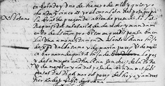
Although some of the Mexico City Lozano’s eventually moved on to other parts of the country, the surname is still fairly common in Mexico City and the Federal District today.
Lozanos in
Aguascalientes
Although it has not been absolutely verified at this time, Juan Lozano, a native of Lobón, Badajoz, Extremadura, Spain, and Ines Martinez are believed to be the ancestors of the Lozano family that settled in Aguascalientes in the early years of the Seventeenth Century. The name of Cristobal Lozano appears in the earliest parish registers of that city. On November 29, 1609, two Indian laborers employed by Cristobal Lozano were married in the Church of Aguascalientes. In 1614, he is first mentioned as a padrino at the wedding of a couple.
Then, on April 1, 1619, Juana Lozano, the daughter of Cristobal Lozano and María de Isla, was married to Hernando de Velasco, a resident of Zamora (the son of Diego Arias Puebla y Maria de Velasco, natives of Valladolid). At the same time, Juana’s parents were still in the process of building their own family in the Hacienda de Xiconaque. Several of Cristóval Lozano and María de Isla’s children were baptized in the early years of the Villa, including Leonor (May 22, 1617) and Magdalena (September 7, 1619).
Although Lozano has been a very common surname in parts of Aguascalientes, it was equally prevalent south of Aguascalientes in Nochistlán (Zacatecas) and Jalostotitlán (Jalisco).
Jalostotitlán (Jalisco)
Lozanos
The Lozanos also made an early appearance in Jalostotitlán, which is about 49 miles (78 kilometers) almost directly south of Aguascalientes. Their first recorded marriage in that parish took place on October 17, 1707 when Benito Lozano, the son of Fulgencio Lozano and Juana Casillas, married Rosa Francesca (whose parents’ names were not given – “hija de padres no conocidos”).
At this early stage, many Lozanos lived in the town because more than half a dozen served as padrinos at the marriages of other people in the first few years. The second Lozano to get married in Jalos was Jacinto Lozano (a widower) who, on Oct. 24, 1712, was married to Lugarda Enriquez del Castillo.
The five or six Lozanos living in Jalos at this time were prolific families and, as a result, the surname flourished over the next few decades and today, anyone who has ancestors from Jalostotitlán more than likely has Lozano ancestors.
Lozanos of Zacatecas
Finding the Spanish origins of Mexican families can be difficult when you consider that the Atlantic journey for many families took place several centuries ago. A Zacatecas will dated September 9, 1674 described the testament of one Pedro Lozano. Among other things, the will said that Pedro Lozano was the son of Francisco Lozano and Teresa de Alcolea (both deceased) who were residents of “Lugar de Campisarcalos, jurisdiccion de la villa de Miedes, Obispado de Siguenza” (in Zaragoza). Pedro’s own wife was Antonia de Urquicu and his children were listed: Pedro, Francisco, Ignacia, Joseph (a priest) and Teresa. Their descendants appear to be inhabitants of Monterrey (Nuevo Leon).
José Luis Vasquez y Rodríguez de Frías, in masterpiece “Genealogía de Nochistlán Antiguo Reino de la Nueva Galicia en el Siglo XVII Según sus Archivos Parroquiales,” discusses several dozen of the earliest families in that area. Among the early lineages discussed by José were:
Lozanos of Monterrey
The Monterrey Cathedral marriage records start in 1667 and are available on Family History Library Film 605179. One of the earliest marriages in this book is the October 2, 1669 marriage of Pedro Lozano and Mariana de la Garza, which we have reproduced below:
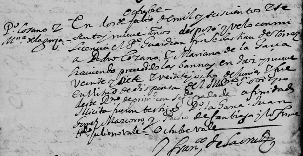
Capitan Pedro Lozano and his wife had eight children between the years of 1670 and 1687 and many of these descendants continued to live in Nuevo Leon for many generations. Capitan Pedro Lozano died on April 20, 1708 and was buried on the same date in the chapel of San Francisco Javier in Monterrey. His wife died nine years later, also in Monterrey. Their descendants are shown at the following link:
http://www.somosprimos.com/inclan/pedrolozano.htm
According to Kimberly Powell, “Meanings of Hispanic Surnames,” Lozano is the 51st most common surname in Spain, with an estimated 39,000 people bearing the surname. The surname is also believed to be fairly prevalent in many regions of Mexico today.
Copyright
© 2014 by John P. Schmal. All Rights Reserved.
Sources:
Archivo
General de Indias. “Pasajeros a Indias: Libros de Asientos” (Sevilla, 1978).
De
Atienza, Julio. “Nobiliario Español: Diccionario Heraldico de Apellidos Españoles y de
Titulos Nobiliarios” (Madrid, 1959).
García
y Carraffa, Alberto and Arturo. “Diccionario
Heráldico y Genealógico de Apellidos Españoles y Americanos”
(1920-1963), 86 volumes.
Hanks,
Patrick and Hodges, Flavia, “A
Dictionary of Surnames” (Oxford: Oxford University Press, 1988).
Iglesia Catolica, Catedral
(Monterrey, Nuevo Leon). “Registro Parroquiales, 1667-1968.” FHL Microfilm
#605179.
Inclan, John D. “The
Descendents of Captain Pedro Lozano Rodriguez
And Dona Marianna de la Garza y Rocha” Online: <http://www.somosprimos.com/inclan/pedrolozano.htm>.
Méndez
de Torres y Camino, Daniel Alejandro. “Archivos
Parroquiales de Aguascalientes: Siglo XVII” (San Jose, California:
2011).
“Notarias
of Felipe de Espinoza, Caja 02, Experiente de 1674.” From: “Gonzalez Direct
Lines - Person Sheet.” Available at: <http://www.currays.net/Gonzalez%20Web%20Project/ps05/ps05_080.htm>.
Powell, Kimberly. “Spanish
Surnames & Origins: Meanings of Common Hispanic Last Names.” Online: <http://genealogy.about.com/od/surname_meaning/a/spanish_names-2.htm>.
Vasquez y Rodríguez de Frías, José Luis, “Genealogía de Nochistlán Antiguo Reino de la Nueva Galicia en el Siglo XVII Según sus Archivos Parroquiales” (2001).
Woods,
Richard D. and Alvarez-Altman, Grace. “Spanish
Surnames in the Southwestern United States: A Dictionary” (G. K. Hall,
Boston, 1978).
THE
SURNAME OROZCO: FROM VIZCAYA TO AGUASCALIENTES
By
John P. Schmal
The
Surname “Orozco”
The surname Orozco (or
Orosco) is a surname that has been prominent throughout both Spain and
Mexico over the last few centuries. According
to Richard D. Woods and Grace Alvarez-Altman, “Spanish Surnames in the
Southwestern United States: A Dictionary,” two elements form this
surname: “oros” which means holly tree and the suffix “-ko” which
suggests place. Orozco therefore means place of the holly trees.
Orozco is also believed to have been derived from the Latin word “orosius”
– the son of bringer of wisdom.
However, Orozco is also widely accepted as a Basque surname that
indicates that one is a descendant of the ancient Señores de Vizcaya. In the Dictionary of Surnames, Patrick Hanks and Flavia Hodges offered
an alternative explanation for the surname Orozco, indicating that it was Basque
and that the first element of the name may have derived from the Basque oru
(plot of land).
Spanish
Origins
It seems likely that the surnames Orozco (or Orosco) – in all
their forms (i.e. single surnames or double surnames) – may have evolved from
several points of origin in different parts of Spain. According to García y
Carraffa’s Diccionario
heráldico y genealógico de apellidos españoles y Americanos , one
form of the surname, Orozco de Vizcaya,
originated among ancient horsemen whose descendants moved to the city of
Trujillo in the present-day province of Cáceres in the Extremadura region of
western Spain.
Another family of this surname seems to have originated in the
villa de Villademiro in the partido de Castorgeriz in the Province of Burgos.
And still another Orozco surname developed in the villa of Portillo in the
judicial jurisdiction of Olmedo. Today Portillo is a municipio within the
Province of Valladolid in the north of Spain.
García y Carraffa also
noted that another branch of Orozco lived in the small village of Candeleda of
the judicial district Arenda de San Pedro in the Province of Avila (Central
Spain). The progenitor of this
family was Diego de Orozco, a native
of Candeleda and Alcaide (Warden) of the village castle and the husband of Doña
Isabel Monte, who was a native of Turégano in the province of Segovia. Their
son was Diego de Orozco Monte, also a native of Candeleda, followed in the
footsteps of his father as the Warden of the village castle. Diego married Doña
María de Olmedo, a native of Arenas de San Pedro (which is just east of
Candeleda). This branch of the
surname continued to occupy Candeleda for several generations.
The
Oroscos Arrive in the Americas
With the migration of Spaniards to the Americas in the Sixteenth
Century, several Orosco’s are known to have embarked to Nueva España
(Mexico), including:
Francisco
de Orozco
Persons with the surname Orozco are known to have played
significant roles in the early history of both Nueva España and Nueva Galicia
(which was the first Spanish name given for the areas now known as
Aguascalientes, Jalisco and Zacatecas). One
of Hernán Cortés’ chief lieutenants in his conquest of Tenochtitlán (the
Aztec name for the present day Mexico City) was Francisco
de Orozco, who was believed to have come from Ubeda or Sanlúcar el Mayor.
It was Orozco who first made his way to Oaxaca, claiming the region for Cortés
and subduing the Mixtec inhabitants. He died in 1524 in Oaxaca.
Orosco
in Guadalajara
Diego de Orosco from Toledo – mentioned above as a pasajero to
Nueva España in 1535 and the son of Francisco Orozco –became one of the first
63 founders of Guadalajara in 1542. According
to Steven F. Hernandez and Tony Campos, other Orosco’s soon came to prominence
in Guadalajara and surrounding areas of present-day Jalisco. Juan Bautista de
Orozco, who immigrated to Nueva España in 1566 (as noted above), was appointed
an oídor of the Real Audiencia de Guadalajara in the same year and served in
that position until 1571.
One of the best sources of information relating to the Jalisco
Orosco’s can be found in the 94-page Steven Hernandez and Tony Campos article,
“Basic
Foundations of Significant Families of Mexico: Tello de Orozco,” in
the SHHAR Genealogical Journal, Volume 5 (2003), which is available
through SHHAR. This masterpiece discusses Orozco and Tello de Orozco, as well as
many other affiliated surnames, including Velasco, Liébana, Lomos and Bañuelos.
On of the many documents referenced in this work is the May 2, 1714 marriage of
Joseph Tello de Orosco and Lucía de Zamora in Ocotlán, which we have
reproduced below:
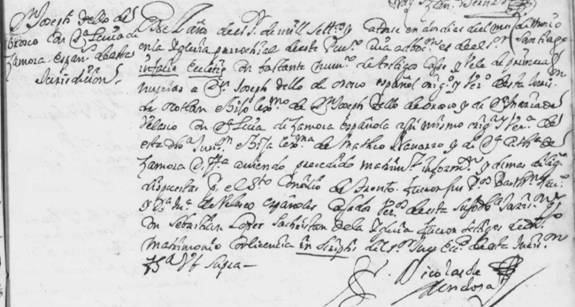
Dr.
Gerónimo Orozco and the Founding of Aguascalientes
Juan Bautista de Orozco’s brother, Gerónimo de Orozco y Lerma,
was believed to have been born in Sevilla sometime between 1518 and 1522, as
speculated by Hernandez and Campos. Sometime after arriving in Nueva España,
Gerónimo became a licenciado (lawyer
or attorney) with a degree from the University of Salamanca. Then in 1559, he
obtained a doctorate in law from the University of Mexico. For fifteen years up
to 1572, Doctor Orozco served as an oídor in the Real Audiencia.
On December 15, 1574, Dr.
Geronimo de Orozco y Lerma took office as the Governor-President of the
Royal Audiencia of New Galicia. From his headquarters in Guadalajara he played
an important role in organizing the settlement of the Villa de la Asunción de las Aguas Calientes (Villa de
Aguascalientes). On October 22, 1575 Orozco signed the certificate of foundation
for the new villa, which today is a major urban center of Mexico.
Gerónimo de Orozco established Aguascalientes during the long
Chichimeca War, in which the native peoples of the area attempted to stop the
Spanish advance and waged a very effective guerilla warfare against the
Spaniards and their indigenous allies from the south (i.e., Christianized
Indians). The intensity of the
Chichimeca War led to numerous engagements.
Some researchers have stated that Geronimo Orozco was killed during
a skirmish between Chichimecas and Spanish troops either in December 1580 or in
April 1581. However, Hernandez and Campos have stated that Gerónimo continued
to serve as the Governor until his death in 1592. Dr. Gerónimo de Orozco
married Beatriz Tello de Sandoval around 1554 or 1555 and, together, they had
ten children, including the following:
The descendants of Gerónimo and Beatriz and their many children
are discussed in great detail in Steven Hernandez and Tony Campos’ article
cited above and in the sources at the end of this story. Anyone who has Orozco
ancestors should consult this work to see if they have any connections to this
lineage, which is extensive throughout several parts of Mexico and discusses
seven generations of Orozco’s.
Aguascalientes
Grows
By 1582, the threat to the small villa of Aguascalientes became so
serious that the population had dwindled to one military commander, 16 soldiers
and two citizen residents. In effect, the small settlement – located in the
middle of the war zone – was under siege. But in the late 1580s, the threat of
Indian attack diminished steadily, as the Spanish authorities attempted to
negotiate a peace with the Indians of the region. The last Indian attack took
place in 1593, after which the threat of hostile attack disappeared entirely and
the region experienced a new peace.
The new-found peace of the 1590s, according to the historian Peter
Gerhard, “brought a tide of Spanish settlers beginning in the 1590s, mostly
cattlemen and farmers, together with Indian and Negro retainers.”
By 1610, the small town of Aguascalientes had approximately 25 Spanish
residents, about fifty families of mestizos, at least 100 mulatos, twenty Black
slaves, and ten Indians.
By 1616, the Parish records at Nuestra Señora de la Asunción de
Aguascalientes mention La
Estancia de Santiago as the property of one Jerónimo de Orozco and his wife, Doña Ángela Temiño de Velasco. Some researchers have stated that
Jerónimo was a descendant of Alberto de Orosco, a first cousin of Geronimo de
Orosco y Lerma, the founder of the city. Angela, for her part, was a
great-granddaughter of Hernán Flores de la Torre, a conquistador of Nueva
Galicia, and his wife Maria Alvarez de la Torre.
On September 24, 1618, Jerónimo and Angela had their son, Juan,
baptized in the Parish Church. Another child, Maiana, was baptized on January 5,
1623. During the first few decades of the parish, Jerónimo, his wife and his
children and grandchildren would serve as padrinos for many of the baptisms and
marriages that took place in town.
The first known marriage of an Orosco in the Aguascalientes parish
records was the marriage of one Diego de Orosco – another son of Jerónimo and
Angela – who married Doña María Medel on April 14, 1637.
By the time of the 1648
Padron (church registry or census), Angela de Velasco – now the widow of
Geronimo – was living with her family in “La cassa de Geronimo de Orosco”
with her son Diego, her grandchildren and a large number of servants. By this
time, Diego had lost his first wife, and had married a second wife, Maria de los
Ynojos, and now had two children with her.
Living elsewhere in the City was Juan Marín de Penalosa who would
later marry Francisca de Orosco y Santa
Cruz, the daughter of Lucas Orosco y Santa Cruz of San Luis Potosi and
Leonor Marin of Aguascalientes.
The Orozco family continued to live and thrive in Aguascalientes
for many generations. The detailed document below is the March 14, 1670
Aguascalientes marriage between one Frtancisco Murillo and Maria de Orosco, the
daughter of Francisco de Orozco y Magdalena Gomez de Portugal, who were
residents of Teocaltiche, almost 40 miles southwest of Aguascalientes.
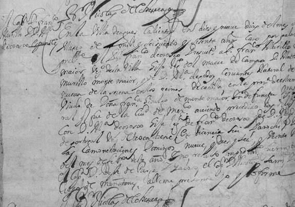
Don
Juan de Villaseñor Orozco
According to J. Ignacio Avila Garibi, Don Juan de Villaseñor Orozco was among the founders of Valladolid
de Michoacán (later known as Morelia, the capital of the State) and the
encomendero of Huango, Puruándiro and other cities. It is believed that he was
born at Vélez de Castilla in Spain around 1500 and he died in 1566 at
Tacámbaro, Michoacán. He was
married to Doña Catalina Cervantes de
Lara (a native of Sevilla, Spain) and they are believed to be the ancestors
of a long line of notable individuals in Mexican history.
Through their son, Federico de Villaseñor y Cervantes de Lara,
Juan and Catalina were the great-great-great-great-great-grandparents of Don
Miguel Hidalgo y Costilla, the priest from the city of Dolores in Guanajuato
who led the first battles of the Mexican Revolution in 1810. Dolores would later
be renamed Dolores Hidalgo in his honor and that is the name it carries today.
Through another son, Diego, Juan and Catalina were the
great-great-great-great-great-great-grandparents of Don Agustin de Iturbide, a native of Morelia (1783), who played a
significant role in the last part of the Mexican Revolution, eventually becoming
Emperor of Mexico and then losing his life in 1824.
Orozco
in Mexico
Persons with the surname Orozco (or Orosco) have continued to play
significant roles in Mexican political and cultural life. According to Wikipedia,
José Clemente Orozco (November 23, 1883 – September 7, 1949) was a Mexican
social realist painter who specialized in bold murals. Living around the same
time, was Pascual Orozco Vazquez (28 January 1882 – 30 August 1915) who was a
Mexican revolutionary leader. The surname in both forms continues to be fairly
prevalent in some parts of Jalisco, Zacatecas and Aguascalientes, as well as
other parts of the country.
Copyright
© 2014 by John P. Schmal. All Rights Reserved.
Sources:
Archivo General de Indias. Pasajeros
a Indias: libros de asientos (Sevilla, 1978).
Campos, Tony and Hernandez, Steven F., “Basic Foundations of
Significant Families of Mexico: Tello de Orozco,” in Society of Hispanic
Historical and Ancestral Research (Steven F. Hernandez, editor), Genealogical
Journal, Volume 5 (2003), pp. 167-238.
Davila, J Ignacio.
Los
nietos de Don Juan (Mexico, D.F., 1949)
Davila, J Ignacio. Los
nietos de Juan de Villasenor Orozco, fundador de Valladolid
(Michoacan, Mexico, 1948).
García y Carraffa, Alberto and Arturo. Diccionario heráldico y
genealógico de apellidos españoles y Americanos (1920-1963), 86
volumes.
Gerhard, Peter. The
north frontier of New Spain (Oklahoma: Univ of Oklahoma Press, 1993).
Hanks, Patrick
and Hodges, Flavia, A dictionary of surnames (Oxford: Oxford University Press,
1988).
Hardy, Rose and Valdez, Dave. A
genealogical look at the 1648 padron of Aguascalientes (2010).
Méndez de Torres y Camino , Daniel Alejandro. Archivos parroquiales de
Aguascalientes: Siglo XVII (San Jose, California: 2011).
Muria, Jose Maria and Olveda, Jaime. Lecturas históricas de
Guadalajara : generalidades históricas sobre la fundación y los primeros años
de Guadalajara (Instituto Nacional de Antropología e Historia,
Guadalajara: 1991).
Rodríguez, Juan Manuel. “Gerónimo
de OrozcoPor mercadointerno: El fundador de Aguascalientes y León, fue muerto
por chichimecas” (October 22, 2011). Online:
http://mercadointerno.wordpress.com/2011/10/22/geronimo-de-orozco/
Wikipedia, “Orozco,” Online:
http://en.wikipedia.org/wiki/Orozco
Woods, Richard D. and Alvarez-Altman, Grace. Spanish Surnames in the
Southwestern United States: A Dictionary (G. K. Hall, Boston, 1978).
09/10/2017 08:28 AM